|
Ain Murr - An active Geo-Hydrotherm
in the Sudanese part of the Jebel Uweinat
(three countries corner Egypt/Sudan/Libya)
Norbert Brügge,
Germany
Dipl.-Geol.
Upload: 29.04.2020
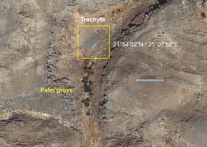
The Jebel Uweinat is a sandstone
plateau in the Western Desert that rises on the edge of a large granitic intrusion
of tertiary ages up to 1200 m above ground. The plateau of Paleozoic sandstones
is located directly above the uplifted Archean Basement of the
ESGC.
The expanded region is characterized by a multitude of volcanic structures
that were created in the Tertär period. In the meantime, there are growing
indications that post-volcanic activities could have existed up to the recent
past (Holocene). The Jebel Uweinat provides sufficient discussion material
for this.
At the moment, a possibly even a recent post-volcanic activity in the Jebel
Uweinat is coming into focus.
Andras
Zboray (fjexpeditions.com) has also explored a dry valley in the southeastern
part of the Uweinat during his numerous tours. His informations and photos
are of great interest because they allow an extraordinary interpretation of
the spring "Ain Murr"as a geo-hydrotherm.
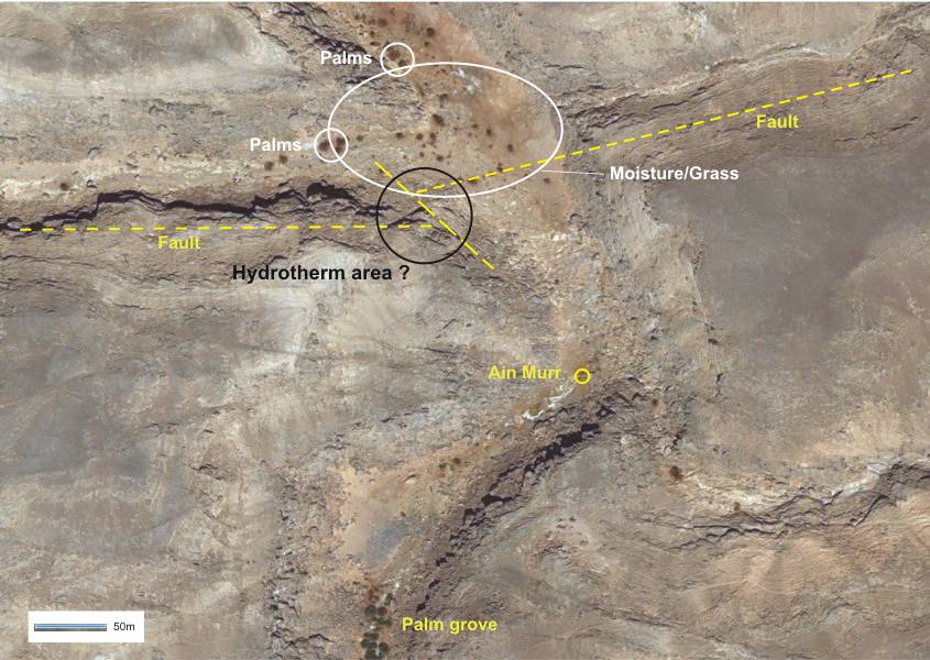
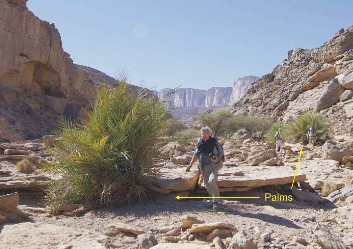
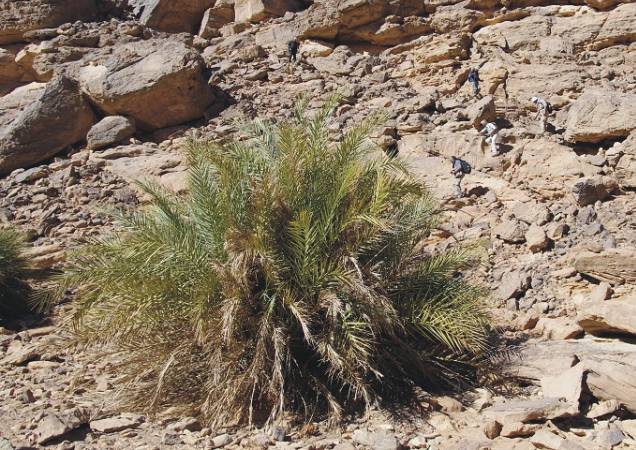
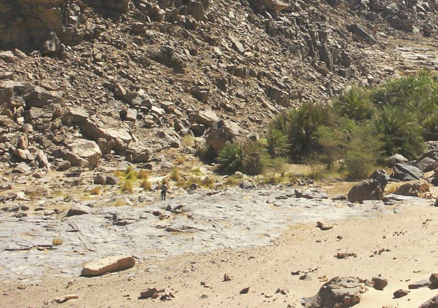
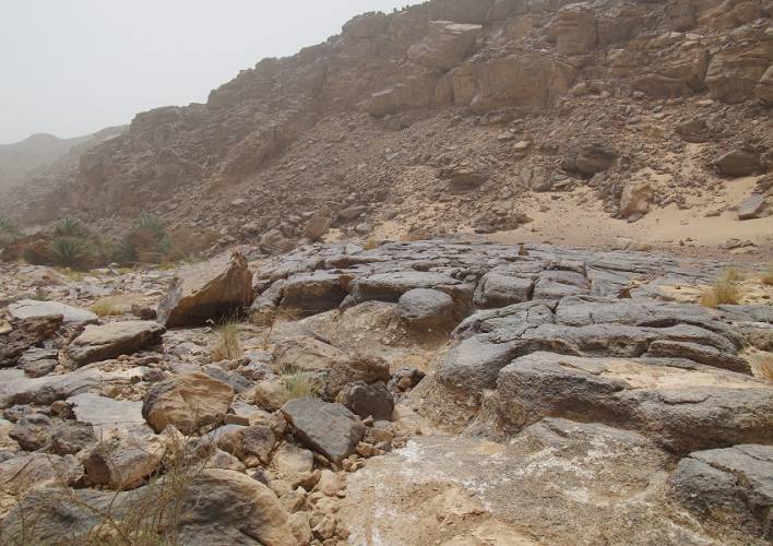
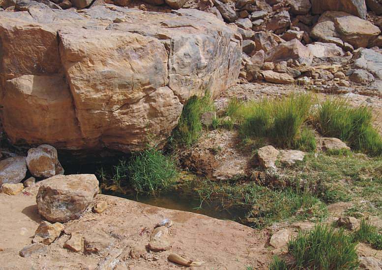
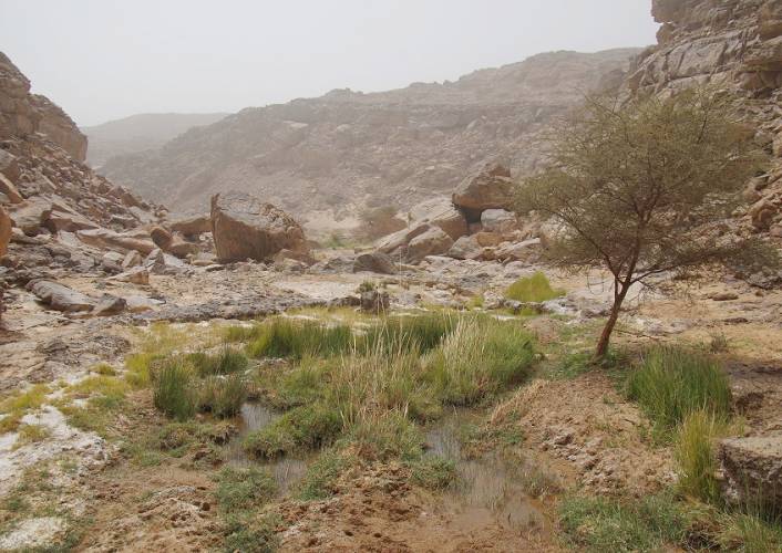
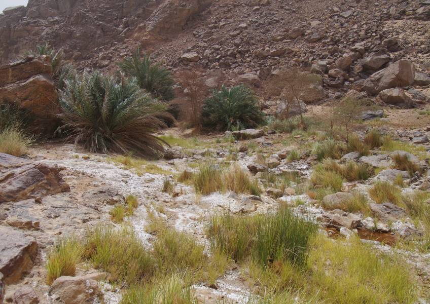
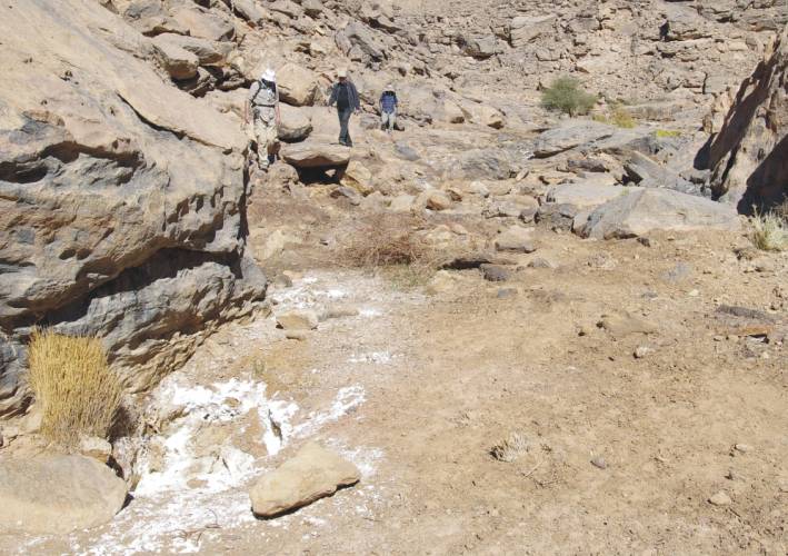
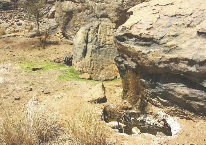
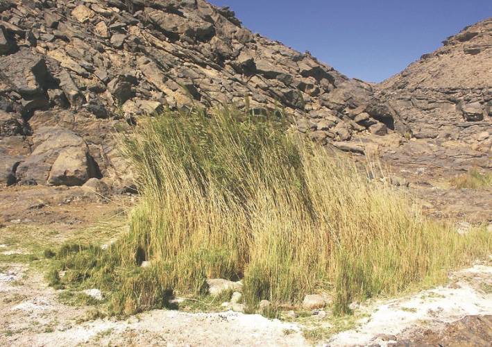
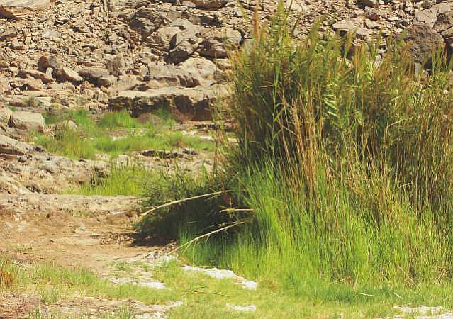
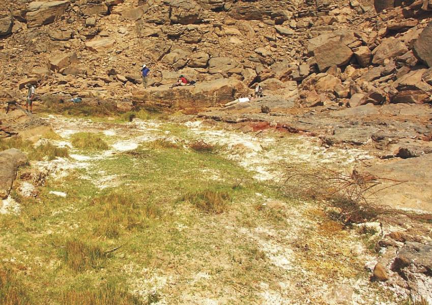
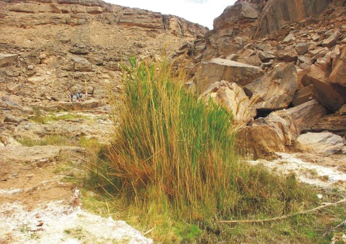
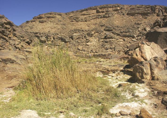
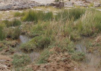
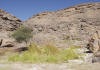
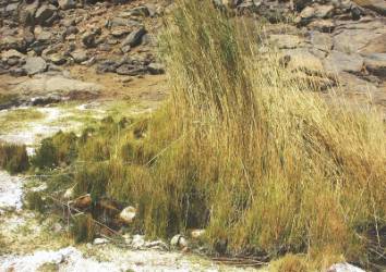
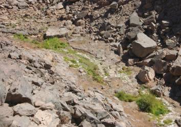
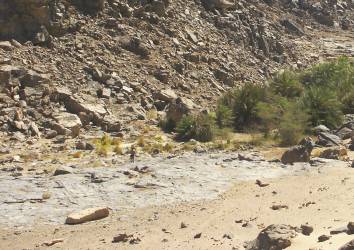
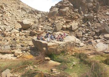
This dry valley, called Karkur Murr, is known to connoisseurs due to its palm
grove, temporary water holes and further up in the valley the constantly water-bearing
spring "Ain Murr".
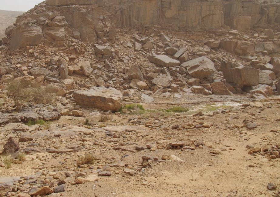
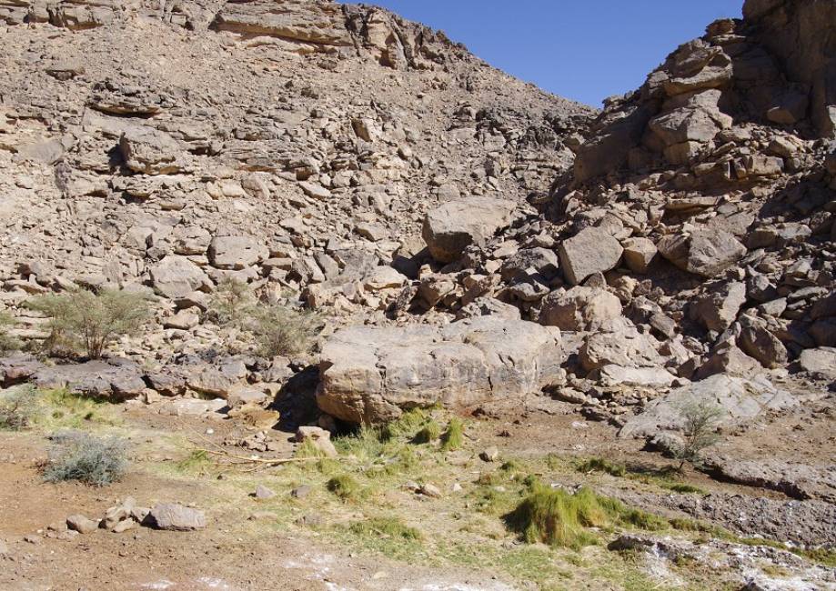
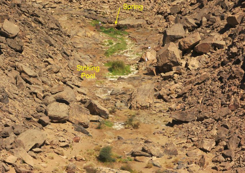
From a geomorhological point of view, this part of the Karkur Murr can be
described as an erosion channel, in which the sandstone layers have been eroded
down to near base of the crystalline surface,which is to be expected here
at about +700 m asl.
Thanks to the information provided by Andras Zboray, the following
is known in summary about the spring "Ain Murr" and the following waterholes
downstream:
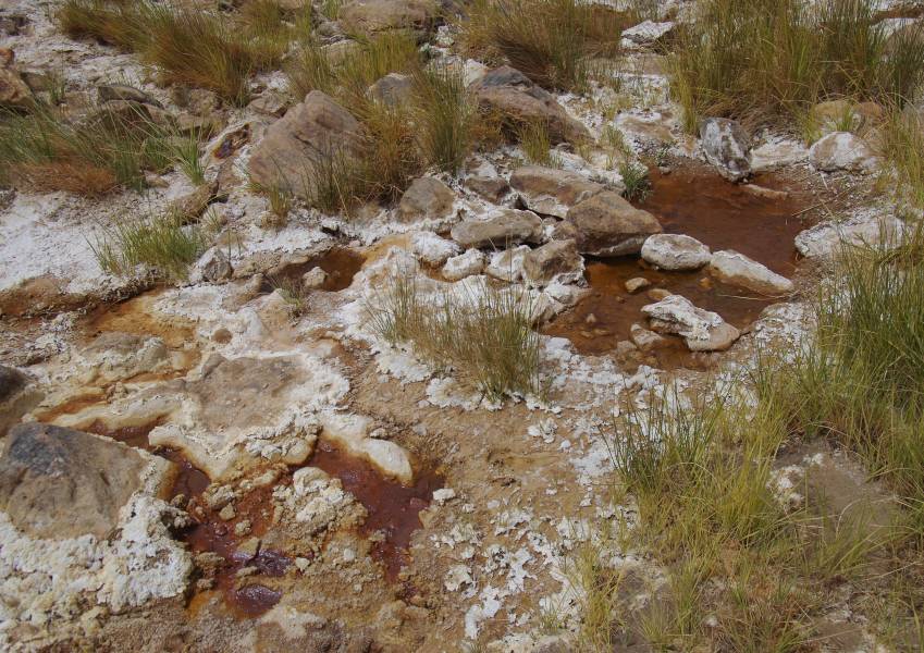
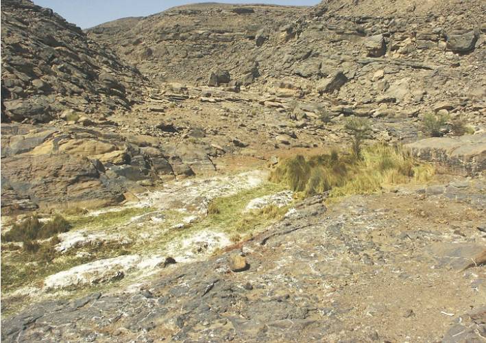
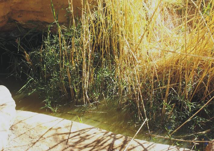
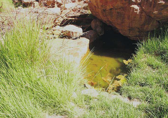
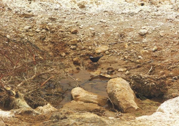
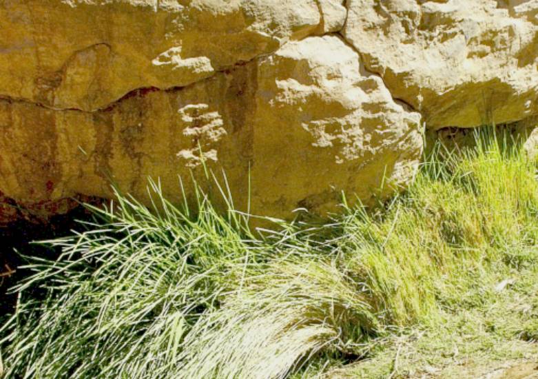
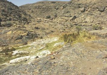
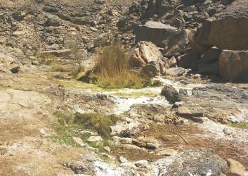
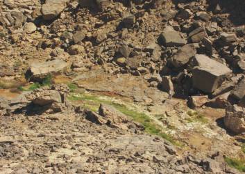
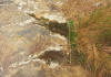
- The spring "Ain Murr"carries water permanently. In a valuable
water analysis from 2002, a conspicuous concentration of Ca-Na-Mg sulphates
was found.
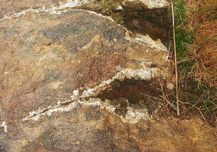
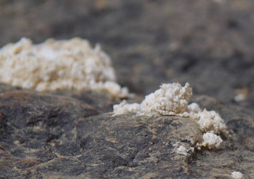
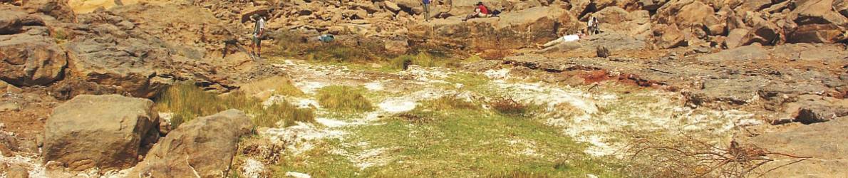
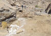
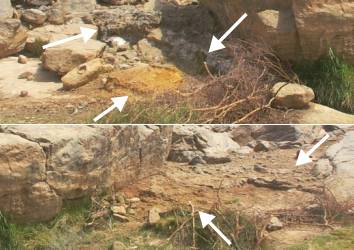
- The ground between spring and a striking water hole, 90m downstream,
is covered with a thin crust of white crust of anhydrit crystals.
- But there are more water holes with residues of crusts down
the valley including at the palm grove, about 400m down the valley.
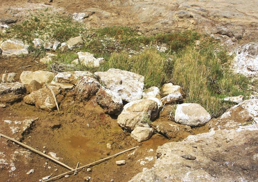
- Currently at the striking water hole are to see adhering crystals
on reed, which suggests a higher water level.
- The edge of the spring is mostly free of crystals as the rivulets
and water holes itself, probably due to the solution of crystals by weakly
contaminated water.
- However, there are permanent markings of white crust on the
rock directly above the spring, which indicate high water levels from up
to 40/50 cm above normal level.
- The water holes are supplied with leachate from the spring
with normal level conditions and if not they dry out.
- About 150m in upstream of the spring crossing a fault the
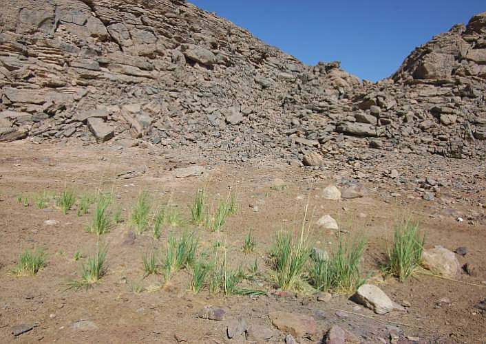
valley. In this area, some palm trees and fresh grass grow on the damp ground.
A connection with the spring is suspected.
|
|
|
Hydrological Research Institute in Budapest |
|
pH
|
-
|
5.9
|
|
Specific conductivity
|
µS/cm
|
480
|
|
Chemical oxygen
absorbtion
|
mgO2/l
|
1.35
|
|
Total hardness
|
CaOmg/l
|
110
|
|
Total dissolved
matter
|
mg/l
|
472
|
|
Ammonium
|
NH4mg/l
|
0.41
|
|
Nitrites
|
mg/l
|
<0.01
|
|
Nitrates
|
mg/l
|
<1
|
|
Chlorides
|
mg/l
|
31
|
|
Sulphates
|
mg/l
|
210
|
|
Alkalinity
|
mmol/l
|
0.8
|
|
Calcium
|
mg/l
|
45
|
|
Magnesium
|
mg/l
|
23
|
|
Sodium
|
mg/l
|
51
|
|
Potassium
|
mg/l
|
5.9
|
|
Iron
|
mg/l
|
0.03
|
|
Manganese
|
mg/l
|
1.57
|
|
|
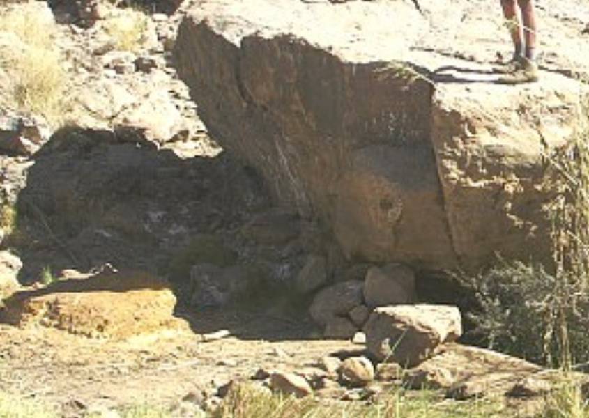
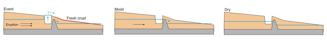
Hypothesis of a hydrogeological scenario, derived from informations and
photos
The
following hydrogeological model can be developed based on for years documented
conditions around the spring "Ain Murr" spring and water holes (see history):
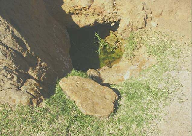
The spring "Ain Murr" has an unhindered underground hydraulic connection
to a hidden hydrotherm, which is located about 150m upstream at a striking
west-east fault. In the area of the suspected geo-hydrotherm there is
vegetation (some palm trees and grass) and at least a moist soil. The
spring "Ain Murr" down the valley is the end point of a reservoir of hydrothermal
water, which collects in a morphological deepening of the basement and
is filled by the hydrotherm.
The geo-hydrotherm has short eruptive phases at intervals, as a result
of which highly sulphate-rich water emerges at the "Ain Murr" spring.
Then there is a violent outflow of water above the ground, which flows
down the valley.
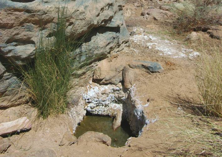
After the hydrothermal water has cooled, the first sulfate crystals form downstream
when the water level is still high (crystals in the reeds or on stone
surfaces). In the course of the event, the water output at the spring
decreases again. Water that remained in the bumps between the spring and
the water holes then evaporate and leaving a crust of anhydrite.
The white crust largely persists because it cannot be dissolved by further
events with highly concentrated water.
If there are no crusts on the edge of the spring itself and in the residual
water in the rivulets, there will have been solution effects due to the
already lower concentrated water after an eruption has subsided. This
also applies to the pools in the water holes after an eruption.
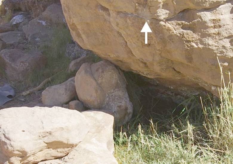
On closer examination, however, it can also be ascertained that white
crusts can very well have been preserved at the edge of the spring. There
are also permanent markings at the "big rock" above the spring. That are
bands of crusts and rust-colored strips that document different water
levels of up to 50cm above normal and that clearly prove eruptive overflows
of the spring.
the period between the eruptions, depending on the normal water level
of the spring, the water holes can be weakly filled with leachate from
the spring.
The normal water level fluctuates around 10cm. When it reaches its peak,
water seeps away in the direction of the water holes. Depending on the
surface of the terrain, they fall dry one after the other when the water
level drops and there is no seepage. If the water level rises slightly
again, the opposite effect occurs.
This water from the spring is contaminated with differently low sulfate
concentrations. This is supported by differences in the taste perception
of the leachate in the water holes (water exchange).
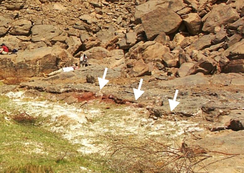
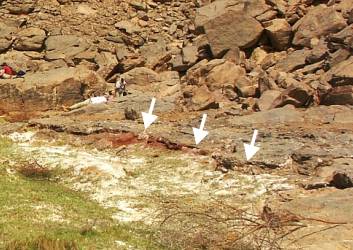
A special feature are darker, partially eroded deposits at the "big rock"
on the spring and in the downstream. Rust-red and yellow-red deposits
can be seen in exposed areas. It will be older deposits and therefore
prove a long lasting lifetime of the geo-hydrotherm (Holocene). Such deposits
can prove that "Ain Murr" was a formerly more active hot Sulphur source.
Note:
Andras Zboray does not agree with my hypothesis of an violent
overflow the spring "Ain Murr". Further research is planned for March
2021 at the earliest. Above all, the obvious presence of further deposits
up the valley must be checked.
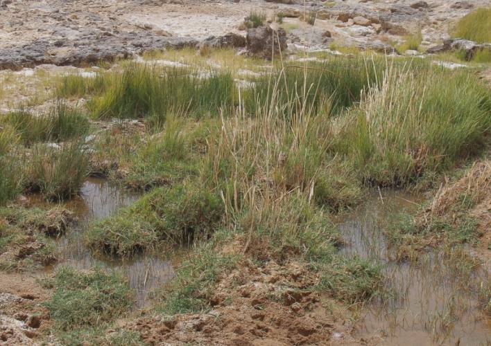
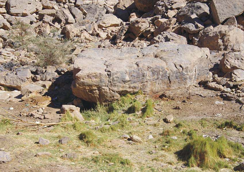
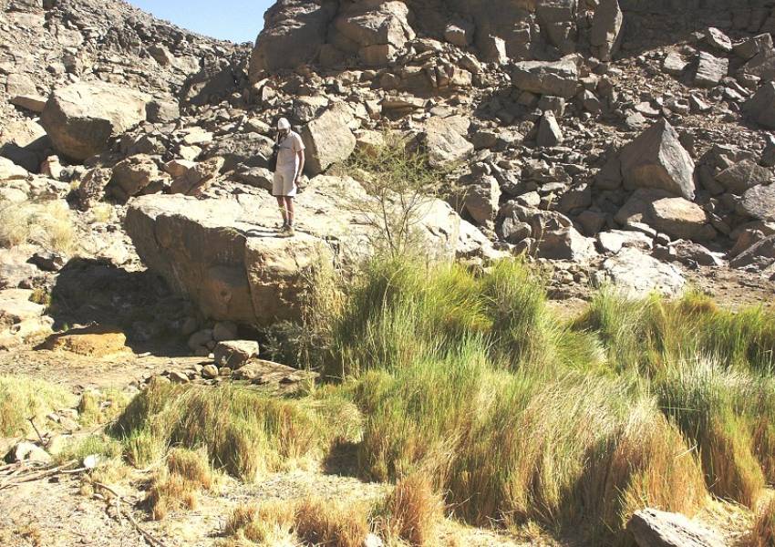
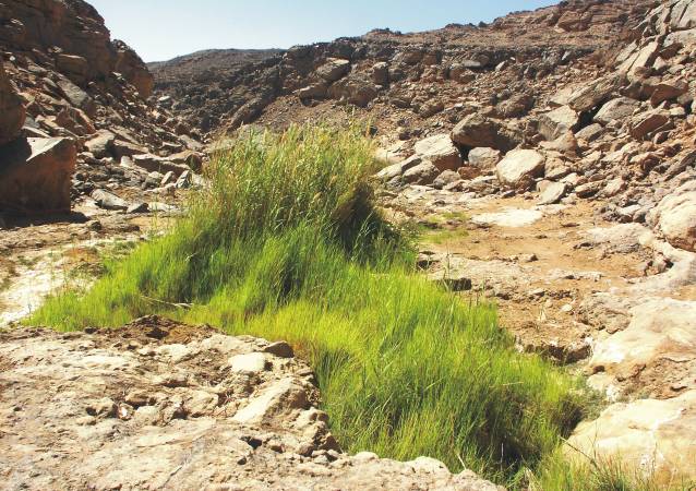
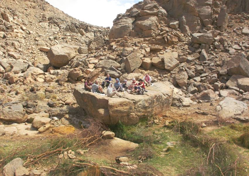
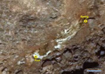
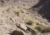
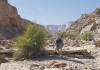
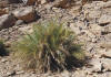
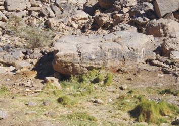
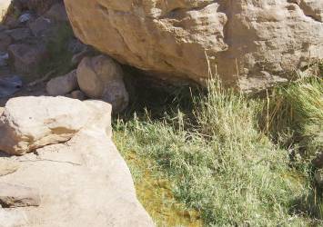
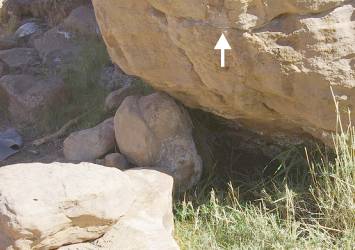
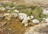
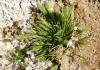
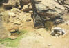
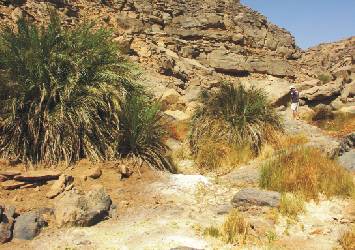
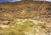
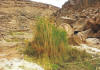
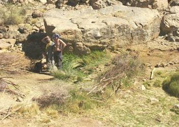
Suspected Hydrotherm
It is
believed that the "Ain Murr" spring is just a stagnation point of water
that is supplied underground by a hydrotherm. About 150 m upstream there
is a west-east fault, which is crossed by the Karkur Murr. In both the
main and secondary valley, palm trees and grass grow on a soil that isoccasionally
at least moist.
|
|
|
|
|
|
|
|
Hydrotherm
|
2006:
Palms
|
2006:
Fresh grass
|
2015:
Palms (3)
|
Crystalline underground
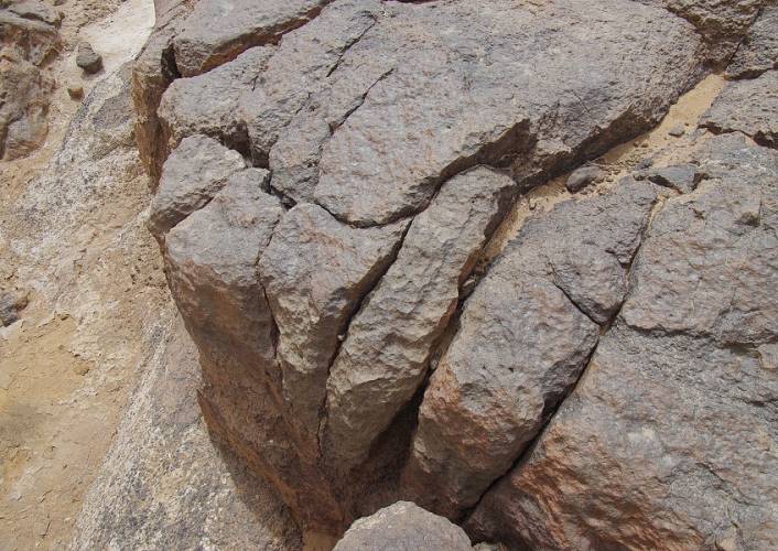
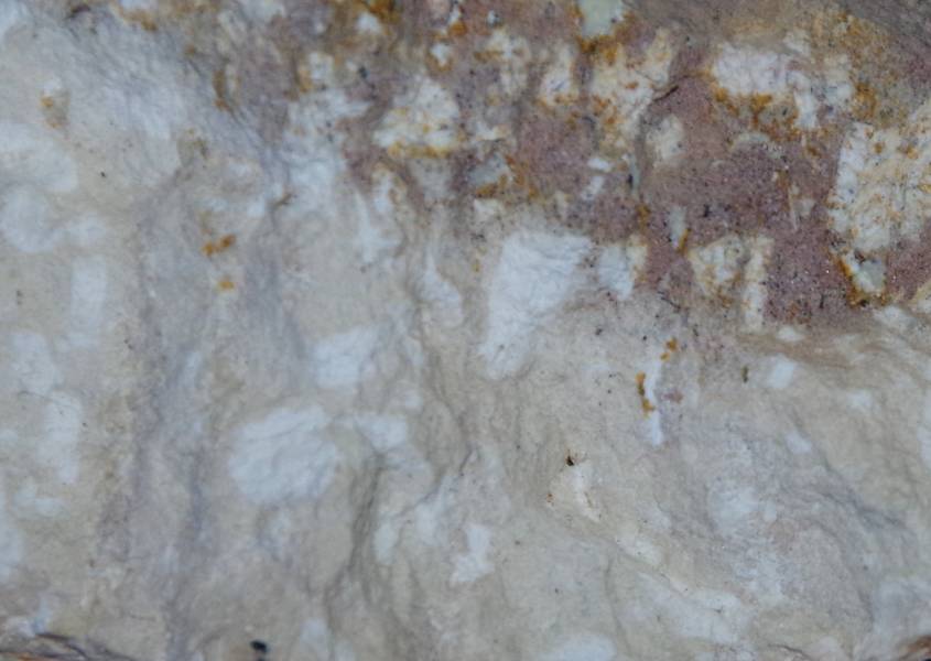
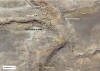
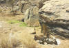
An outcrop of the crystalline underground in the valley is
up to now not detected. It could be the suspected Archean Basement. Thanks
to Andras Zboray, there are photos and a sample from an elevation in the
valley, nearby the palm grove, which according to initial findings is
a trachyte like intrusion.
Numerous bright clusters can be seen in a sample
in a slightly brownish-colored groundmass. Enlarged, these clusters contain
directed elongated white crystals. The entire matrix contains small reflective
crystals. A few small gas bubbles are visible. If it is trachyte, the
elongated crystals are alkali-feldspar. Andras Zboray: A hardness and
acid test exclude a amount of quartz or carbonate in the rock.
|
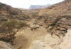
History of discovering
(visited and documented by Andras
Zboray nine times from 2002 to 2019)
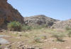
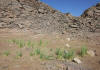
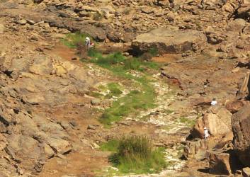
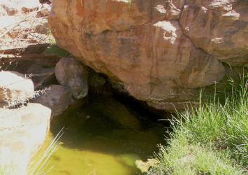
2019,
March
The documented white deposits directly at the spring are convincing
for a recent overflow of the spring. They are located on the surface of stones
and also as
parallel markings on
the "big rock" itself. It is visible that the height of an eruptively water
levels was more than 40-50cm above the normal water level. Fresh crusts and
crystals can be found in the filled water holes in the downstream.
|

Spring
|
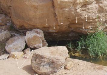
Detail
|
Residual water from
the spring's last overflow
|
|
|
Quote:
"We found the spring of Ain Murr with abundant
water, both at the main source and along the series of shallow pools below."
"Vegetation like in 2015. Pools were full, including those near the palm
grove far downstream from spring. Lot of fresh vegetation farther upstream
in valley at the fault." |
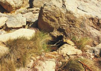
2015, November
The vegetation at the source is clearly disturbed. Currently,
the water holes have already dried out due to a low water level. A defect
line filled with crystals on the "big rock", far above the normal water level,
is visible again.
|
Spring
|
|
|
|
|

Spring
|
Spring downstream
|
Hole
|
|
| Quote:
"The vegetation around the spring of Ain Murr
was much less than on previous visits, the secondary serie of holes were
all dry. The spring itself was almost completely overgrown with vegetation,
showing only a small patch of open water." |
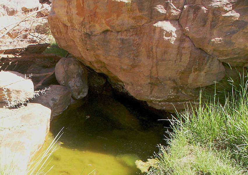
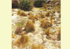
2010, March
The fresh crusts in the entire downstream and the holes filled
with water are a clear sign that there was a recent "eruption" of the spring.
|
Spring
|
Striking pool
|
Crystals in the
reed
|
|
|
|
|
|
|
Nearby
palm grove
|
Fresh crystals
|
Artificial
holes
|
|
Quote:
"There was much more water as 2009, the shallow
pools between the two springs all had some water or at least wet mud on
their bottoms, and the cluster of reeds a short distance south of the
main spring were actually standing in water. We also observed a strange
transformation of the water. While the upper larger spring was rather
bitterish when we last visited in November 2009, the water taken from
under the rock in the smaller pool some 200 metres away was crystal clear,
and practically tasteless. Now the striking pool also was as bitter, or
even more than the upper spring, which appeared to have cleared somewhat."
"The first series of shallow pools had mostly dry reeds, but there was
shallow water in them. Second series of pools among rocks lower down all
had water." |
2009, November
A recent event is undetectable. The upper
water holes are already dry. The deposits of crystals from eruptive water
levels can be recognized by the "big rock". The white crust on the upstream
side of the "big rock" (even with the splashes) is also not new either.
2006, October
Little or no seepage from the spring.
The water holes were almost all dry.
|
Spring
|
|

Water in a artificial
hole
|
| Quote:
"Still plenty of green grass and green reeds,
but no water in the shallow pools. There was water in the artificial hole
at the second series of pools lower down." |
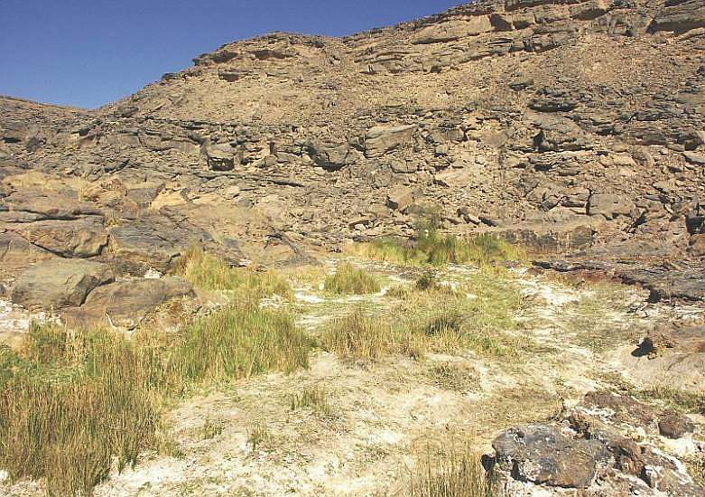
2005, October
There is no evidence of a recent event. The markings on the
"big rock" are not new.
The
higher water lines with white crystals are shown in the photo.
|
Spring area
|
Downsteam
|
|
|
|
| Quote:
"The vegetation around the spring was much less
than on previous visits, the secondary holes were all dry. The spring
itself under the big rock was almost completely overgrown with vegetation,
showing only a small patch of open water. Abundant green grass in watercourse
and green reeds in pools, but no observable surface water." |
2004, October
|
Holes before Palm grove (2002)
|
10-2004
|
Hole with very little
water
|
| Quote:
"Don’t have any photos, don’t remember if there
was any water in the pools. Visited the lower spring (Ain Brins), it had
very little water." |
2004, March
Photos document a recent "eruption" at the spring following activation
of the Hydrotherm. The soil in the immediate vicinity of the spring is still
damp. The water holes in the downstream are filled. For the first time, eroded
remains of an apparently older gray deposit were documented, which was deposited
at the source itself and in the downstream. It contains rust-red and red-yellow
deposits, as can be expected from a "Hot Sulphur Spring".
|
Spring
|
|
Older deposits
|
|
|
|
|
|

|
|
|
|
|
Spring
|
Spring area downstream
|
Spring area upstream
|
Hole downstream
|
Striking pool
|
Palm grove area
|
|
| Quote:
"It was interesting to note, that in 2004 water
was seeping out from cracks in a distinct rock band for about 200 metres
along the wadi, forming numerous little pools. The water seemed more abundant
then when we last visited in October 2002. The first series of shallow
pools had green reeds and water. There was open water at the second series
of pools lower down. There was a trickle of water among the rocks above
the palm groves." |
2002, October
The soil at the spring should not document
an overflow of the spring. Since the first water hole with the reeds has already
dried up, an event would have happened some time ago. Traces of higher water
lines with white crust on the "big rock" are not visible in the photo, but
there are probably old rust-red strips from running back water at the upstream
side. The devastation at the spring could have been caused by humans. The
barriers with brushwood are unnatural.
|
Spring
|

Spring
|

Striking pool
|
|
Quote:
"The first series of shallow pools had mix of dry and stll green reeds,
but the pools dry. Second series of pools among rocks lower down had a
clearly excavated pool with water
|
|