|
The actual origin of the
travertine-like deposits of
the Tassili, Tadrart and Acacus Mts.
in Algeria and Libya
Norbert
Brügge, Germany
Dipl.-Geol.
Upload:
16.03.2020
1. Accacus Mts. (Libya)
Publications about ....
Geomorphological Map of the Tadrart Acacus Massif ...... (Libyan Central
Sahara)
Zerboni, A. Perego & M. Cremaschi -- Link to this
article: https://doi.org/10.1080/17445647.2014.955891
"Along the wadi banks on the inner parts of the Tadrart Acacus Massif, at
an elevation ranging from 900 to 1000 m a.s.l., calcareous tufa were identified
(Cremaschi et al., 2010; Zerboni & Cremaschi, 2012). Outcrops of this
kind of deposits were found within rock shelters, along vertical fractures
inside relict solutional tunnels, and on vertical cliffs; they are related
to the horizontal boundary between sandstone and thin, impermeable beds of
shale or fine-grained sandstone beneath (Cremaschi et al., 2010). In
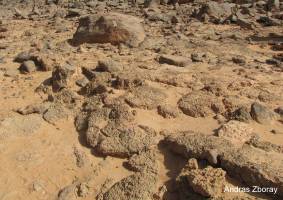
the central part of the Tadrart Acacus, tufa deposits occur as thin laminated
crusts on the floors of rockshelters and belong to the pool and barrage types;
in the upper reaches of the wadis, up to several tens of meter long alignments
of massive flowstone line vertical walls (Figure 8). An alignment of
calcareous tufa on a vertical cliff along the upper reach of wadi Imha. In
the latter case stalactites may be 2 m long. The microscopic properties of
tufa are discussed by Carrara, Cremaschi, and Quinif (1998) and
Cremaschi et al. (2010), with several U/Th and radiocarbon dates placing
their deposition to the Early Holocene (Cremaschi et al., 2010). Due
to the topographic and geologic position of tufa and their sedimentological
characteristics, we define them as spring tufa and their occurrence indicates
the position of ancient springs that were active during humid phases."
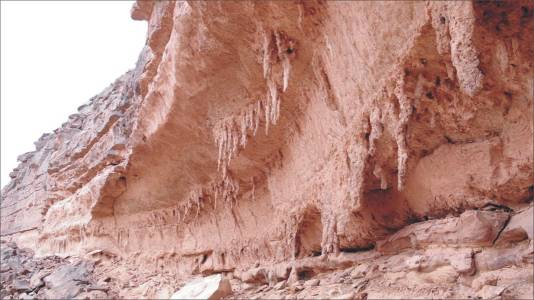
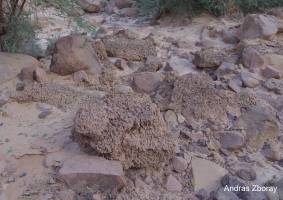
Figure 8. Upper part of Qued Imha
Comment: Probably eroded remains on the roof of a volcanic spring with
younger (?) stalactites
The calcareous tufa in the Tadrart Acacus Mt. (SW Fezzan,
Libya) -- An early Holocene palaeoclimate archive in the central Sahara
M. Cremaschi, A. Zerboni, Ch. Spötl, F. Felletti
-- ELSEVIER / Palaeogeography, Palaeoclimatology,
Palaeoecology 287 (2010) 81–94
"The tufa deposits were discovered during
a geoarchaeological survey in the Tadrart Acacus mountain conducted from
1994 to 2005, when almost all the wadi of the massif were examined. Nineteen
tufa outcrops were identified, and six of them were now sampled for laboratory
analyses.
The calcareous tufa deposits crop out at the base of rock shelters and
niches, originated by undersapping processes and related to the horizontal
boundary between sandstone and thin, impermeable beds of shale or fine-grained
sandstone beneath. Tufa also formed along vertical fractures inside relict
silicakarst tunnels. In both cases tufa deposits occur as thin (3–20 cm
thick) laminated crusts at the floors of the rock shelters and belong
to the pool and barrage types. They also line the walls and roofs of the
cavities and tunnels as massive flowstone. Pool-, barrage-, and flowstone-type
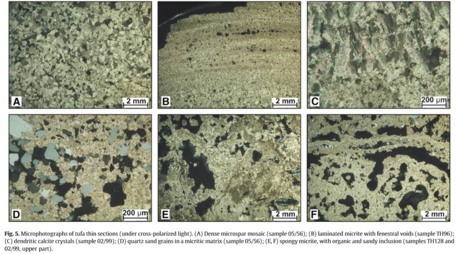
tufa is uniformly white to light brown and well lithified. The laminar
structure, observed macroscopically, also clearly appears at the microscopic
level: cryptalgal and bacterial structures are embedded in a dense, whitish
yellow, micrite groundmass, which appear as very thin, planar or wavy
"stromatolithic" laminae containing calcified algal filaments, fan-shaped
branching algae and bacterial clumps. Compact tufa is laterally discontinuous
and grades into highly porous moss tufa consisting of tubules and phytoclasts.
In a few cases tufa also impregnates clastic deposits, such as aeolian
sand and detrital fragments of sandstone occurring mostly at the base
of the sequences.
Six samples were U/Th dated. A single date is available
for the sample 05/56, a massive, sand-rich flowstone, located above a
small spring pool. A sequence of five dates (four U/Th and one AMS 14C)
was obtained on the sample from site 02/99, which is the thickest (130
mm) deposit identified; samples were taken from the top and the base of
each hand specimen and in correspondence to the main lithological discontinuities.
Two dates each were performed at the base and at the top of the samples
from the sites 94/96 and 94/49, obtained from flowstones, and on
sample TH128 (pool and dam type). U concentrations of the Tadrart Acacus
tufa deposits are high (4–12 ppm) and U-series analyses gave consistent
results, with the exception of sample TH96-2 (very high 230Th/238U ratio).
An AMS 14C age was performed on the lower part of sample 02/99 and gave
8360±50 14C yr BP (9500–9250 cal. yr BP (2σ) using the INTCAL04 calibration
curve of Reimer et al., 2004.
This result is in good agreement with the U/Th data, and supports their
reliability. The available dates indicate that tufas were deposited between
c. 9605 and 7634 yr BP. Most of the sedimentation occurred between 9500
and 8100 yr BP; a single date hints towards a slightly younger age in
one location (7634 yr BP)." |
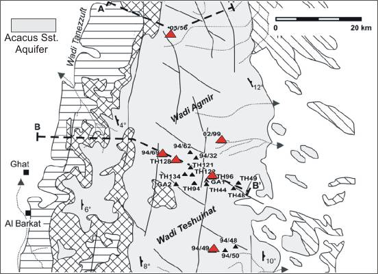
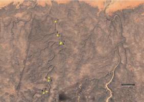
Red triangles: Examinated deposits (6)
|
|
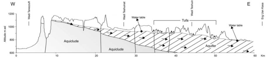
Comment: Profile-B depicting a groundwater table
in an ideal (but unrealistic) saturated sandstone aquifer in the Holocene
Comment: Probably an eroded volcanic
spring
|
Contradiction
and new proposal
Consolidated bedrocks (also sandstone)
of Paleozoic age
cannot absorb groudwater. Porosity and permeability are very low. No aquifer in the true sense can form. Rainwater
can only seep away along cracks in the sandstone and accumulate in cavities
etc. The infiltration rate into the "aquifer" of the Acacus Mts. was
consequently low despite intensive rainfalls and could not lead to a
saturated true aquifer with a high uniform water table, as it was declared.
Most of the rainwater ran off along the valleys towards the foreland.
A true “groundwater level” would also have been significantly lower,
since it is determined by the level of the foreland. The formation of
permanent small lakes at barriers was possible, but pent-up water would
have been exposed to constant exchange with rainwater, so carbonates
could not form autochthonous.
It is crucial, however, that there is no convincing
geological evidence for the thesis of carbonate precipitation
through solution processes in imaginary or at least hardly available
carbonate layers. There are therefore no prerequisites for the
meteogenic formation of travertine in this mountain region. The only
realistic possibility is the formation of these deposits by feeding
them from volcanic springs containing carbonates, and which may be
older than the Holocene, probably the Pleistocene. Such young
hydro-volcanic activities have nothing to do directly with the
volcanoes in the region (eg Adrar volcano southern of the Tassili
Mts).
The usability of the determined age of the deposits with the
U/Th-dating method is questionable because the reliability of the method
is restricted in an "open system". The deposits could have later been
contaminated by leachate in the rainy phase of the Holocene. An indication
of this is the likely new formation of flowstones (stalactites) in shelters.
The suspected organic residues appear to be phantoms.
The data found can only relate to the period of erosion, renewed
deposition (eg stalactites) and/or contamination. Since there is no
U / Th older data to before 9,500 yr BP, we should assume that the age
of the original carbonates cannot be determined using the U/Th method.
(Pleistocene ?)
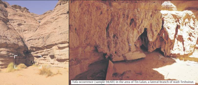
Pure carbonates can be seen in photos of the shelters. The microphotographs
presented in the publication are from other locations, of which there
are no photos. In a table one speaks of flowstones, presumably samples
of secondary stalagmites and stalactites. These can also contain contaminats
and foreign material. We can suspect that they were used for the analyzes.
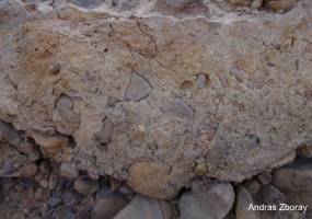
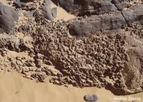
Deposits of a sand and gravel mix in drainage valleys were consolidated
by carbonate muds from eroded volcanic springs.
Such deposits can be found in the Qued Djerat (Tassili Mts., Algeria)
or the Qued Tin Uded in the Algerian Tardrart Mts. The age of these
deposits is likely to be the same or younger than that in the Acacus
Mts. (Holocene).
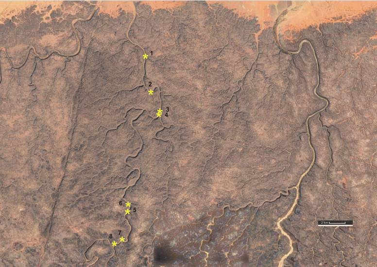
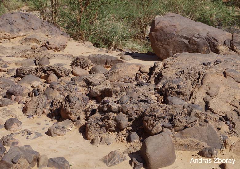
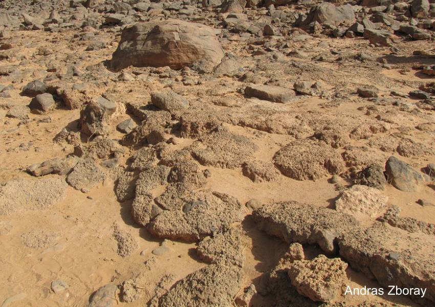
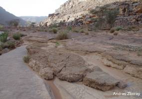
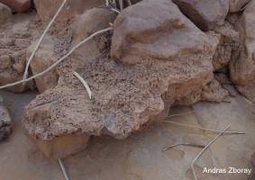
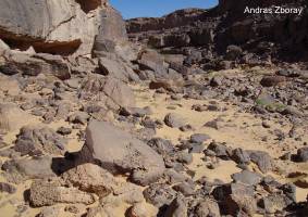
2. Tassili Mts. (Algeria)
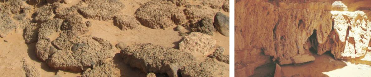
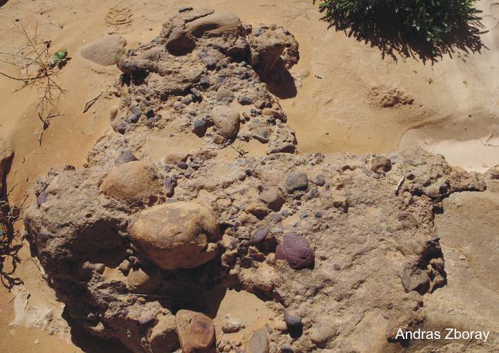
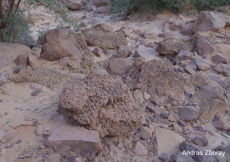
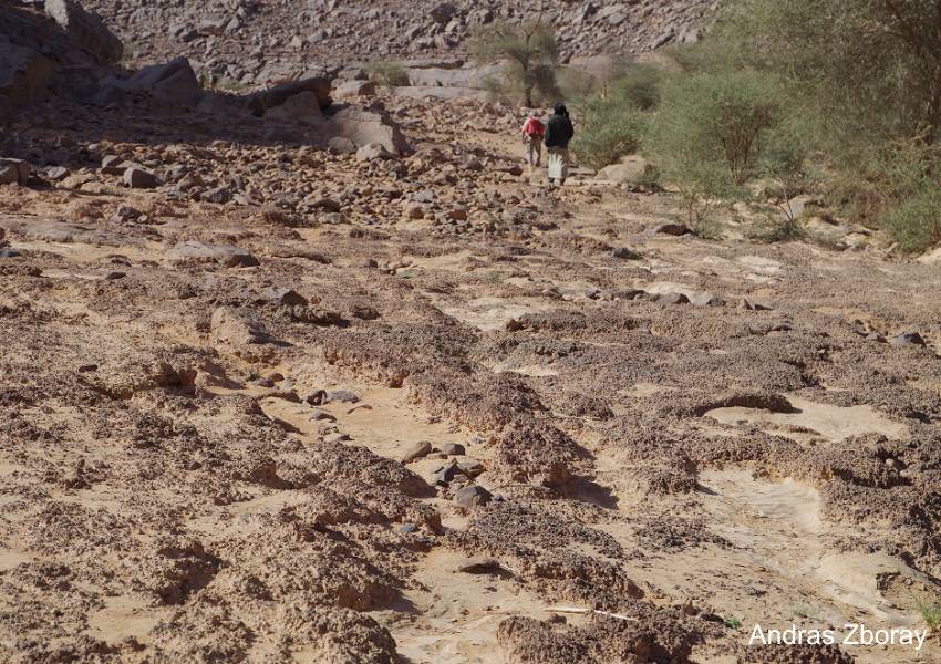
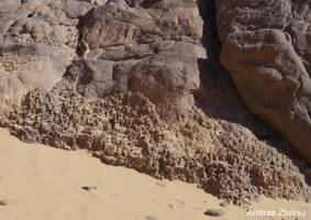
Andras Zboray was back in Algeria
in November 2019 and examined some mysterious carbonate deposits in
the Qued Djerat (Tassili Mountains) again. He had documented his first
finds in November 2014 photographically. These deposits can be traced
a good 20 kilometers along the Oued side, although they are not continuous.
They are found regularly and seem to mark a river terrace , as they
rise with the valley floor. Carbonate mud have cemented a mix of sand
and gravel. The predict eroded volcanic carbonate springs were not sought
because the planned route only followed the valley.
|
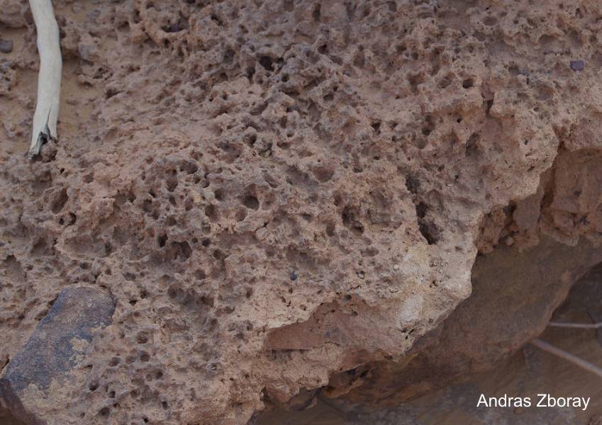
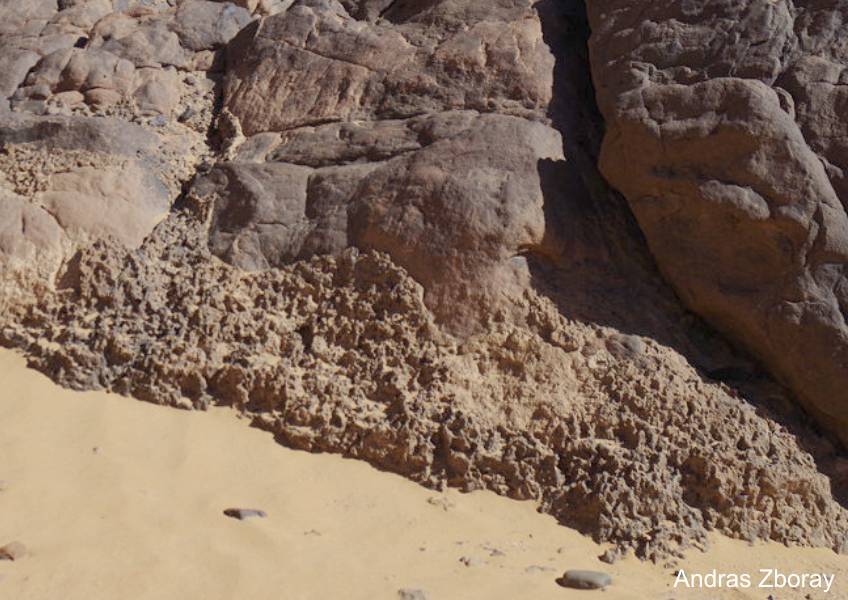
Locations 1-8 im Qued Djaret
|

Loc 1 |
Loc 2 |

Loc 3 |
|
Loc 4
|
Loc 5
|

Loc 6.1
|
Loc 6.1
|
|
Loc 6.2
|
Loc 6.2
|
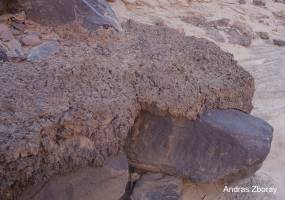
Loc 7
|
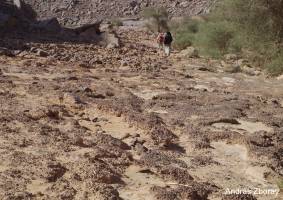
Loc 8
|
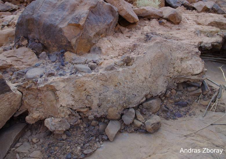
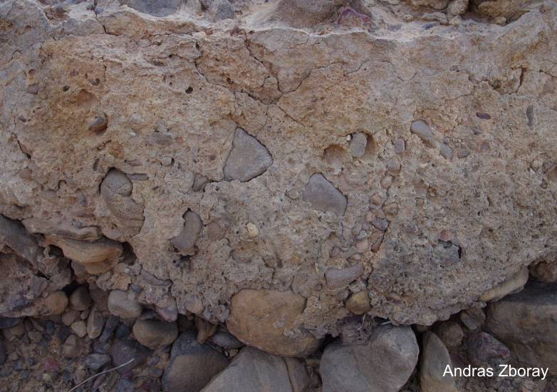
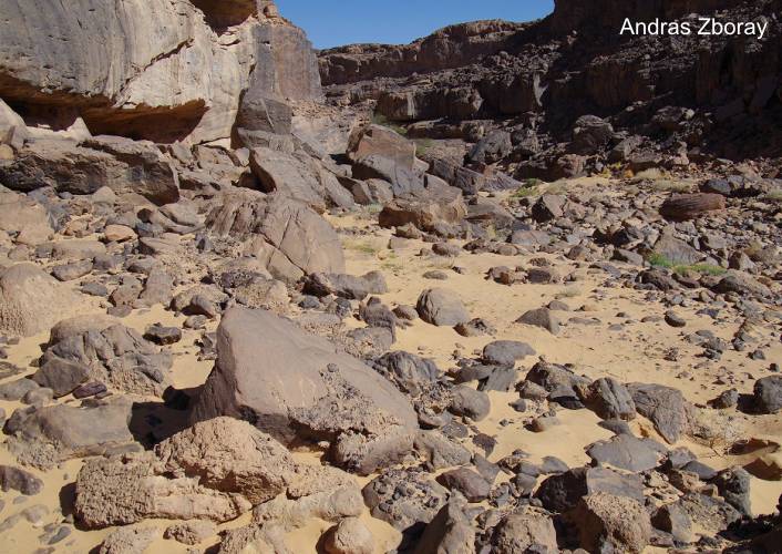
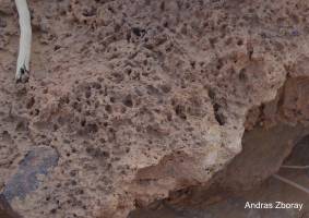
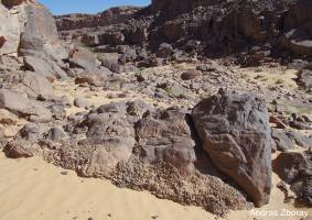
3. Tadrart Mts. (Algeria)
Andras Zboray has also found in 2019 another
similar series of outcrops in a Qued Tin Uded in the Algerian
Tadrart Mountains. Location: 23°54'14"N / 10° 55'20"E. This seems
to indicate that these strange deposits are not limited to the
Tassili Plateau. It is very plausible that carbonate mud, mobilized
from still to be found older volcanic springs, has solidified
the sand and debris-leading terrace deposits in drainage valleys.
These kind of deposits also can be compared with some deposits
in the
Jebel Uweinat (Sudan).
|
|
|
|
|
|
4. Conclusion
coming soon
|
|