|
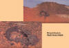
Structure and Geology of the Gilf-Kebir in the SW-corner
of Egypt
Norbert Brügge, Germany
Dipl.-Geol.
Update: 16.12.2019
|
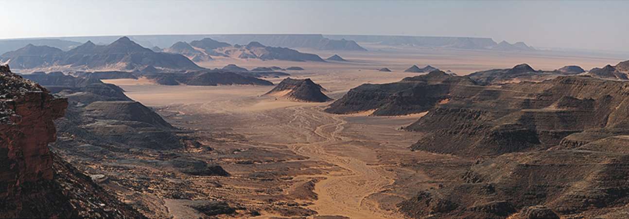
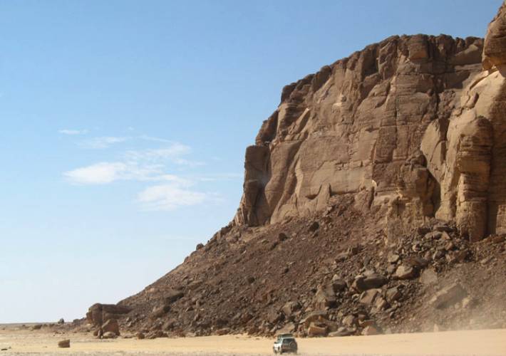
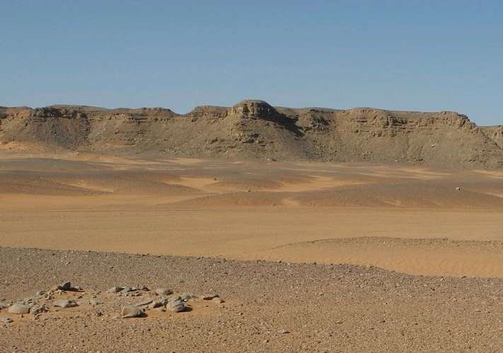
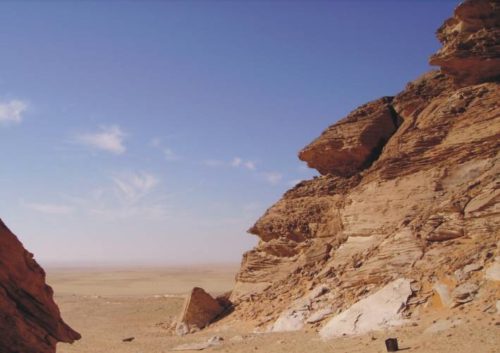
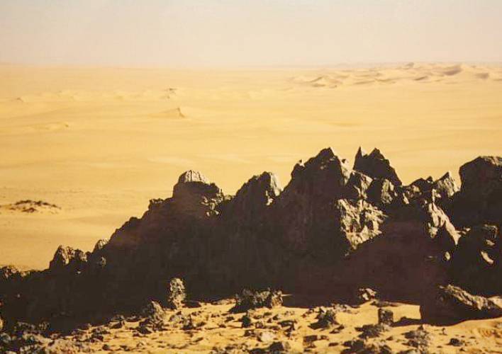
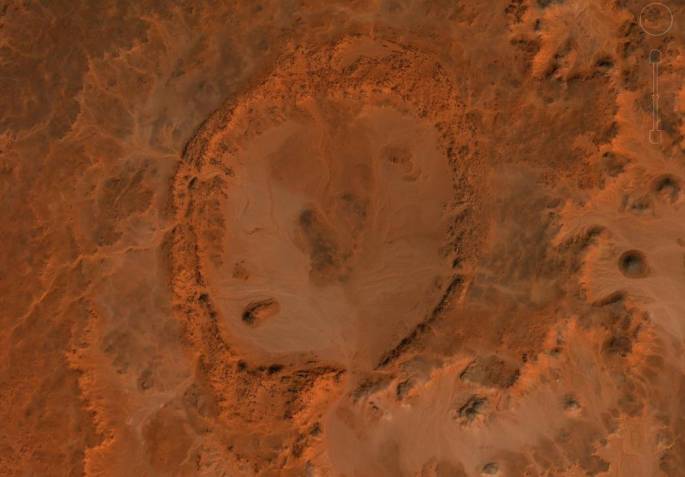
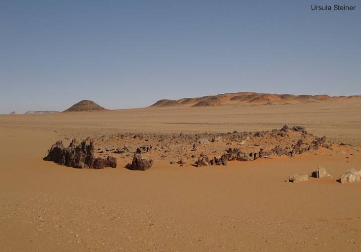
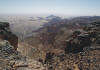
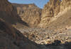
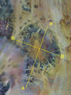
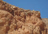
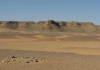
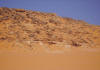
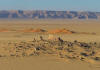
Overall view
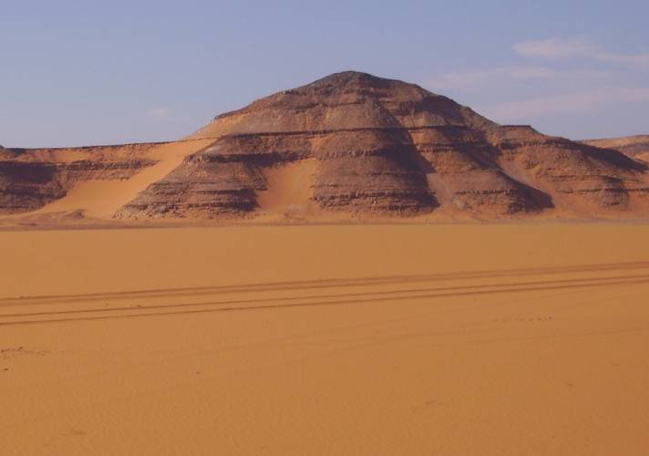
In 1926, when Prince Kemal
el Din Hussein makes the expedition to Jebel Uweinat, he saw a "great
plateau", and called it "Gilf Kebir" (Great Barrier). What he could not
know that the Gilf Kebir is a vast plateau of Paleozoic sandstones with
a length of about 260 km in the NW-SE direction. The more than 500 m thick
sandstone sequence lies as that of Jebel Uweinat directly on outcropping
Precambrian basement. The entire sequence is part of a between 2000 and
3000 meters uplifted structure on the eastern edge of the Kufra basin,
which extends up to Libya and southern Sudan extends (Howar-Uweinat uplift).
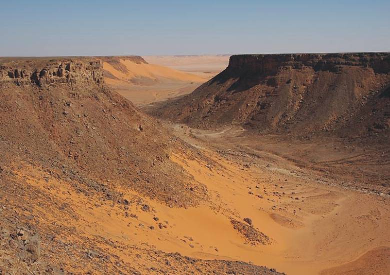
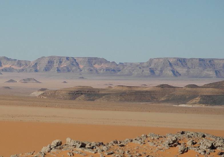
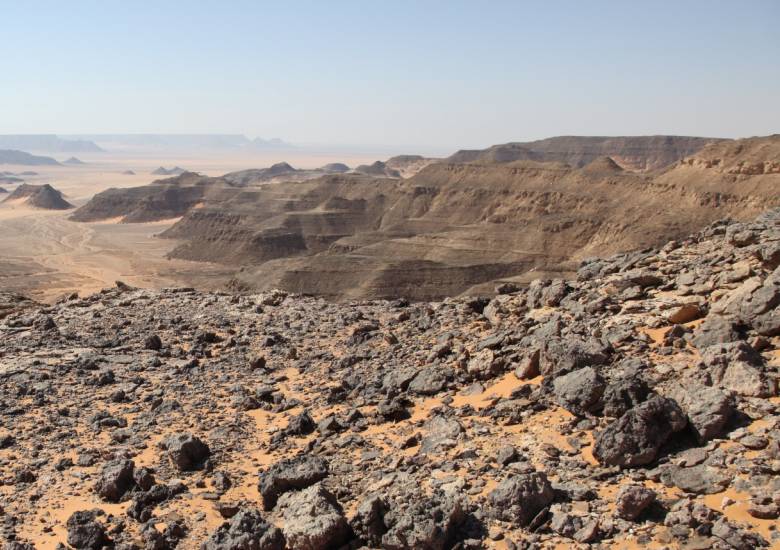
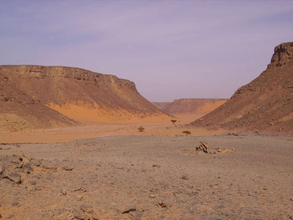
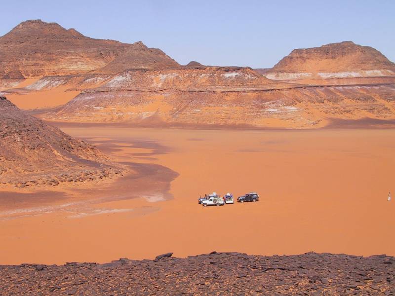
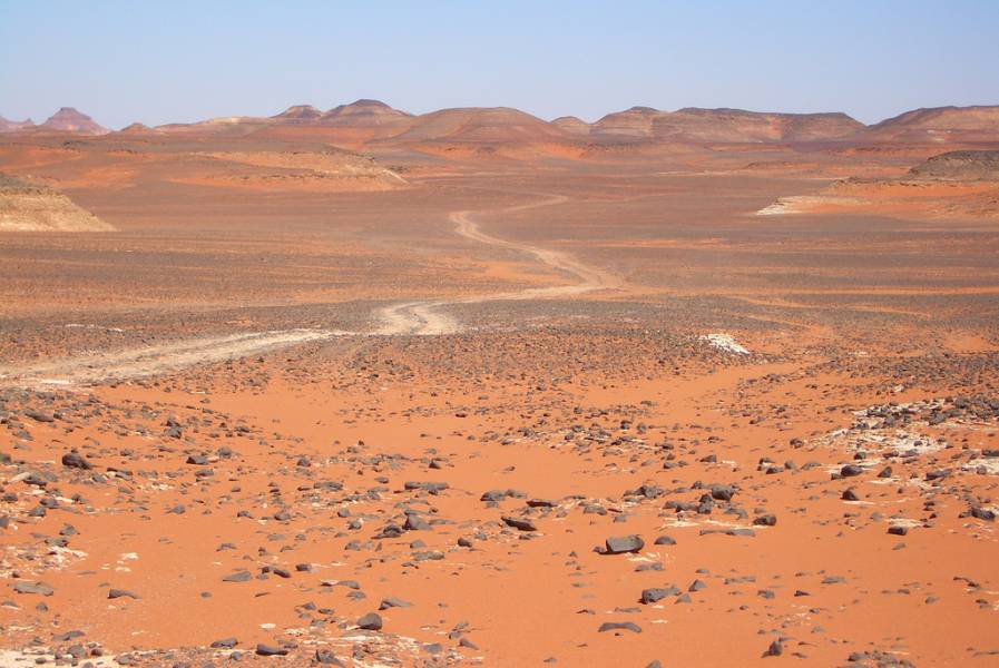
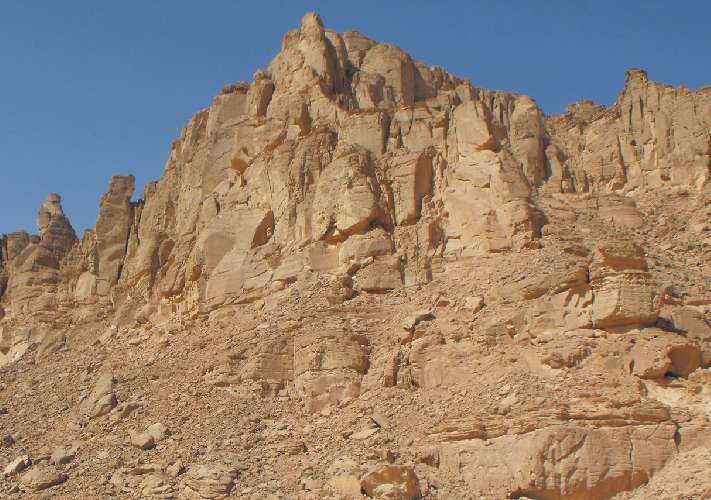
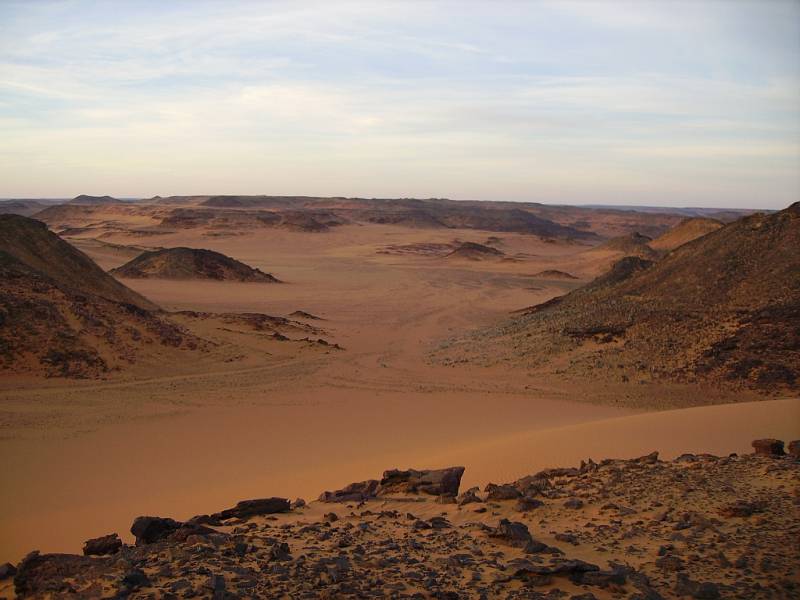
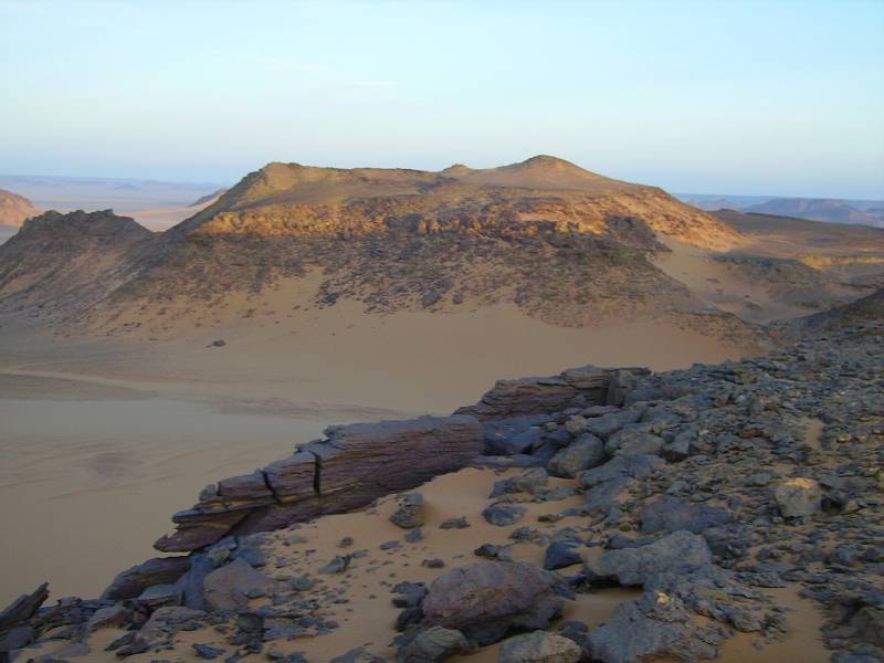
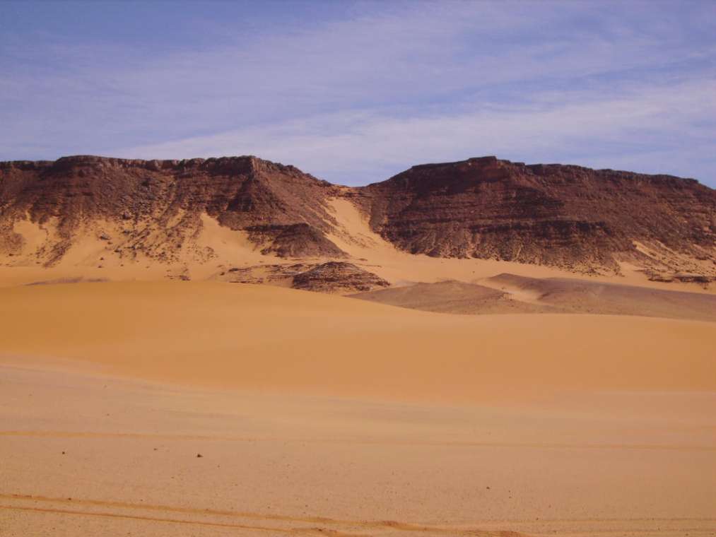
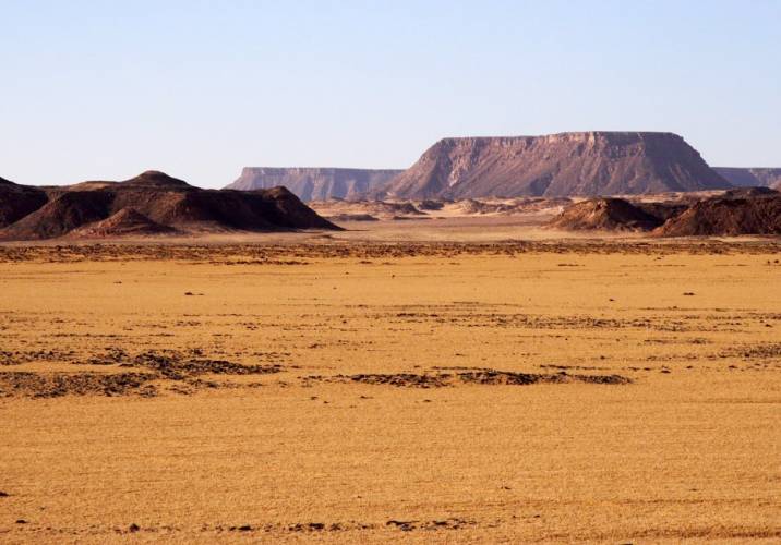
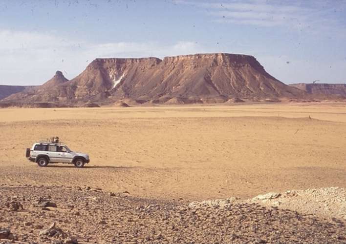
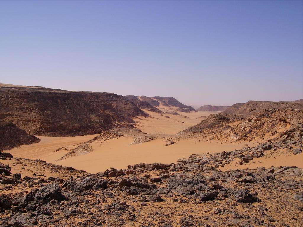
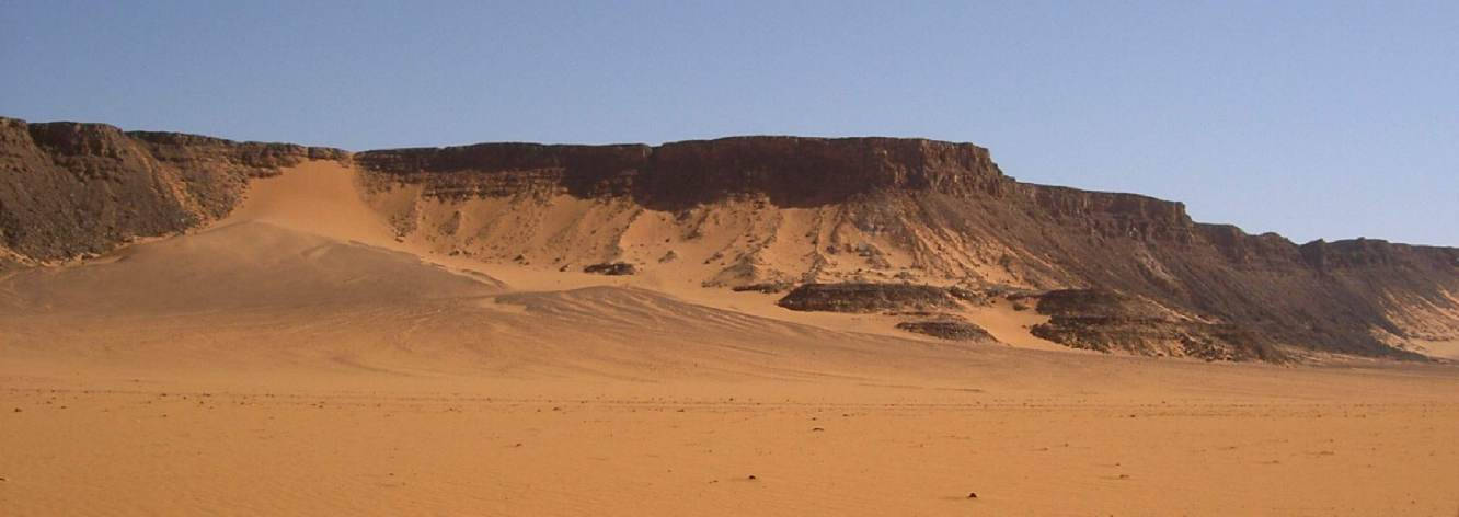
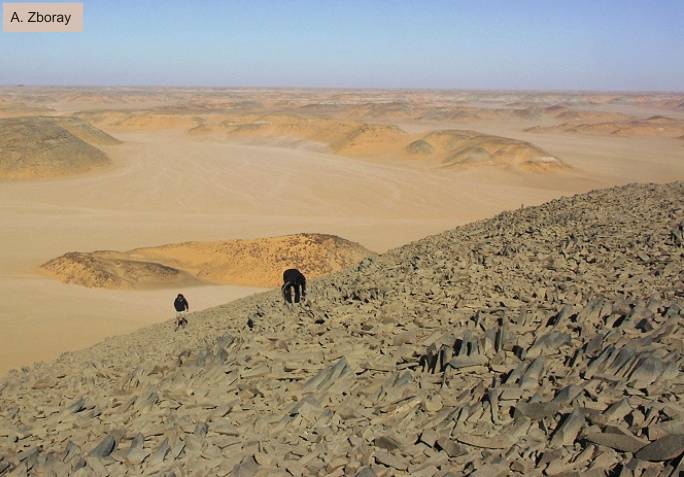
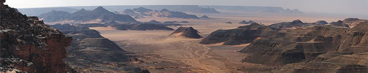
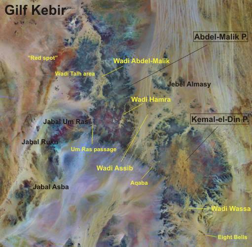
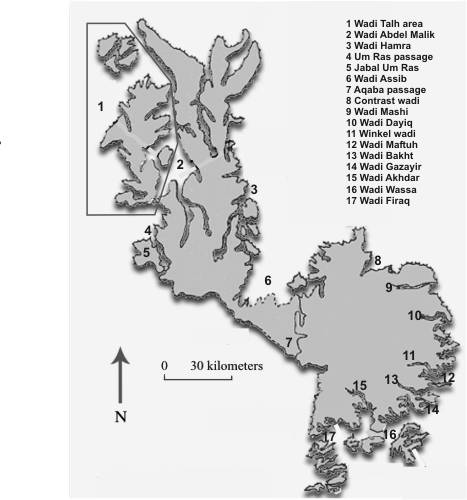
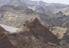
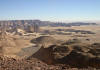
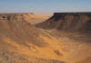
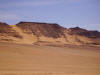
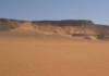
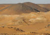
Geomorphologically, the Gilf Kebir can be divided
into two parts. An offshoot of the Great Sand Sea, Wadi Assib (with the
passage Aqaba) separates visually a northwestern part (Abdel-Malik plateau)
from a southeastern part (Kemal-el-Din plateau).
The Abdel-Malik plateau extends over 140 kilometers from north to south
and about 40 kilometers from west to east. It is cutted by two gigantic
wadis, the approximately 100 km long Wadi Abdel Malik and the Wadi Hamra.
On the southwestern edge of the plateau continues to Libya (Jabal Um Ras,
Jabal Rukn and Jabal Asba). The morphological separation is effected by
the Um-Ras passage. The mountains Um-Ras and Abu-Ras the passage overtop
on both sides.
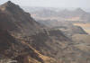
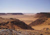
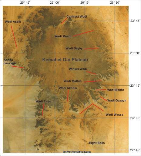
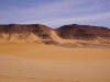
The Kemal-ed-Din plateau extends
over 120 km in a north-south direction and 80 km in the east-west direction.
Many wadis cuts its east and south sides. It are from north to south the
named Wadi Mashi, Dayiq Wadi, Wadi Maftuh, Wadi Bakht, Gazayir Wadi, Wadi
Wassa, Wadi Akhdar, Wadi Firaq.
|
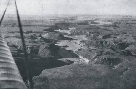
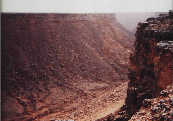
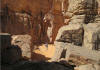
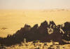
Historical Photo of Wadi Abdel-Malik
( L. Almasy in his Aeroplane in 1933)
|
|
The geographical exploration of the Gilf Kebir began
in the 30s of the last century. This were the Hungarian Laszlo Almasy
and the four Englishman Sir Robert Clayton East, Penderel, Patrick Clayton
and Ralph Bangnold.
Despite some meritorious German-French attempts in the 70s and 80s of
the last century to decrypt the previously unknown geological structure
of the Gilf Kebir (Klitzsch, Lejal-Nicol, Wycisk), there is still no
conclusive answers. So could be the official geological map of the Gilf
Kebir false. By new finds of plants imprints of the Carboniferous period
at the edges of the Gilf Kebir are the postulated Cretaceous sediments
within both plateaus put into question.
The
Abdel-Malik
Plateau is complicated structured
and geologically difficult to decode. A special feature are marine Carboniferous
deposits with plants imprints, which are widely spread in the so-called
Wadi Talh, and probably above a heavily eroded relief of older Paleozoic
sandstones lie.
The
Kemal-el-Din
Plateau has a simple structure,
but has a
subvolcanic overprint that also spread is in the surrounding ranges
(eg Clayton Craters and Gilf Kebir Crater Field).
|
|
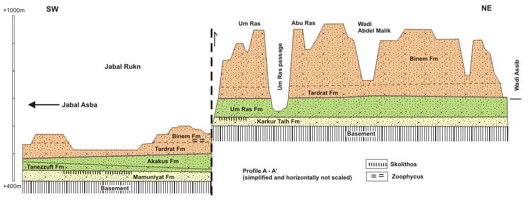
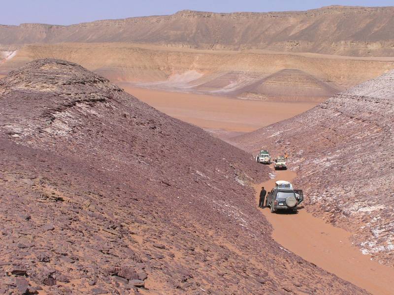
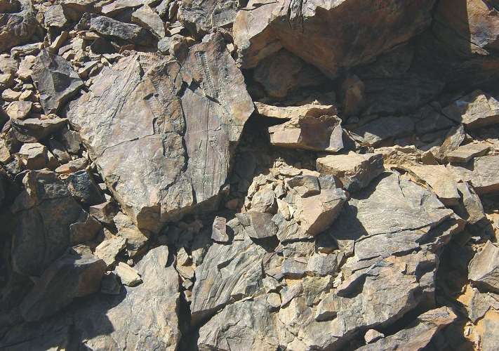
In the Abdel-Malik plateau,
of about 100 km in length, an eponymous Wadi separates two different
structural-geological units. The western part, the so-called Wadi
Talh area, is dominated by shallow marine Carboniferous deposits (Wadi
Malik formation in sense KLITZSCH), which were deposited on a relief
of heavily eroded older sediments. The eroded layers include the time
of Devon and Silurian. In contrast, the eastern and southern part
is by thick, sometimes significantly cross-stratified sandstones dominated,
which lie in an unconformity on in varying degrees eroded Ordovician
sandstones. This unit includes deposits of Silurian and Devonian.
Separated by the
Abu Ras passage is this about structural-geological unit to the SW
in the Libyan Jabal Um Ras and Jabal Rukn away. The subsequent Jabal
Asba has in its structural-geological development of a special relationship
between the Kufra Basin and the Howar-Uweinat Uplift. Striking is
a much deeper level of the basement. Here are to find also clearly
open marine Silurian deposits. In the Gilf Kebir are this Silurian
strata by a fluviale to shallow marine facies replaced.
For a temporal allocation of
the sediments in the Gilf Kebir, however, are only the Carboniferous
strata secured. Plants prints and brachiopods are available. Without
fossils it is difficult to distinguish Ordovician, Silurian and Devonian
strata. The presence of trace fossils (Scolithos, Cruziana, Arthrophycus
or Harlania) in some sequences is not enough. Characteristic,
however, is a Paleosol-layer with rich Scolithos in all structures
(Gilf Kebir, Jebel Uweinat and Jabal Asba). This horizon occur in
the upper unit of a series of particularly compact sandstones above
the basement, and should be used as a marker horizon between the Ordovician
and Silurian. It follow Silurian strata with Arthrophycus and
Harlania. This sequence corresponds to the so-called Um-Ras
formation (KLITZSCH), but without the lower part with the Scolithos-layer.
It corresponds to the Ordovician Karkur Talh formation (KLITZSCH)
in Jebel Uweinat.
In the official geological
map early Cretaceous sediments are widespread in the Gilf Kebir plateau.
There are, however, no concrete evidence. This assumption is probably
based on an determination of a few poorly preserved plant imprints,
not accurately localized by Anni Lejal-Nicol, in the Aqaba passage
and in the northern foothills of the plateau were found.. The associated
sedimentary sequence is called "Gilf Kebir Formation".
|
|
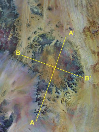
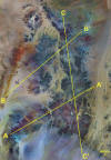
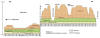
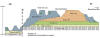
Structural-geological models
|
|
|
|
|
|
|
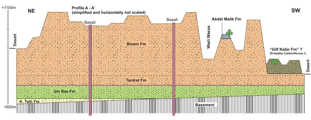
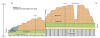
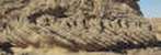
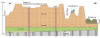
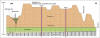
Profile A-A'
|
Profile B-B'
|
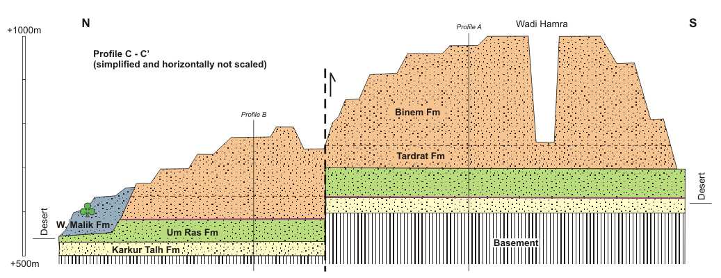
Profile C-C'
|
|
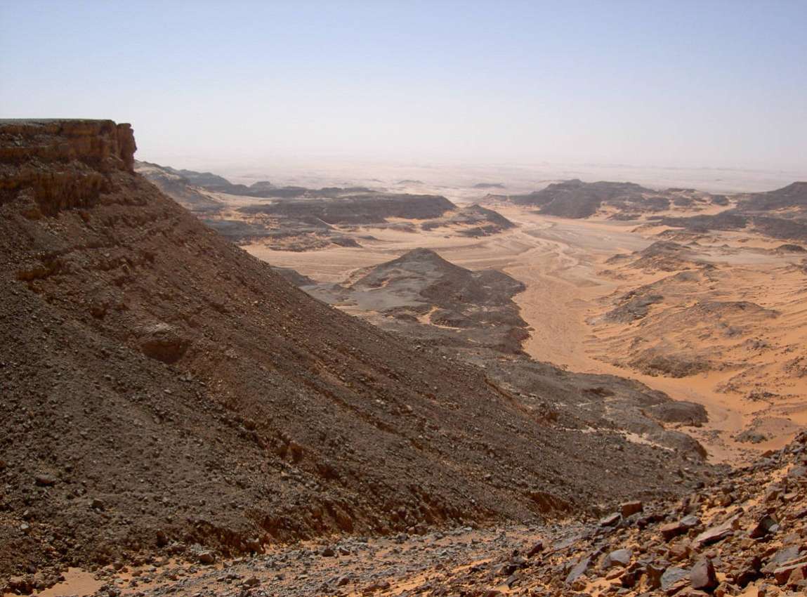
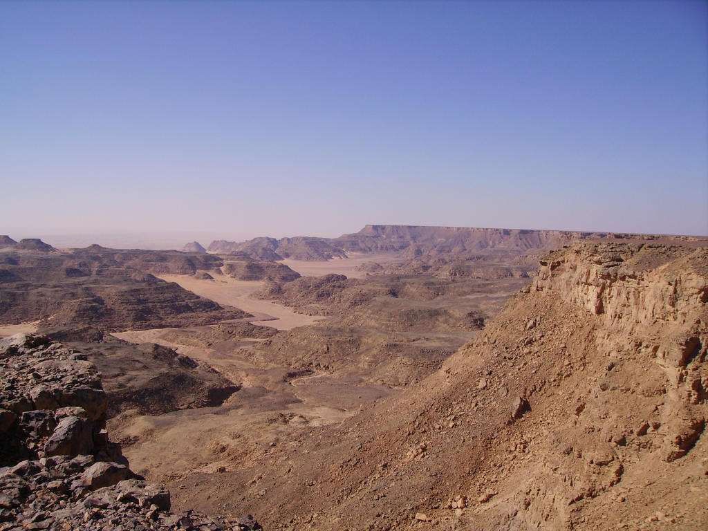
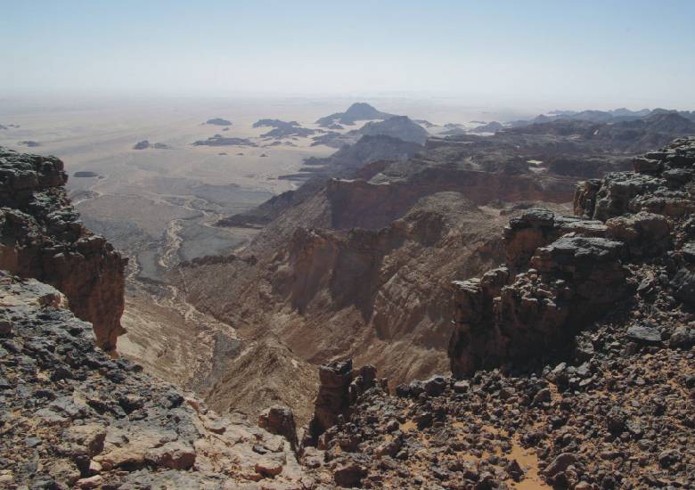
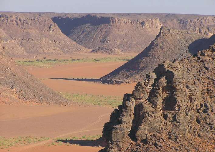
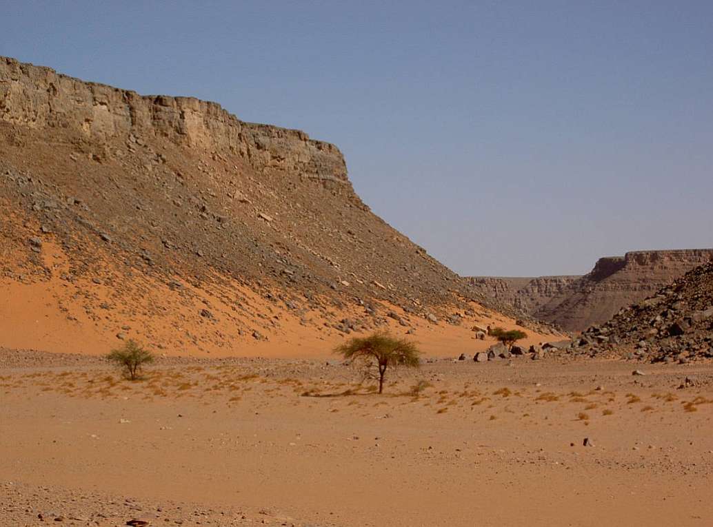
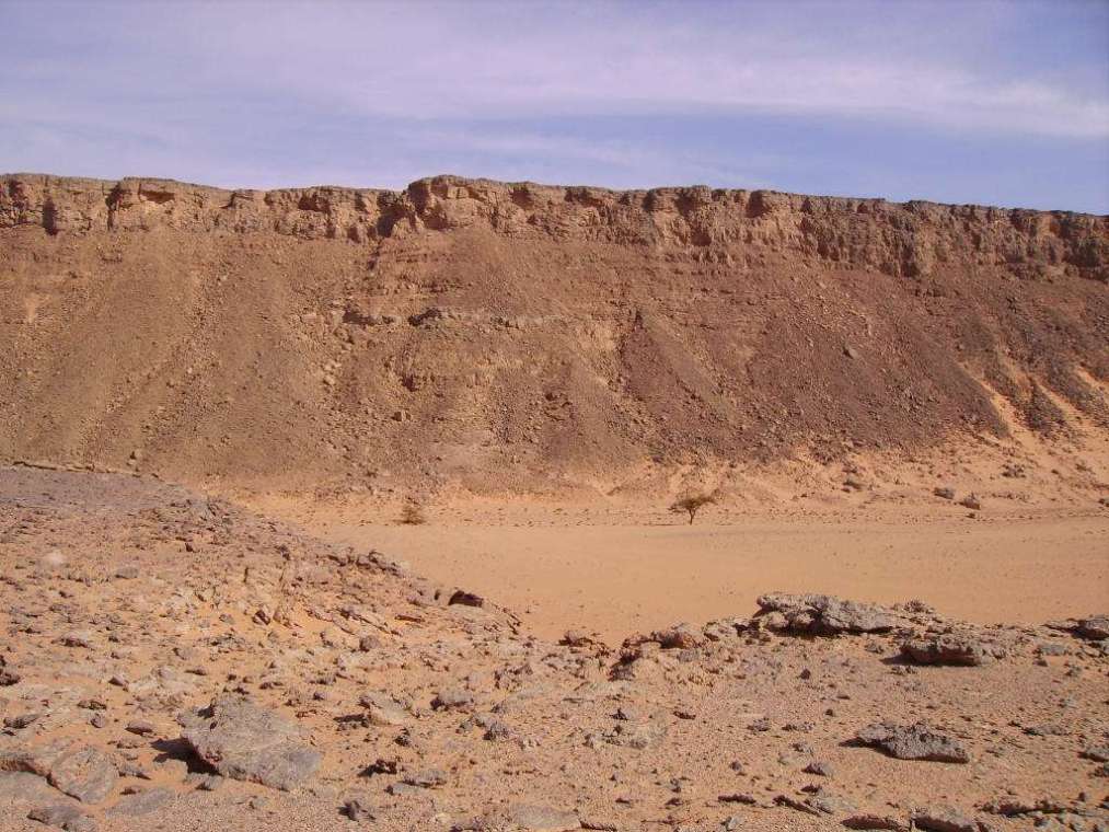
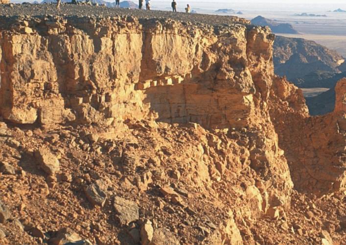
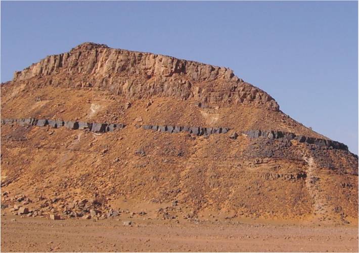
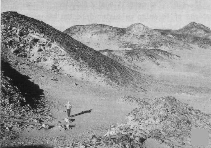
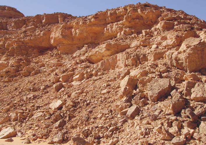
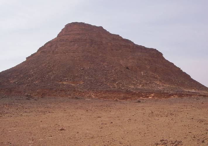
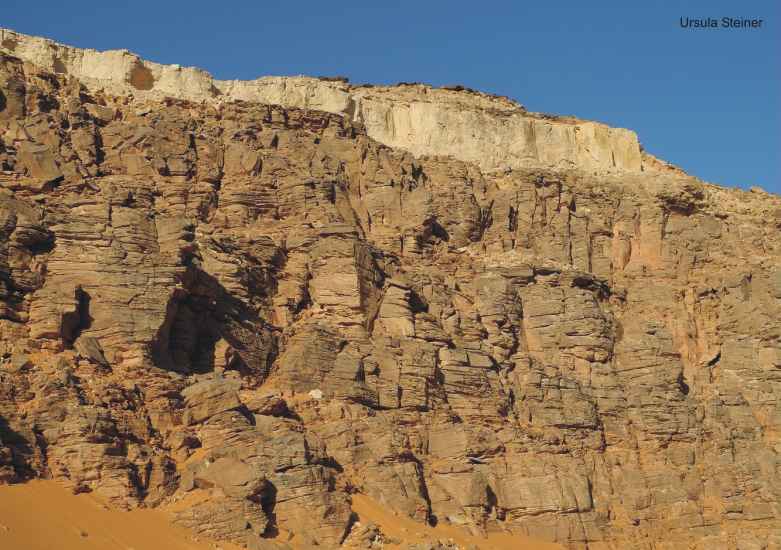
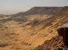
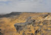
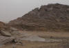
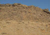
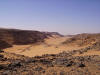
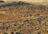
Plateau
escarpment
|
|
|
|
|
|
|
|
|
|
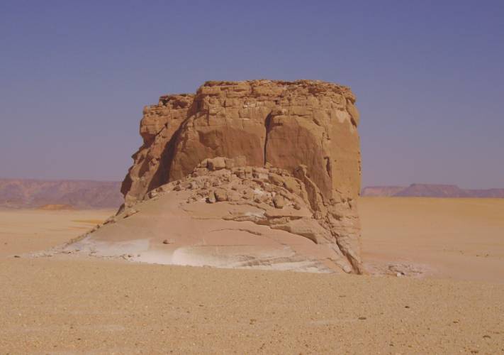
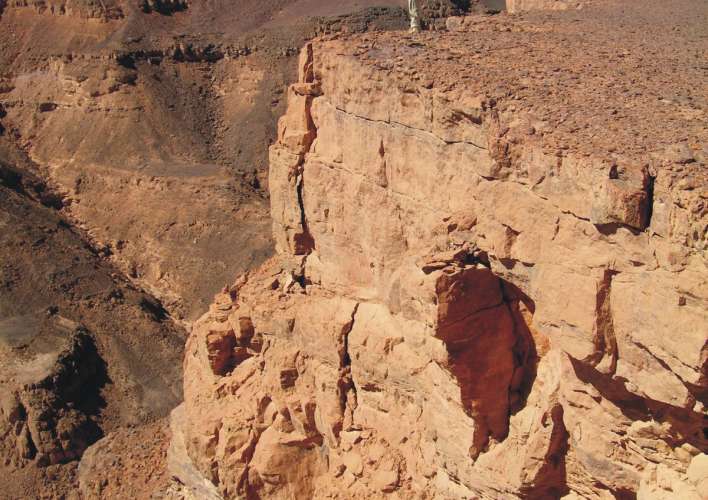
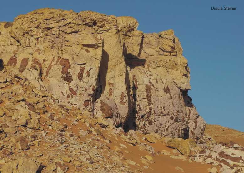
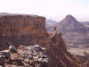
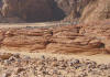
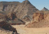
Southwestern
Cliff (Samir Lama point)
|
|
|

|
|
|
|
|
|

|
|
|
|
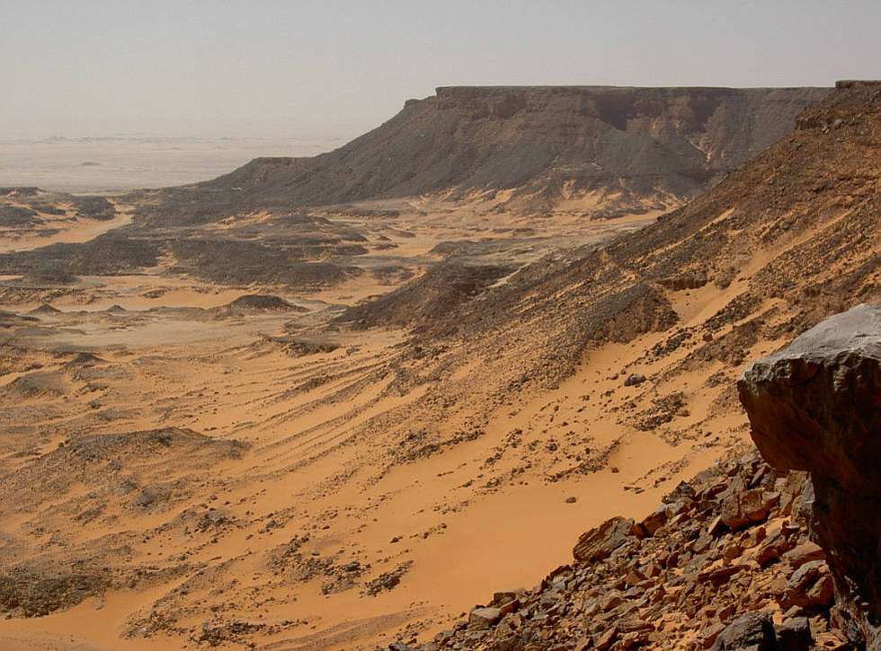
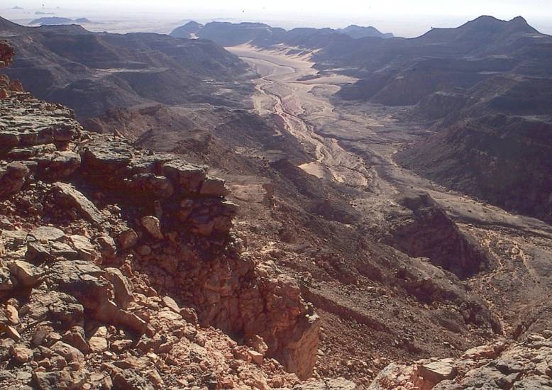
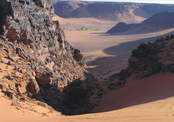
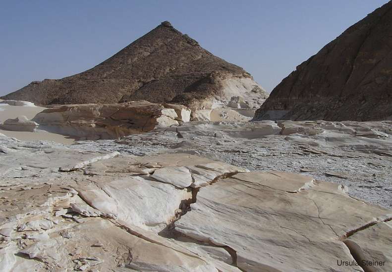
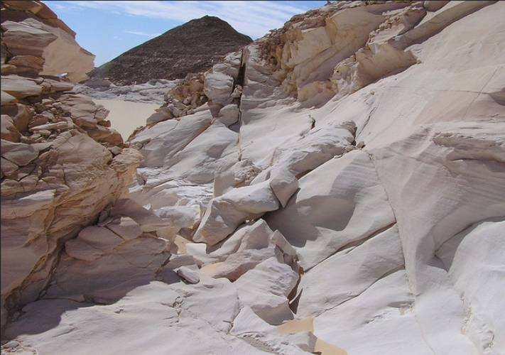
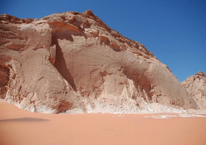
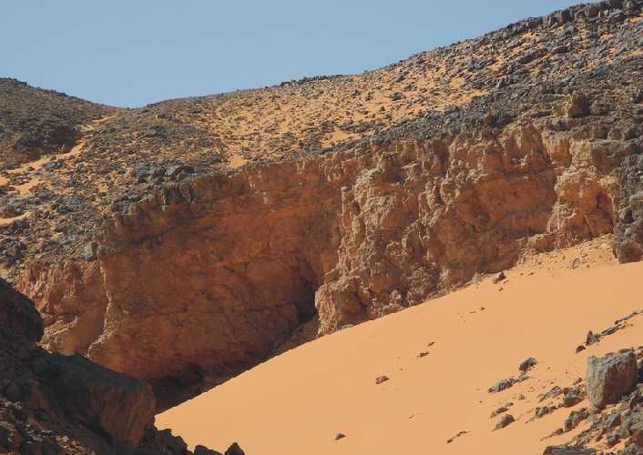
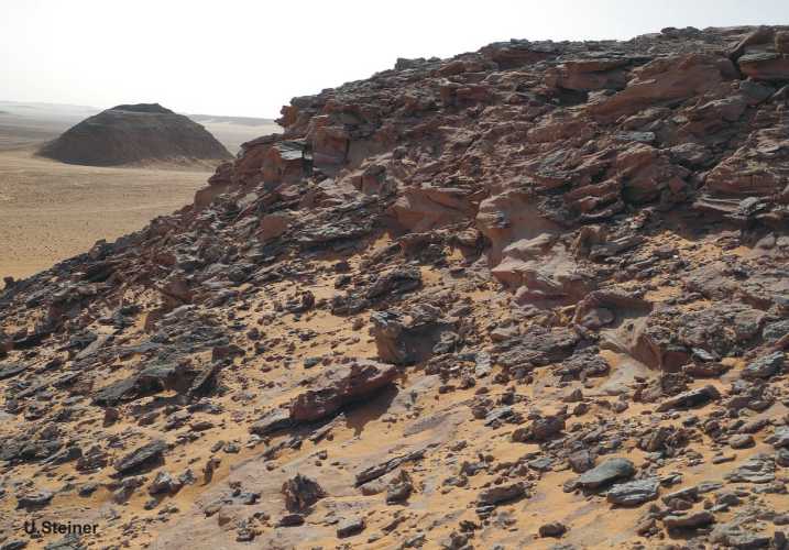
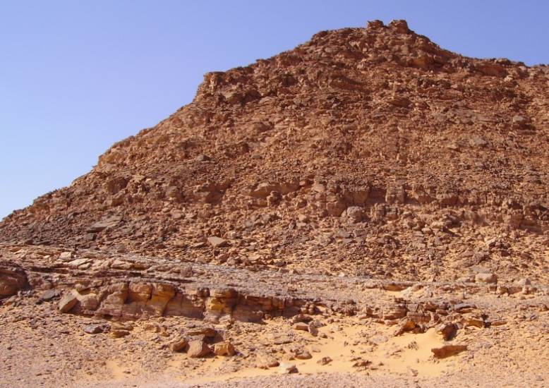
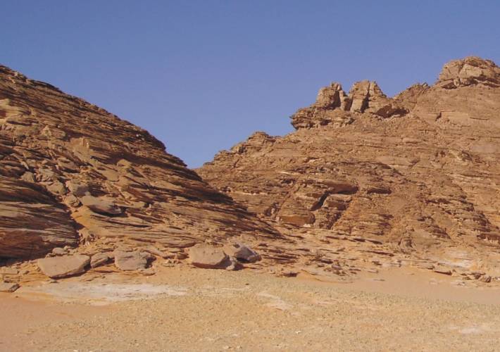
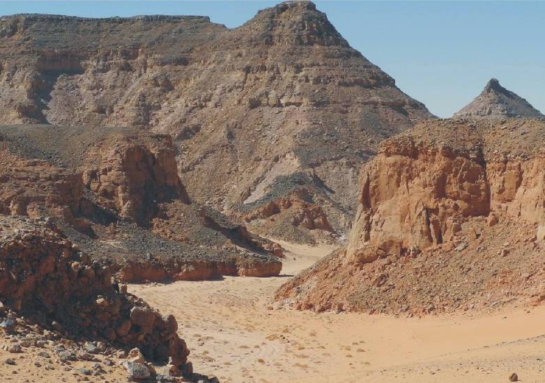
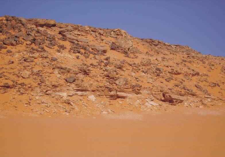
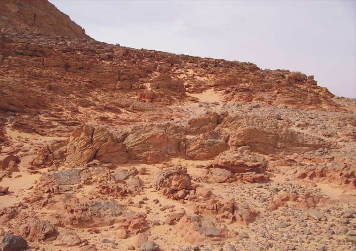
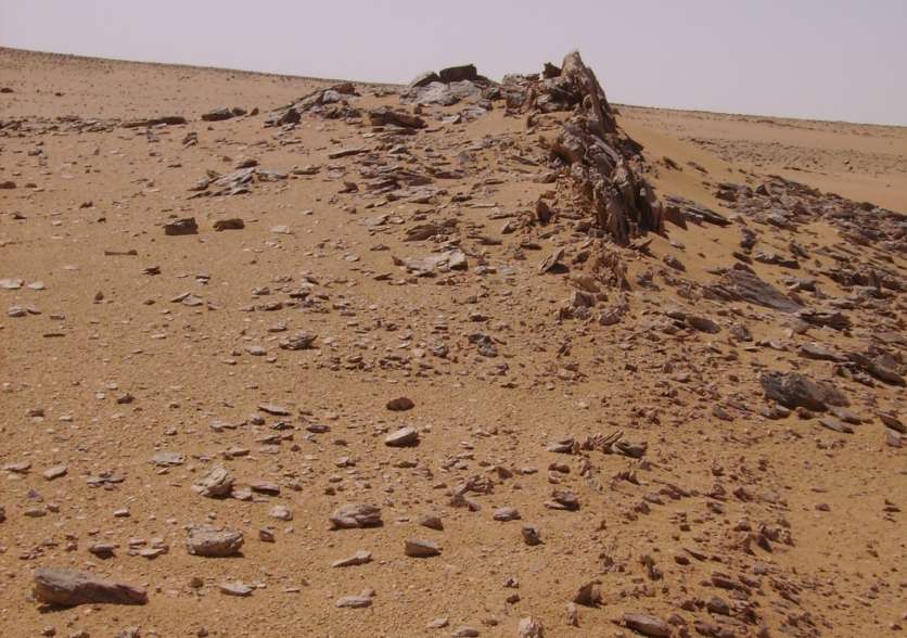
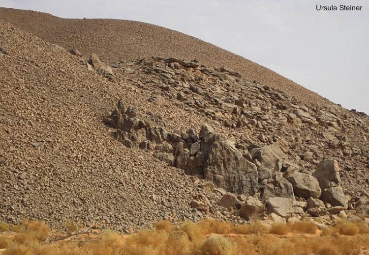
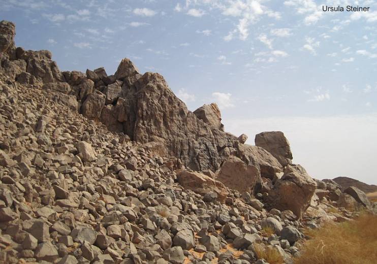
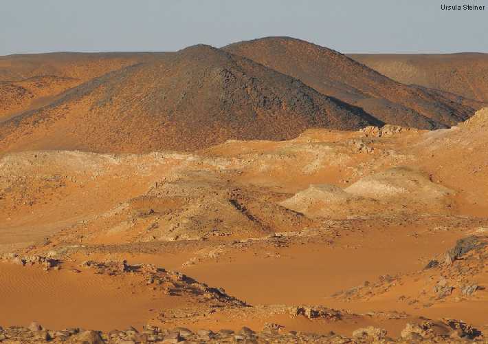
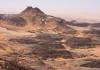
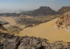
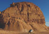
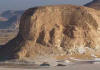
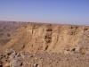
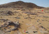
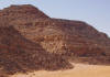
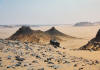
Jabal
Um Ras and surrounding
|
|
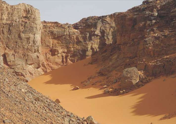
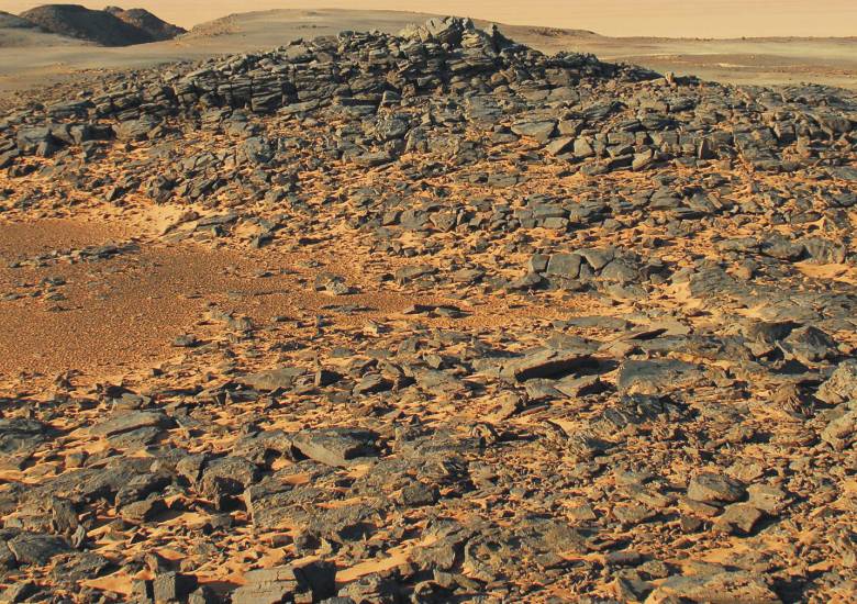
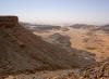
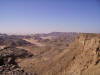
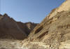
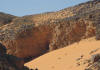
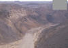
Wadi
Zura
|
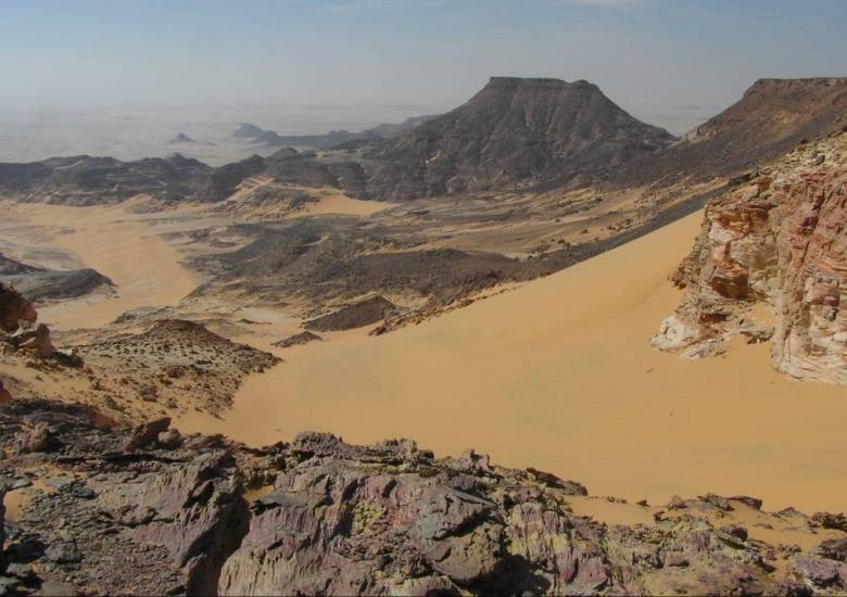
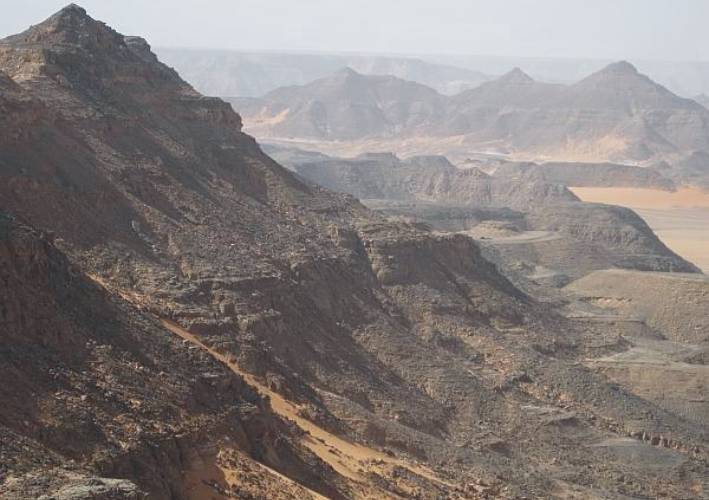
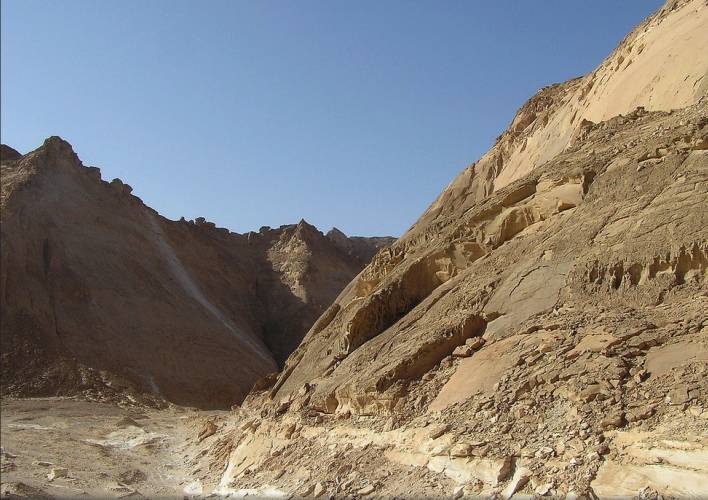
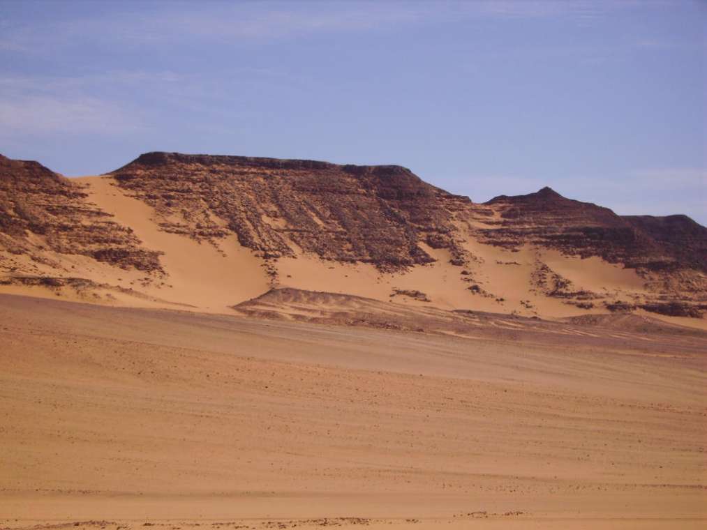
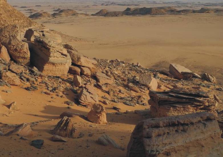
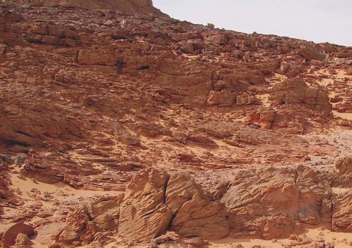
Gilf
Kebir eastern side
|
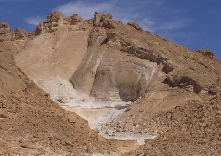
Northern
plateau (Wadi Talh area) and foothills with Carboniferous strata
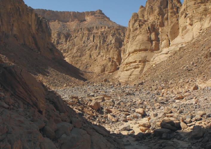
Plateau
main wadis
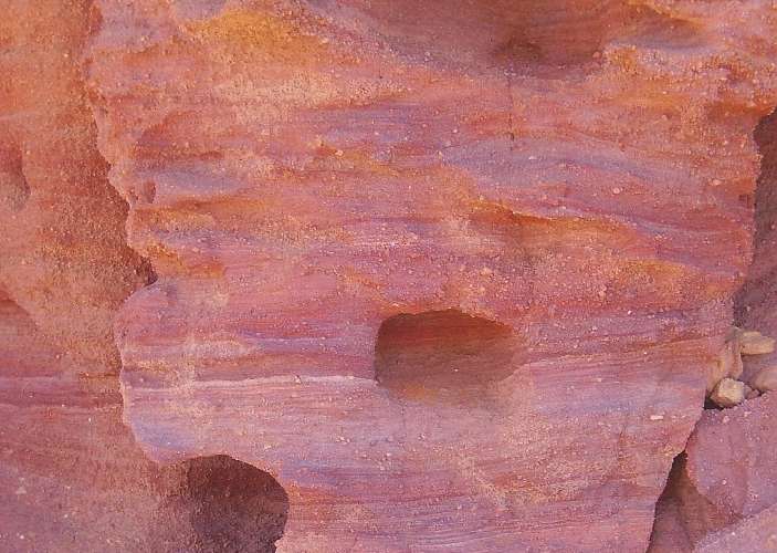
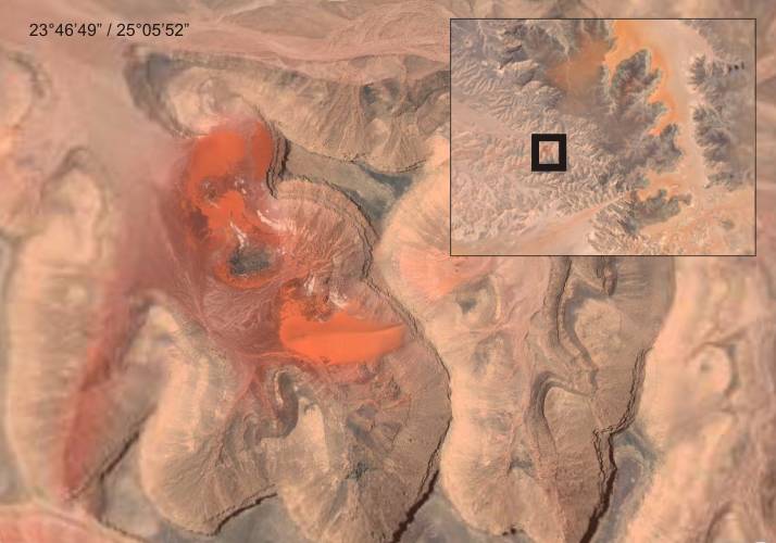
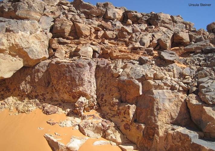
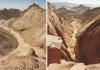
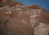
"Red
Spot"
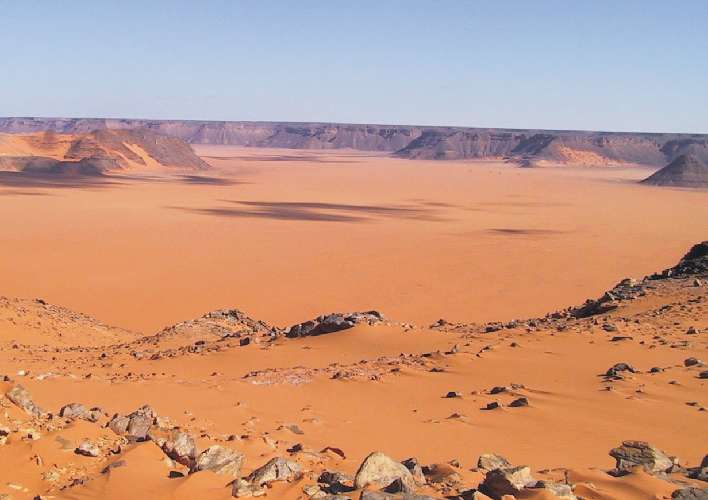
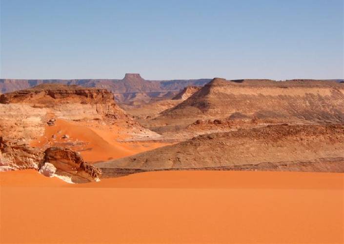
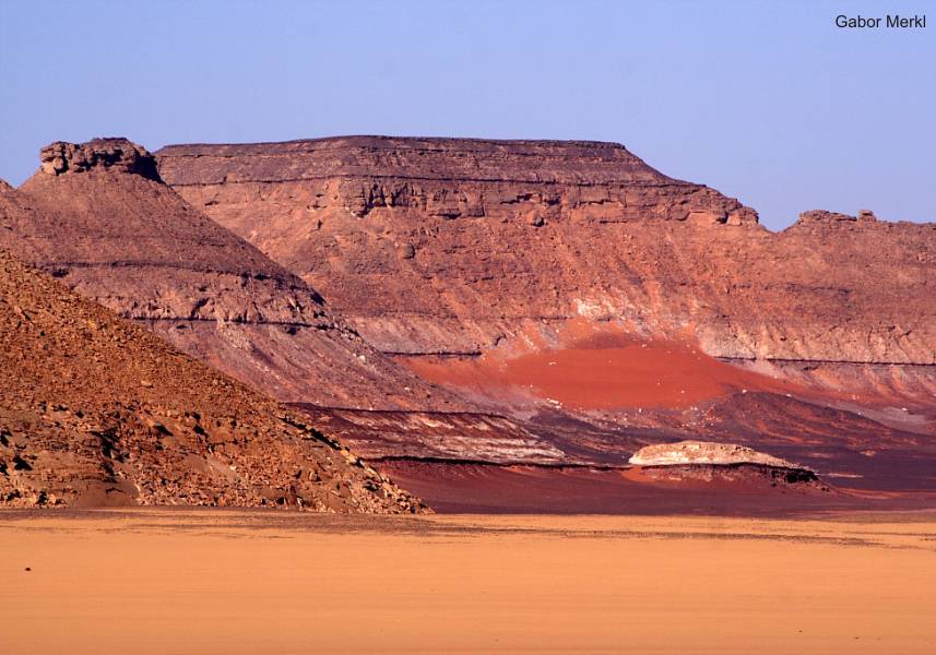
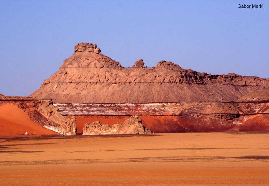
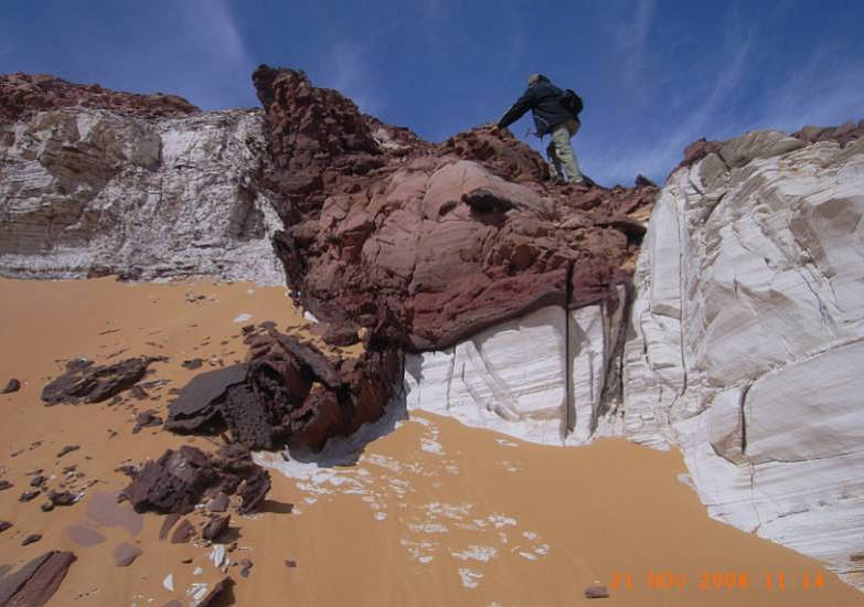
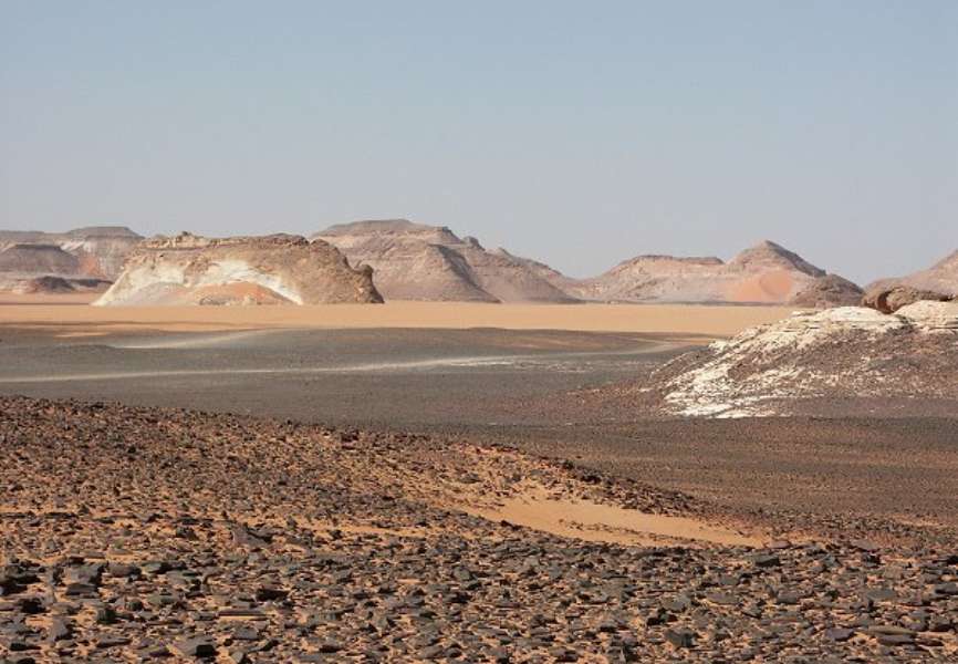
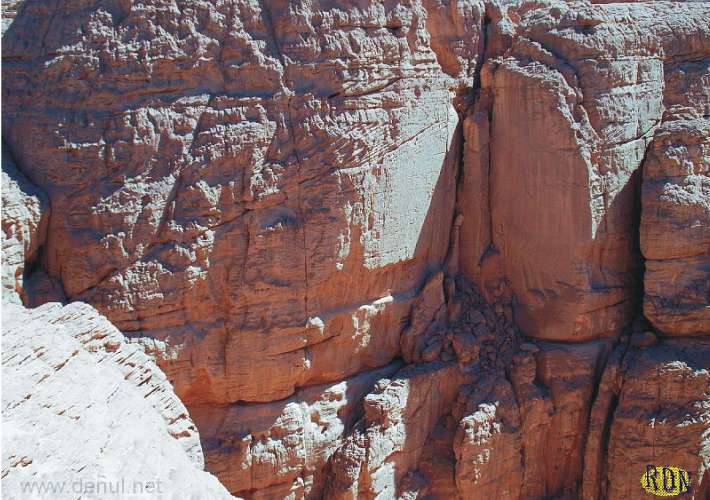
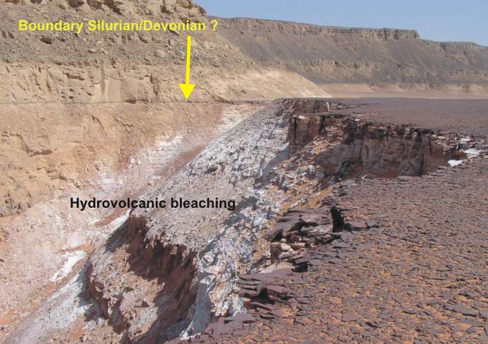
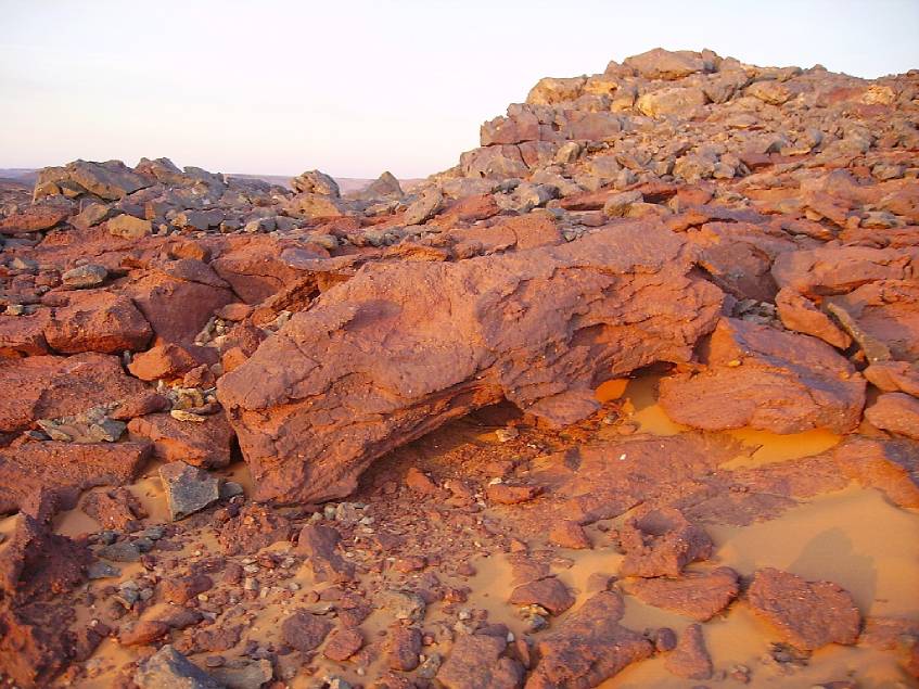
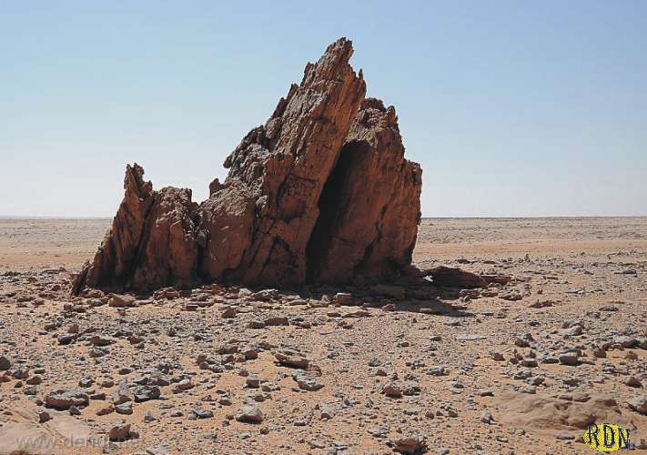
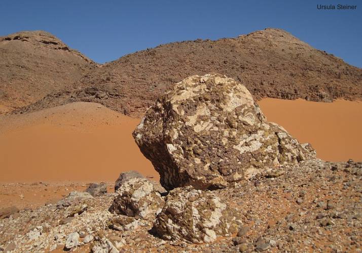
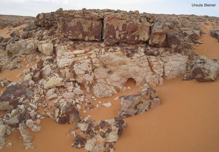
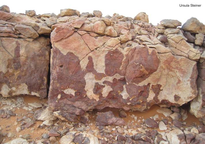
In the western part of the Gilf
Kebir and its foothills at the Libyan side is observe widespread
conspicuous red discolored areas on the satellite image. This area,
beyond the Egyptian border, is an intensively influenced
by hydro-volcanic activities
during the Oligocene age (Gilf Kebir crater field, Regenfeld pipes,
Libyan desert glass etc.). A striking feature is the "Red
Spot". Here are the strata complete impregnated by iron-containing
hot solutions. Locally it should be noted that these surfaces are
covered with hardened ferruginous sandstone plates or detritus on
alluvial plains.
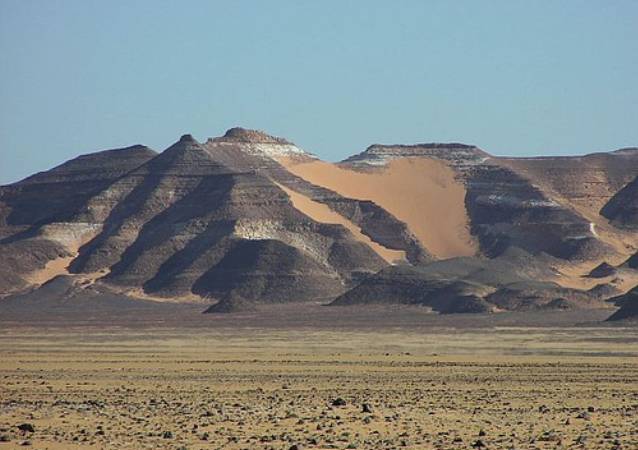
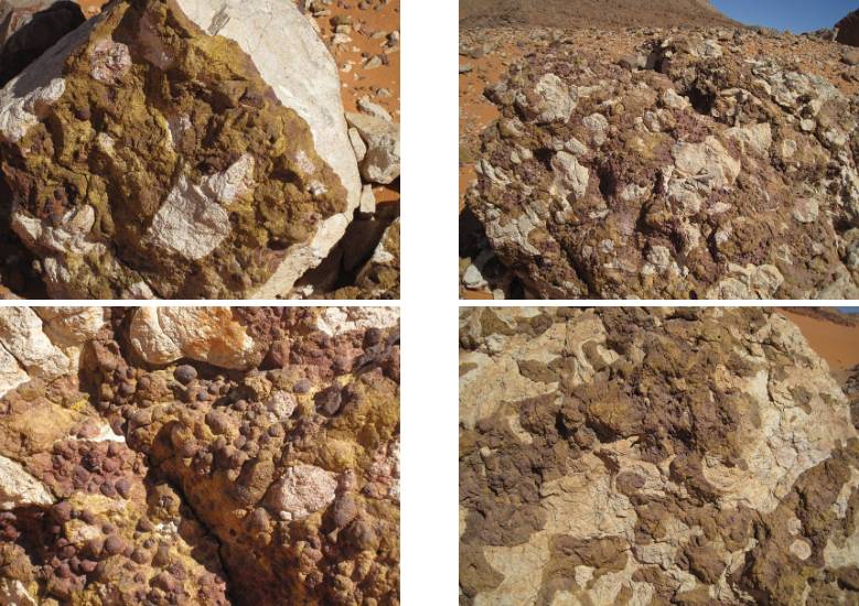
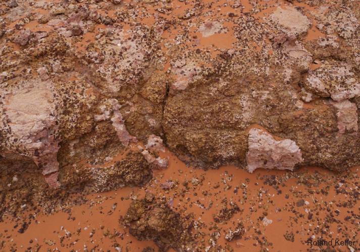
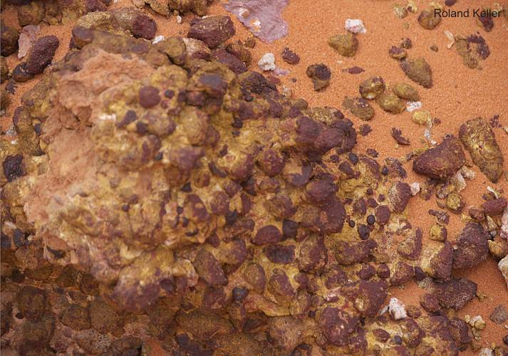
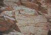
In the geological profiles of the hills and mountains in this region
is also to observe a several changes of these red layers with
white sandstones. Such a change is not necessarily coupled
to the bedding planes in the sediments.White sandstones also occur
as clusters which break the stratification.
This is a clear indication of the predicted hydrothermal processes
that have led to a bleaching of the sandstones. The possible chemical
and mechanical processes are not explored.
|
Sedimentary
accumulation and stratigraphy
1. Proterozoic
Basement
The Proterozoic
basement is located very close to the surface. On the widespread erosion
surfaces in the foreland but are outcrops very rare because they are
covered by desert sand. Debris of basement has the author found in the
foreland of the Gilf Kebir plateau nearby the Aqaba passage.
2.
Lower Paleozoic Sedimentation
|
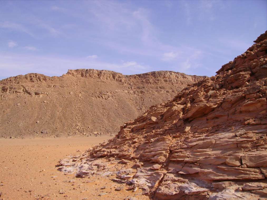
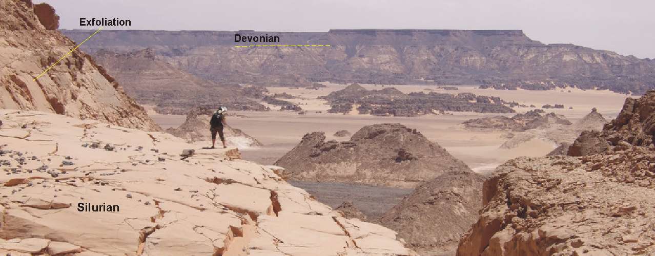
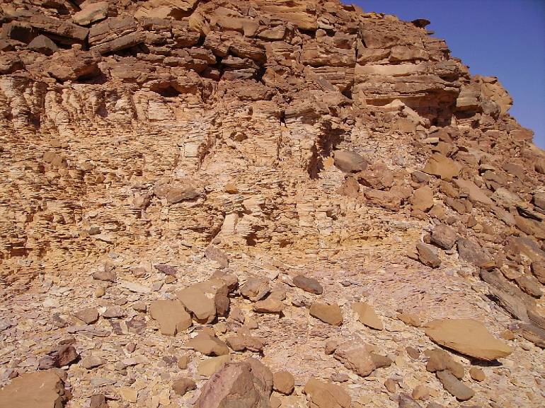
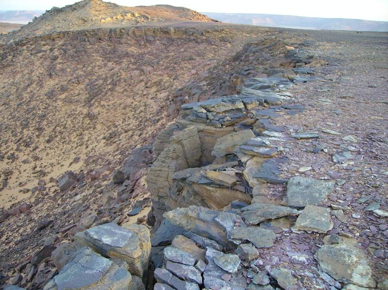
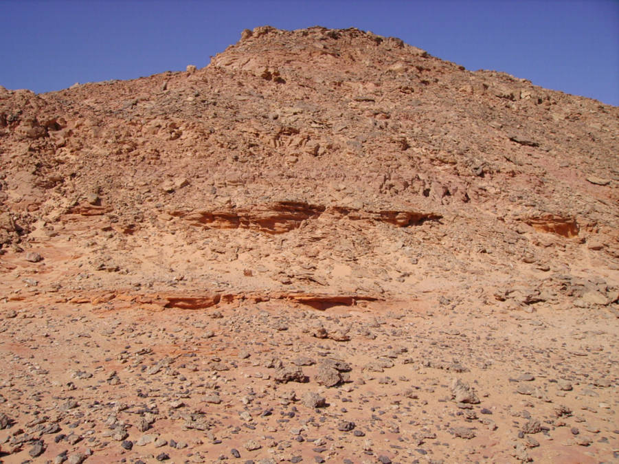
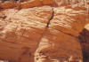
Along the southwestern
ridge of the Gilf Kebir Plateau can be studied Paleozoic strata
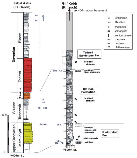
at many places. The Ordovician/Silurian Um-Ras Formation (in sense
KLITSCH) reaches a thickness of 100 m between the Um Ras passage
area and the southwestern slope of the Abdel-Malik plateau. It consists
mainly of fluvial and deltaic sandstone, intercalated with interbeds
of shallow marine siltstone, some shale and burrowed sandstone.
These beds contain Harlania harlani DESIO, Cruziana cf.
acacensis SEILACHER, Scolithos sp. and other trace fossils
at several levels. At the type locality, the Um-Ras Formation directly
overlies Precambrian basement. South of the Um Ras passage, the
trilobite tracks (Cruziana) of Ordovician age occur only
some meters above basement. The Um-Ras Formation is overlain by
maximal 300 m fluvial sandstone similar to the Devonian Tadrart
and Binem Sandstone, are exposed at the escarpments of the plateau
as well as in large wadis in the plateau.
|
|

Stratigraphical typus (KLITZSCH & WYCISK,
1987)
|
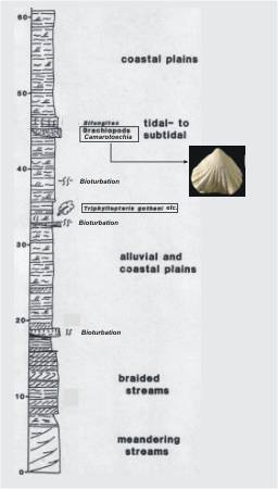
The Karkur-Talh Formation is represented by 30 meters
of shallow marine and tidal sandstone.
"The Formation can be interpreted as deposits of subtidal shoals
and tidal channels. The coarsening-upward sequence at the lowermost
part of the section is made up of interbedded laminated siltstone
and fine-grained sandstone with wavy lamination and
ripple cross-lamination. It contains trace fossils. The upper
part of this coarsening-upward sequence is made up of fine- to medium-grained
destratified sandstone, containing abundant Skolithos-burrows.
This Skolithos-sandstone of up to two meters in thickness is erosively
overlain by tidal channel-sandstone, consisting of medium- to coarse-grained,
trough and planar cross-bedding with intraformational conglomerates
at the channel floor.
The uppermost part of this first shallow marine unit is formed by
skolithos-baering, medium- to coarse-grained sandstone which is
poorly defined cross-bedded and partly conglomeratic. This unit
can be up to 18 m thick. The density of the skolithos-burrows increases
towards the top. The environment of origin is assumed to have been
subtidal shoals, produced during more rapid sedimentation.
The second minor shallow marine intercalation in the upper part
of the formation is only up to 5m thick. It is composed of a fining-upward
tidal-channel sequence with trough cross-bedde sandstone and fine-grained
sandstone to shaly siltstones, with partly intensive bioturbation
towards the top. Locally, a subfacies of well-sorted, fine-grained
sandstone exhibiting horizontal and low-angle cross-stratification
with parting lineation occurs. This subfacies indicates upper-flow
conditions within the nearshore environment. The shallow marine
intercalations can be traced to the area of Aqaba passage (Gilf
Kebir)."
The Um Ras Formation is typical for the interface
of fluvial and very shallow marine environment near the edge of
the Silurian marine transgression. It has a thickness of approximately
75-80 meters.
"The deposits of the Um-Ras Formation are descrided as non-cyclic,
braided fluvial systems. This sheet-like, medium- to coarse-grained
sandstone is moderatly sorted and exhibits small- to large-scale
tabular cross-stratification. Grouped sets of omikron crross-stratification
alternate with a minor facies of horizontal stratification, and
low-angle cross-bedding and single pebbly layers. Deformed cross-bedding
is frequent and may occur in successively superimposed sts. The
style of deformation ranges from buckled to overturned and convolute
foresets. Braided fluvial systems are subject to rapid fluctuations
in flow velocity and cause the sediment to be deposited mainly in
the form of channel bars. The planar stacked cross-bedded sandstone
is attributed to high-stage deposition within transverse bars by
straight-crested megaripples. The facies association corresponds
to rivers of low sinuosity with linguoid and partly transverse bars.
The abundant overturned foresets within this facies are attributed
to the action of current drag on a liquefied sand bed. The coarse
friable nature of the sandstone make internal fabric conditions
an unlikely cause of liquefaction. An external mechanism such as
of tectonism must be sought."
The Devonian strata of the Tadrat and Binem Formation
have not been dated until now by fossils. Lithofacies and stratigraphic
comparisons with the corresponding sequences in th Kufra basin suggest
a stratigraphic connection between the fluviatile deposits in the
area of Jebel Uweinat und Gilf Kebir. It has a thickness of approximately
300-400 meters.
"The fluvial sandstone is medium- to coarse-grained, subangular
to subrounded, and moderately sorted. Small-scale to large stacked
tabular cross-bedding is the most common bedding type. Minor lithofacies
are the horizontal bedding, through cross-bedding and the thin-bedded
pebble-bearing sandstone layers. The predominantly non-cyclic fluvial
sequences can be interpreted as braided river deposits. Unlike the
Silurian strata, these contain an increasingly high pebble content.
The pebbly sandstone can be seen as deposits fromproximal outwash
braidplains, including some shallow channels. The paleocurrent direction
indicates a NW to locally NE drainage pattern." Source:
KLITZSCH & WYCISK (1987)
|
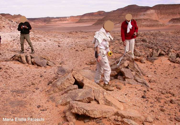
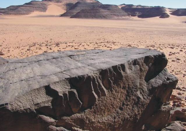
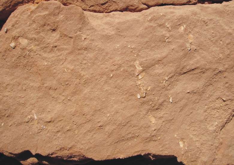
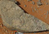
Karkur Talh Formation (Ordovician)
The occurrence of Ordovician deposits
in the Gilf Kebir is only detected in local outcrops of paleosol layer
with rich Skolithos.
|
|
|
|
|
|
|
|
|
|
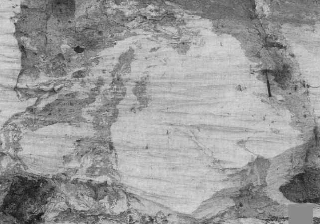
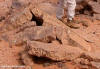
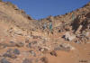
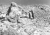
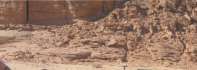
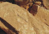
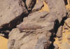
Eroded
Skolithos paleosol layer: Probably
Wadi Talh area
|
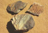
Boulder with Skolithos
|
Rippel marks
|
|
|
|
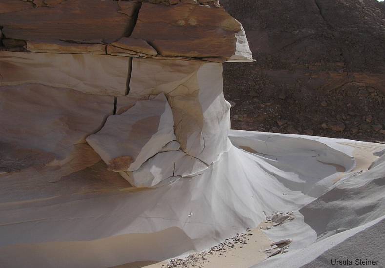
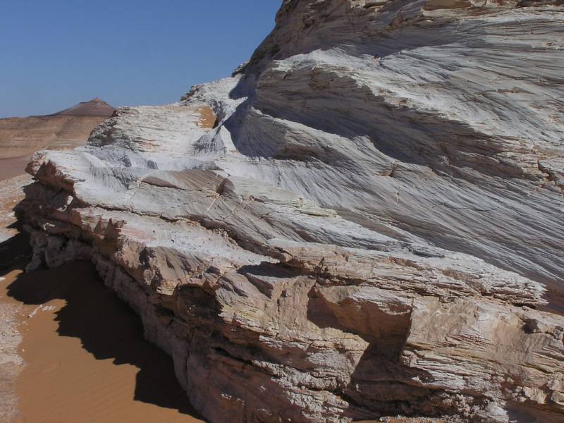
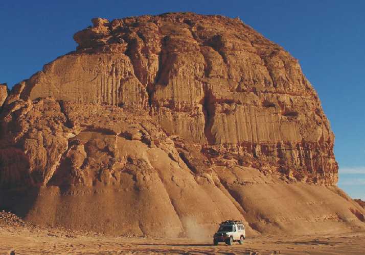
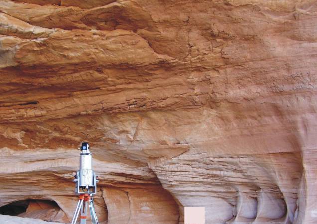
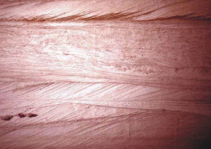
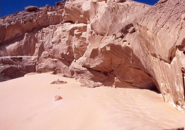
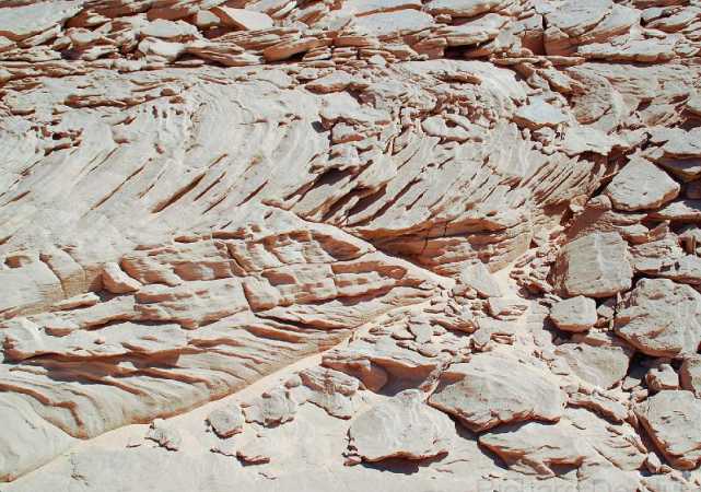
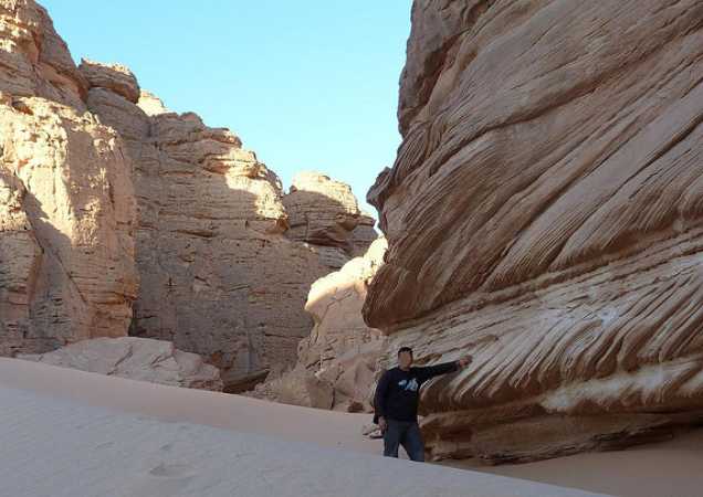
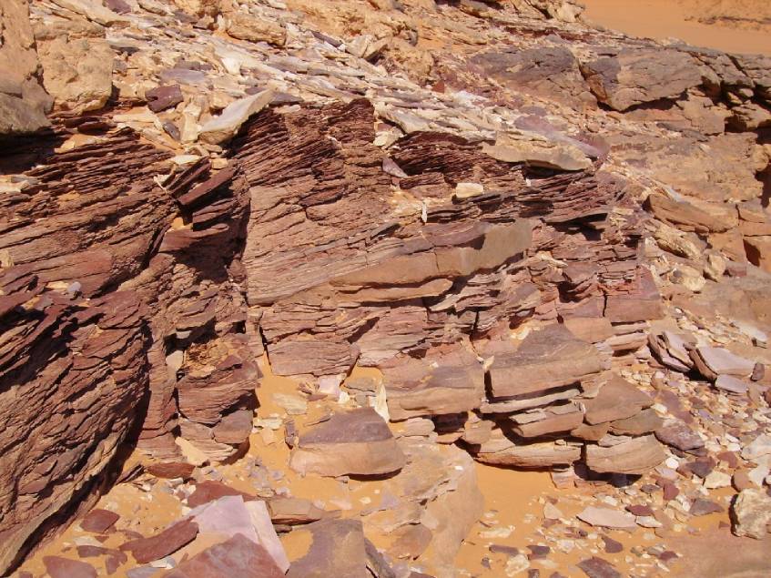
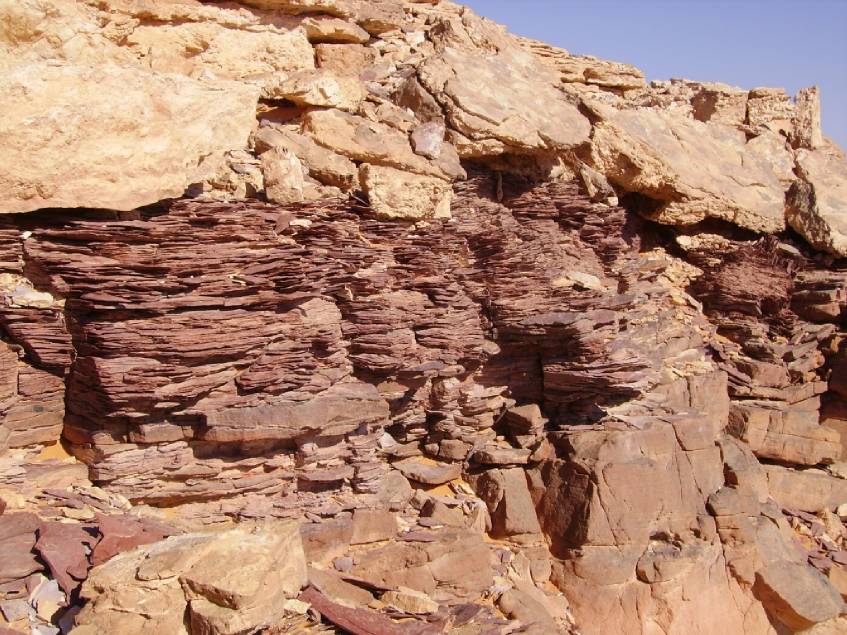
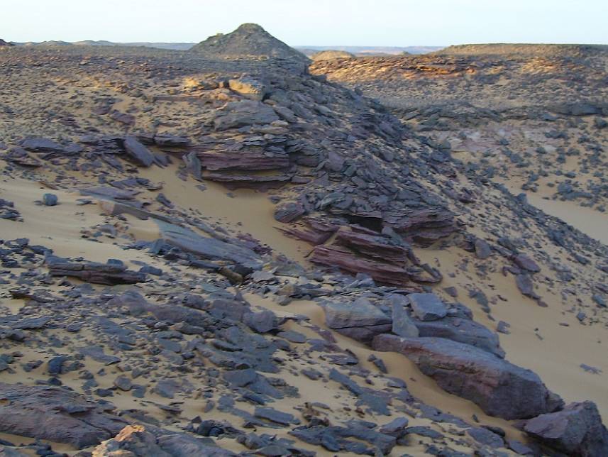
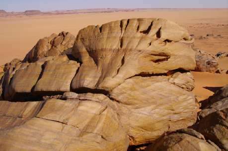
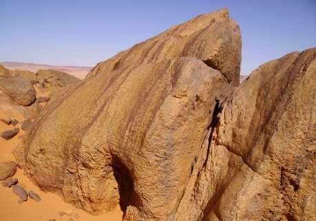
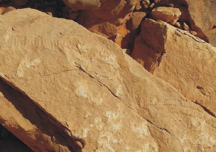
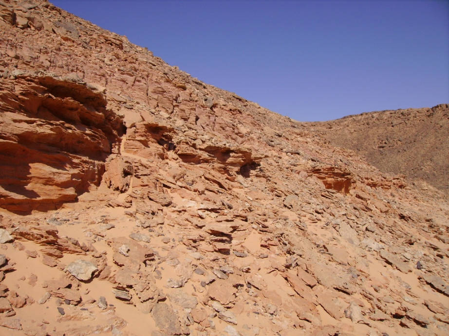
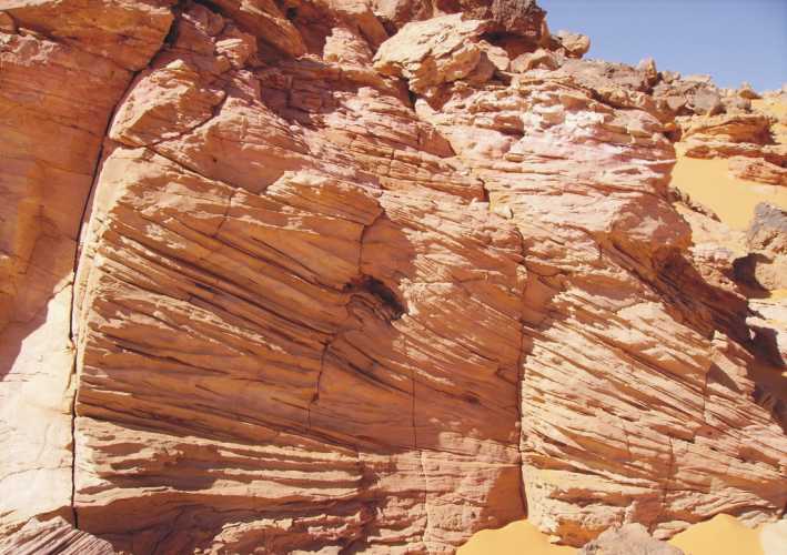
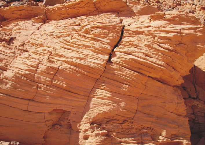
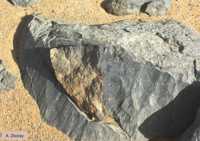
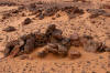
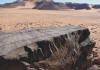
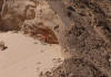
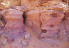
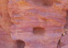
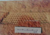
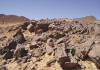
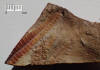
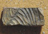
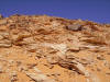
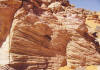
Um Ras Formation (Silurian)
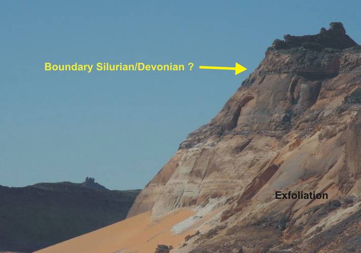
Massive sandstone,
partly in an state of exfoliation
At the northwestern edge of the plateau, between
the Um Ras passage and Wadi Sura, unusual features are observed especially
in the Silurian strata. The sandstones are subjected to a so-called
exfoliation (like the Navajo sandstone in North America). The causes
of exfoliation (shelled weathering) is not explored. It is believed
a tectonically induced stress effect (uplifting process?).
|
|
|

|

|
|
|
|
|
|
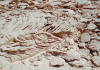
Silurian sandstone
in state of exfoliation
|
|
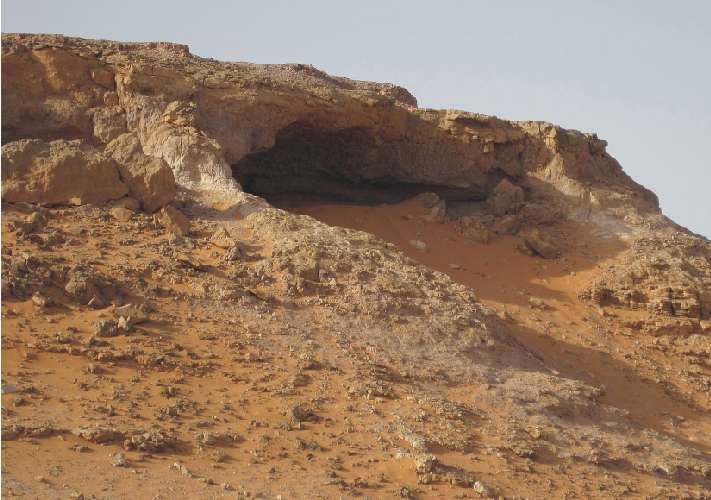
Foggini/Mestekawi
cave
|
|
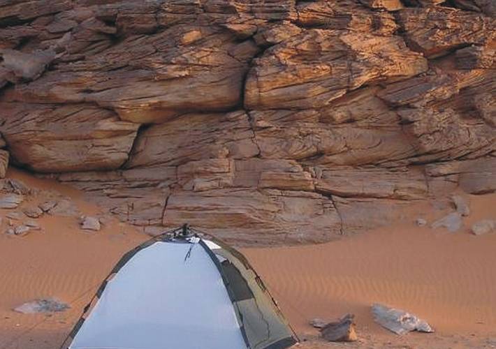
Fine stratified massive sandstone
Intensively cross-bedded sandstone on base
|
|
|
|

|
|

|
|

|
|
|
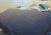
Wadi Zura
(with Bivalves ?)
|
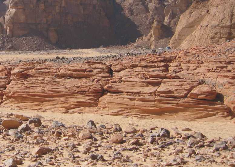
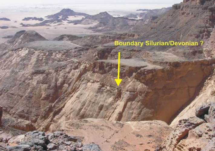
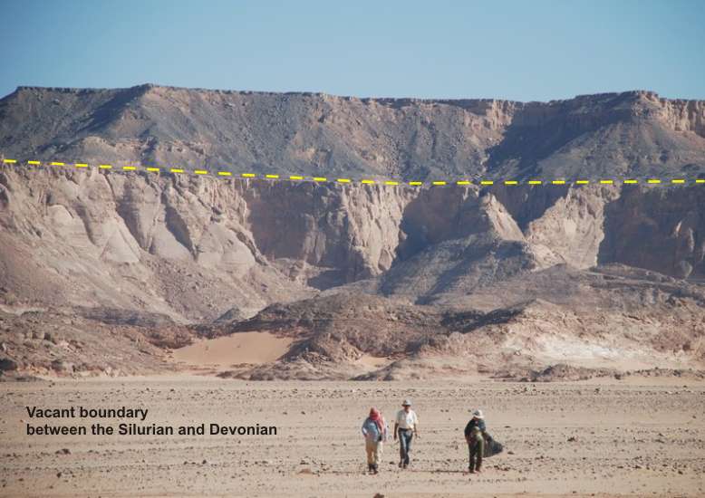
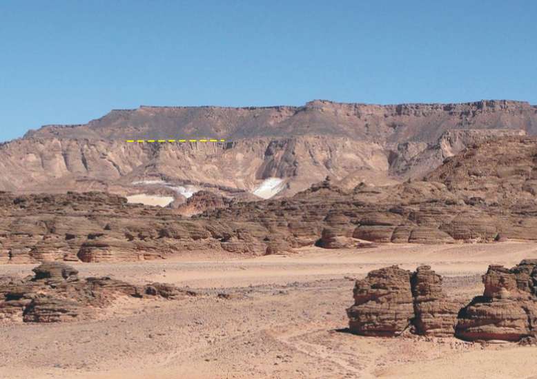
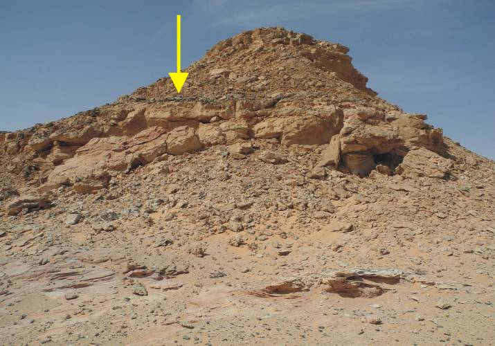
Boundary between
Silurian and Devonian strata
In the Gilf Kebir can be determined, in principle,
the stratigraphic boundary between Silurian and Devonian above the
stressed sandstones (exfoliation). An iron-rich crust documented a
time gap between Silurian and Devonian layer.
Tadrart and Binem Formation (Devonian)
The Devonian sandstones are of fluviatile
origin form a compact fine stratified serie. A separation of
Tadrart and Binem formation is not yet possible. The boundary between
the Silurian and Devonian layers is placed above the layers with exfoliation
(if any). In between, there is a thin red-brown mudstone layer with
bioturbation.
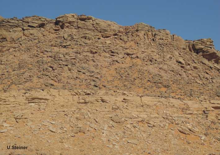
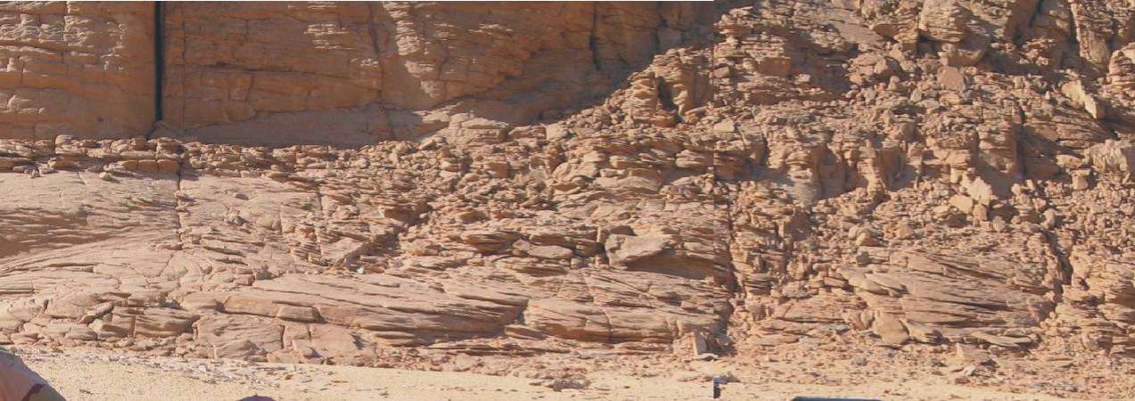
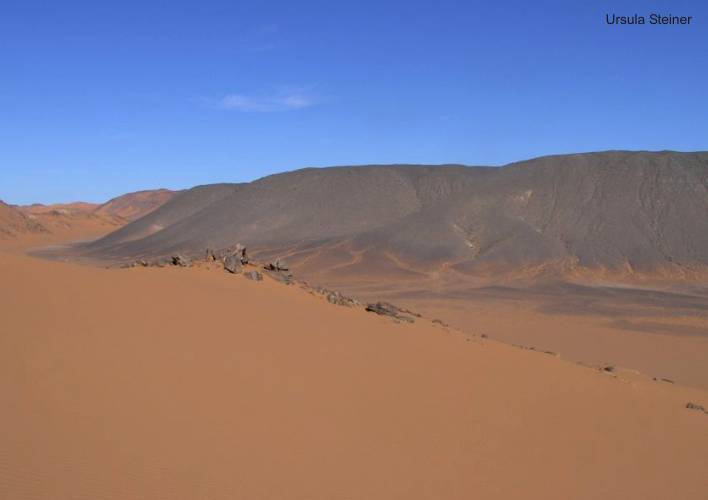
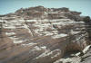
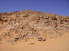
Escarpments
|

|
|
|
|

|
|
 |
 |
|
Western edge of plateau |
Plateau |
Northern branch of Wadi Abdel-Malik |
Wadi Hamra |
 |
|

|
|
|
|
|
|
|
Wadi Hamra |
|
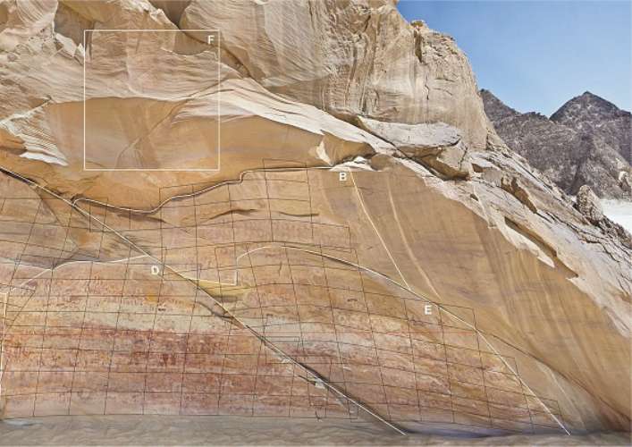
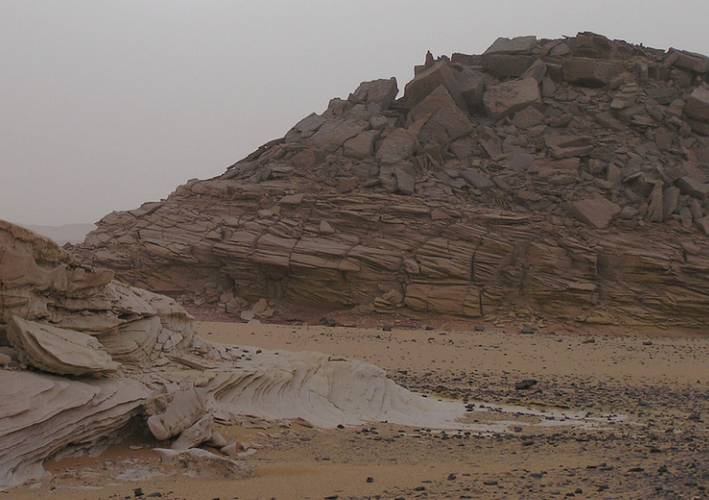
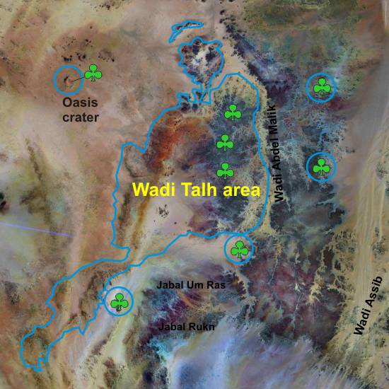
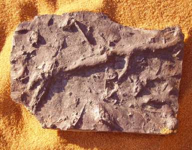
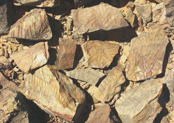
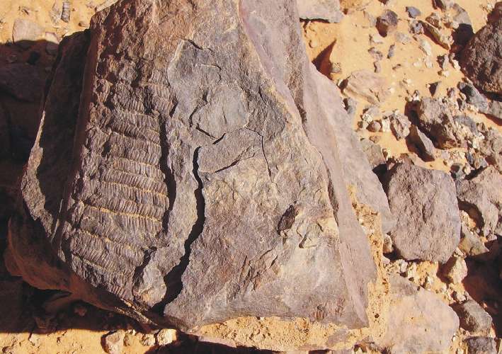
3. Carboniferous
Sedimentation
Carboniferous
layers of the Wadi-Malik Formation (in sense
KLITZSCH) more or less conformably overlies older Paleozoic
beds (e.g. Ordovician Um-Ras Fm.) in the middle part of the southwestern
and western Abdel-Malik plateau. However, it is best exposed along
the Wadi Abdel Malik and its side wadis in the Wadi Talh area
which reach from the southern and southwestern part of this 40
x140 km large plateau towards its relatively flat northern end.
The 100 to 150 m thick Wadi Malik Formation consists of marine
sandstone, siltstone and shale interbedded with fluvial, deltaic
and tidal sandstone. In marine beds are frequent brachiopods (Camerotoechia
sp.), trace fossils like Zoophycus and Bifungitisas
as well as small Lamellibranchiata.
Several beds contain frequent plant remains including many different
species. A rich flora was discovered in the Wadi Abdel Malik/Wadi
Talh type area, including: Archaeosigillaria minuta, Lepidodendropsis
cf. sinaica, Lepidosigillaria intermedia, Prelepidodendron lepidodendroides,
P. rhomboidale, Rhacopteris ovata, Triphyllopteris gothani, Cordaites
angulostriatus, Rhodea lontzenensis, Eremopteris whitei. This
flora proves a Tournaisian to Stephanian age of the Wadi-Malik
Formation according to LEJAL-NICOL (1987).
|
|
Stratigraphical typus in sense
KLITZSCH & WYCISK, 1987
|
"The lowermost part consists
of medium- to coarse-grained sandstone with grouped sets of
small- to large-scale planar cross-bedding alternating with
horizontally bedded medium-grained sandstone. The percentage
of horizontally stratified sets increases towards the top. Overturned
cross-bedding is less frequent in this facies. The facies
type displays conditions of extensive deposits of braided
river.
The second part of the succession shows a fining-upward
sequence with a slighlty erosive base made up of medium- to
fine-grained sandstone and intercalated thin laminated shaly
siltstone. This cross-bedde pointbar sequence is 8 to 12m in
thickness and is topped by fine-grained, partly even laminated
overbank deposits, which lacally display pedogenetic features.
These facies represents deposits of high sinuosity rivers.
The third part consists of fine-grained sandstone with
shaly siltstone intercalations and horizontal strata. Main bedding
types are ripple cross-lamination, even and wavy lamination
and flaser-bedding. Parting lineation can be observed
in the uppermost part of this unit. Ferruginous siltstone layers
and reworked shale intraclasts within scour-and-fill structures
occur. Asymetrical oscillation ripples are common on the bedding
planes. Tadpool nest ripples indicate shallow water conditions
in a predominantly low energy wave-generated environment. This
facies can thus be considered as a marine influenced sedimentary
environment in a transition zone from alluvial to coastal
plains.
The uppermost part represents a shallow marine sequence
of Late Visean age. The sequence is made up of various
increasingly thick layers of tidal channel-filled sandstone
with distinct erosive contact which interfinger with the above
mentioned facies. Channel-sandstones with a maximum thickness
of up to 3 meters are overlain by thin-bedded fine-grained sandstone
with interbedded clay-iron-stone layers. Intensive bioturbation,
trace fossils such as Bifungites and remains of brachiopods
confirm the marine origin of this probably tidal channel
to subtidal paleoenvironment." Source: KLITZSCH
& WYCISK (1987)
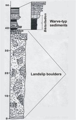
"The overlying strata are
heterogeneous. In north Wadi Abdel Malik, the Wadi Malik
Formation underlies unconformably a 30 to 60 m thick bed
of an chaotic sediment, consisting of clay, sand, gravel,
blocks of older strata up to house size. Southward, in the
middle and southem parts of Wadi Abdel Malik and its side
wadis, these strata are replaced by fluvial sandstone, conglomerate
and sandstone with isolated blocks of older strata.
The thickness of this chaotic boulders (not glacigenic
origin !) unit is several tens of meters. It is
overlain by cross- and parallel-bedded sandstone and varve-type
shales containing plants of Stephanian age in the
central parts of the Abdel-Malik plateau, for example
Cordaites angulostriatus GRAND'EURY, was found in sandstone
directly overlying the erratic boulder unit." |
|
|
|
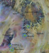
Distribution of Carboniferous layers
with plant imprints
|
|
|
|
|
|
|
|
|
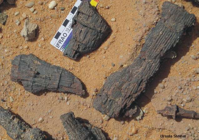
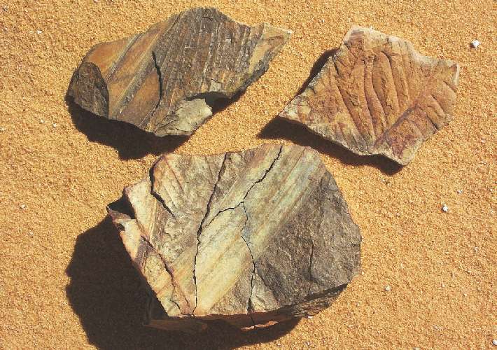
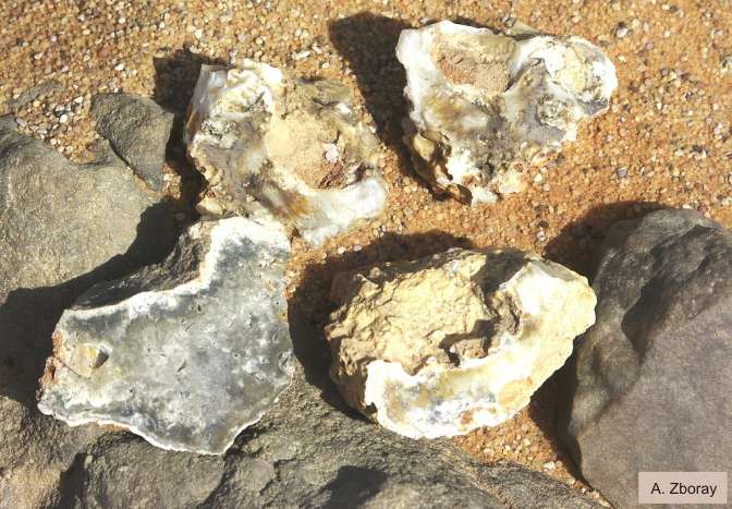
Rich
fossil location: Wadi Talh
central-area
|
New
fossil locations: Northeastern
edge of the plateau |
|
Carboniferous
plant imprints in the Western Desert (Egypt/Sudan)
Northern Wadi Talh area (Photographed
by the author)
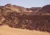
Pushed area (northern Wadi Talh area)
It looks as if at least the
bleaching of the sandstones was caused by hydro-volcanic activity.
This occurs on injective and independent of the stratification.
|
|

|
|
|
|
|
|
|
|
Pushed zone of
white erratic blocks. Source: Klitzsch & Wycisk, 1987: Loc
24°32'25"N / 25°05'30"E
|
|
|
|
|
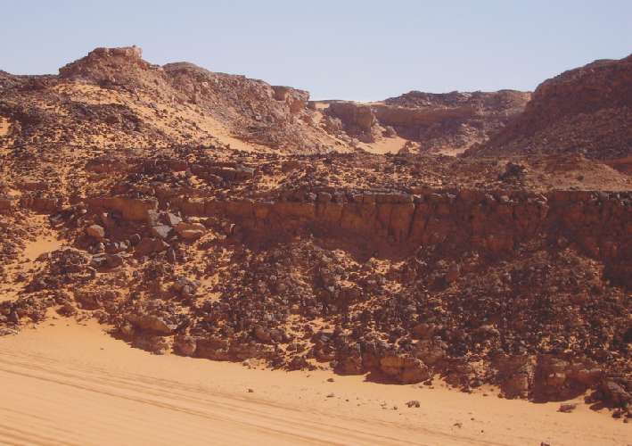
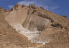
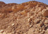
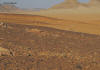
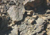
Foothills
of Wadi Talh area
|
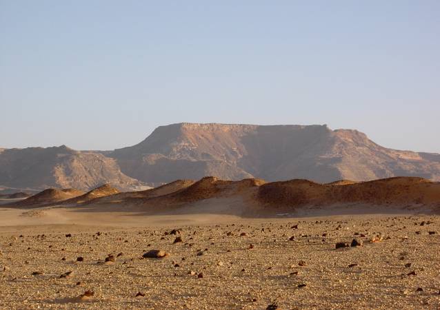
Eastern edge of plateau and Wadi Hamra
|

|
|
 |

|
|
|
|
 |
|
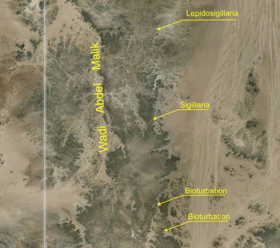
Locations
|
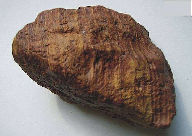
Bright sandstone
with Sigillaria
imprints
Source: A. Barakat
|
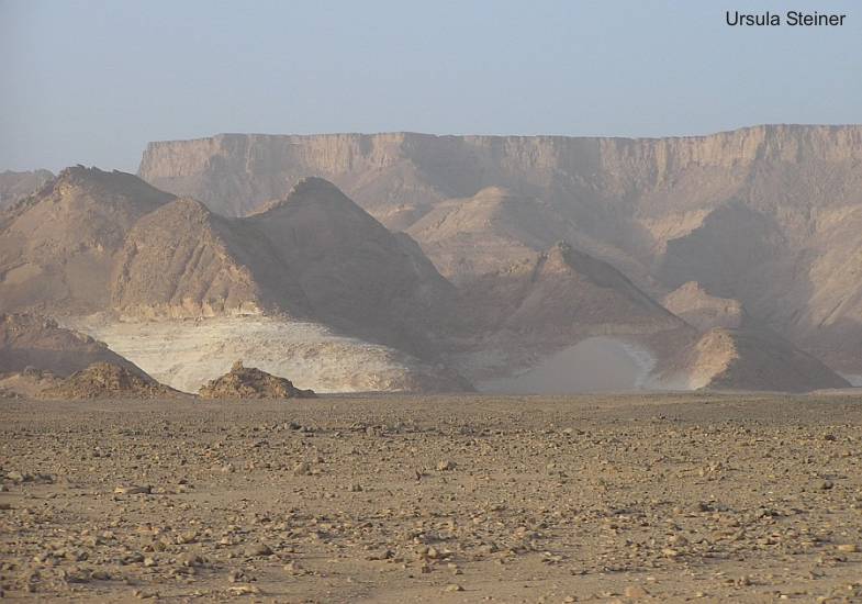
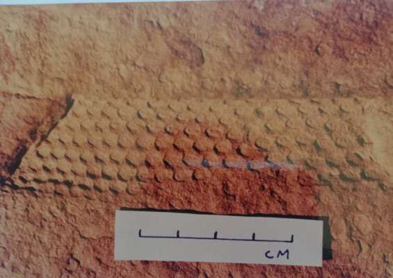
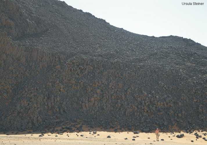
Bioturbation
in the Wadi Hamra region
Source: U.Steiner
|
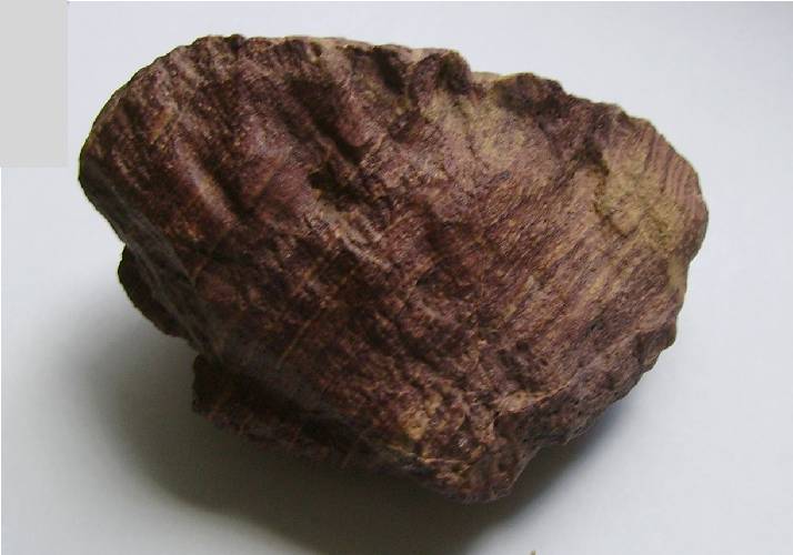
Lepidosigillaria
imprints at eastern edge of plateau
Source: U.Steiner
|
|
|
The Kemal-el-Din
Plateau has a simple structure, but has a subvolcanic overprint
that also spread is in the surrounding ranges.
The structural-geological composition is similar to the northern
Abdel-Malik plateau. The towering plateau (+ 1000m SL or more)
is bounded on the north by the Wadi Assib (with the Aqaba
passage); in the east of the foothills of the Great Sand Sea
and the south and west of the basement high position. The
eastern and southern edge of the plateau is cut by numerous
deep wadis.
A stratigraphic assignment of up to 400m (or more) compact
sandstone sequence is difficult, because no fossils are found.
Significantly cross-stratified sandstones in the footwall
of the sequence can be classified similarly to the northern
plateau as Silurian. The most of the sequence should be Devonian.
The postulated Cretaceous sandstones are it not, because in
eroded deeper layers of the plateau (Wadi Wassa) there Carboniferous
sediments.
Questionable are sediments the so-called Gilf Kebir Formation
(early Cretaceous age) in the Wadi Wassa and south of it (Kemal
el Din monument and surrounding). This also relates to corresponding
sediments in Aqaba passage (see below).
Structural-geological
models
|
|
|
|
|
|
Profile A-A' |
Profile B-B' |
|
|
Plateau escarpment
|
|
|
|
|
 |
 |
 |
|
|
NE-edge;
right young fluvial deposits
|
Northeastern
cliff |
Southern cliff |
Aqaba passage |
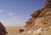
|
Plateau wadis
|

|
|
|
|
 |
 |
 |
|
|
Wadi Mashi |
Wadi Maftuh
|
Wadi Bakht |
Wadi Wassa |
|
Sedimentary
accumulation and stratigraphy
1. Proterozoic
Basement
The basement of
the "East
Sahara Ghost Craton" is located very close to the surface.
On the widespread erosion surfaces in the foreland but are outcrops
very rare because it is covered by desert sand. Important exceptions
are observed at the structure "Eight Bells".
2. Lower
Paleozoic Sedimentation
Typical are cross-bedded Silurian
sandstones in the footwall of the thick sandstone sequence of
the plateau. Devonian sandstones are in the Aqaba passage exposed.
|
|
|
|
 |
|

|
 |
|
Cross-bedded
Silurian sandstone
|
Devonian
(Aqaba passage)
|
Silurian ?
(Wadi Maftuh) |
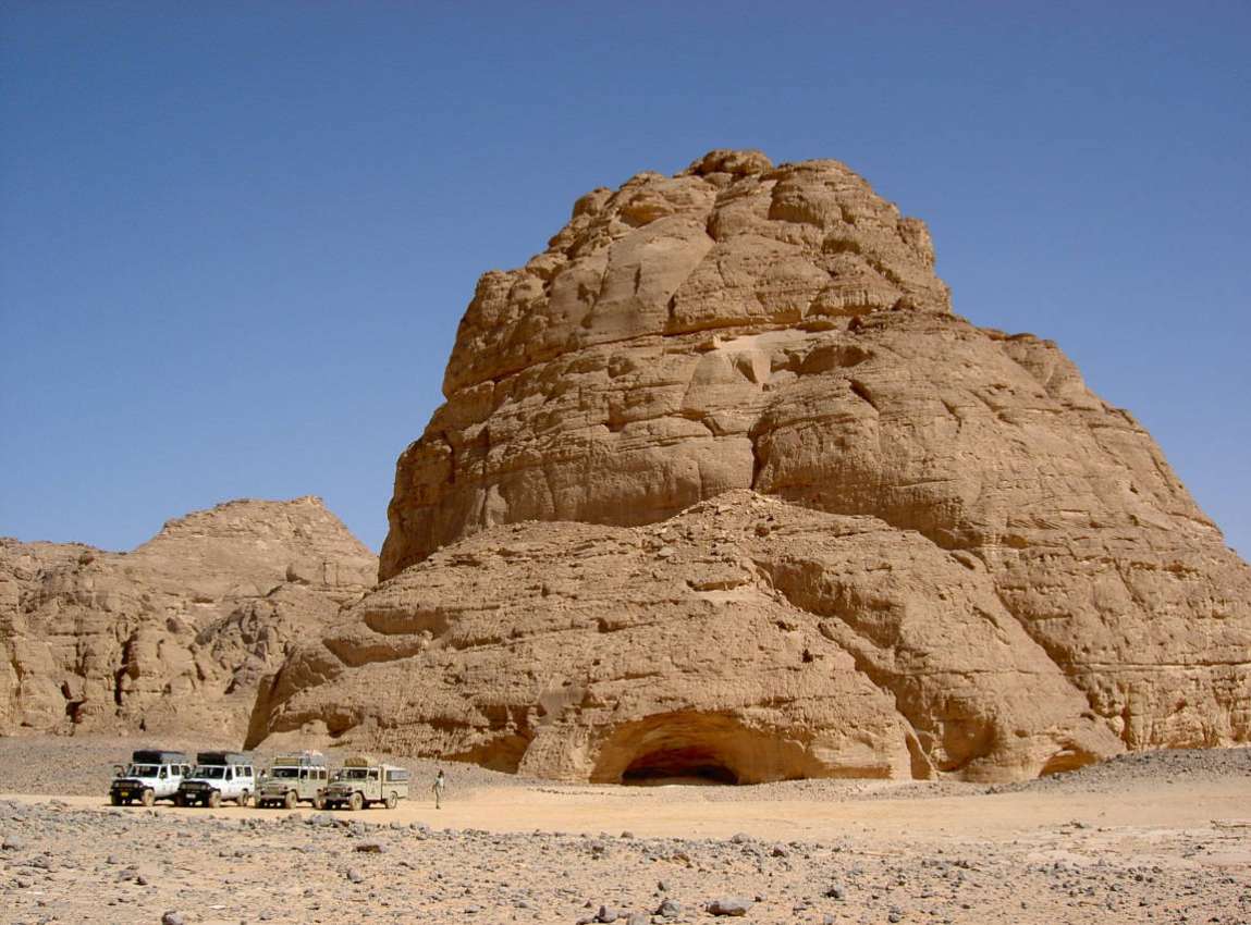
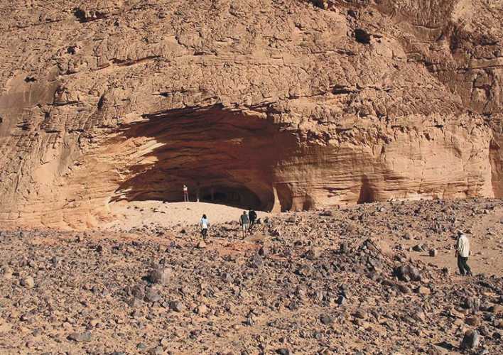
Shaw's cave (Devonian with
Carboniferous on top) |
3.
Carboniferous Sedimentation
|
Distribution of Carboniferous layers
|
Some details
on images, presented in the Internet, show sediments in a
facies which comparable is with sediments which are demonstrated
in the southern Clayton craters. They contain abundant imprints
of Carboniferous plants. Since the latest discoveries
of plant imprints (Ursula Steiner) is proved that in
the Wadi Wassa actually exist Carboniferous deposits. They
lie above Devonian sediments on eroded slopes of the plateau
or as debris on the bottom.
This relativized the few finds of Lejal Nicol from the 1980s,
which were classified as early Cretaceous age (Phlebopteris,
Podozamites).
Another place with excellently
preserved Carboniferous plants imprints is a large crater-like
structure in the southern direction (Clayton Craters). Such
finds are also mentioned in the literature on the locality
Peter & Paul, but not documented. |
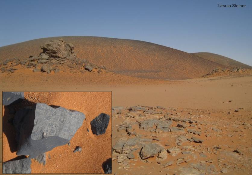
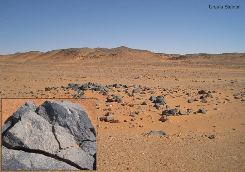
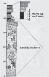
Wadi Wassa
|

|
|
|
|

|

|
|
|
|
Warve-type
|
Shallow marine
type
|
Slope with
plant imprints
|
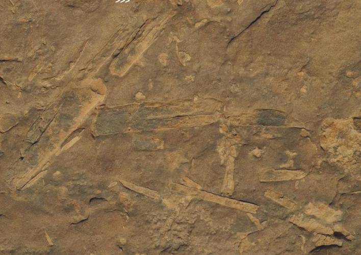
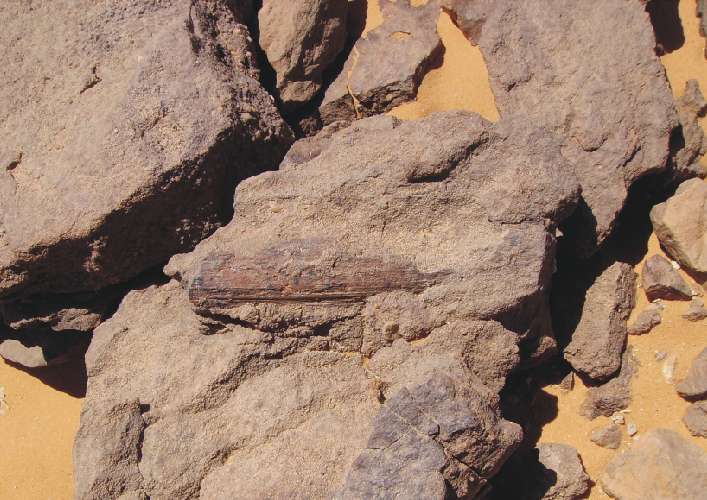
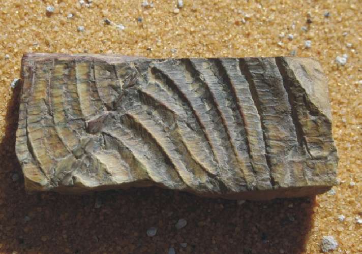
Pecopteridae imprints
|
Stalks of Cordaites
|
Ferruginous
Calamites
|
|
|
Clayton Craters
New ample plant-prints were found
now (2007) by Geoffrey Kolbe (UK). The place of discovery
is the interior of a large Clayton Crater. This crater is located
in the area between Gilf Kebir and Jebel Uweinat in southeastern
direction from the "Peneplain plateau". In silty sandstones is
to find a monotonous flora of Paleoweichselia
halfa n.sp. and aff.
Cordaites.
Images:
Andras
Zboray and the author
|
|
|
|

|
|
|
|
|
|
Silty shallow
marine and near shore grained sandstone with
Paleoweichselia
imprints
|
4.
Early Cretaceous Sedimentation (both plateaus)
(Carboniferous strata ?)
The Wadi Assib separates
both Gilf Kebir plateaus morphologically. The Aqaba passage
therein is an small eroded valley. It should be filled with Early
Cretaceous layers of the
Gilf
Kebir Formation.
The Gilf Kebir Formation is described in details by KLITZSCH,
1979:
"The Aqaba passage is the type area. Here rests fluvial, deltaic
and partly near-shore marine sandstone unconformably on an eroded
relief. But, this unconformity between them is not detected
up to now. At the eastern edge of the Gilf Kebir toward the Abu
Ballas area, the Gilf Kebir Formation interfingers with the shallow-marine
Abu Ballas Formation. Within the Aqaba passage and directly north
of there, along the northern edge of Abdel-Malik Plateau, northeast
of the Wadi Abdel Malik as well as at the western end of Wadi
Wassa, several horizons contains flora. Fine-grained sandstone
and siltstone locally contain an abundant flora of ferns and other
plants of the Early Cretaceous age (among "Cladeophlebis",
"Phlebopteris", and Weichselia reticulata STOCKES
& WEBB)."
From the type area (Aqaba passage) and the
other locations are available in the literature illustrations
of plant-finds with the corresponding determination by LEJAL-NICOL,
1987. There is however unfortunately no exact statements to the
places of the discovery. It also lacks verifiable lithostratigraphic
profiles in the literature.
The plant imprints are in such
poor condition that the determination and classification as Mesozoic
fauna are questionable. The determined Weichselia reticulata
can also be the new Carboniferous
Paleoweichselia
halfa n.sp.
|
|
|
|
|
|
|

|
|
|
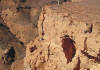
Aqaba:
Are this the mysterious Cretaceous strata ?
|
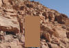
ore
here ? (Three Castles)
|
Southern
foothill, secondary (?) deposited Calamites
|
Foothills
near Kemal-el-Din monument
|
|
|
|
|
|
|
 |
 |
|
|
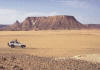
The Jebel Almasy is an
isolated structure of the Gilf Kebir. The sandstone sequence
reaches a maximum height of about +870 m SL and exceeds the
desert floor by about 150 m. Are this also strata of the Gilf
Kebir Formation ? |
|
Sources:
KLITZSCH, E. & LEJAL-NICOL, A. (1984): Flora and
fauna from strata in southern Egypt and northern Sudan (Nubia
and surrounding areas).
Berliner geowiss. Abh., (A) 50, p. 47-79.
KLITZSCH, E. (1984): Northwestern Sudan and bordering
areas: Geological development since Cambrian time.
Berliner geowiss. Abh., (A) 50, p. 23-45.
KLITZSCH, E. & WYCISK, P. (1987): Geology of sedimentary
basins of northern Sudan and bordering areas.
Berliner geowiss. Abh., (A) 75.1, p. 97-136.
LEJAL-NICOL, A. (1987): Flores nouvelles du Paleozoique
et du Mesozoique d’Egypte et du Soudan septentrional.
Berliner geowiss. Abh., (A) 75.1, p. 151-248.
"Geology of
Egypt"
A. A. Balkema, Rotterdam, 1990
|
Abdel-Malik Plateau area
|
|
|
|
|
|
|
 |
 |
|
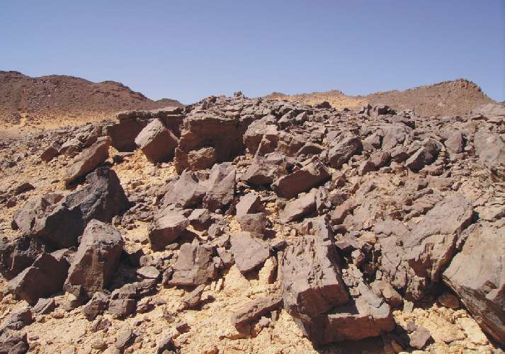
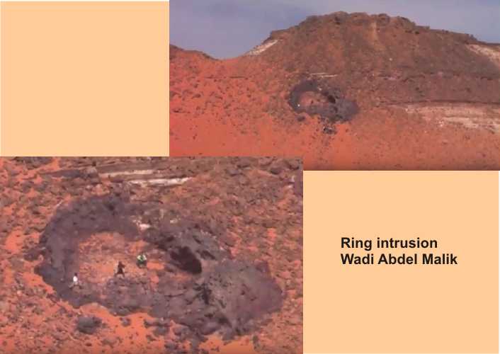
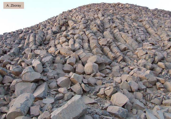
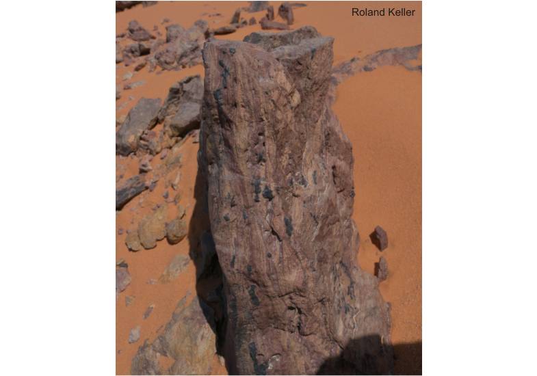
Many volcanic
fissures with erected layers between Wadi Sura and Aqaba
|
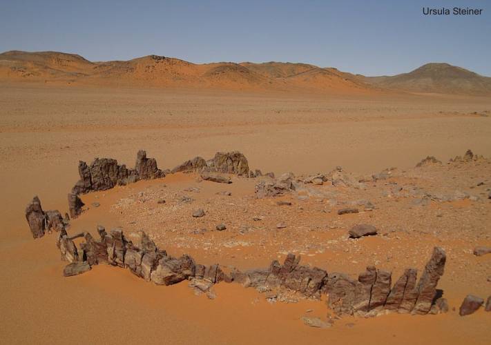
Hydrovolcano
(Um Ras)
|
Ring intrusion
|
|
|
|
 |
 |
|
|
|
|
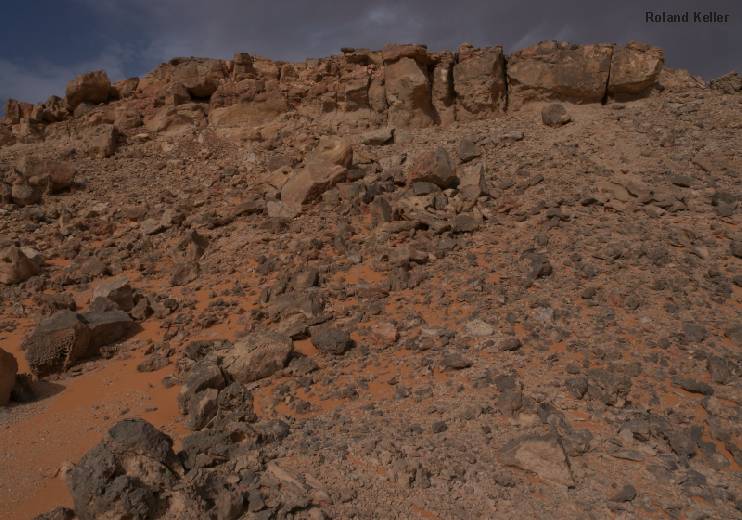
|
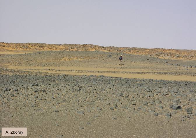
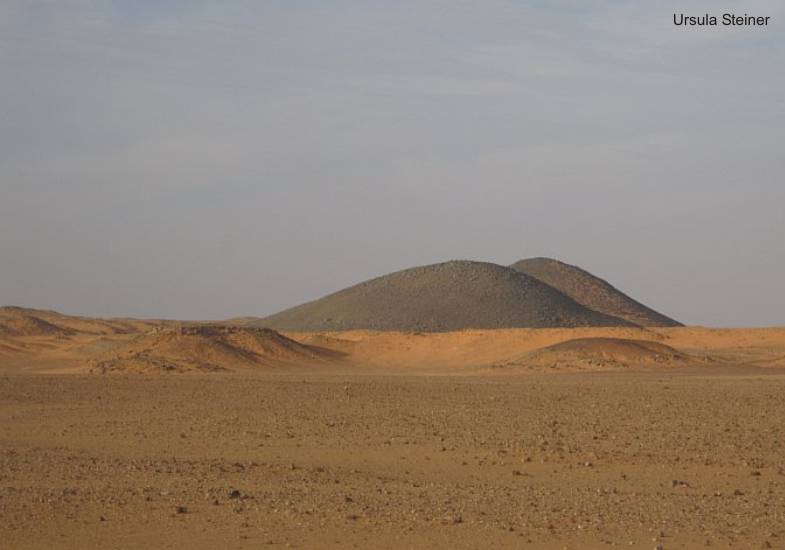
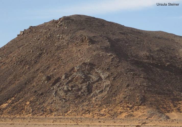
Basalt hill
on top of plateau
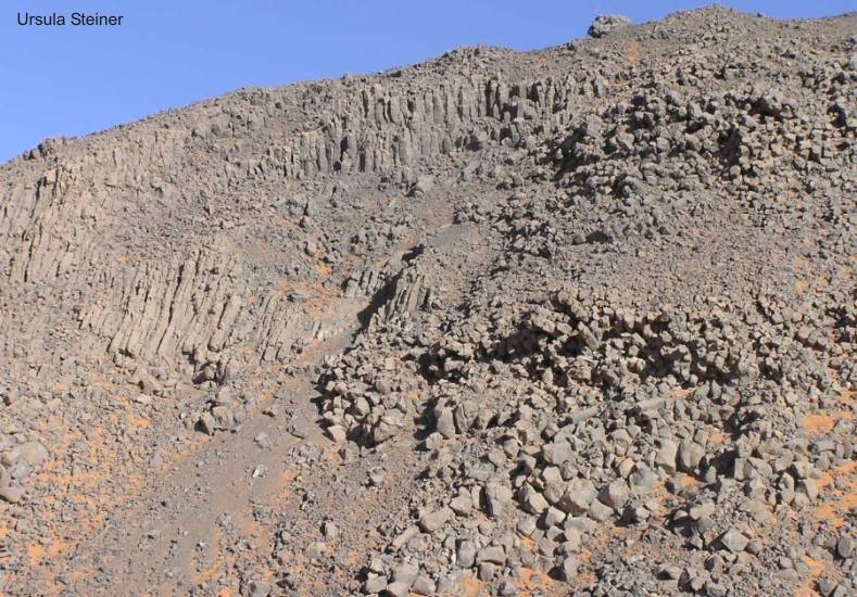
|
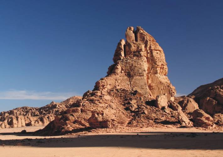
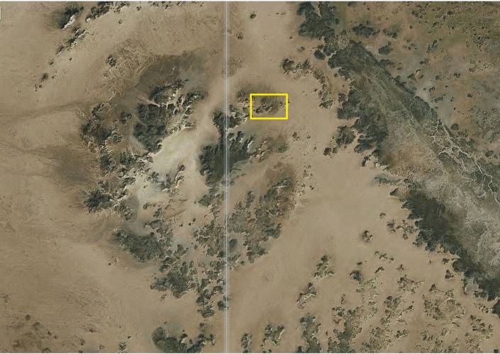
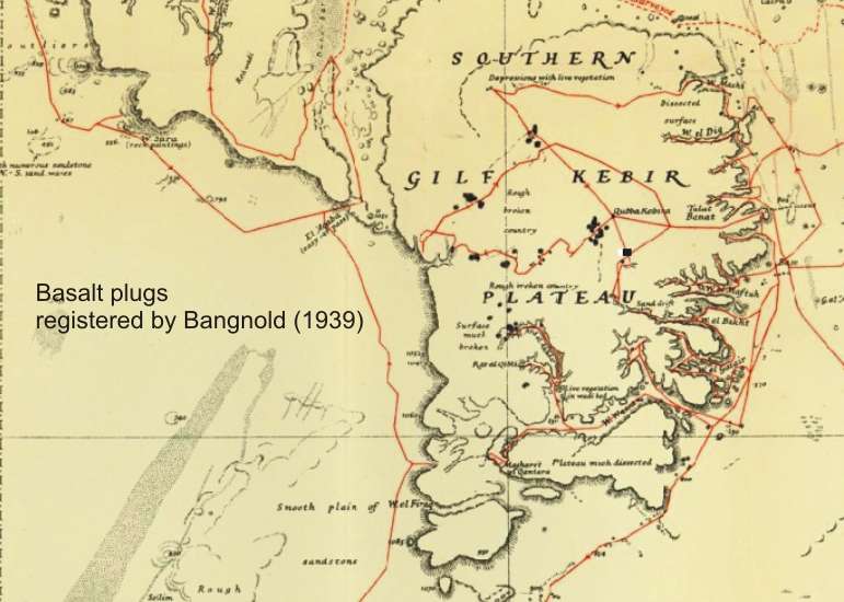
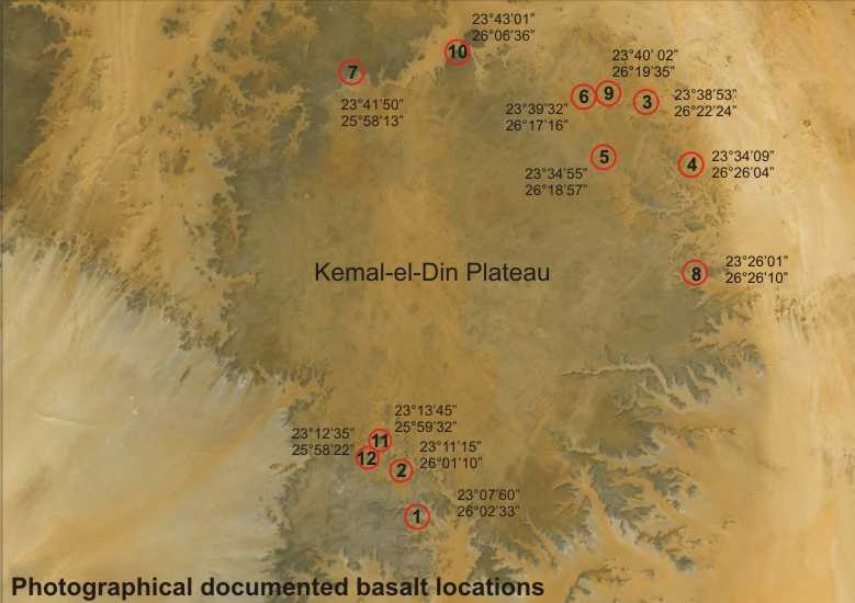
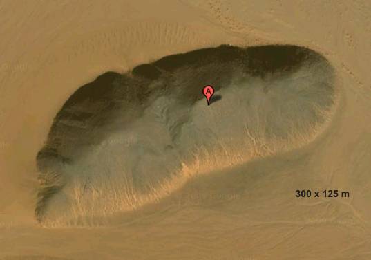
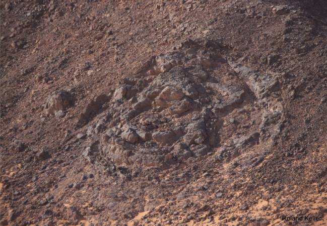
"Kebira" structure: Volcanic plugs |
|
|
|
|
Kemal-el-Din Plateau area
Especially the southern part
of the Gilf Kebir as its surrounding (Clayton
Craters & Gilf Kebir Crater Field) is extensively overprinted
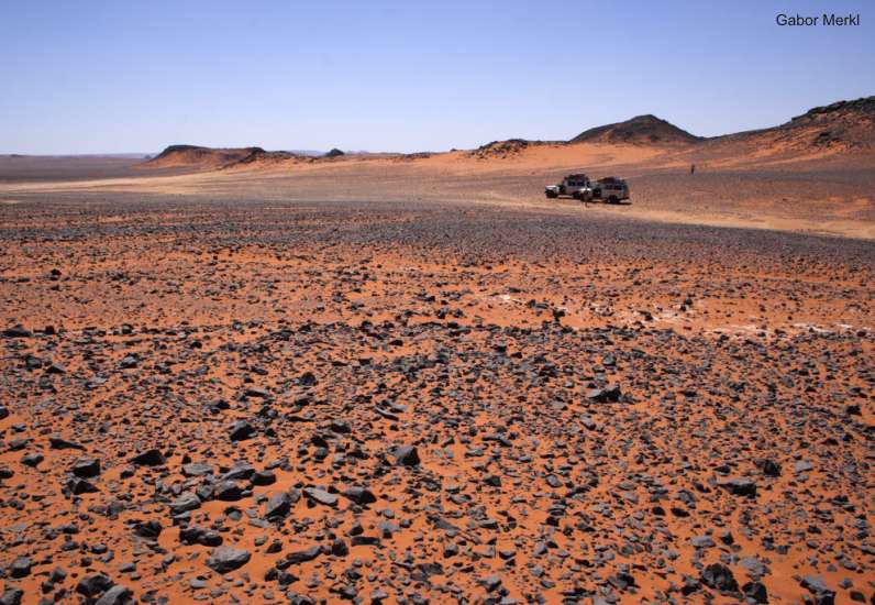
with subvolcanic intrusions. Across the entire plateau (including
the wadis) are numerous basaltic plugs and crater-like structures
distributed. All things were made in the wake of igneous activities
in the Oligocene age (Photo
Gallery). This is also the age of the
Libyan Desert Glass
(28.5 million years ago).
|