|
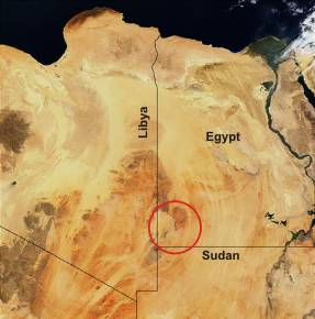
The origin of the crater-shaped structures on the Uweinat-Howar Uplift
in the
three country corner Egypt/Libya/Sudan
Norbert Brügge, Germany
Dipl. - Geol.
Upload:
2004
Last update: 06.03.2020
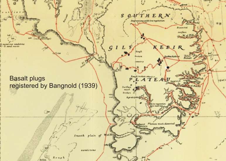
The knowledge about
the exceptionally intense overprinting of the Western Desert in the surrounding
of the Egyptian Gilf Kebir Plateau with volcanic structures began in 1932.
Ladislaus Almasy found from his airplane -- during
the Almasy/ Clayton expedition of Sir Robert Clayton -- some mysterious craters
south of the Gilf Kebir plateau. This craters then were named "Clayton Craters".
The first serious study of this craters was done by K.S. Sandford,
who accompanied the Bagnold expedition in 1934. During his limited time he
determined, that the hills were ancient volcanic explosion craters. The rims
of the craters are of sandstone, tilted vertical by the volcanic forces, and
fused by heat on their inner sides. There traces of volcanic rocks within
some of the craters, and all craters are associated with dykes formed by two
parallel uptilted rows of sandstone, filled with white trachyte in-between.
Until the beginning of the 80s, there was no further field research.
It was geological investigations of the Gilf Kebir region by F. El-Baz
as well Klitzsch & Issawi,
and the possibily to use Landsat satellite imagery, to recognize the enormous
regional distribution of such crater-like structures far beyond the Clayton
Crater region.
The fieldwork was continued in 2004. As a result, Ph. Paillou's
team interpreted the "Gilf Kebir Crater Field" as the Earth's largest meteorite
impact field because they believed to have found evidence.
In the same year 2004, the author contradicted this thesis
by the creation of this website and offered the hydrovolcanic interpretation.
There upon M. Di Martino's team in 2005 re-examined
the impact theory and concluded that the identified features were not of shock
origin. In accordance with the autor they offered the alternative interpretation
that the craters were formed as hydrothermal vent complexes. The close physical
and temporal association of the craters with basalt cones, flows, and dikes
leads to support the interpretation that they are all related to volcanism.
Due to the high-resolution satellite image technology available today, it
is even possible to detect the much larger regional spread of this volcanic
structures (craters, cones, plugs, dykes).
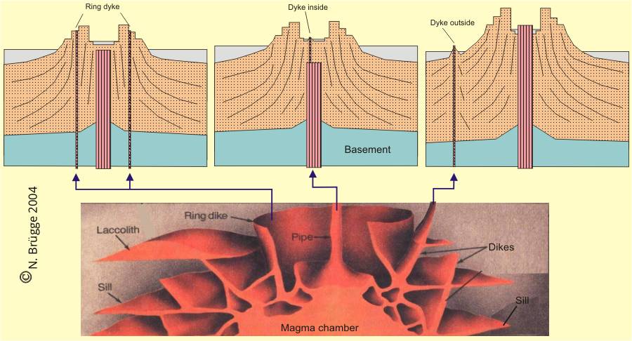
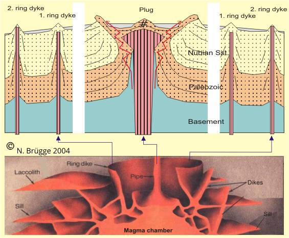
Structural-geological
History
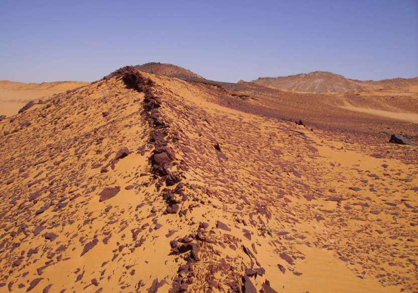
Widely distributed and in unusually very
high numbers (thousands) are sub-volcanic structures in the form of craters,
cracks, dykes and plugs to find in a region in which the basement of the
East Sahara
Ghost Craton was upliftet to the surface (Uweinat-Howar Uplift).
The Uweinat-Howar Uplift between Kufra basin in the west and Dakhla basin
in the east is a tectonically elevated block. Along main faults (possibly
staggered), the basement has been lifted up to 2000 m compared to the Basement
of the basins, and lie near surface level now (about +500m SL).
The cause of the uplifting is hardly explored, but a
continuously active plume in the earth's mantle is assumed by the author due
to the long-lasting processes of uplifting (Ordovizium-Carboniferous) magmatism.
The overlying incomplete Palaeozoic
sediments (Ordovizium-Carboniferous) were uplifted along with the basement
above the plume. They are today as remains (plateaus) present, despite continuous
erosion.
During the late
Eocene of the Tertiary period (about 46 - 42 Ma) in the underground of the
Uplift, were initiated in the chamber with acidic magma new activities (ring-complexes
of Jebels Uweinat, Arkenu, Babain, Bahari).
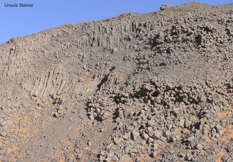
Then, in the Oligocene (38 - 28 Ma) in the Jebel Uweinat and Gilf Kebir
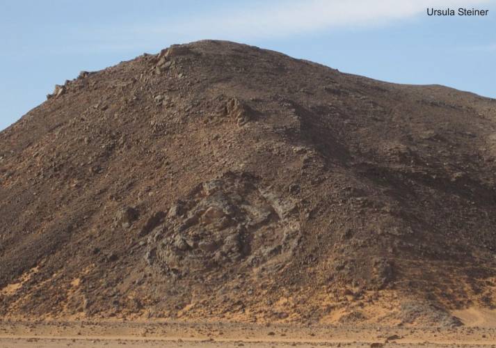
region and surrounding was occur a culmination of subvolcanic activities.
Various kinds of features are present, i.e. small-scaled cones, dykes or plugs
as well as large crater-shaped structures. Frequently no volcanic rocks are
exposed, or exist only as relics in the centre of the structures. In these
cases, the circular pattern is manifested only by brecciated and hardened
sediments with a higher resistance to erosion than the country rock. On other
hand, basalt cones can be easely confounded with small sandstone hills covered
with desert varnish.
The widespread plugs and dykes are either related to the Tertiary subvolcanic
or intrusive ring complexes. In any case, there is an obvious correlation
between igneous activity and the regional fault pattern. Very often subvolcanic
rocks are situated at points of intersection of faults.
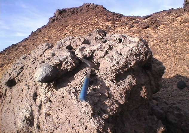
In general, the extrusives consist of alkaline, SiO2-undersaturated to oversaturated
trachytes and related rocks, as well as of olivine-basalt. To a minor extent,
intermediate to rhyolitic varieties are present.
There are few age determinations of the basaltic bodies in the crater field.
Greenwood (1969, cited in Meneisy 1990) obtained a K/Ar date from an basaltic
sample south of the Gilf Kebir of 37 ± 2 Ma.
Franz et al. (1987) determined K/Ar ages of 37.9 ± 2.0 Ma (mid-Paleocene)
east of the plateau as well 59 ± 1.7 Ma (late Eocene) for a porphyritic olivine-bearing
basalt field (23°03'N / 27°18'E). Another sample from basalt field (Bosworth
et al. 2016; 23°24'21"N / 27°02'37"E) yielded a 40Ar/39Ar age of 46.0 ± 0.5
Ma (mid-Eocene). This would mean that older fields with basaltic outflows
was created even before the crater field exist.
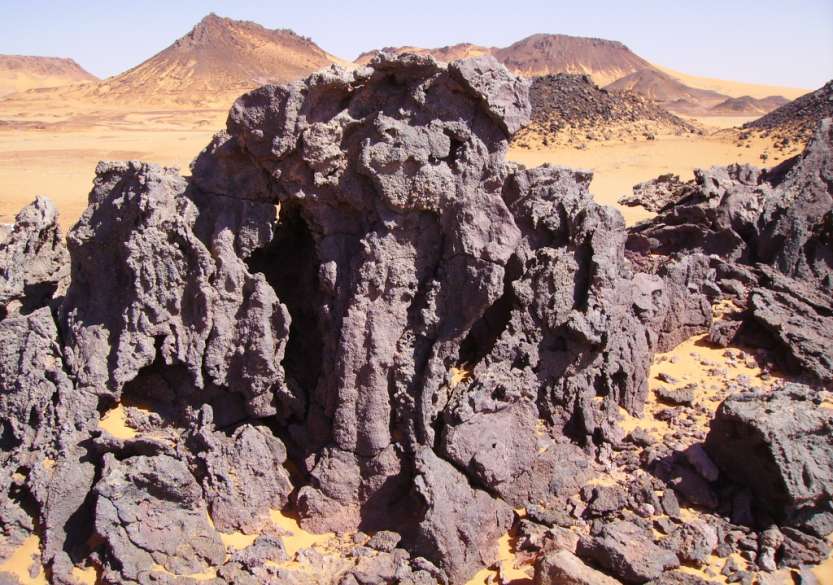
- Alkali olivine
basalt: Cones and plugs of fine-grained alkali olivine basalts and associated
rocks occur far beyond the boundaries of the Uweinat basement inlier. They
can also be found on top of the southern Gilf Kebir plateau and in
its eastern foreland.
- Trachyte and
related rocks: Alkali trachyte, saturated trachyte, trachy-phonolite,
and phonolite are considered within this rock group which is the most common
subvolcanic group in the entire region. Typical of all is their fine-grained
trachytic fabric. Some rocks are clearly fluidally developed, while others
are completely unoriented. When the trachytic rocks are considered together
with the olivine basalt und with the related basanite, tephrite and phonotephrite
outcrops from east of the Gillf Kebir plateau, this could mean that two
or more such alkaline cycles have to be assumed.
- Rhyolotic rocks:
Extrusive rhyolitic rocks are scare within the Jebel Uweinat and
Jebel Kamil.
|
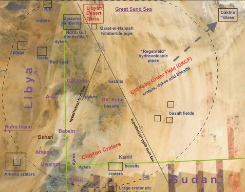
From the many widespread
subvolcanic structures two crater - fields are considered up to now mostly:
Gilf Kebir Crater
Field - GKCF (Outside of the uplifted region)
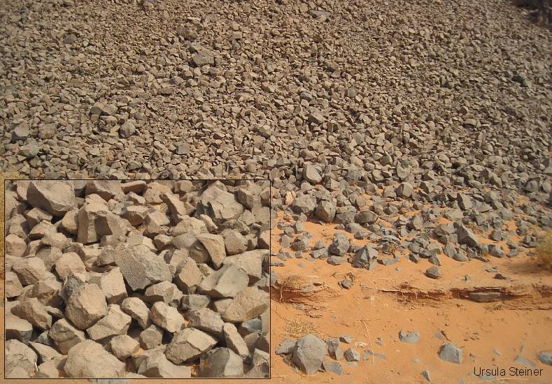
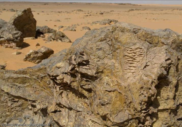
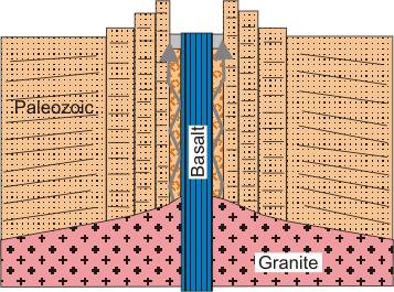
The basaltic magma intruded into Basement, Paleozoic and Nubian layers
with high energy. Thereby rocks and quartz grains were shaped by shock
waves and destroys (breccia, planar lamelles) and in addition melted or
fused by heat.
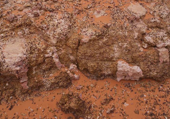
The melted or fused breccia became out pressed by the ascent of the magma
and forms the rim of the craters. In the breccia are included demolished
Basement material, broken parts of Paleozoic sandstones, debris from the
layer between them (well-rounded quartz and angular debris) and finally
light Nubian sandstones. The breccia is tips over at the rim of the crater
to outside and is broken. The basaltic plug often is not lifted out or
is spilled.
Clayton Craters (Central Uplift)
In the Clayton Craters are been found basaltic plugs. The rims of the
craters have an other structure. The rims are composed of steeply erected
Paleozoic sandstones. Nubian sandstones normally are missing (central
uplift !). Frequent are also dykes with Basalt between the edges. Breccias
were not found up to now. It is evident, that the dynamic conditions were
different. Presumably the basaltic magma had a slighter explosive power
and is climbed slow and along longer time.
There are further striking subvolcanic structures, which should be discussed
likewise here:
-
Libyan crater-shaped
structures "Oasis" , "B.P." and Arkenu
-
Crater "White
Spot" (Jebel Uweinat)
-
Hydrovolcanic
pipes nearby "Regenfeld"
-
.... etc.
|
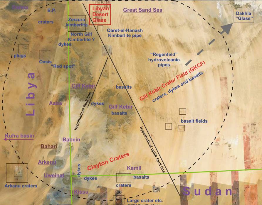
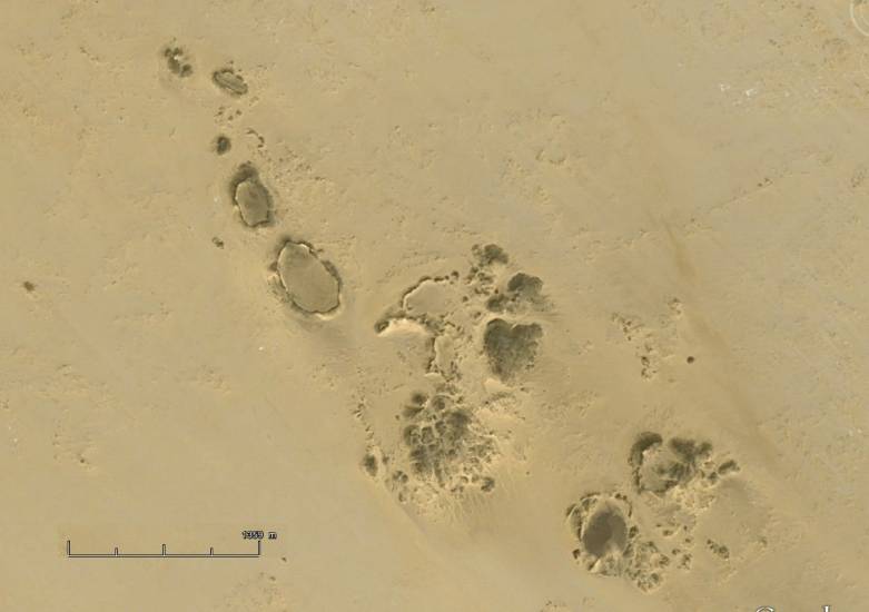
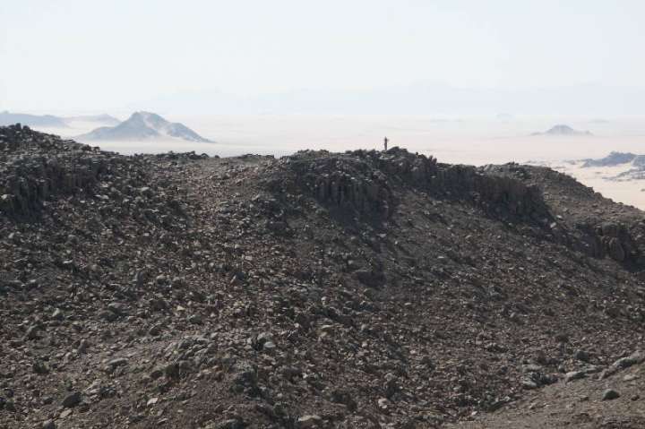
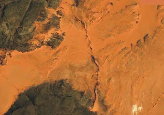
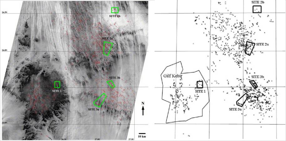
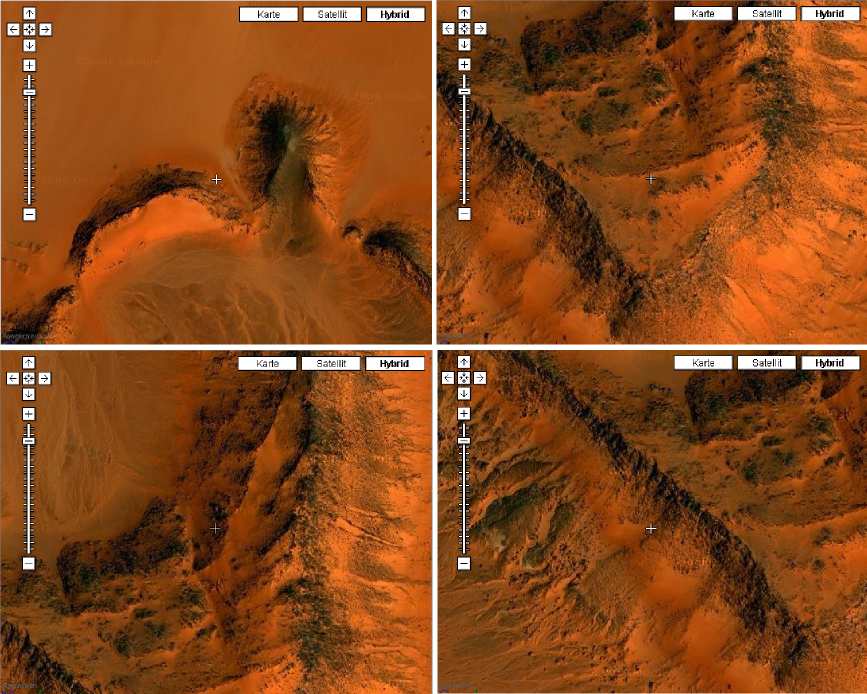
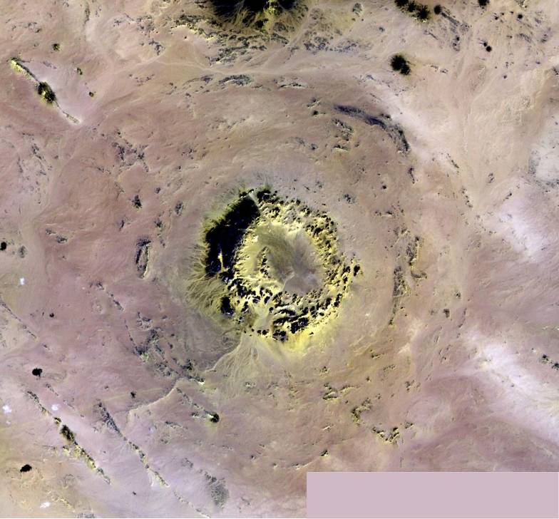
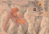
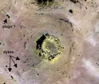
Map with crater-shaped structures
and plugs in the Western Desert
|
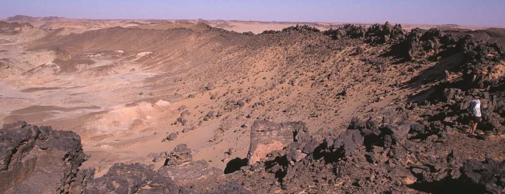
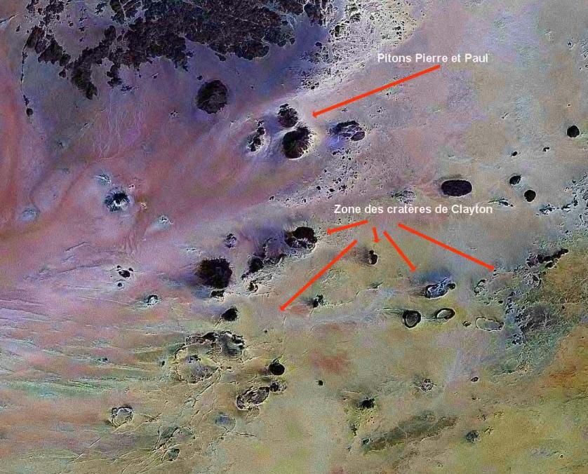
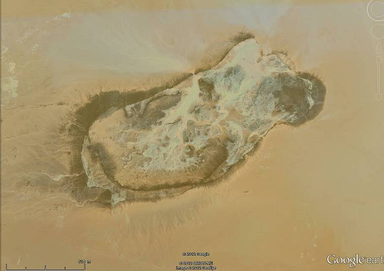
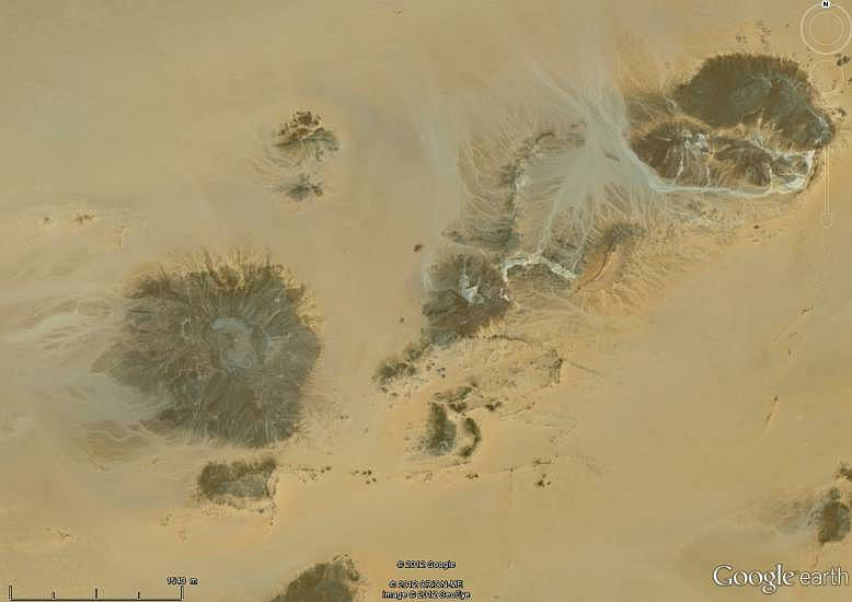
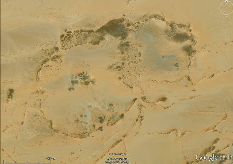
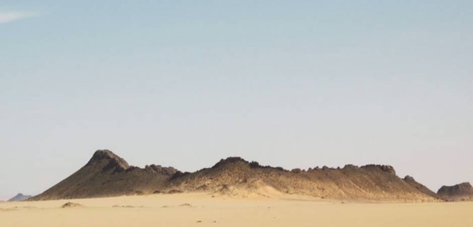
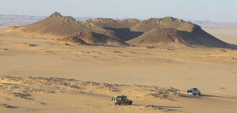
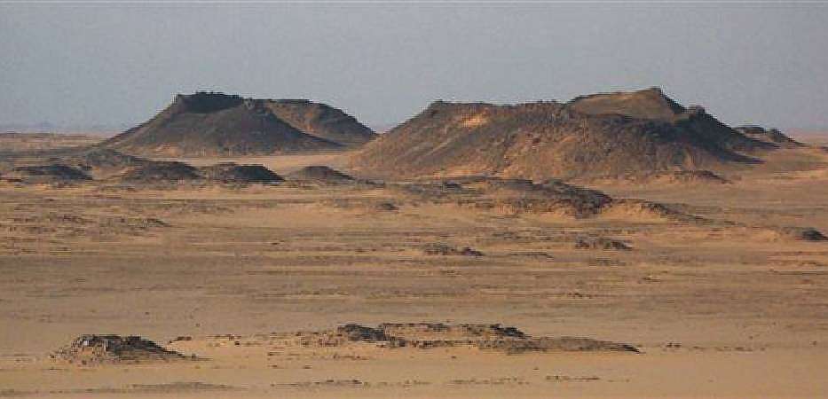
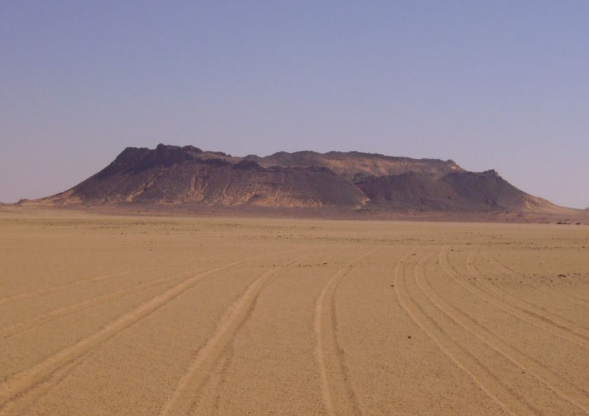
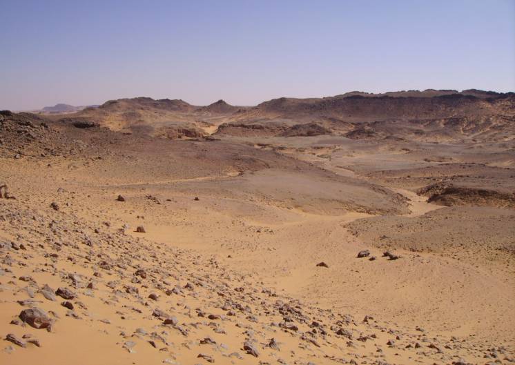
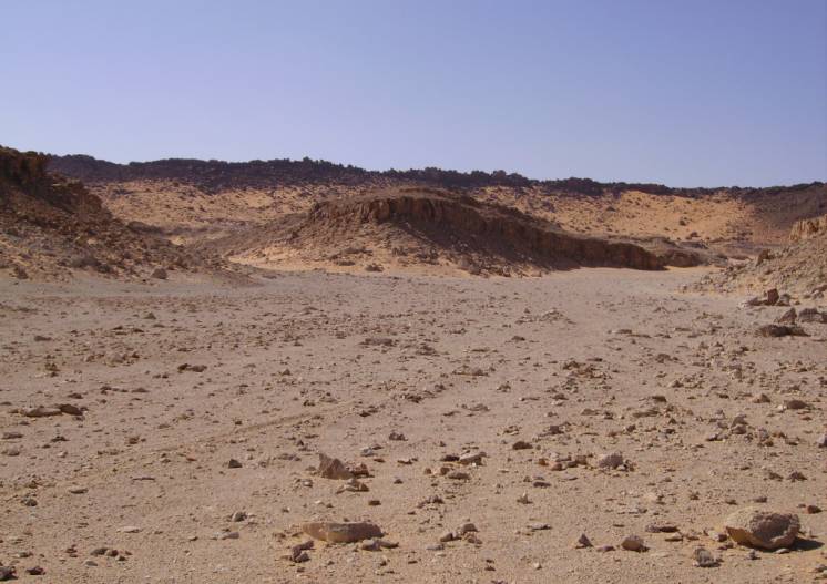
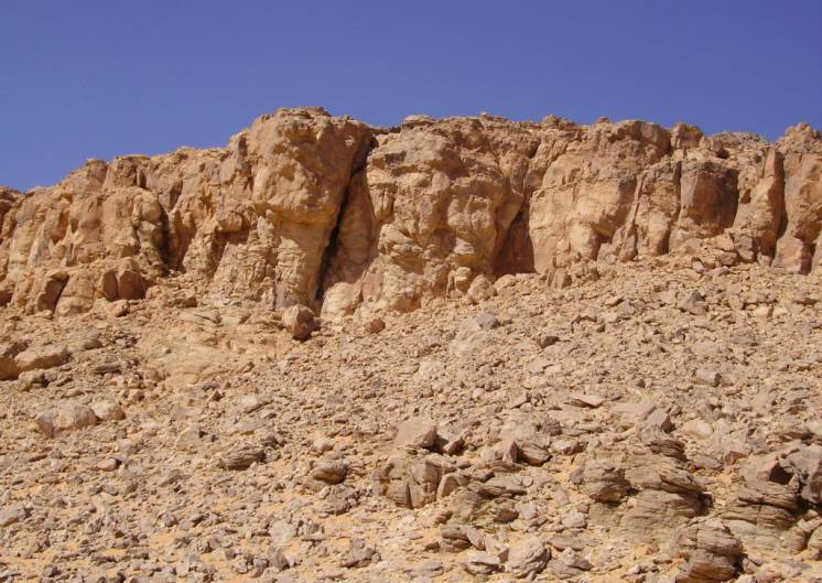
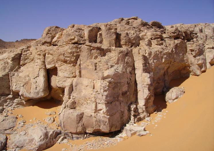
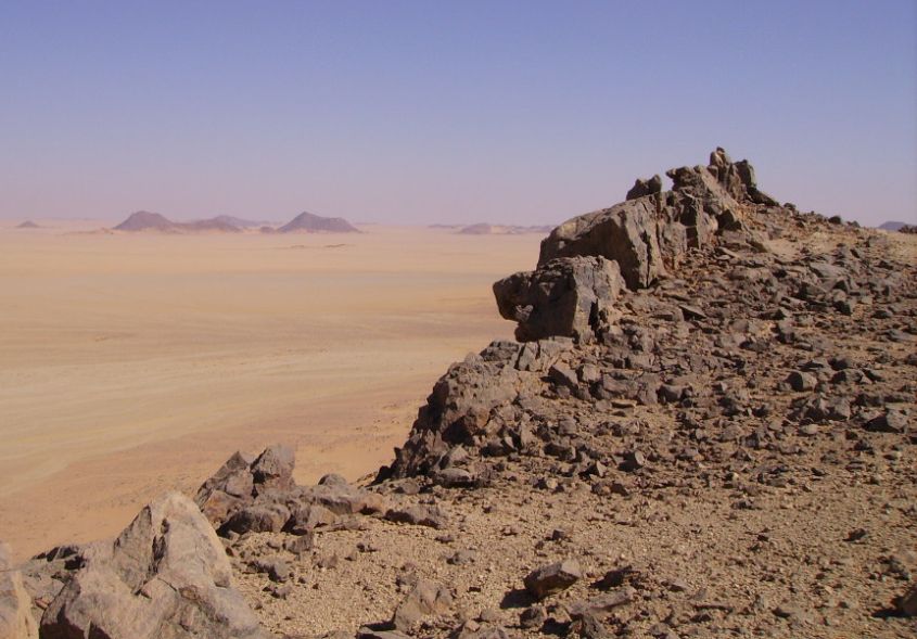
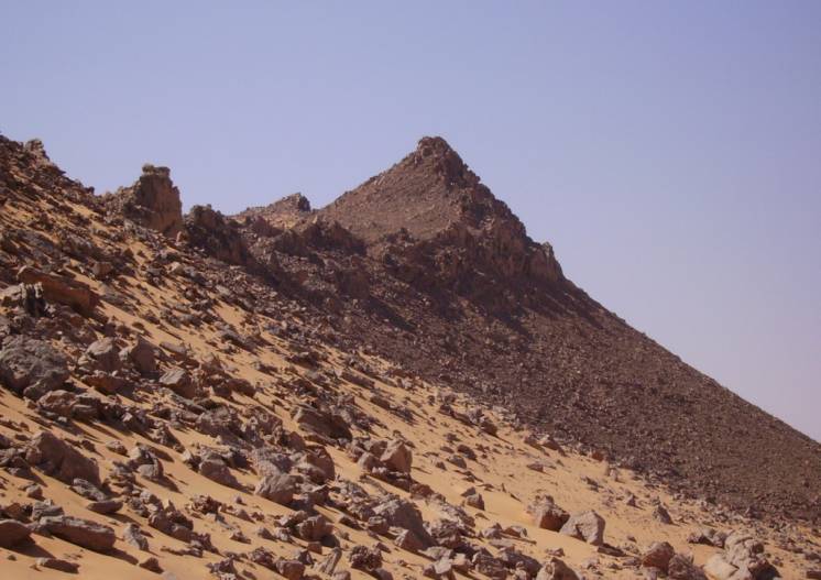
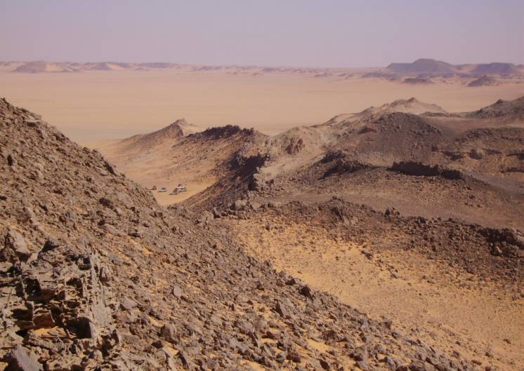
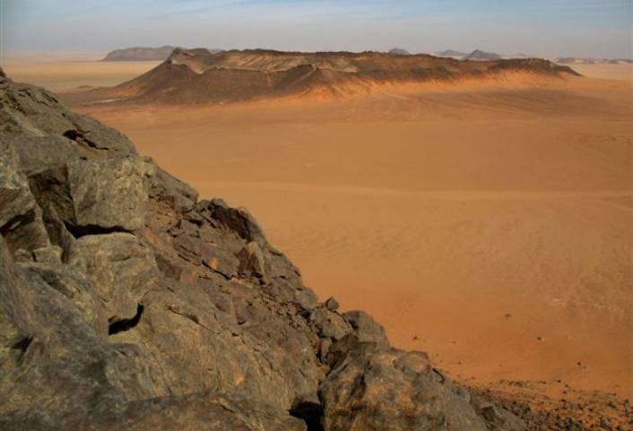
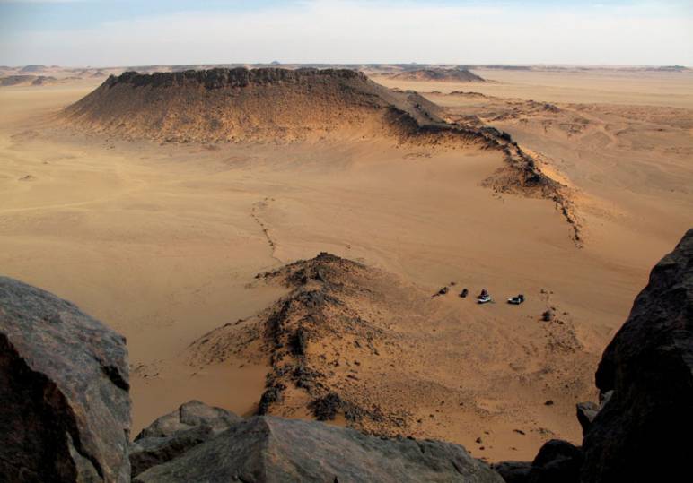
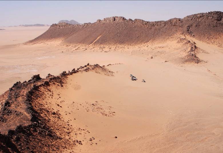
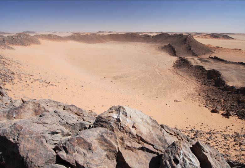
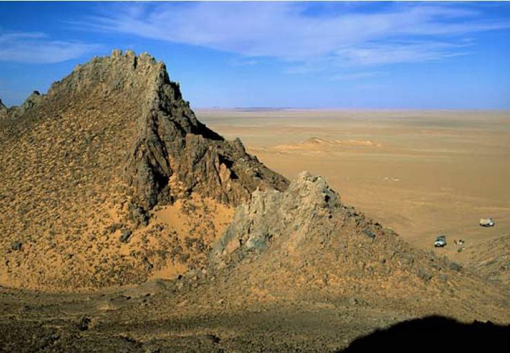
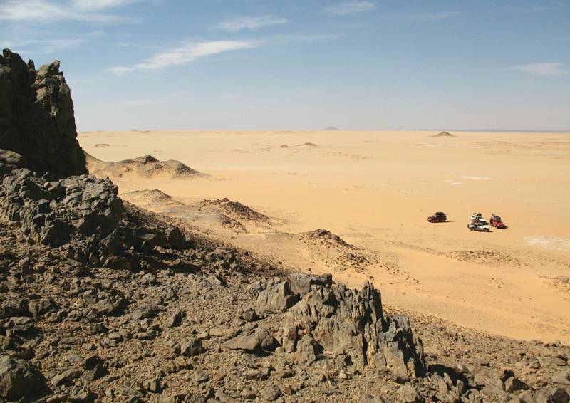
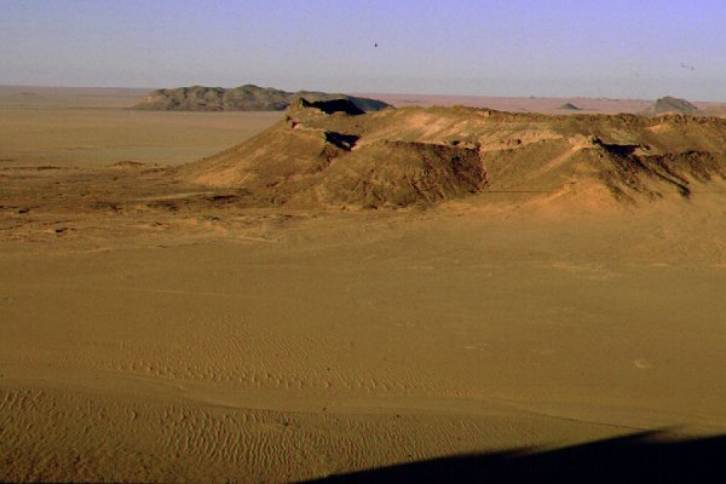
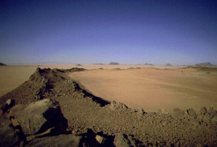
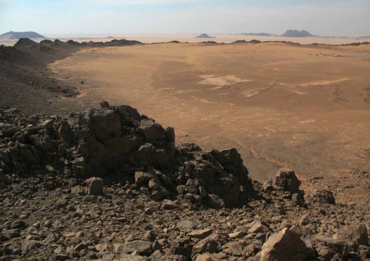
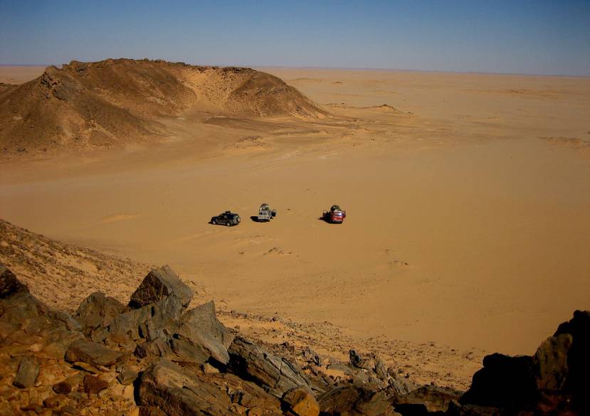
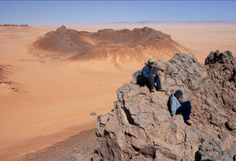
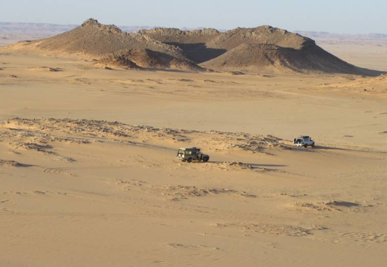
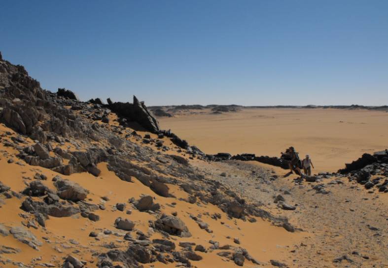
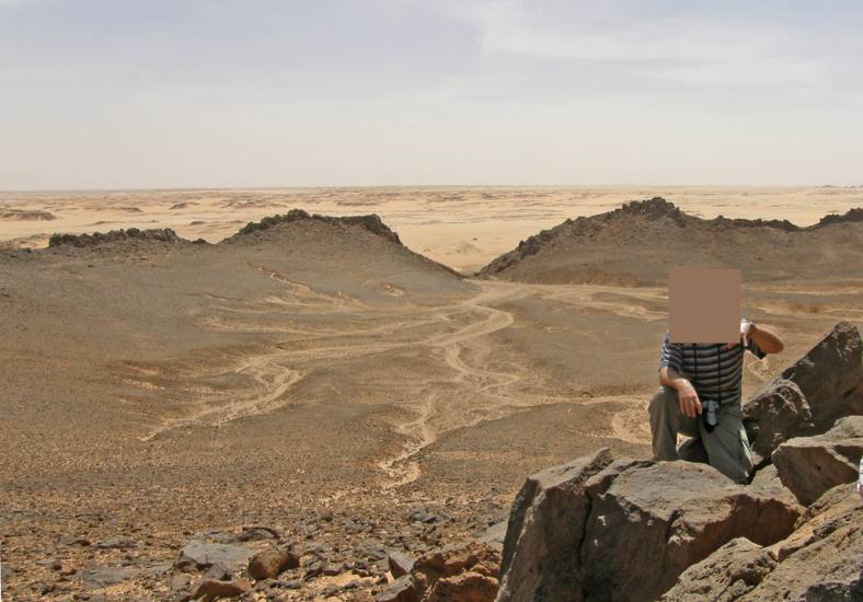
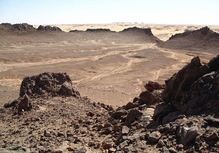
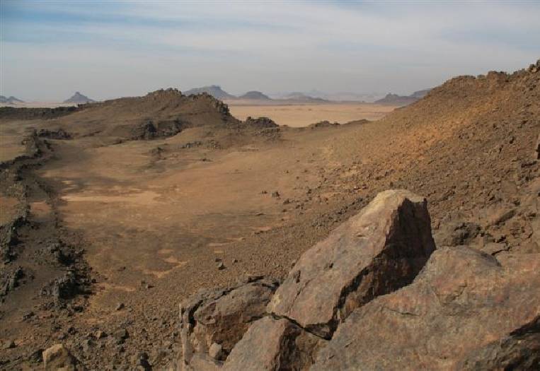
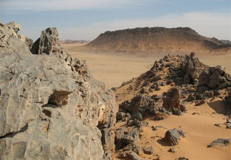
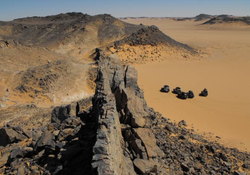
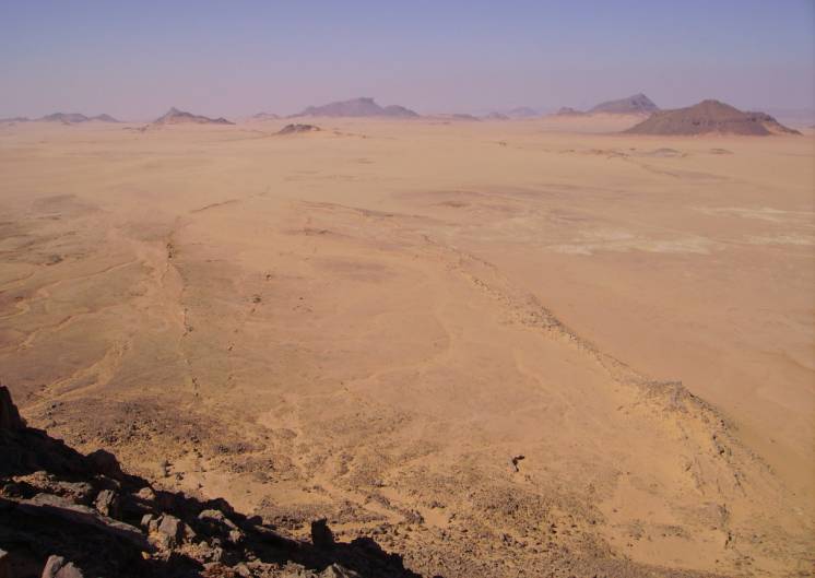
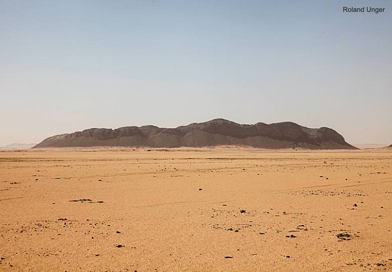
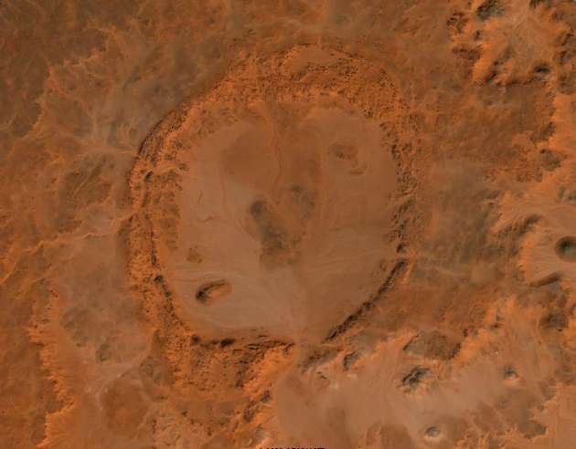
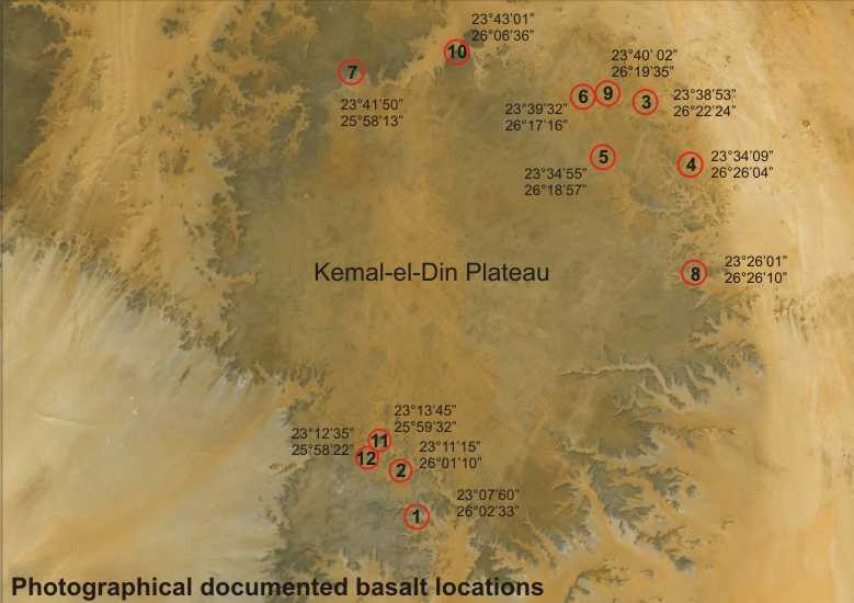
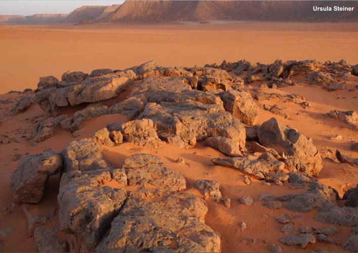
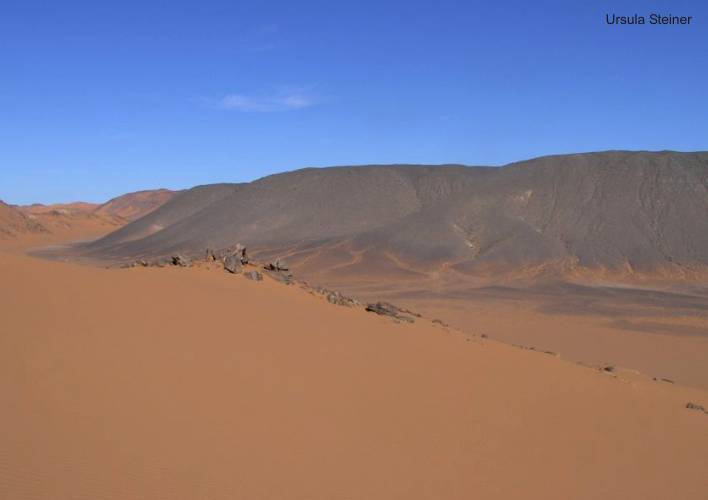
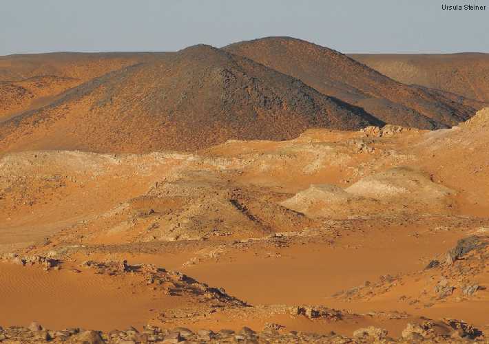
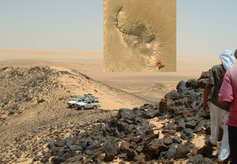
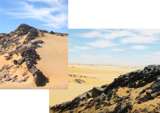
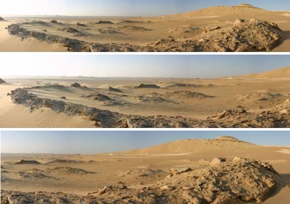
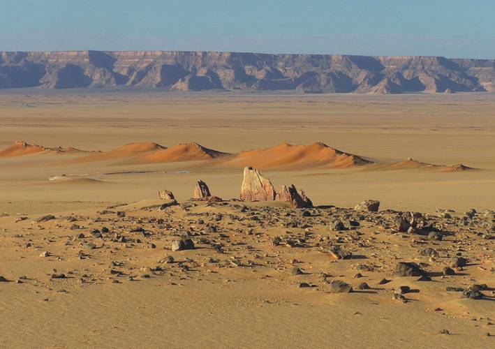
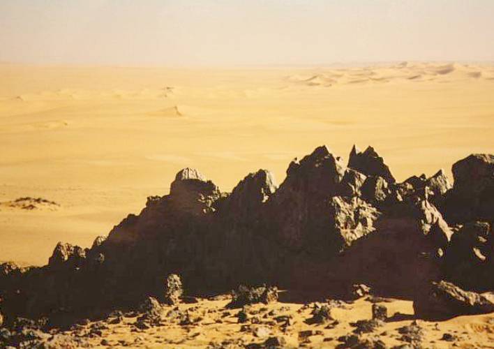
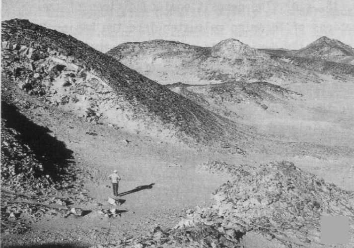
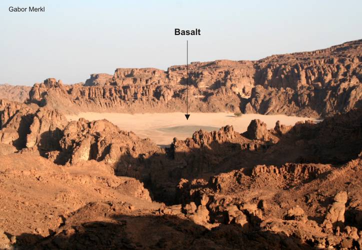
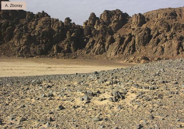
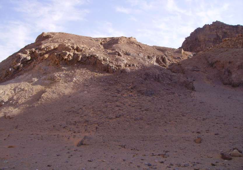
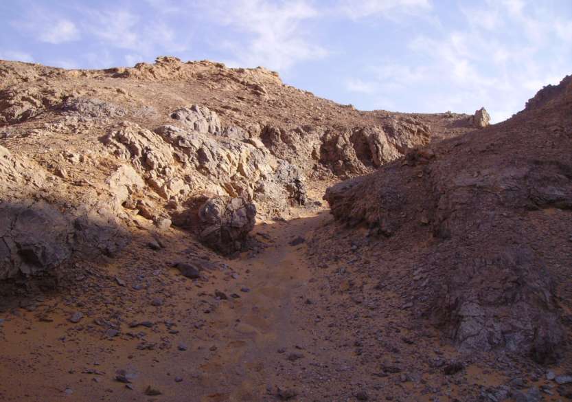
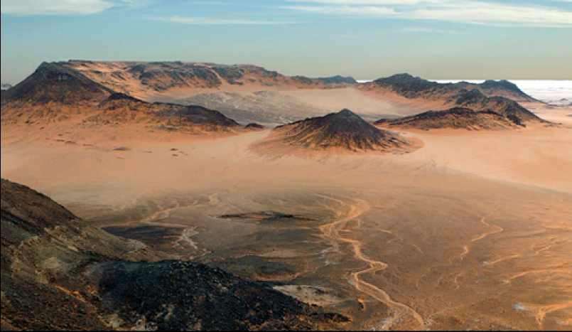
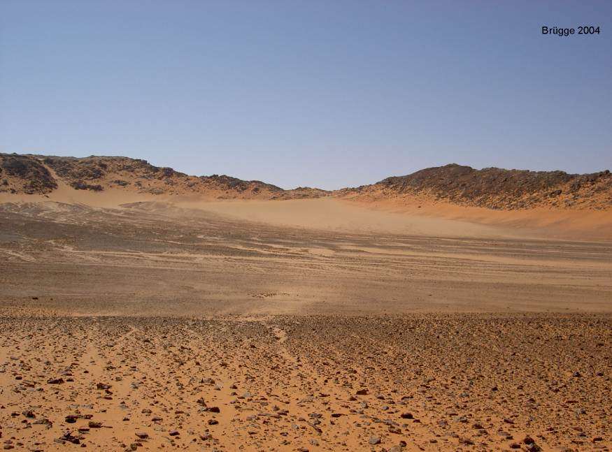
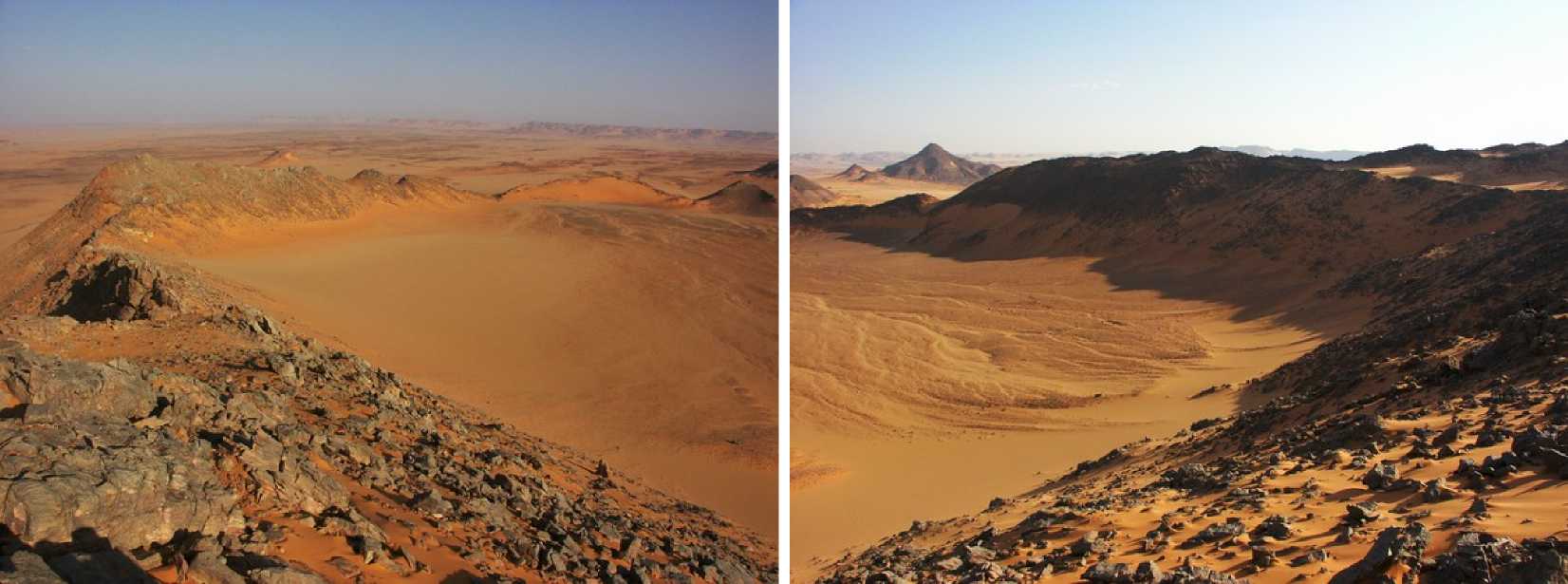
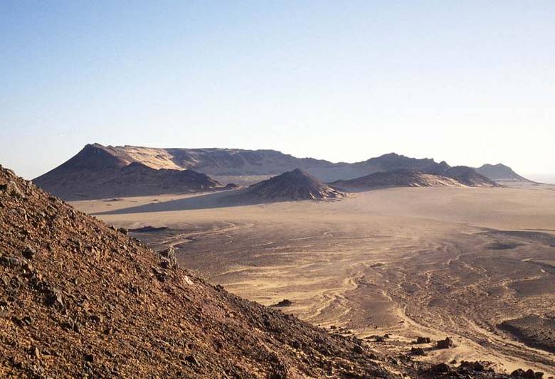
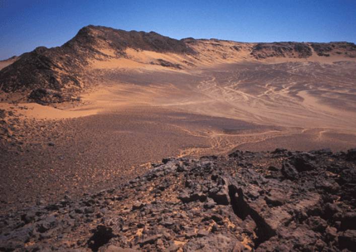
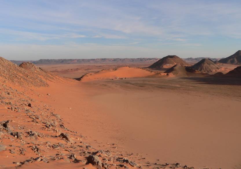
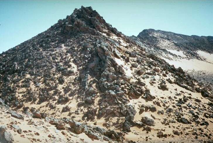
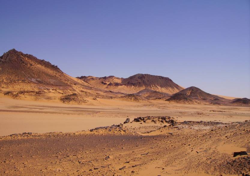
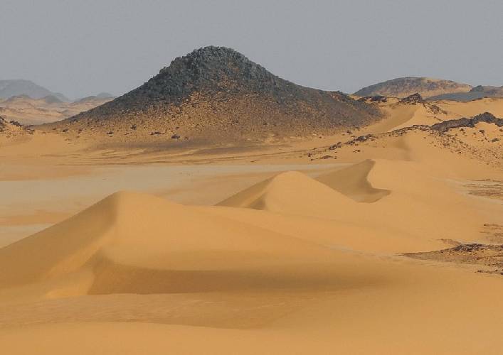
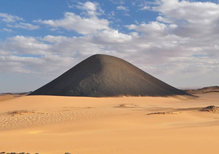
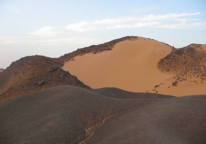
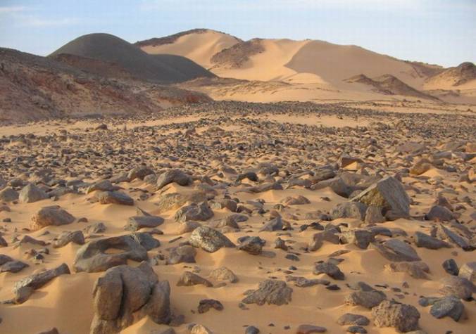
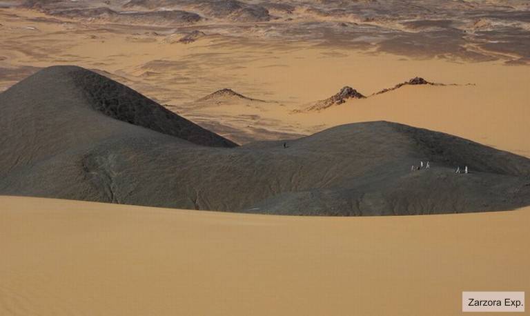
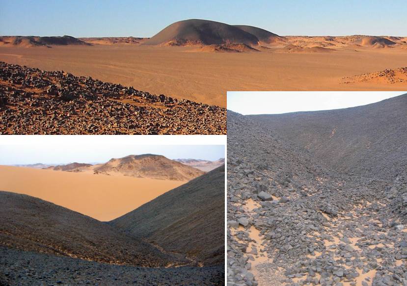
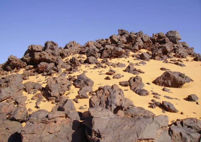
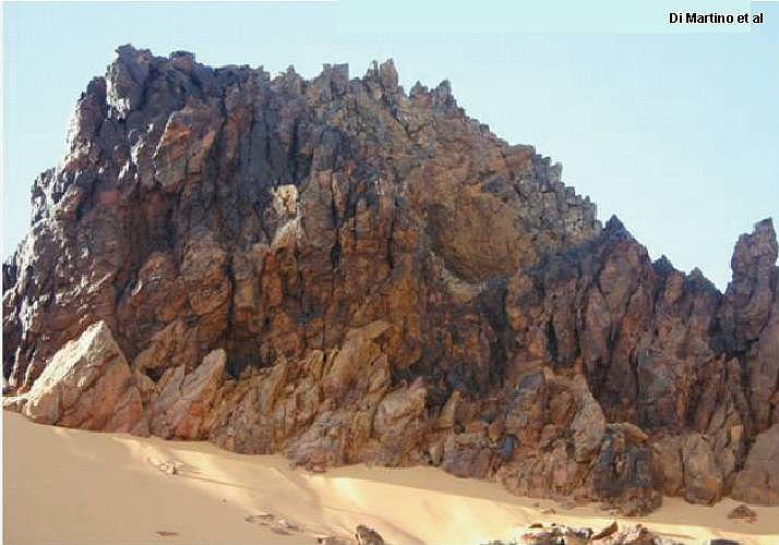
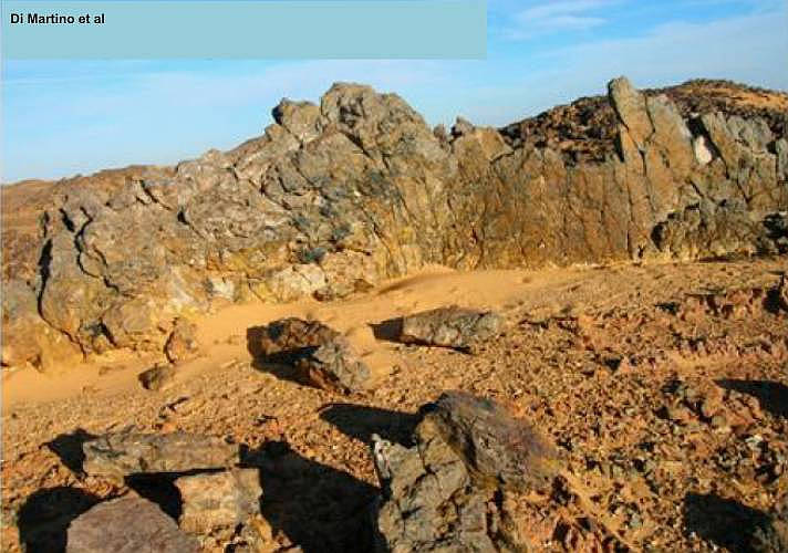
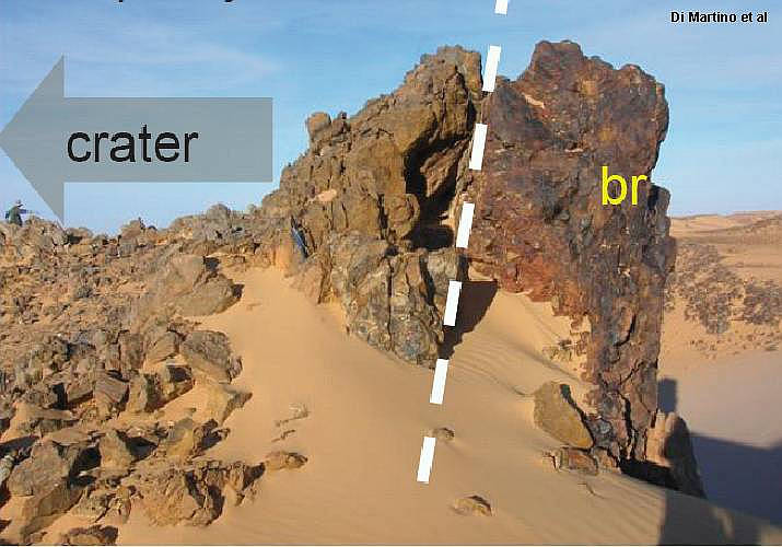
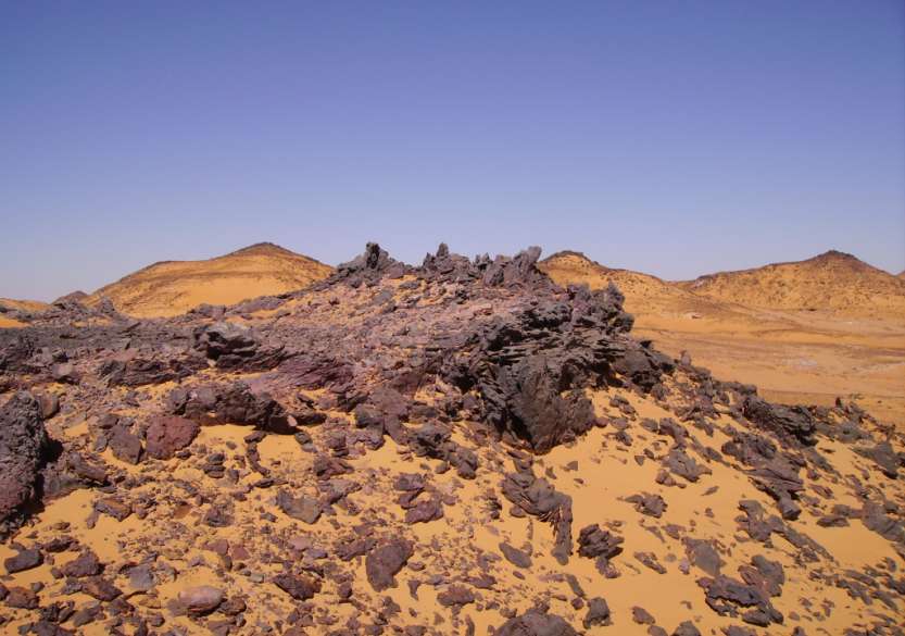
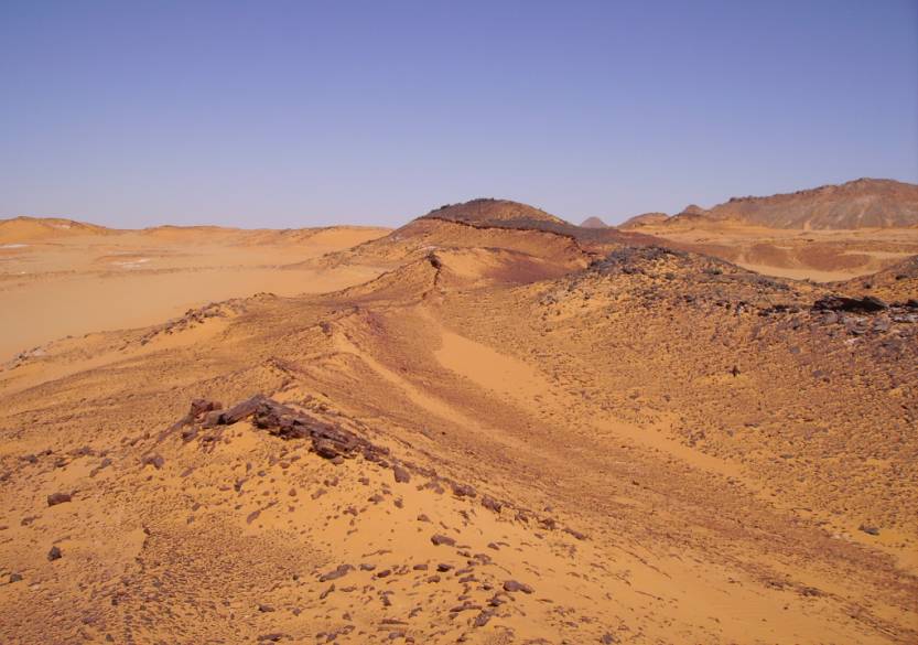
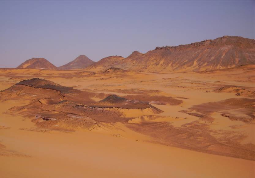
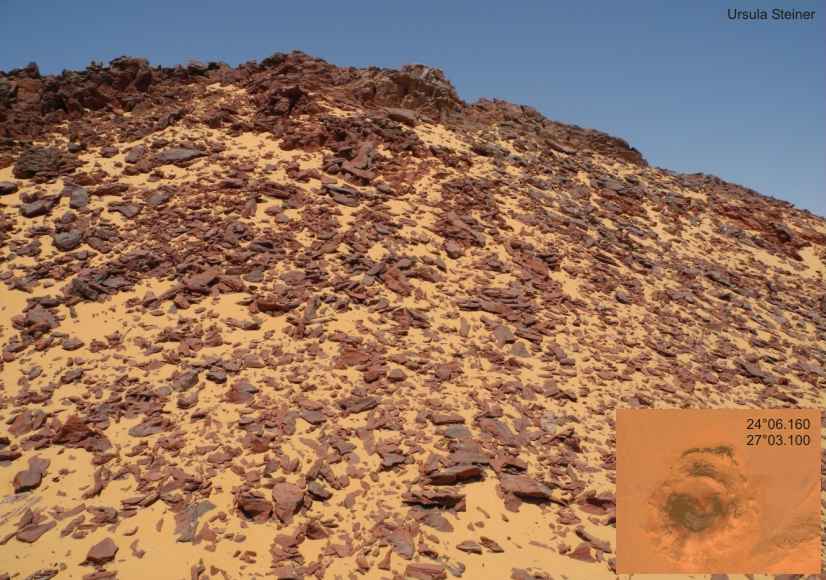
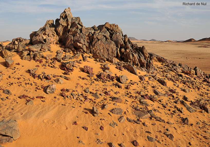
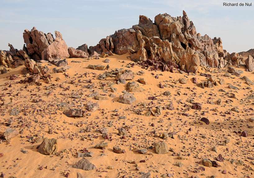
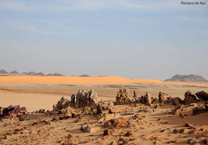
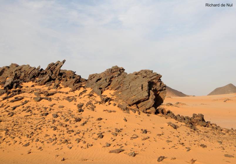
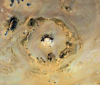
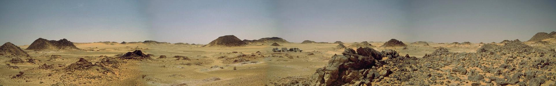
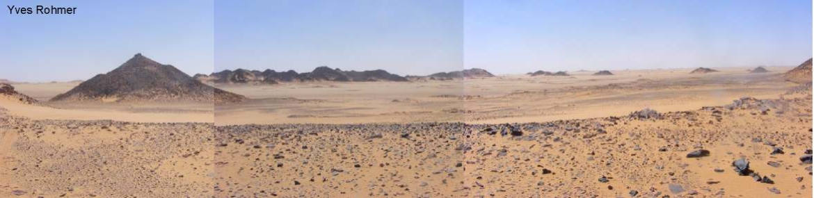
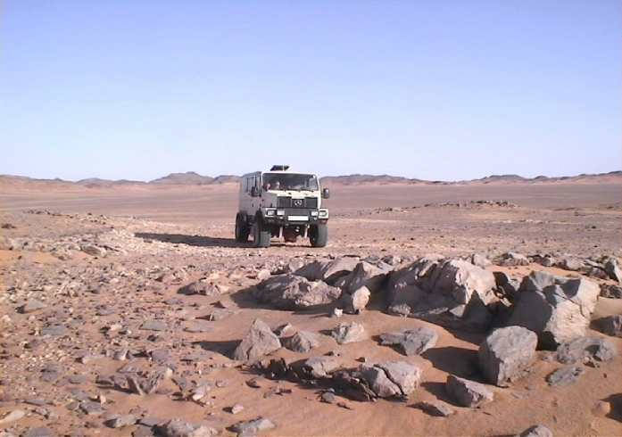
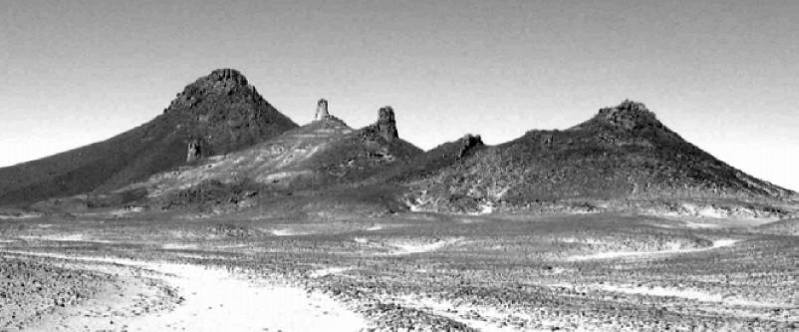
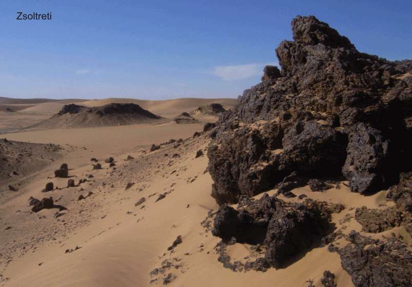
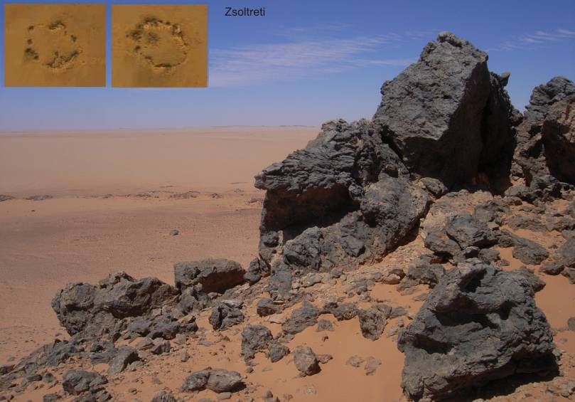
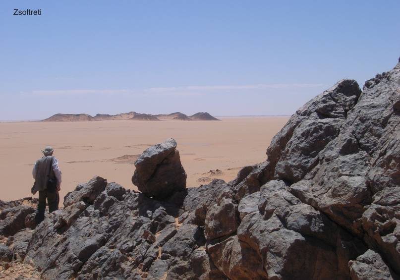
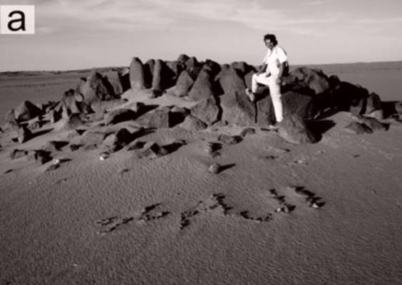
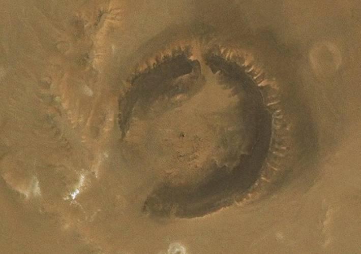
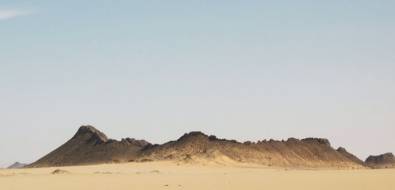
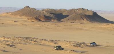
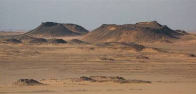
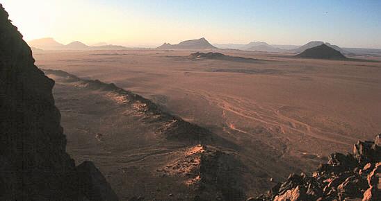
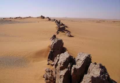
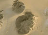
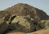
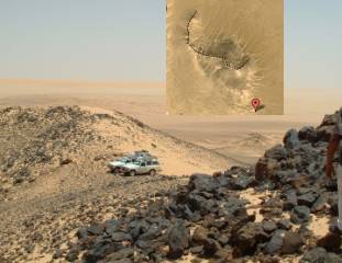
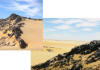
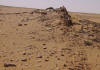
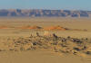
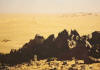
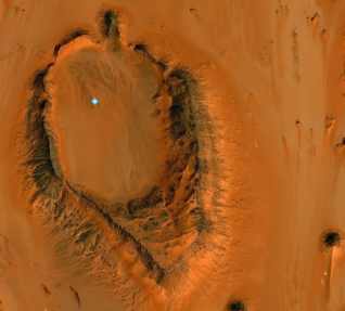
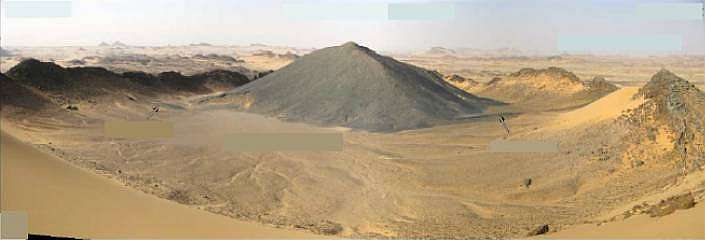
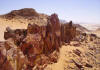
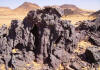
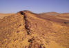
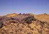
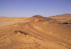
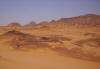
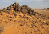
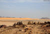
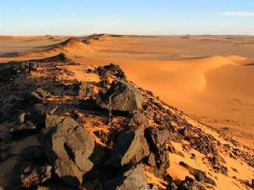
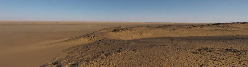
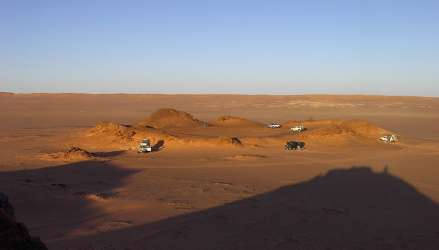
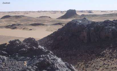
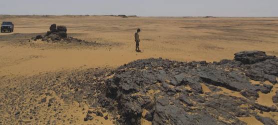
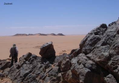
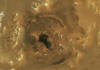
1.0 The craters in the uplift-region around Gilf Kebir and Jebel Uweinat
1.1
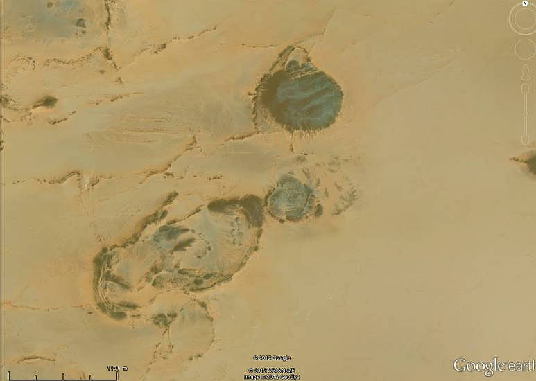
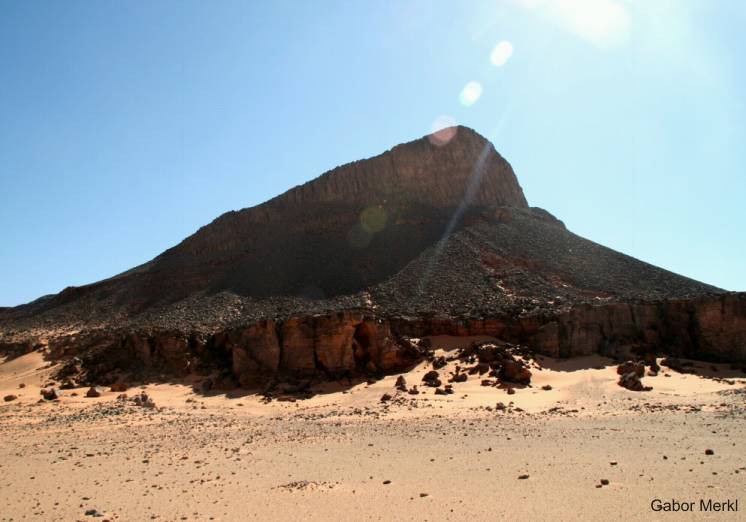
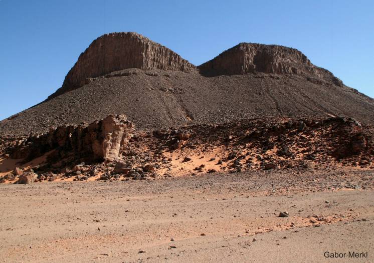
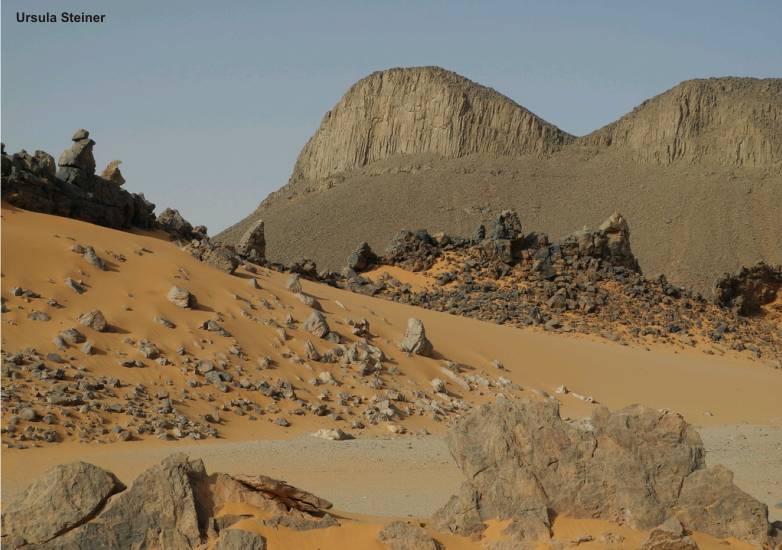
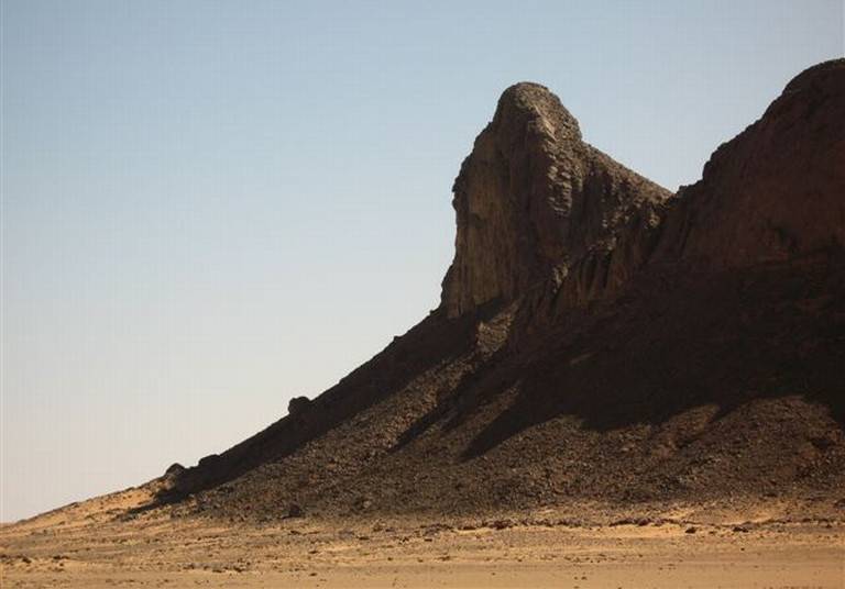
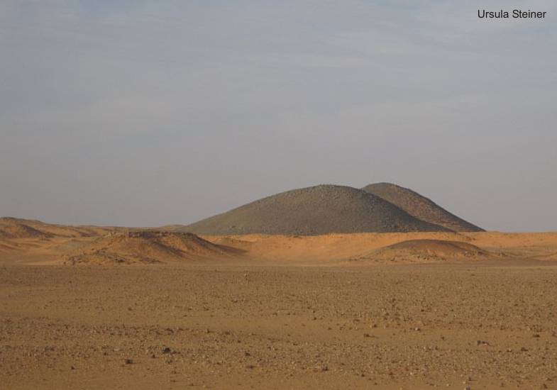
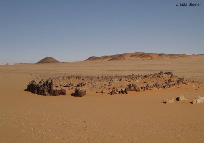
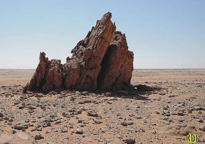
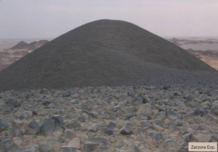
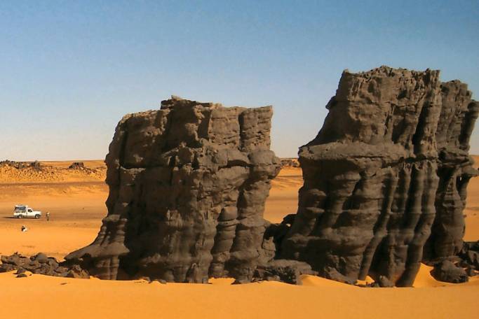
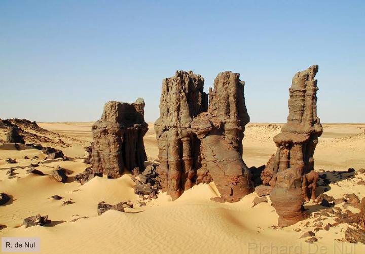
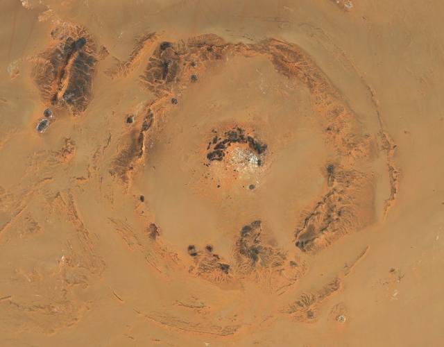
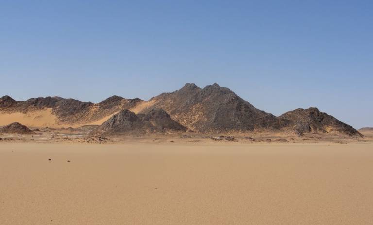
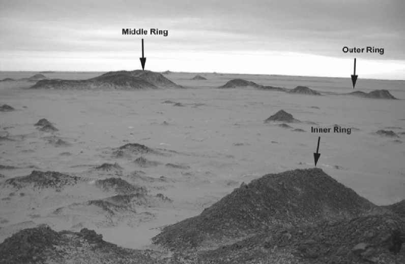
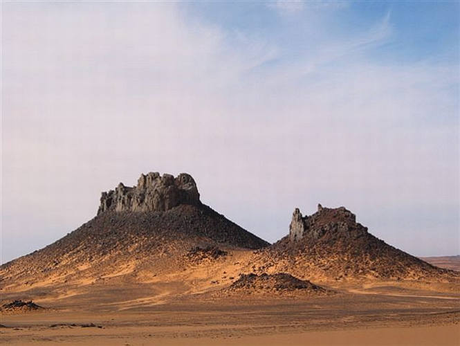
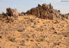
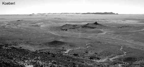
The "Clayton Craters"
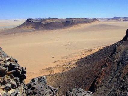
The main group of the Clayton
craters
"In the region of
the Jebel Uweinat und Gilf Kebir, there are hundreds of intrusive plugs und
dykes, ranging in composition from Carbonatites to Olivine Mela-Nephelinites,
Alkali-Basalts and minor Phonolites and Trachytes. Olivine Mela-Nephelinites,
Basanites and Alkali Basalts are the most abundant rock types. These rocks
are from ring complexes and mafic plugs located between the Jebel Uweinat
and the Gilf Kebir. These intrusive rocks range from 28.2 to 26.7 Ma in age.
Olivine Mela-Nephelinites and Basanites are not genetically related to each
other by fractionation but they represent primitive magmas generated by different
degrees of partial melting of a metasomatised upper mantle source. Incompatible
trace elements in Olivine Mela-Nephelinites may be modelled with small degrees
of partial melting of such a source. Close relationships are also observed
with the slightly older intrusive rocks from Gilf Kebir suggesting that Uweinat
magmatism is possibly related to a northeastward migration of the African
plate above an intracontinental Hot Spot."
(Source: www.geoscience.org.za).
On the active line following structures are found from the southwestern to
the northeastern direction:
-
Crater "White Spot",
dykes and basaltic plugs in the Jebel Uweinat,
-
many dykes and
craters in the area between Jebel Uweinat and Gilf Kebir,
-
all groups of Clayton's
Craters,
-
basalts and crater-shaped
structures along and on top of the southern Gilf Kebir Plateau,
-
large crater fields
of the "Scarp-Contours" in the eastern direction of Gilf Kebir,
-
hydrovolcanic pipes
nearby "Regenfeld",
-
crater like structure
"Jasper Mountain"
All of the craters -
meant are the Clayton Craters - are not volcanic explosion craters
(in sense K. SANDFORD, 1934). The best argument against explosion events are
Carboniferous layers in the centre of a large crater (with bright trachyte
therein), which contain plant imprints (Carboniferous
plant imprints).
The
craters were first seen by an airplane during the 1932 Almasy - Clayton expedition
by Sir Robert Clayton. Therefore the craters were named to him.
The first serious study of the
craters was done by K.S. Sandford, who accompanied the 1934 Bagnold expedition.
SANDFORDS's study is the most comprehensive in the
region between Gebel Uweinat and the Gilf Kebir he described:
1) open craters, probably the result of single explosions.
2) craters with subidiary plugs of trachyte.
3) trachyte necks with boundary walls of indurated sandstone.
4) isolated hills capped with trachytic lava.
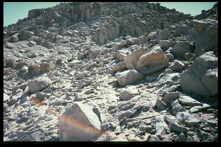
The crater walls he described as "almost vertical, of intensely indurated
and silicified sandstones, brecciated on a large scale as weII as in the hand-specimen,
locally with columnar structure imposed upon them, the prisms being more or
less horizontal (at right angles to the source of heat). With the exception
of the columnar joints, this general crater morphology was present even in
those features that lacked central igneous masses.
The contact between sandstone and the various trachytic plugs was typically
fused. From thin sections of these fused zones, Sandford described "heat or
explosion-shattered grains of well-rounded quartz, with an isotropic black,
brown, and glassy material between them".
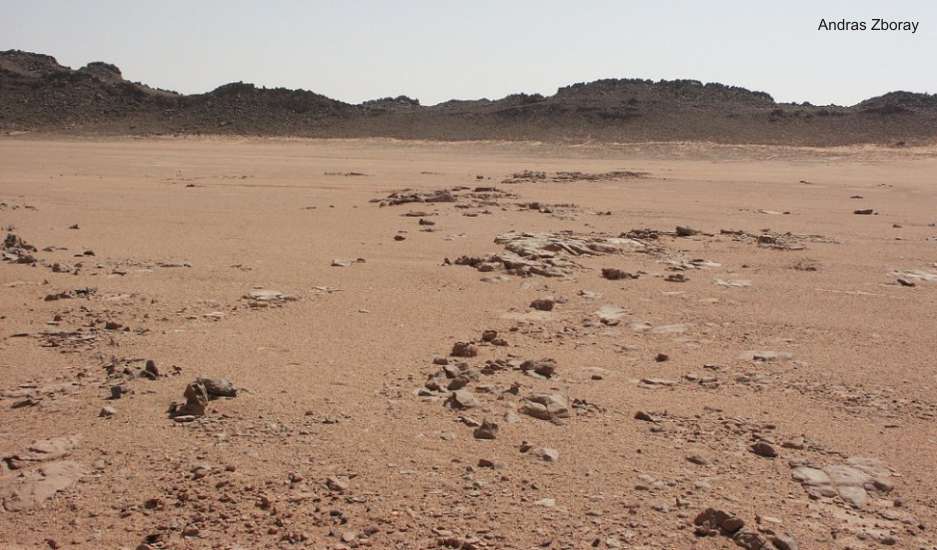
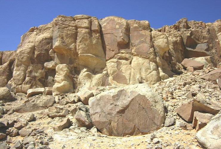
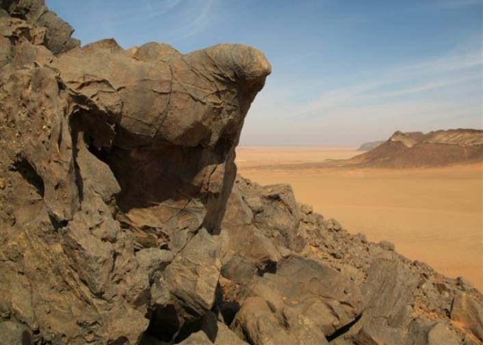
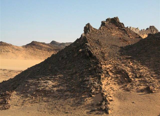
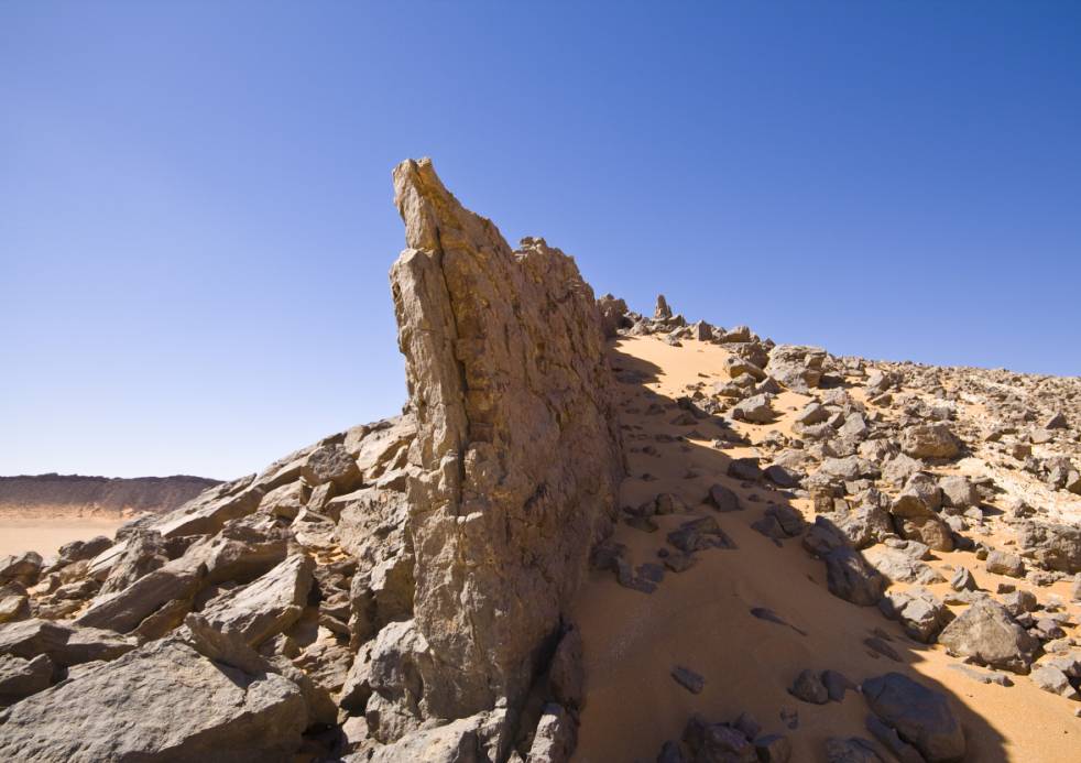
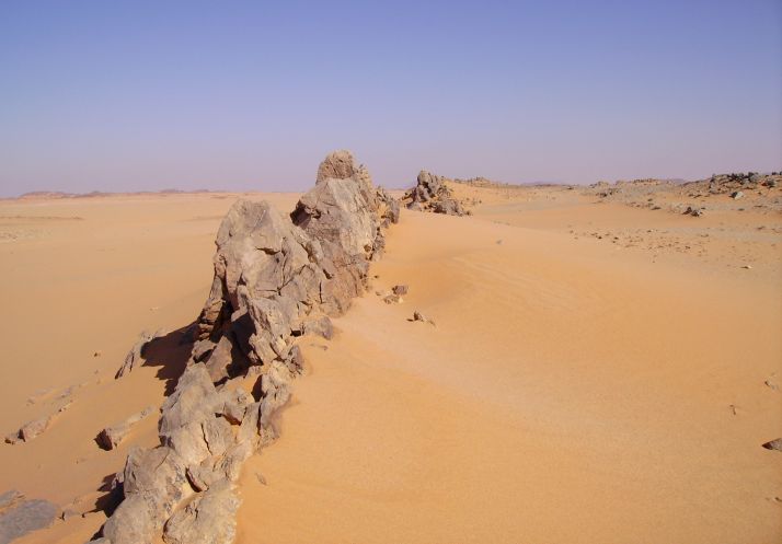
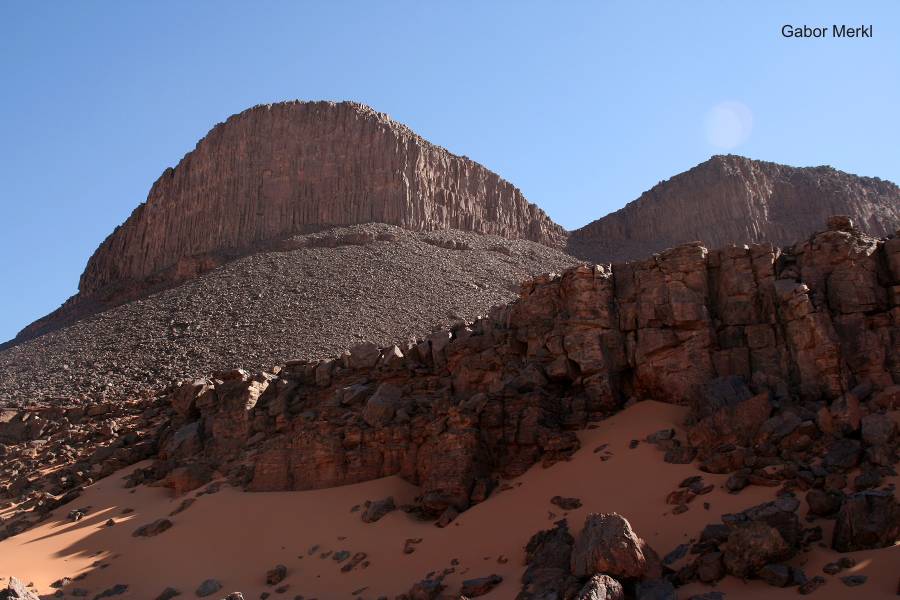
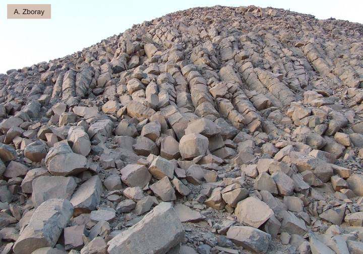
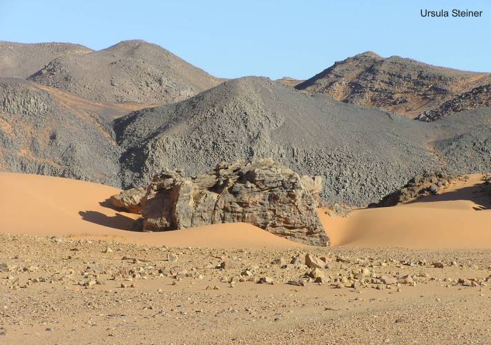
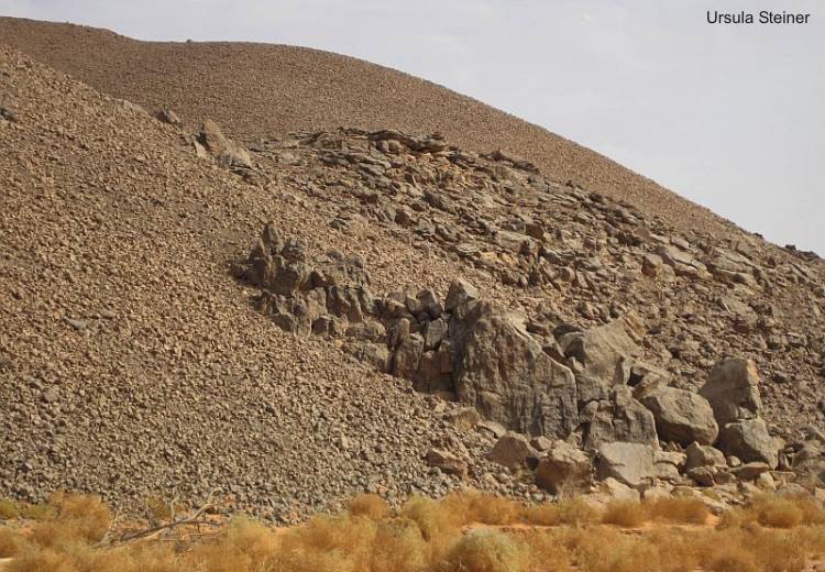
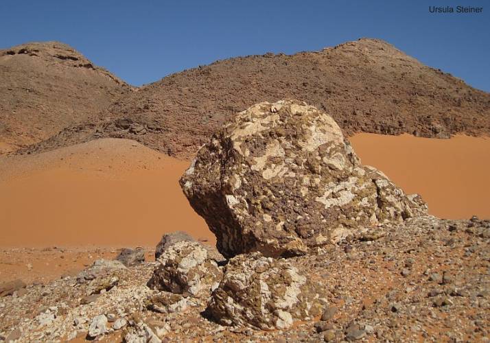
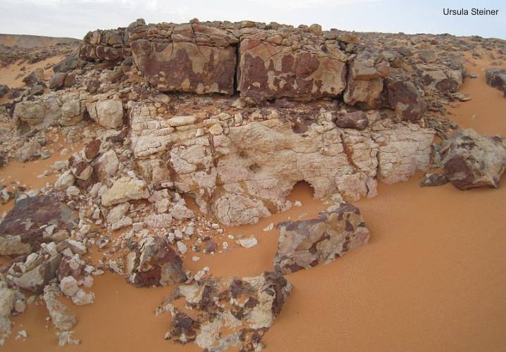
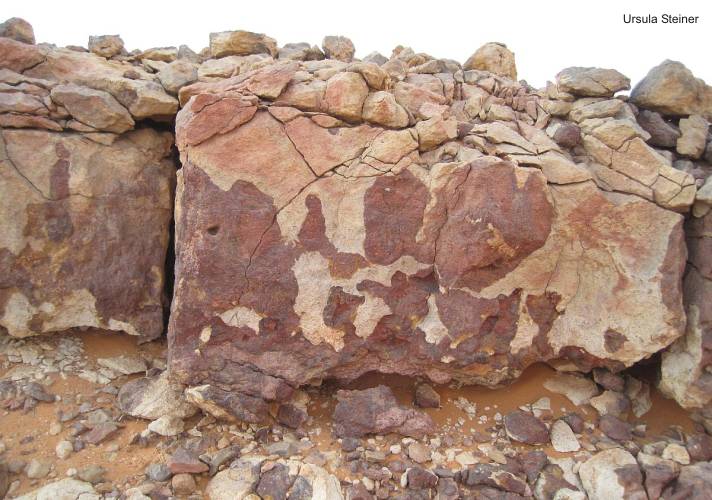
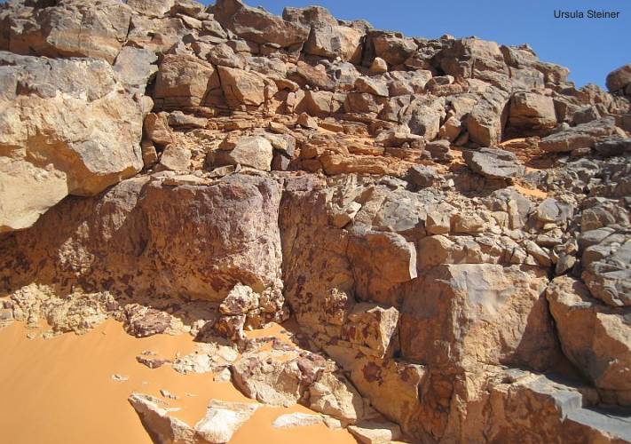
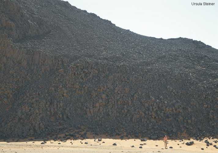
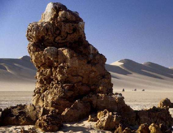
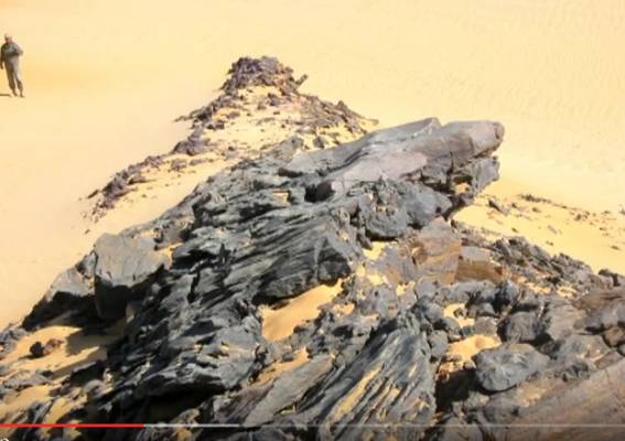
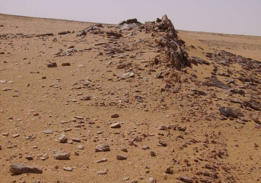
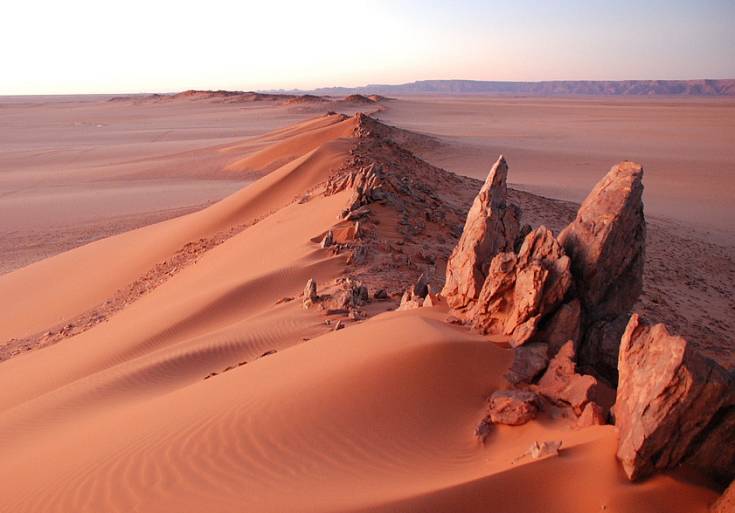
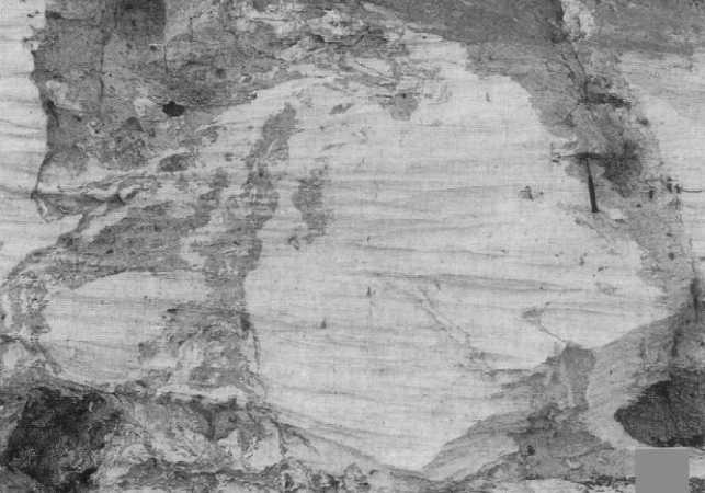
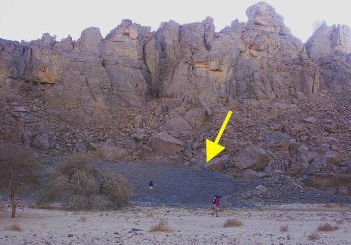
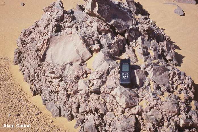
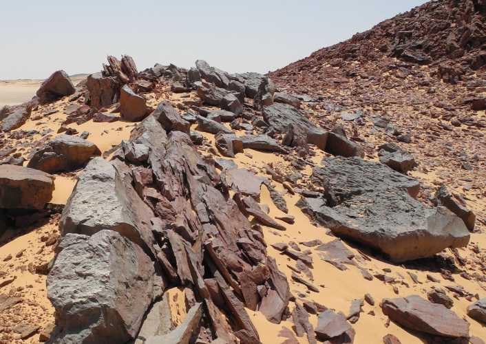
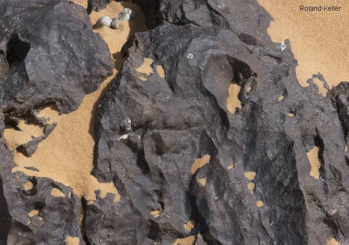
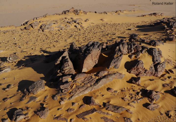
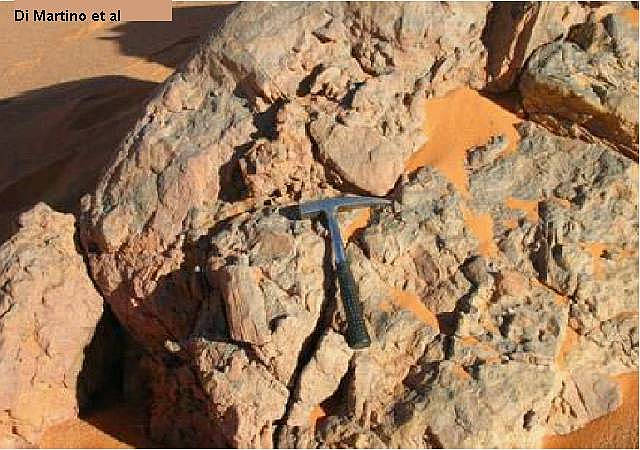
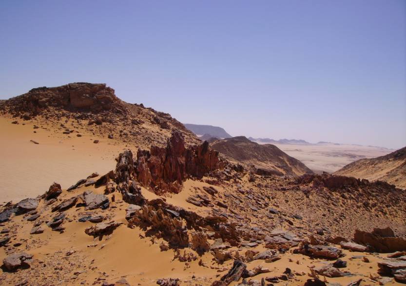
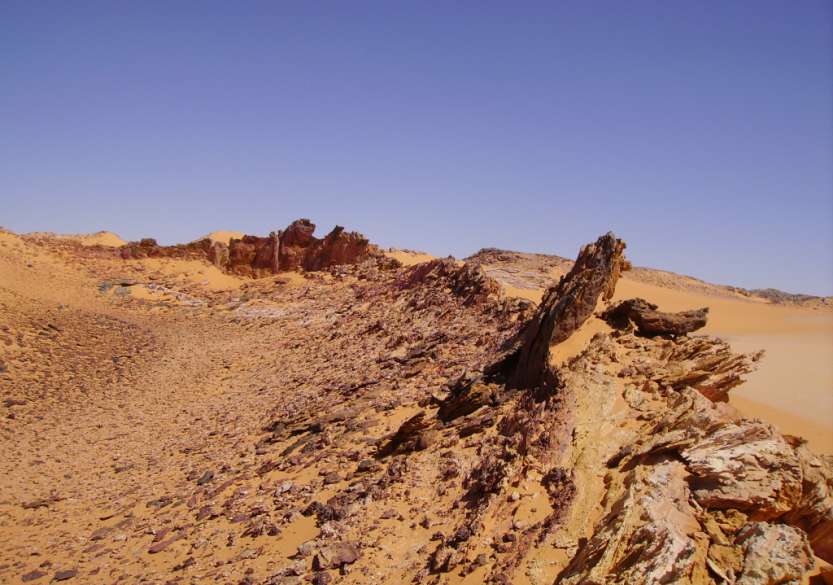
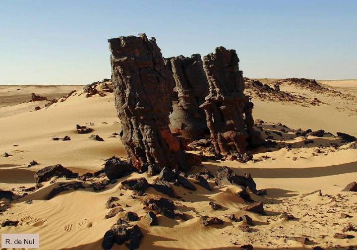
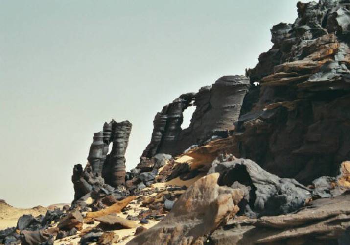
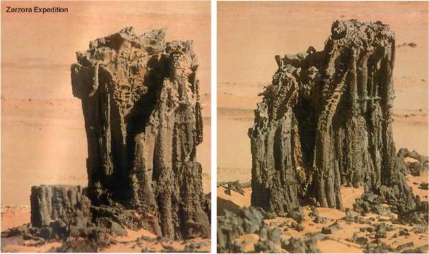
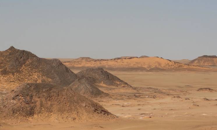
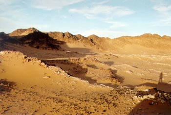
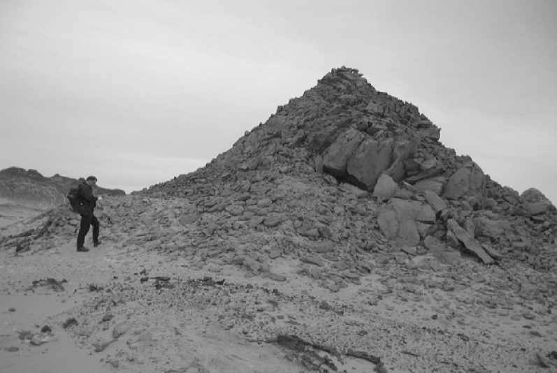
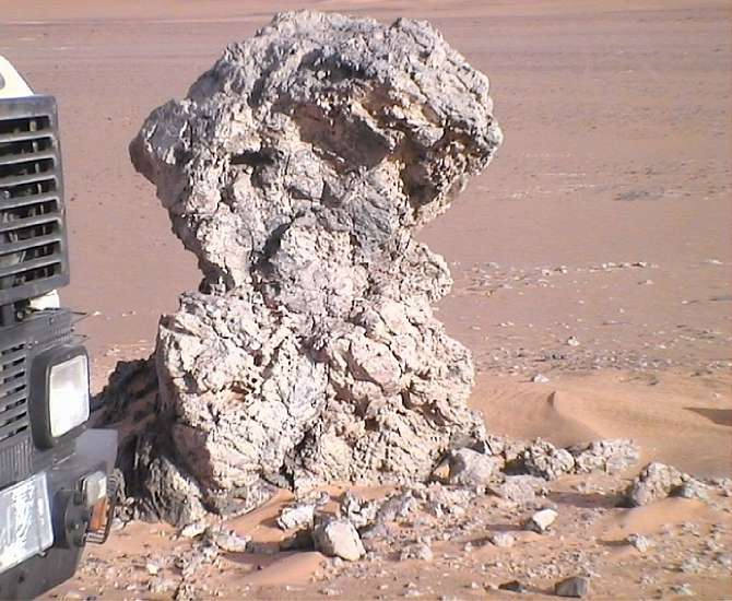
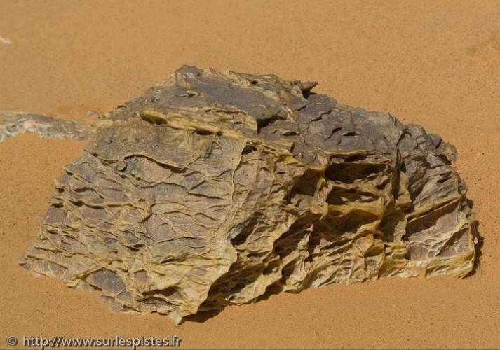
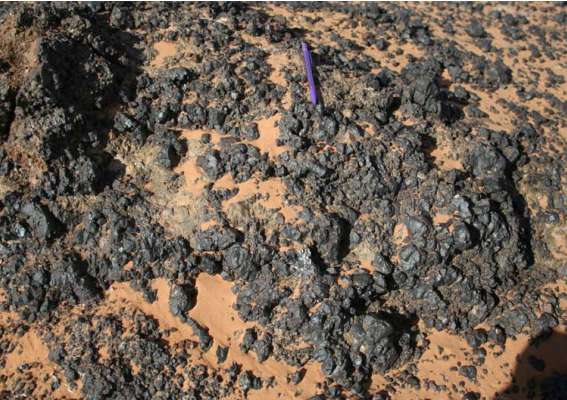
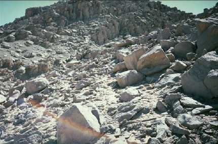
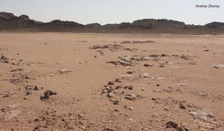
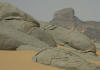
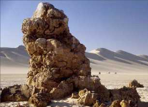
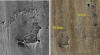
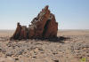
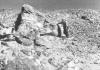
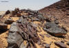
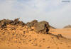
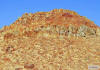
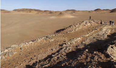
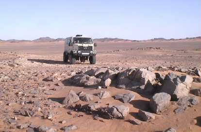
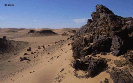
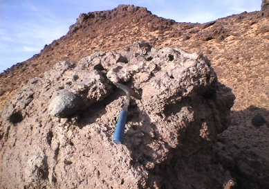
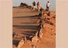
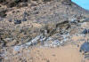
An intrusive dyke in the foreground of the crater
An other dyke with erected layers
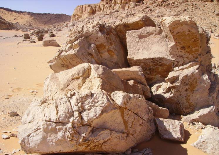
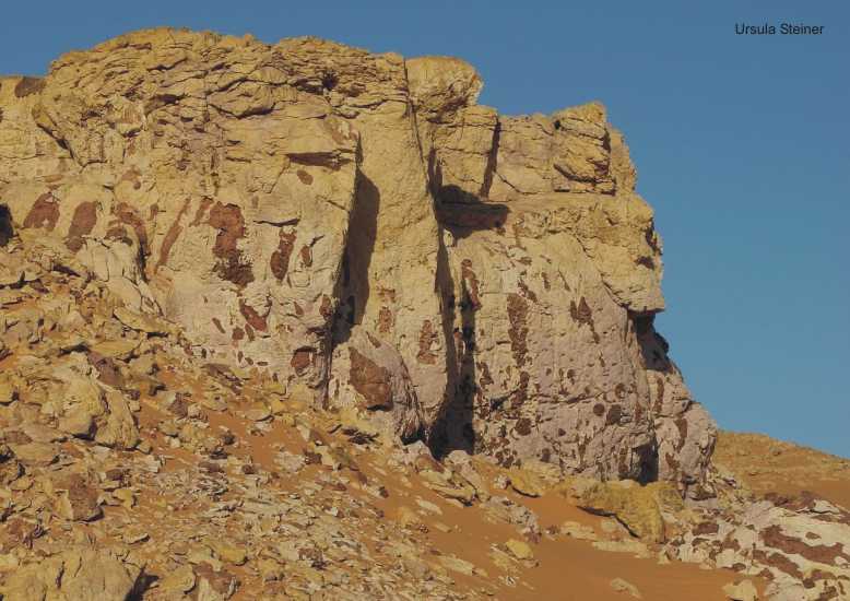
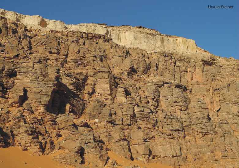
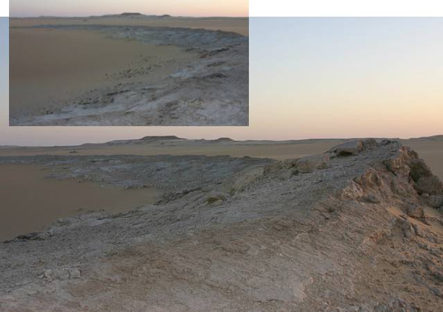
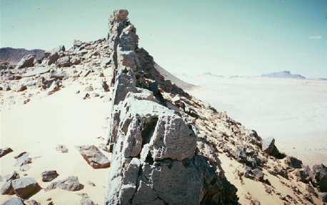
The
rims of the craters are of sandstone, tilted vertical by intrusive forces,
and fused by heat on their inner sides. There traces of intrusive rocks (Basalt
or Trachyte) within some of the craters. The basaltic plugs are sometimes
visible as small hexagonal columns.
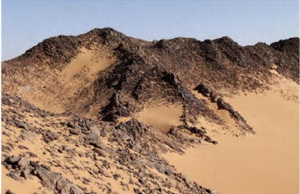
Likely it was a slow upthrust of magma, that also explains the almost perfectly
vertical walls. In some craters the magma remained, while in others it fully
subsided, leaving empty craters only containing material from the erosion
of the rim and inblown sand of the desert.
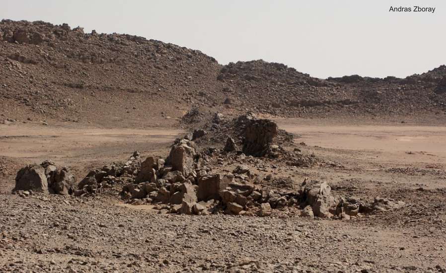
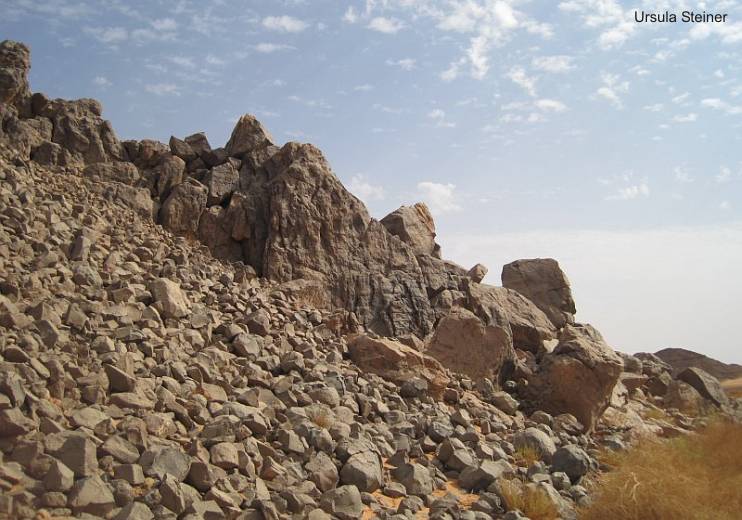
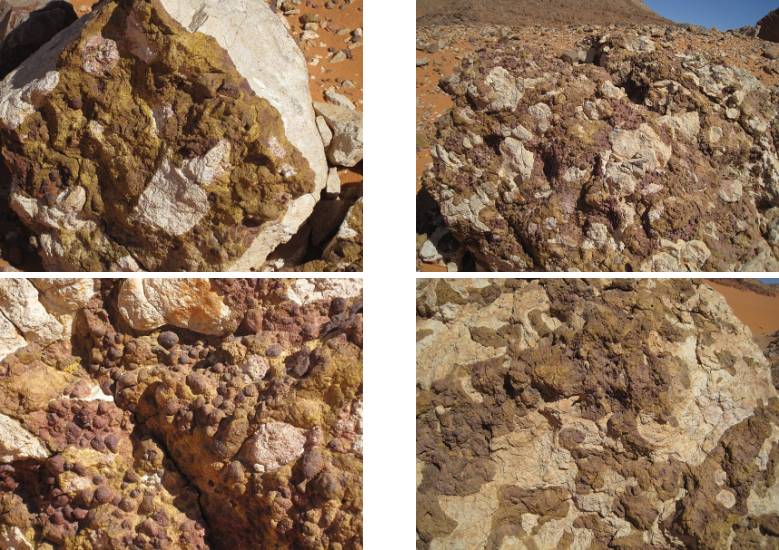
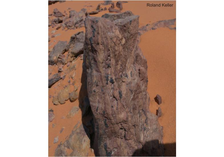
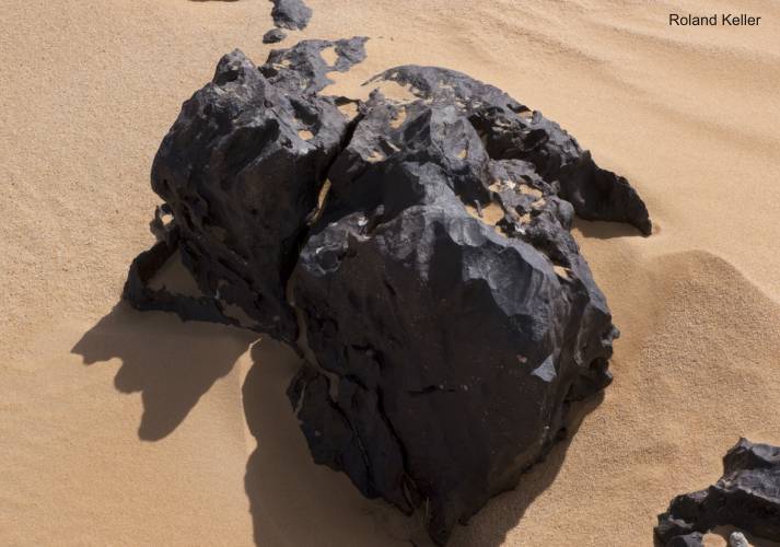
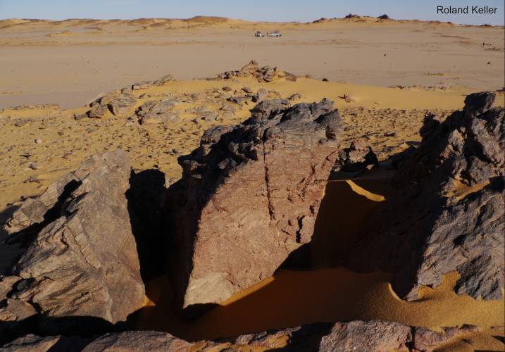
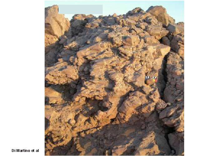
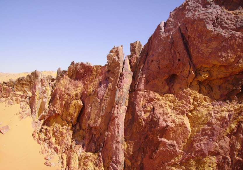
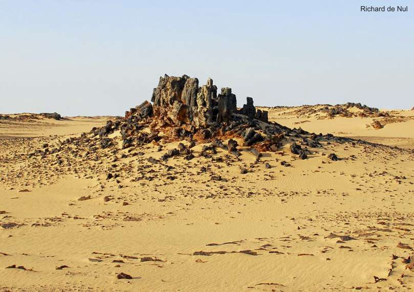
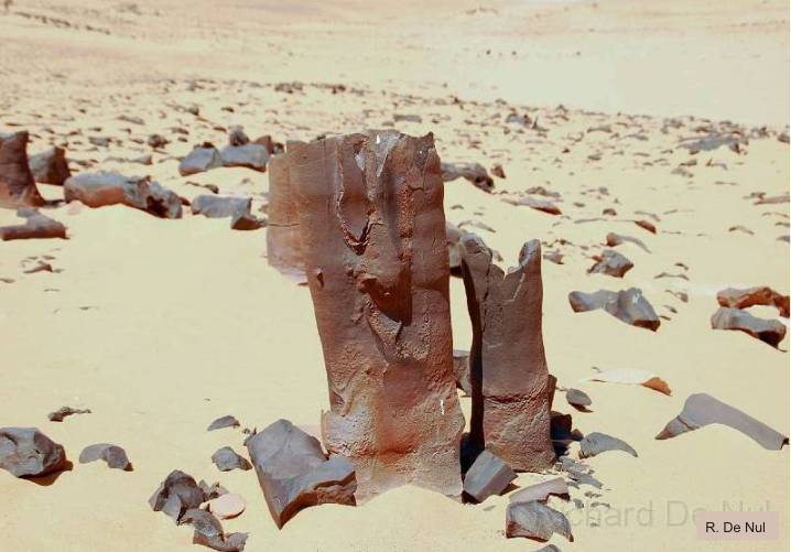
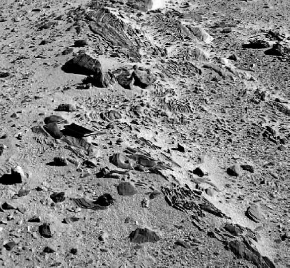
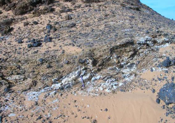
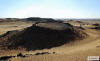
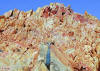
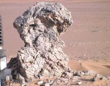
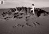
Visible
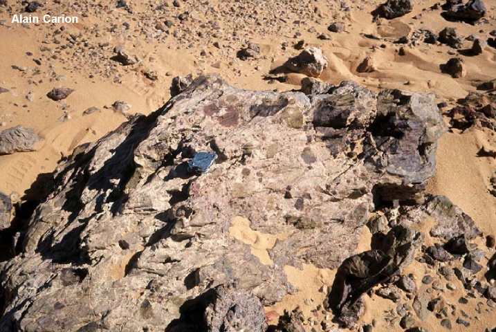
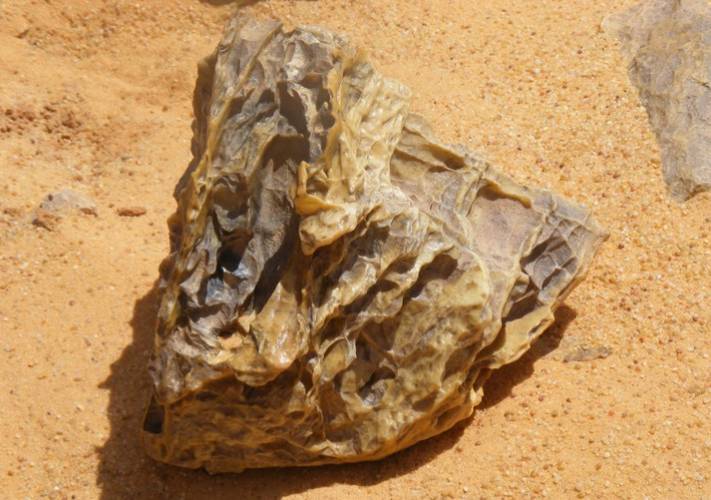
central plug of intrusive white Trachyte
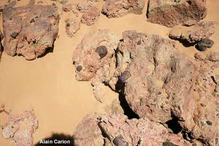
View of a crater with erected Paleozoic sandstones
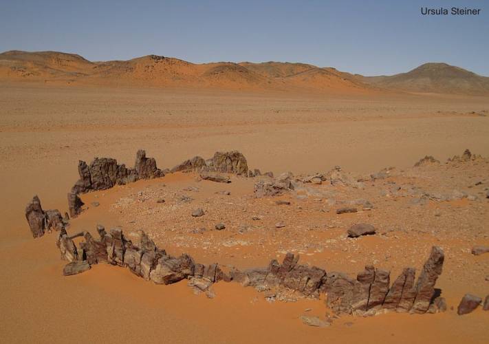
Many
craters are associated with dykes formed by two parallel uptilted rows of
sandstone, filled with white Trachyte in between. Some craters are imbued
by the dykes even within their rims, and the only intrusive material was found
in between the dyke walls.
There are also narrow dykes, which cross rim and bottom of the crater, where
they have the same kind of sandwitched structure with two upright walls of
sandstone, and intrusive material in between (Andras
Zboray).
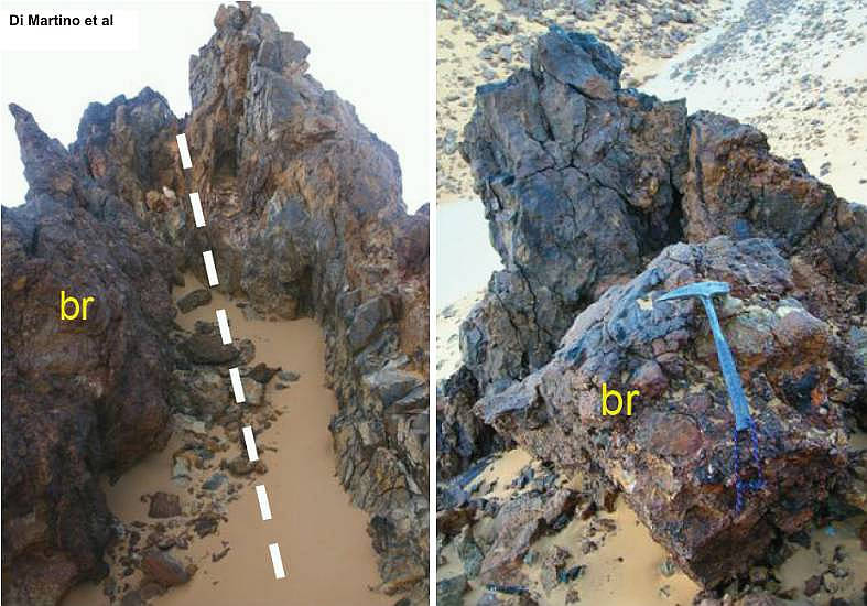
It is quite clear, that magma having welled here up along fissures. These
dykes are a little bit younger or at most contemporary with the main structure,
because they crossed the rims and the bottom of craters.
The magma-chamber in the underground was still activ. The magma in the plug
was not yet hardened. New magma has been transported up on fresh fissures.
The fissures can cross also craters and it plugs therein.
There are large and small dykes. The small dykes are only thin fissures. The
filling with basaltic magma in all kinds of dykes is visible or not (similar
like at the plugs). The erected walls at the dykes (large or small) within
the craters are really no rubble. That means, that the plug is hidden more
deeply. Over it lies a lifted stopper of original sandstone layers.

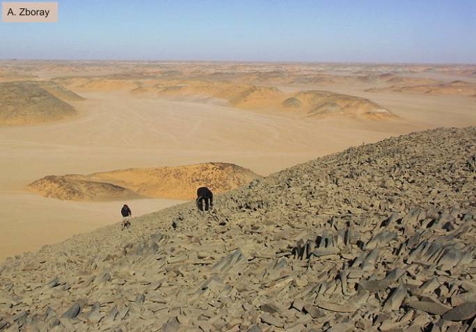
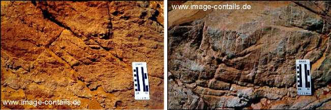
A. Zboray: "Here we noted that the crater
floor is crossed by vertical sandstone dykes, and the only trace of volcanic
material is located
in a dyke flanked by parallel sandstone walls, running along the south edge
of the crater."
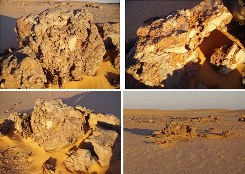
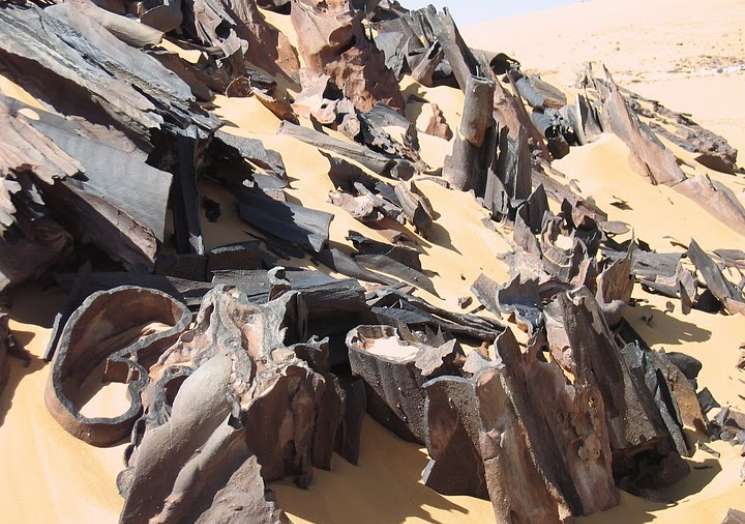
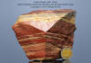
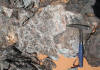
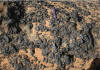
Structural samples for the origin of
the craters
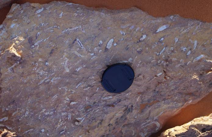
|
|
|
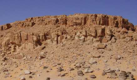
|
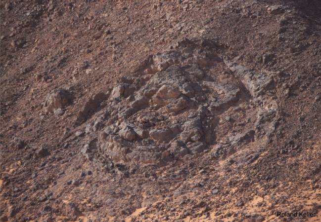
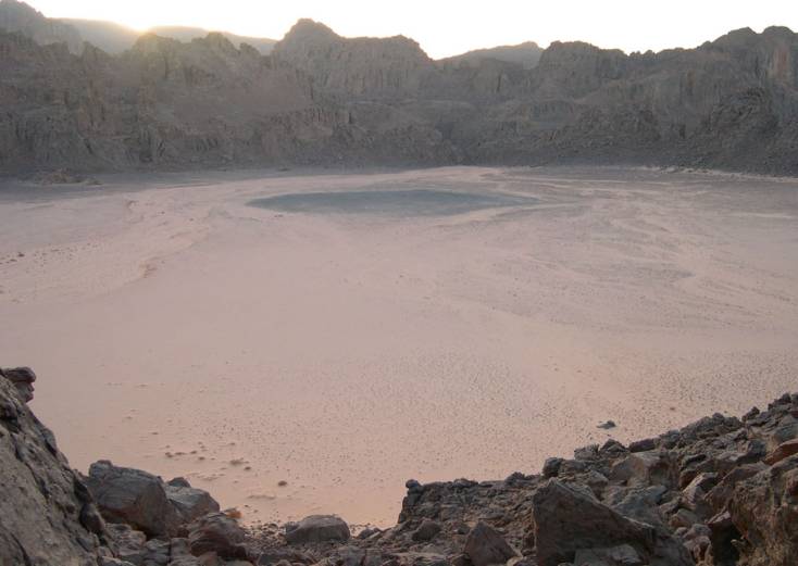
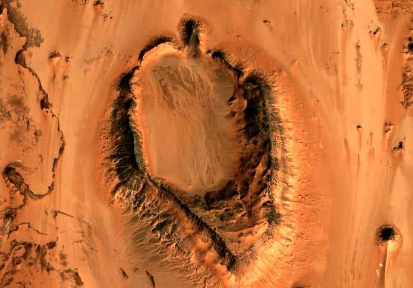
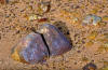
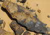
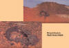
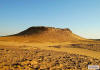
A large significant crater
with Carboniferous plant imprints and igneous trachyte inside
|
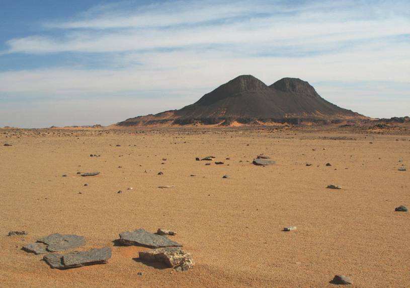
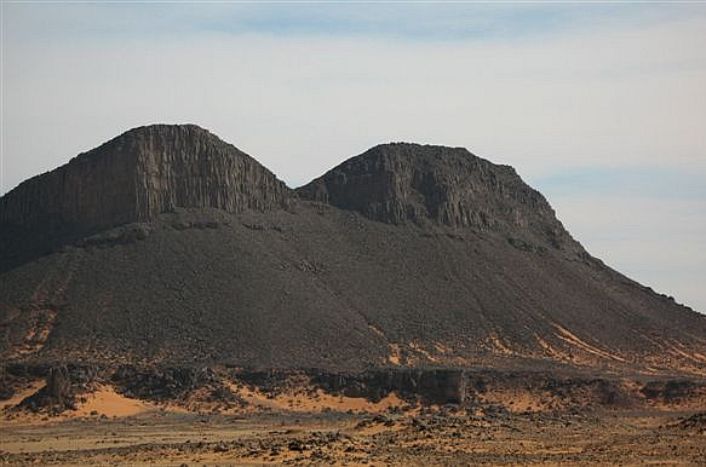
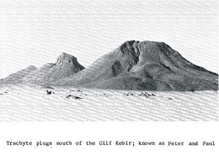
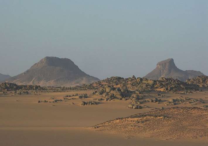
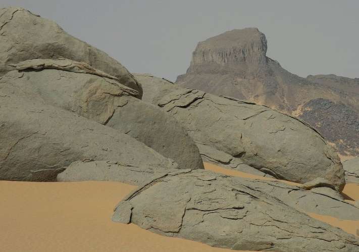
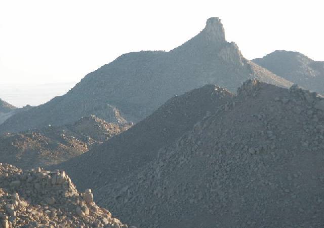
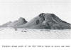
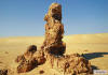
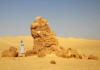
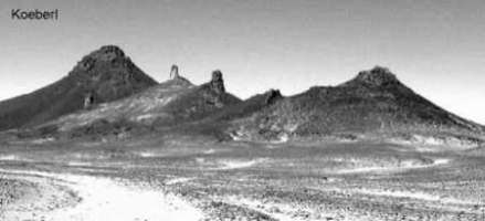
1.2
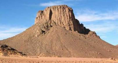
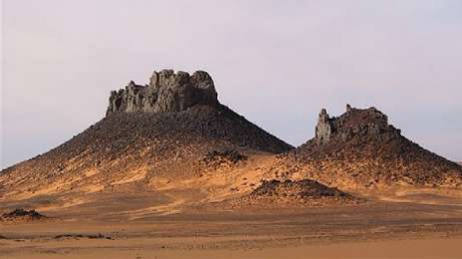
Mountains "Peter & Paul"
The area with the striking
mountains "Peter & Paul" is located between Clayton Craters and the granitic
"unknown" plateau in the north. The both mountains consist of trachyte intrusions.
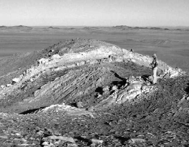
A further hill east of Peter and Paul typifies the locality. It stands approximately
25 m above the plain. The upper half is composed of trachyte with characteristic
jointing that gives it a columnar, steep-sided appearance. The lower half
is composed of a mixture of trachyte and basal conglomerate with a distinct
apron of debris.
|
|
|

|
|
|
|
|
|
|
|
"Peter & Paul" |
|
Granite in the foreground |
|
Trachyte plug |
|
|
1.3
The basaltic plugs on top and nearby the southern Gilf Kebir plateau
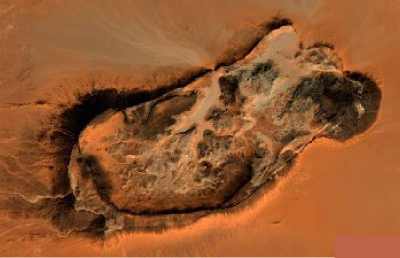
1.4 Structures in the Great Sand Sea
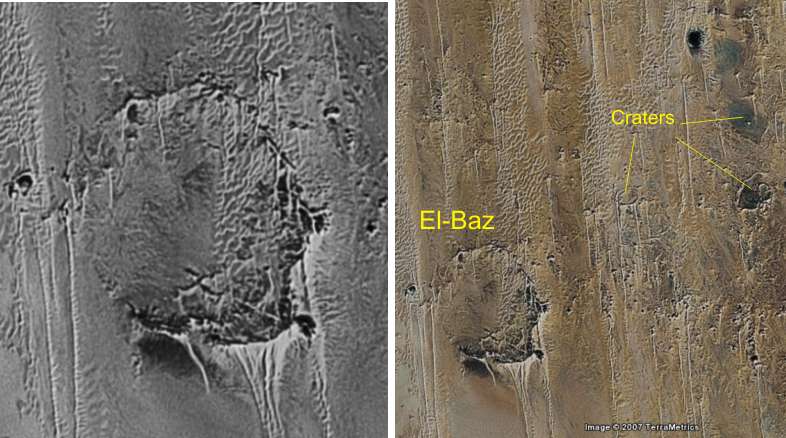
|
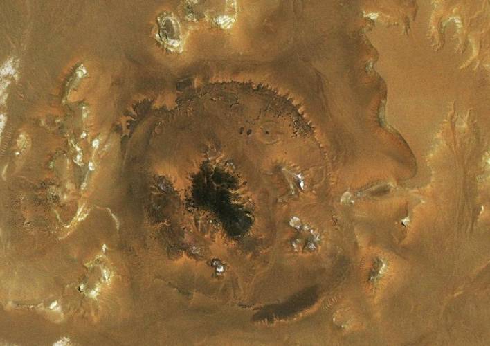
The large crater
" El-Baz"
24° 13' N / 26° 24' E
|
Crater-shaped structure"Qaret-el-Hanash"
southern of Silica field
|
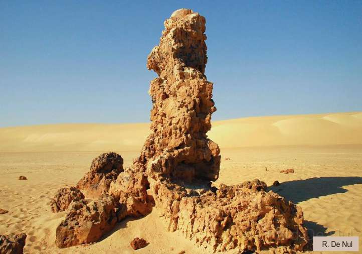
Pillar of brecciated rocks
in the northern Great Sand Sea
27° 07' 60" N / 26° 28' 60"E
|
|
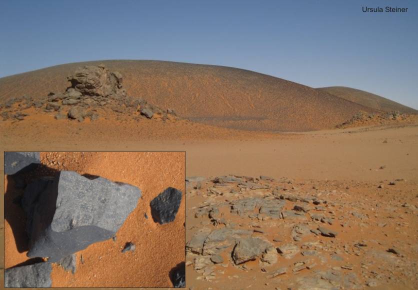
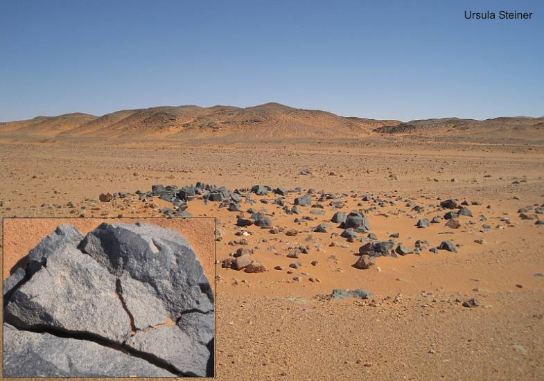
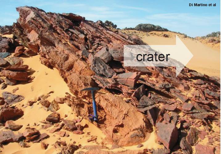
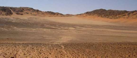
Not far from the Gilf Kebir plateau are to be found in the northeastern
direction further structures. There only rare pictures of a pillar with
brecciated rocks. It is named "Sakhret-al-Amud". The most
known is the crater El-Baz at the beginning of the Great Sand Sea.
It is reported, that in this structure are to be found basaltic dykes
and plugs. Sensational is the finding of large dark brown
diamonds
in the structure Qaret-el-Hanash. In the near past, finds were made
of carbon/micro-diamonds in breccias ("Hypatia" stone etc.)
|
|

|
 |
 |
 |
 |
 |
|
Crater "El-Baz" (3)
|
Sakhret-al-Amud
(3) |
Great Sand Sea |
|
|
|
|

|
|
 |
 |
|
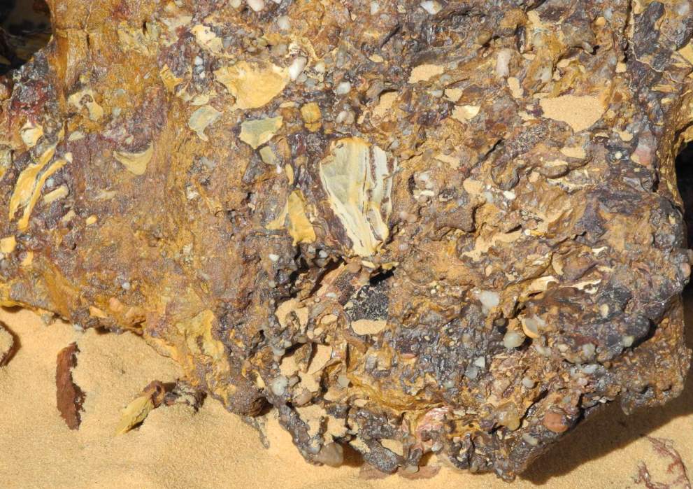
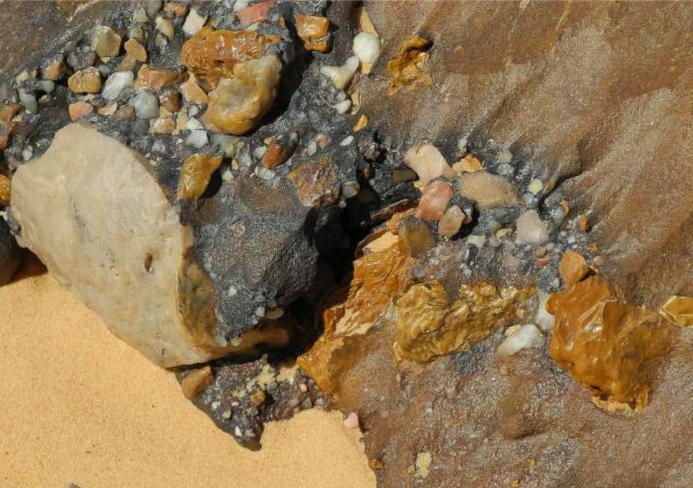
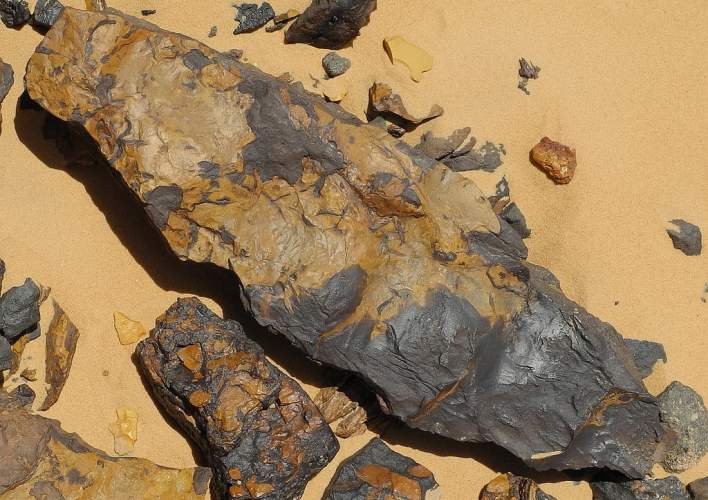
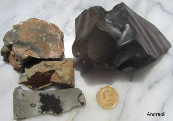
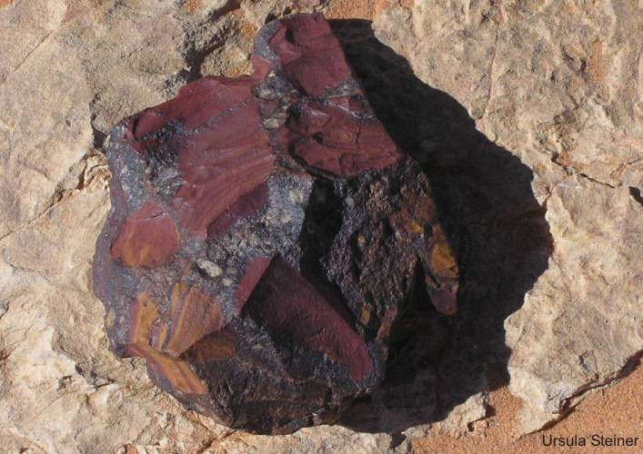
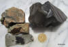
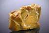
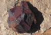
"Qaret
el Hanash" near Silica field: Breccias contain jasper and a black
melt with diamonds
|
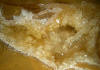
Carbon
+ diamond in sediment
|
Crater-shaped structures SE of Siwa
Oasis |
|
|
1.5
Structures at the western and northern foreland of Gilf Kebir
During the tour in 2010 the author found
in the western foreland of the Gilf Kebir, between Wadi Sura and Aqaba
passage, surprising many dykes, with erected layers therein.
On the satellite pictures is to see a network of such structures. This
means that the subvolcanism in a larger area was active as known before.
|
|
|
|
|
|
|
|
|
|
Many volcanic Fissures with erected
layers between Wadi Sura and Aqaba (6)
|
Hydrovolcano (Um Ras)
|
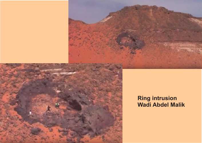
Ring intrusion
|
|
|
|

|
|
|
|
|
|
|
|
|
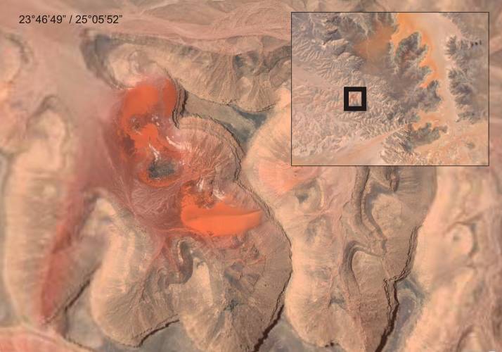
Pushed zone of white erratic blocks.
Loc 24°32'25"N / 25°05'30"E |
|
|
|
1.6 The crater
"White Spot" on top of the Jebel Uweinat and further structures
The crater "White Spot" on top of Jebel Uweinat (Hassanein plateau) is
clearly a basaltic plug. At the bottom of the crater is basaltic material
available. The rims of the crater are composed of Paleozoic sandstones.
They are not erected in contrast to the Clayton Craters. Probably the
sandstones were broken by the up-directed pressure in concentric steps.
The originally horizontal stratification was therefore not changed in
principle. Directly inside of the crater are to be found few up squeezed
sandstones too. The crater is found on the top of Hassanein plateau. The
whole plateau has been uplifted by an intrusive event.
|
Crater "White Spot" (21°55'
01'' N / 25°02'48'' E)
|
|
|
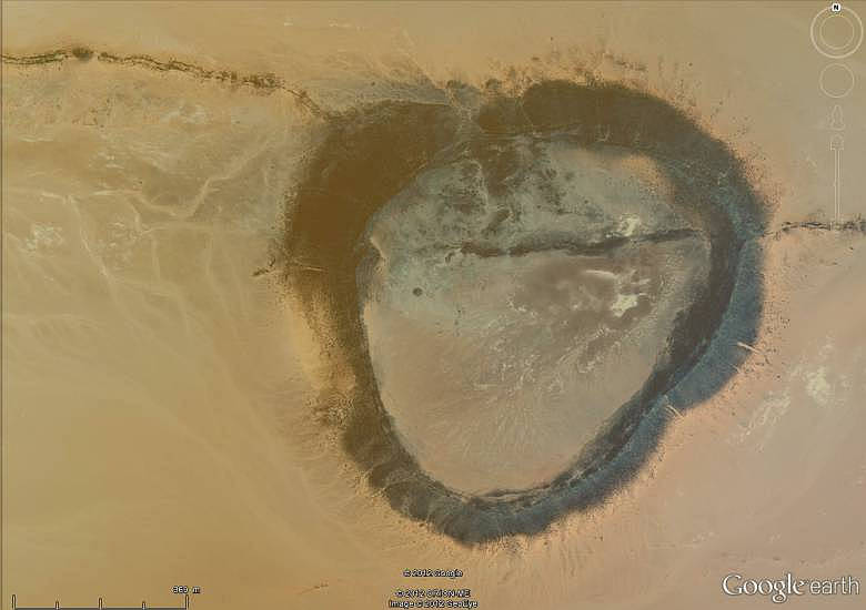
2.0 The craters in the
"Scarp-Contours" -- outside of the uplifted region (Craters GKCF)
(the so named "Impact
Craters Field" by Philippe Paillou, Observatoire Aquitain des Sciences
de l'Univers in Floirac, France)
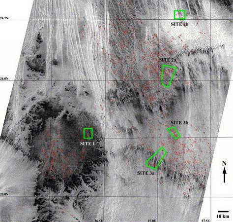
In the year 2004 explored Philippe Paillou
and a team by two fieldworks (February and December) several of circular structures
in the east of the Gilf Kebir plateau. In an area between 26°30' -
27°30' E and 23° 00' - 24°40' N (~21.000 km2) were detected many hundred crater-shaped
structures in satellite-images. The fieldwork should confirm that is a large
impact crater field. The impact origin was derived by the observation of shock-related
structures, such as Shatter Cones (SC) and planar fractures (PF's) in quartz
grains of breccias. In the first time 13 craters were studied. Shatter Cones
were found on the border of three craters (GKCF-01, GKCF-02 and GKCF-12).
|
Some
controversial observations
Andras Zboray,
Hungary, told me, that the crater (meant is GKCF-13) superficially
looks almost the same as the Clayton Craters, with a major difference.
The crater walls are very clear of horizontally bedded sandstone, whereas
at Clayton Craters the walls are all rotated 90 degrees. The layers seem
to dip slightly inwards (?). There became found a layer of fused sandstone
breccia, with purple sandstone fragments embedded into a white sandstone
matrix. However the purple fragments appear rounded and weathered (a brown
cortex visible where rock fractured around the embedded fragments), not
sharp angular.
Philippe
Paillou has also described: "Abundant polymict breccias were observed
along the rim of all craters, forming pluri-decimetric to metric beds,
sometimes interbedded with sandstones. They consist of centimeter- to
decimeter-sized irregular fragments, embedded in a fine-grained quartz
matrix. Beds are systematically dipping inwards (?) the crater, with a
steep dip dose to vertical on the highest rims down to about 30° on the
lowest observable rims."
Are these observations possible?
I have the crater GKCF-13 and others seen also. In the craters the
beds dipping not inwards, in contrary the beds climb upwards,
were tipped over on the rim and broken outside. Consider the pictures
below. My opinion for the origin of the crater GKCF-13 is presented in
the sample below.
The Shatter Cones are not valid.
These structures are
Pseudo Shatter Cones
(PSC). The
enormous Pseudo Shatter Cone structures were modelled by wind erosion.
This forms were found also outside of the crater field in the Gilf Kebir
region. There are however
meanwhile further important knowledges, that the circular structures in
the large field, are of subvolcanic origin. Some structures contain basalts.
Also dykes are frequent. Breccias on the crater rims contain marks of
subvolcanic activities.
The supposed "largest impact crater
field on Earth in the Gilf Kebir region" is a legend therefore !
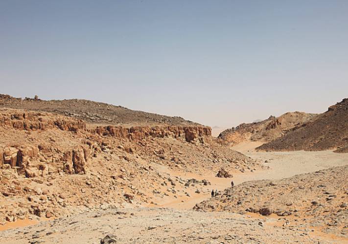
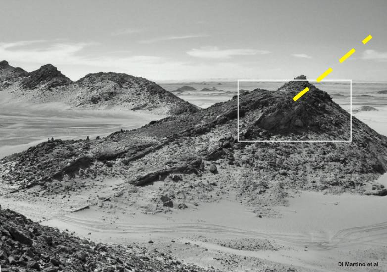
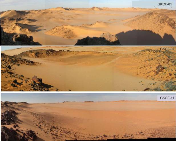
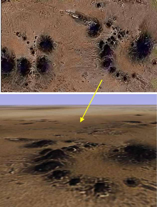
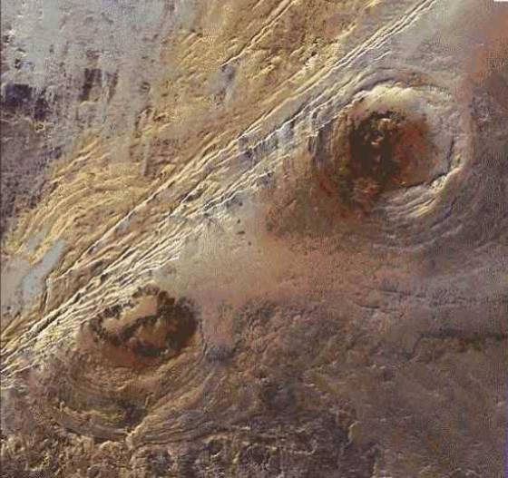
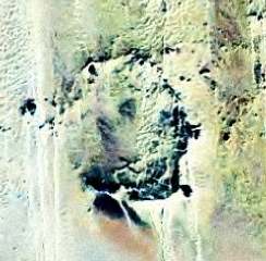
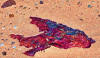
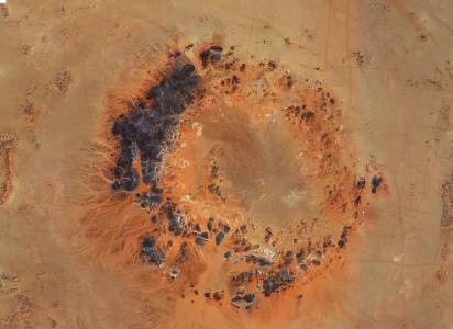
Gilf Kebir Crater Fields
(GKCF)
The red points are craters which were identified by the satellite SPOT.
Source: Paillou/CNES
|
|
|
|

|
|
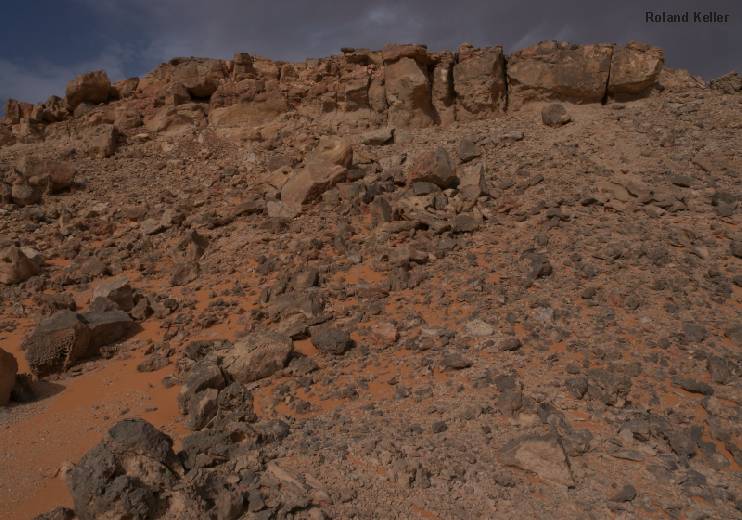
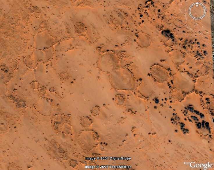
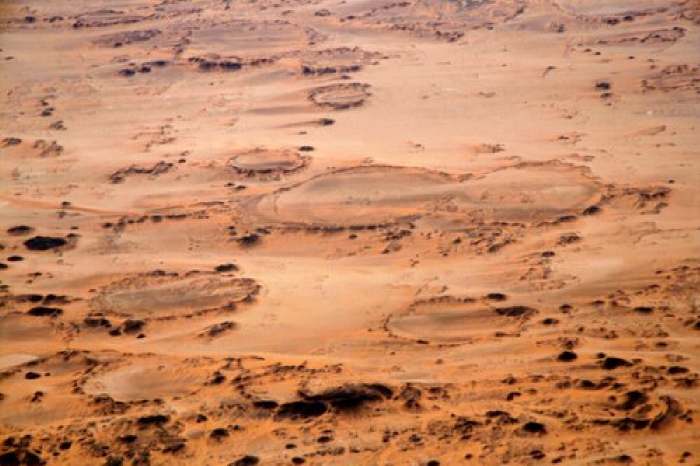
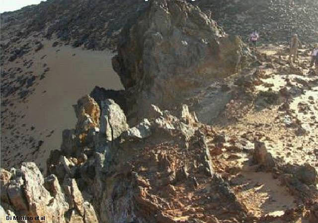
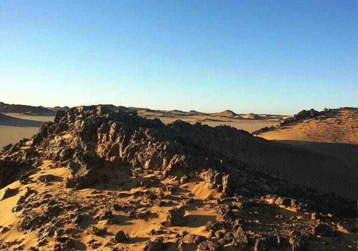
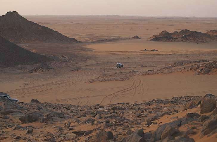
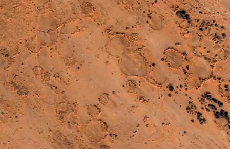
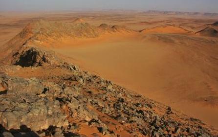
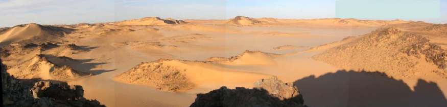
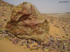
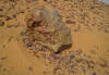
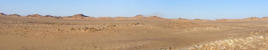
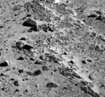
Typical landscape of the crater
field
|
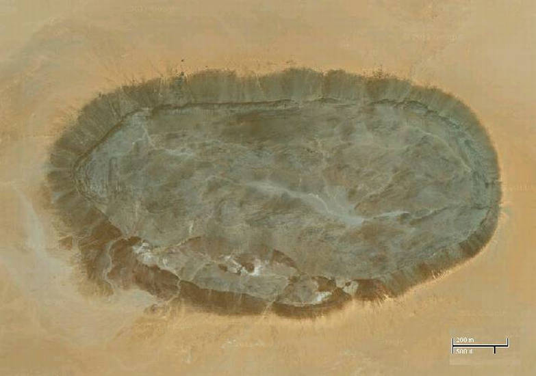
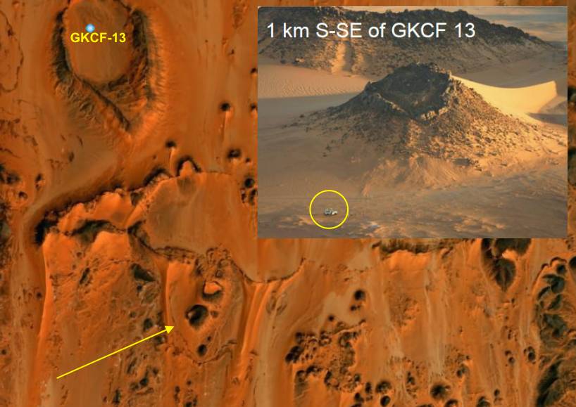
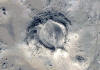
Images from the prominent Crater GKCF-13
|

|
|
|
View into GKCF-13 from
the northern position
|
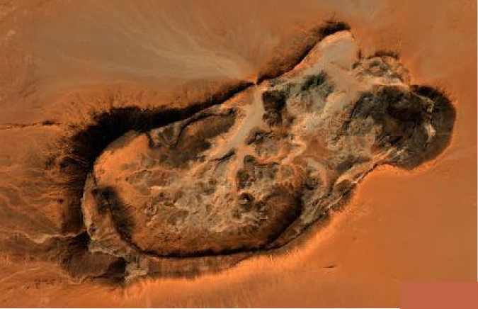
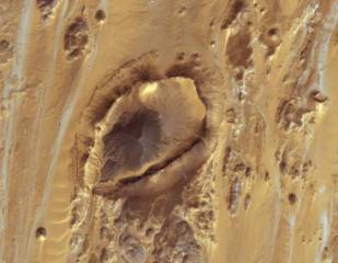
View into the crater
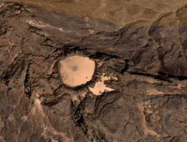
GKCF-13 with a diameter of 950m. Position: 23°18'23'' N / 26°55'28'' E
|
|
|
|
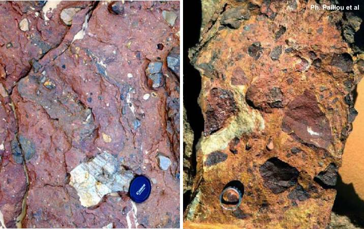
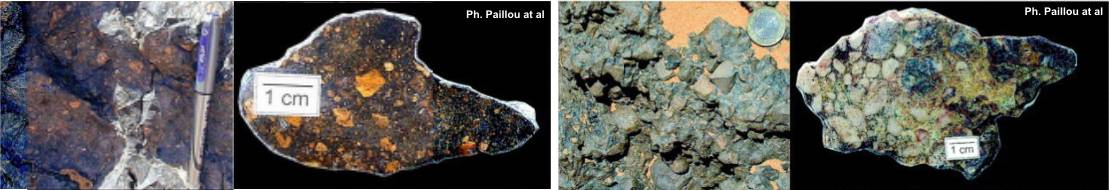
Some as"impact proofs" presentd images of Philippe Paillou and team
(www.impactika.com/PaillouCRAS04.pdf
)
|
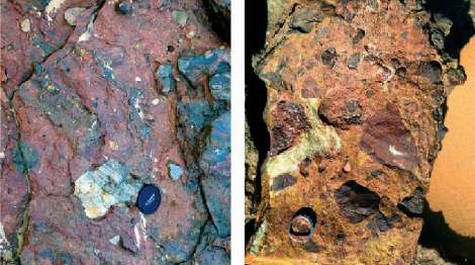
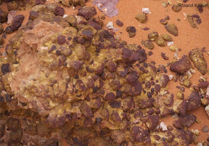
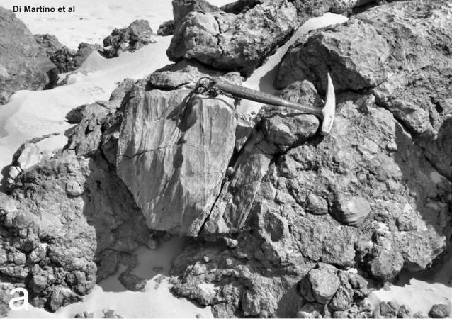
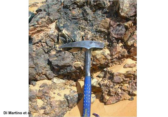
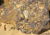
Breccia with included basement
material (GKCF-01and GKCF-05)
|
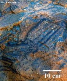
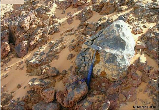
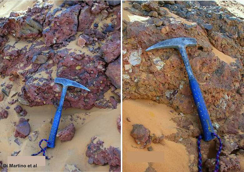
Broken sandstone with marks
of
hydrovolcanic solutions (GKCF-04)
|
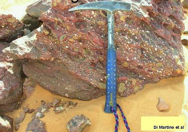
Different brecciated material (GKCF-61)
|
|
Breccias
|
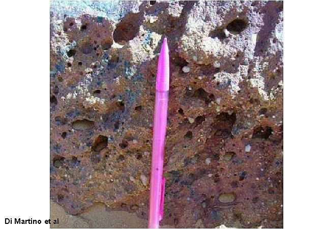
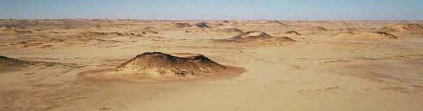
Basalts hills and fused sediments of GKCF
|
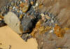
A remarkable Basalt plug inside
of a crater (23.17°N /25.35°E)
|
|
Conclusion
The supposed "largest
impact crater field on Earth in the Gilf Kebir region" is a legend. The craters
of the "Scarp-Contours" (and crater El-Baz) can be distinguished by a geological
particularity from the Clayton Craters. The rims the of Clayton Craters contain
only Paleozoic sandstones (Nubian sandstones were not deposited in the area
of the uplift). The rims of the craters in the "Scarp-Contours" (GKCF-13 and
others) contain Nubian sandstones with embedded breccia of Paleozoic debris
or breccia with pure Basement material. The erected Nubian sandstones and
the breccia were tipped over on the crater rim and broken outside. The breccia
was changed by heat and pressure. Is it possible, that planar fractures in
quartz grains emerge by effect of this intrusive magmatism ? I think it is
possible.
Planar fractures (PF's) in quartz grains are an indicator for
low shock pressure ( e.g. 3-5 GPa). Clear proofs for impact structures does
not give it up to now here. PF's in quartz grains are no clear proofs. Possible
proofs would be the occurrence of Coesite and Stishovite. Both are high pressure
modifications of quartz with high density. In the supposed "impact" craters
in the Gilf Kebir region was found none. The evidence of solutions in breccias
prove subvolcanic processes. The enormous
Pseudo Shatter Cone
structures were modelled by wind erosion.
These important counterevidences are considered too slight up to now.
It is also remarkable, that in the crater field were found basalts and many
dykes. Some structures are cut by dykes. New investigations of the geological
aspects were made now by Di Martino and team (2005).
What's new since 2004:
Sounding cratonic fill in small buried
craters using Ground Penetrating Radar
(Supplemented by my opinion on this results)
E. Heggy & P. Paillou -- Lunar and Planetary
Science XXXVII (2006); 1264.pdf
No "largest impact crater field on Earth in the
Gilf Kebir region" ?
Source: www.lpi.usra.edu/meetings/lpsc2006/pdf/1286.pdf
"We (Philippe Paillou and team)
visited 62 structures during two expeditions in February and December 2004.
Their diameters range from 10 to 2120 m. Except for a couple of small structures
covered by the Quaternary sand sheet, most of them present well-defined rims,
with heights ranging from a couple of meters to more than 80 m. Most structures
are more or less filled with Quaternary aeolian deposits, their centre being
in general higher than the surroundings. Rims are made of tilted sandstone
layers of the Sabaya Formation (Albian age, around 110 Ma) covered by breccia,
some-times also covered by paleo-soils. Some structures are cross-cut by
basalt dykes, indicating that volcanism took place after their formation.
Since basalts in the region are of Lutetian age (46 Ma), we can conclude that
the structures certainly formed before this time. Shatter-cone-like features
were found along the rim of several crater structures. However, wind erosion
of exposed rocks can produce such features, and we could not clearly observe
the typical striation patterns of shatter cones. Abundant occurrences of breccias
were observed along the rim of numerous structures, forming pluri-decimetric
to metric beds, sometimes interbedded with breccia formations can be produced
by classical geological processes such as tectonics and rock falls, but they
do also occur in and around impact structures. Optical microscopic analysis
of thin sections of breccia and sandstone samples collected on the rims of
several structures have shown that quartz is the predominant mineral component
of all samples; minor components include phyllosilicates, iron oxides, and
some accessory minerals such as zircon. Many quartz grain in these samples
contain planar and sub-planar micro-deformations, strongly reminiscent of
planar fractures (PFs), known from weakly shocked quartz of many impact structures,
but also from tectonic settings. GPR soundings were performed on 10 of the
visited structures and on some areas between these structures. The collected
data showed the occurrence of faulting, fractures and chaotic buried terrains
in the quasi totality of the radar transects. All GPR profiles reveal the
same subsurface morphology: a perturbed paraboloid structure buried under
sediments. In terms of lack of stratigraphy and scattering phenomena, they
are quite different from typical profiles observed for volcanic craters for
instance."
"The typical size (about 150 m) and number (more than 1300) of the structures
in the Gilf Kebir region are compatible with the hydrothermal vent hypothesis
and the brecciated sediments found around most of the structures that were
visited could have been produced by fluidized sediments reaching the surface.
However, southwestern Egypt is not known as part of a large igneous province,
it is thus required to discover a major (and still unknown) hydrothermal event
there that could have produced such vent complexes. GPR sounding performed
on several structures revealed a flat floor covered by sedimentary deposits:
hydrothermal vents should show tracks of a vertical structure, the conduit
zone connecting to the tip of a sill intrusion. Also, we could not find evidence
of sediment dykes and pipes in the 62 structures we visited, even though they
should be abundant in the case of hydrothermal vents."
Non-impact origin of the crater field
in the Gilf Kebir region (SW Egypt)
M. Di Martino et al.
-- www.rssd.esa.int/SYS/docs/ll_transfers/296053_Di2DMartino_pres.pdf
sci.esa.int/science-e/www/object/doc.cfm?fobjectid=40214
"November
2005 expedition
we carried out fieldwork on 7 of 13 craters identified as impact craters,
namely GKCF-01, GKCF-06, GKCF-07, GKCF-08, GKCF-11, GKCF-12, GKCF-13, and
we collected rock samples from GKCF-01, GKCF-07, GKCF-11, GKCF-13, on which
petrographic studies has been in part performed. Also some other similar circular
structures in the surroundings have been examined.
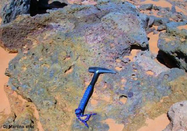
Macroscopic and petrographic observations
The outcropping lithologies in the investigated area mainly consists of quartz-arenites
and minor micro-conglomerates. There is also the presence of two kinds of
breccias, one of which is an intraformational (sedimentary) the other one
possibly of hydrothermal origin.
Quartz-arenites, micro-conglomerates. Medium- to coarse-grained, rarely fine-grained,
sandstones with sub-rounded/sub-angular elements mainly composed of quartz
and minor sedimentary lithic grains (fine-grained quartz-arenites). Matrix,
when not altered, is composed of very fine quartz grains and phyllosilicates;
more commonly it’s partially or totally replaced by iron oxides/hydroxides
cement and minor ferriferous carbonates. Accessory minerals: zircon, tourmaline,
muscovite. Quartz grains often show micro-fracturing. Polycrystalline quartz
is present. In some places the arenites grades to micro-conglomerates with
rounded/sub-rounded quartz grains and sedimentary lithic clasts (fine-grained
quartz-arenites) mm- to cm-sized.
They outcrop in the inner parts of the circular structures but also in the
surroundings external parts. Intraformational breccias are constituted by
quartz-arenitic clasts, angular/sub-angular in shape, cm- to dm-sized, rarely
up to 20-40 cm. Their stratigraphic position is not always clear, but they
seems intercalated with quartz-arenites. Breccias of possible hydrothermal
origin are constituted by sub-angular/sub-rounded quartz grains, mm- to cm-sized
and by rock fragments (fine- to coarse-grained quartz-arenites and minor siltites),
cm- to dm-sized and varying in shape from angular/sub-angular to sub-rounded.
In this second kind of breccia rare boulders constituted by sedimentary breccia
are included. When not altered, matrix is composed of fine-grained quartz
grains and phyllosilicates; often it’s totally replaced by iron oxides/hydroxides
cement and minor ferriferous carbonates. Accessory minerals: zircon, tourmaline
(<1%). Quartz grains often show micro-fracturing. Polycrystalline quartz is
rarely present.
Morphology and Structural Setting
In some cases the rim of these roughly circular features is made by tilted
layers of sandstones. In some other cases there is the presence of arc-shaped
(and concentric) nearly vertical fracture planes, which characterize not only
the supposed “impact craters”, but are also present around their periphery
and in isolated structures in the surroundings.
These fracture planes are often associated with Fe-oxide/hydroxide mineralizations
(situation observable not only at the “crater-scale” but also at smaller scale)
and with breccia bodies of probable hydrothermal origin.
Pseudo-shatter cones
The surfaces of the outcropping rocks in the craters area are characterized
by striations that, in some cases, resemble very much to shatter cones. From
the data collected in the field it’s possible to say that:
- the striations observed are superficial and not pervasive;
- these features are characterized by directions always varying from N 20°
to N 340°, rather consistent with the main winds direction (from N and N-E
at present, from NW in the early Holocene, and no more present);
- the same striations are visible also on the breccia surfaces and on the
surfaces of rocks out of the craters area;
- they are not fracture surfaces but occur on outcrops surfaces.
From these observations we conclude that this “pseudo-shatter cones features”
are likely due to wind abrasion. GKCF-01, GKCF-13, El-Baz volcanic crater.
Conclusion
It has been suggested that the
Gilf Kebir crater field could be the result of a meteorite impacts (Paillou
et al., 2004; Paillou et al., 2006). The present study has been carried out
in order to confirm or not the impact origin of these structures. From the
fieldwork and from the preliminary analyses, the following results can be
summarized.
“Target rocks”:
Don’t show any macroscopic or microscopic shock effects, in particular no
PDF’s, no evidence of melting, no glass.
Breccias:
Don’t show any macroscopic or microscopic shock effects. They are of intraformational
and possibly hydrothermal origins.
Pseudo-shatter cones: The striations which characterize some rocks
near the “craters”and identified as shatter cones are due, very likely, to
the wind erosion.
Morphology:
The same morphology, characteristic of the supposed “impact craters”, is identifiable
(both in the field and in satellite images) in many others structures in their
surroundings
with sizes ranging from some tens of meters to kilometers (and some of these
are associated with basalts).
These evidences indicates that all these features have a common non impact
origin.
On the basis of this preliminary investigation, we can say that there are
no clear and unequivocal evidence for an impact origin of the circular structures
in Gilf Kebir region:
the origin of the craters is very probably associated to endogenic geological
processes. The hydrothermal venting could account for the origin of such an
extended field of circular structures. In this case the brecciation could
be fluid-induced, probably for the fluctuations in pore fluids pressure. These
hydrothermal fluids could also have been enriched with iron oxide during their
way to the surface, crossing oxidized sediments or paleo-soils. The pre-existing
sets of fractures planes could have driven partly the fluids circulation.
The presence of such an extended field of circular structures, linked to a
widespread volcanic activity in the surroundings, leads to take in consideration
a hydrothermal origin for these structures."
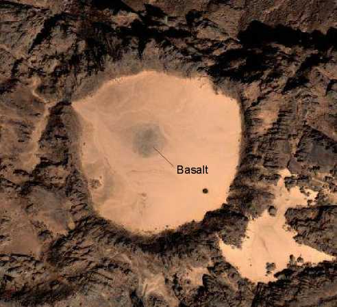
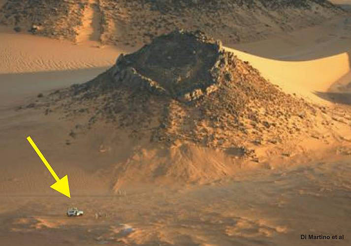
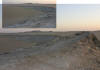
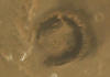
View into the crater GKCF-01 of diameter 630m.
Position: 23°14' 37'' N / 27° 27' 37'' E
Further proofs for the hydrovolcanic origin of the GKCF
structures
New images from structures of the GKCF
 |
 |
 |
 |
 |
 |
 |
 |
|
Small Crater nearby GKCF-13
(Author 2010 |
Hydrovolcanic Structure |
Tilted Layers (Author
2010) |
 |
 |
 |
 |
 |
 |
 |
 |
|
Small Crater (Author 2010) |
Hill with uplifted
red layers (2) |
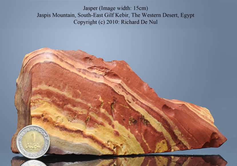
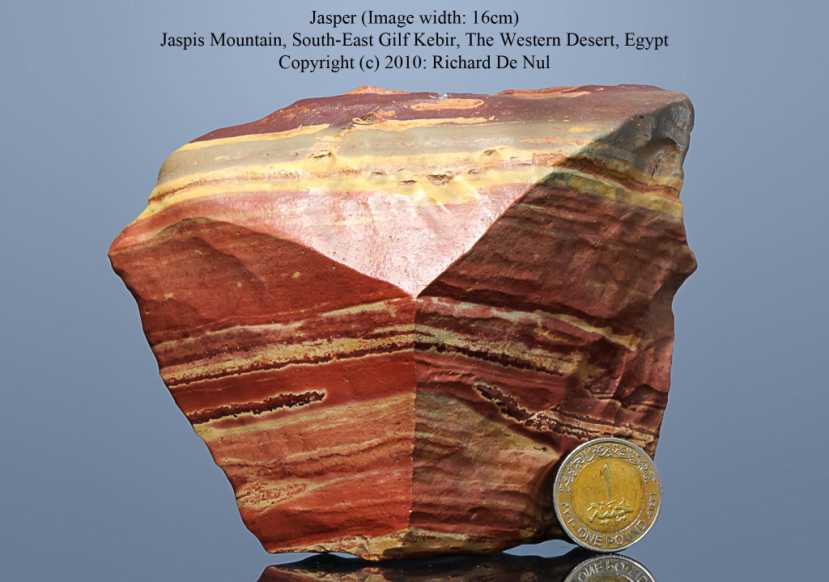
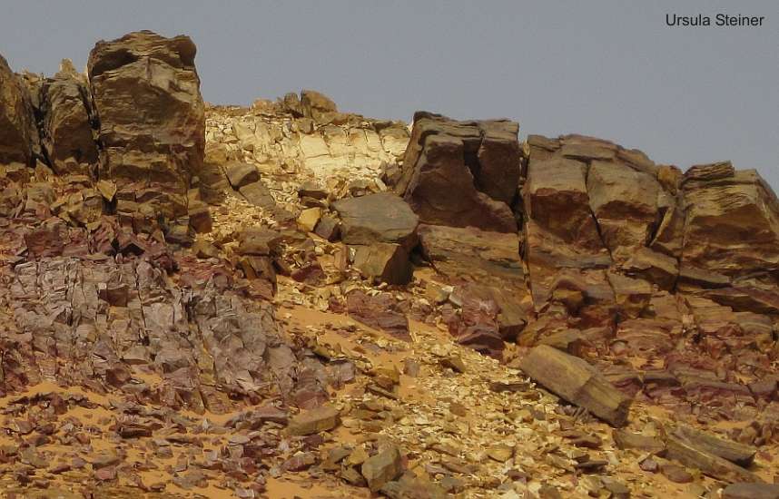
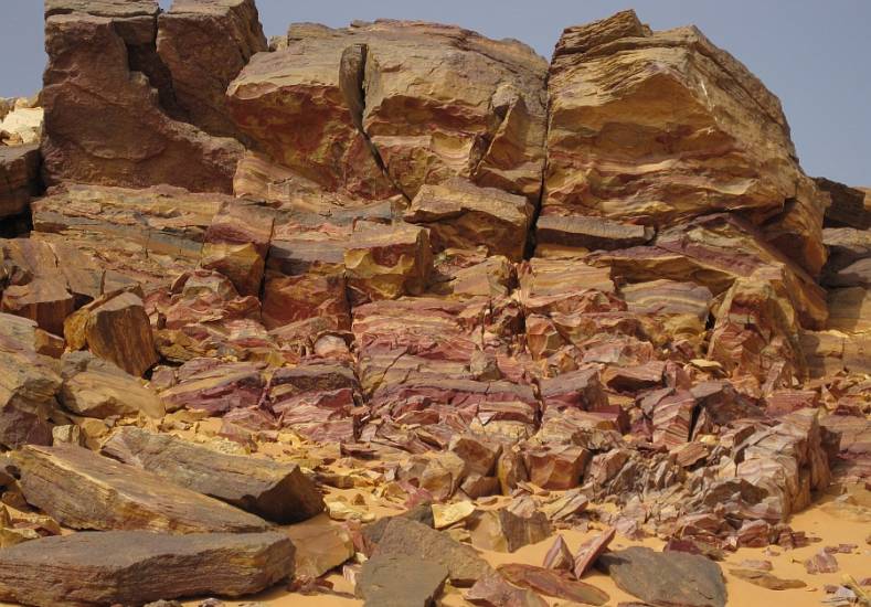
Crater Field nearby Jasper
Mountain (6) |
Hydrovolcanic pipes nearby Abu Ballas and "Regenfeld"
Jasper Mountain nearby Abu Ballas
|
|
|
|
|

|
|
|
|
|
Jasper Crater
|
Jasper Mountain
|
Blood
Jasper
|
Jasper
|
Quartz, Chalcedony
|
|

|

|
|
|

|

|
|
|
Photos by Ursula
Steiner, Switzerland
|
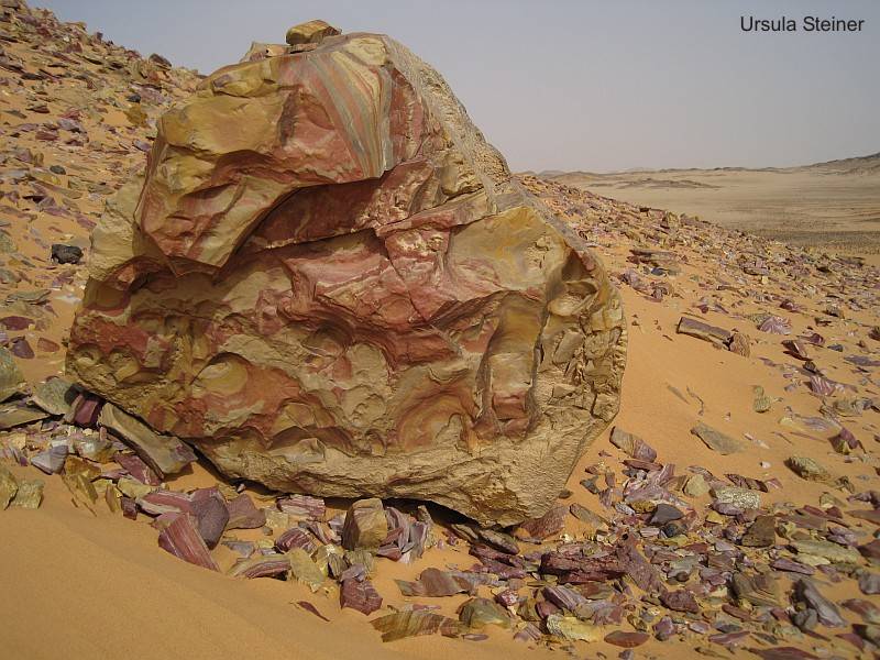
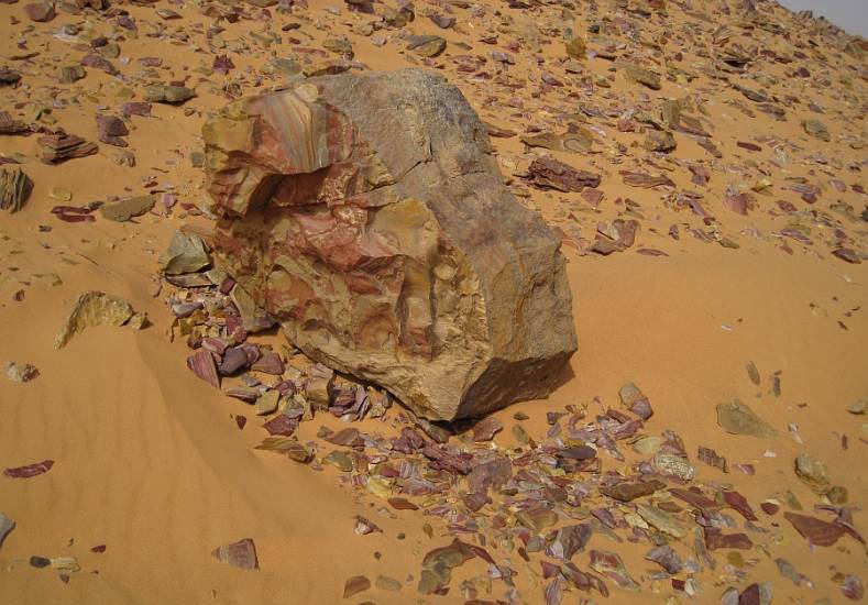
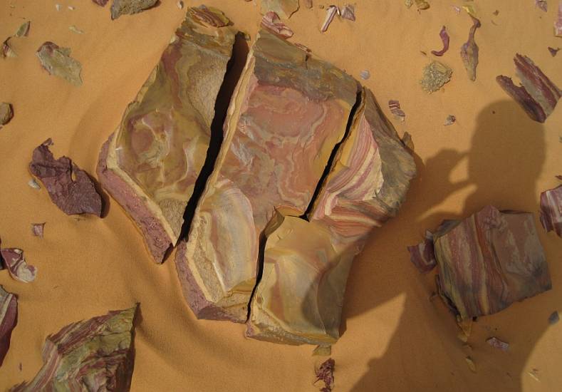
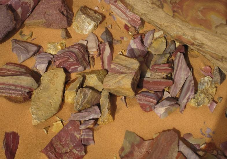
Jasper breccia
(Gilf Kebir; Wadi Hamra)
|
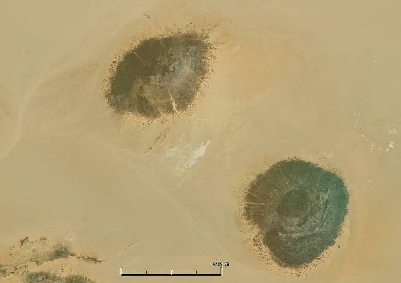
3.0
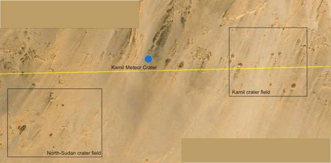
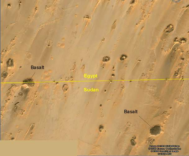
Further crater-fields at the Egyptian-Sudanese border
(Jebel Kamil and surrounding)
In 2009, the author
have discoverd further crater - fields by Google-Earth, which are located
in east of Jebel Uweinat (Jebel Kamil) and southwest of this in northern Sudan.
Most of the structures are similarly of them in the large crater - field "GKCF"
in the east of Gilf Kebir ("Scarp-Contours").
Amid the crater-shaped structures are to be recognized basaltic cones. The
crater-field in the Jebel Kamil has the coordinates between 21° 58' to 22°
03' N and 26° 13' to 26° 20' E. The crater-field in the northern Sudan has
the coordinates 21°50' to 21°58' N and 25°51' to 26° 00' E.
Some
other such structures have recently been found further south in the vicinity
of the so-called Lakia structure (Krisztian Klajnik). 20.60 ° N / 26.55 °
E
4.0 The supposed "impact" craters in
Libya
4.1
Crater B.P.
The B.P. structure, located at 25°19' N/24°20'E,
was first referred by Martin (1969). It is a complex structure with a small
central area of strongly deformed, upturned strata, and a prominent ring of
up to 50 m high hills at 1 km from the center of the structure. The morphology
of this crater structure suggests that it is eroded, with the hills representing
the remaining roots of the crater rim not showing overturning, and only a
small fragment of the original central uplift having remained. The rocks in
the B.P. area are more or less ferruginous sandstones, with intercalated siltstones
and local conglomerate exposures.
Koeberl et al. (2005) reported a remote sensing study and first outcomes of
their fieldwork of 2001. Their field work indicated that the actual diameter
of the BP structure is just about 2 km. The crater rim (their ‘‘middle ring’’)
was characterized by a distinct series of hills of up to 30 m elevation above
the surrounding desert, with sandstone dipping outward. They observed that
some parts of the rim were strongly folded and faulted. The innermost elevation
is a complex terrain of strongly folded sandstone hills, quite a few of which
show steeply upturned bedding. No datable phases (such as melt breccia or
authigenic minerals) have been discovered.
According to French et al. (1974), medium- to coarse-grained orthoquarzite
was sampled with quartz grains that displayed multiple sets of ‘‘planar elements’’.
In particular, PDFs and planar fluid inclusion trails were summarily termed
planar elements.
French el al. (1974) and Underwood and Fisk (1980) described BP as consisting
of two discontinuous rings that surrounded a central block; the outer ring
of hills is 2.8 km in diameter with about 20 m of maximum relief, with sandstone
beds dipping inward (?) at 3°-15°. The inner ring of hills is more deformed,
has a diameter of about 2 km, and an average relief of 30 m. Most of these
beds dip outward at 20°-40°. These two rings form an asymmetric (wider on
the eastern side) ring syncline. According to Underwood and Fisk (1980), the
inner ring also shows numerous gently plunging folds with axes tangent to
the structure and dipping outwards by as much as 70°. The central block is
0.6 km in diameter and has about 38 m of relief. Beds arc intensely jointed,
and the eroded southern half of the block exposes the oldest rock in the area,
a light-coloured (purplish to whitish) sandstone that has been complexly folded.
Within the structure itself, Underwood and Fisk (1980) reported only Nubian
Sandstone. These authors noted that the structure consisted of three near-circular
concentric rock outcrops. The innermost ring had high-angle and chaotic dips
forming a mass of craggy outcrop. The middle ring consisted of uniformly outward-dipping
(30°-50°) strata. The third ring dipped inward (?) at 5°-15° and formed a
low scarp, for most of its extent barely protruding above the surface. Underwood
and Fisk (1980) interpreted these outer two rings to define a ring syncline.
|
4.2 Crater Oasis
The Oasis structure
is centred at 24° 35' N and 24° 24' E.
The structure was
reported by Underwood and Fisk (1980) to have a "disturbed zone" of 11.5
km diameter, but the discontinuous hills that compose the topographically
prominent part of the structure form a circular array of 5.1 km diameter.
Most of the rocks in this prominent ring dip outward, and locally they
are intensely folded, Hills reach a maximum height of about 100 m. Outside
of this ring, the disturbed rocks have only a meter of relief.
There
is no observed central uplift-structure.
The
strata within this ring are intensely crushed, and in some places strata
are overturned or vertical.
Although there have
not been any megabreccias found at Oasis, a team of scientists in the
1970s identified a glass-bearing microbreccia in the rocks. This microbreccia
consists of shock quartz grains and pieces of sandstone, intermixed with
partially devitrified glass, all within a recrystallized matrix.
Shock metamorphism is abundant in the sandstone. The most diagnostic features
are open fractures and planar deformation features (PDF's), which are
quite abundant. Planar deformation fractures are present but poorly developed.
Gibson et al. (2011) found that the rocks of the central parts of the
structure highly kaolinitized and contain iron and manganese nodules,
zones of iron impregnation and, locally, chert, all of which signifies
extensive fluid movement.
Volume-trically
smaller dark gray and red breccias occur in the southeastern- and eastern-central
sectors. Both show extensive hematitic alteration, and the red breccia
contains highly irregular, altered, mm-scale fragments that may be glass
particles.
Remarkable are findings of Lepidodendron and trace fossils
in some strata of the inner ring revealed that in the crater Oasis are
involves sandstones, siltstones and claystones of Carboniferous age.
In the inner ring and interior depression, some breccia occurrences were
noted. The prominent hills of the inner ring are capped by highly resistant,
siliceous sandstones of the Cretaceous (?), whereas the surrounding flats
are underlain by less resistant Carboniferous beds. A distinct quartz-pebble
conglomerate horizon that allegedly marks the base of the Carboniferous
occurs widespread throughout the structure.
|
|
|
|
|
|
|
A
dyke nearby the Oasis structure
|
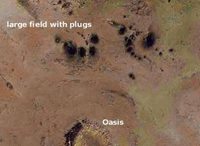
Crater field Oasis (prominent plugs
in the north)
|
|
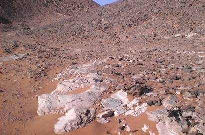
Bleached sandstone
|
|
|
Oasis ring dyke structure with central
uplift
|
|
Crater inside .......
|

........ with Carboniferous layer:
Bryozoa fossils and Ledidodendron plant imprint
|
|
According to UNDERWOOD & FISK (1980), about 6-8 km north and northeast
of Oasis, a field of circular or rounded knobs of sandstone occur. These
are 10-100 m in diameter and 10-50 m high. These authors suggested that
the knobs might be linked to the crater-forming impact event. They described
them as clastic plugs, apparently composed of Nubian sandstone, which
had been emplaced by vertical flow of impact-fluidized sand. Our investigation
indicated that in some cases they have a distinct chimney-like form with
sandstone strata in the central areas having near-vertical bedding orientations.
However, no evidence for fluidization of sand - as speculated by UNDERWOOD
& FISK (1980) – was found. In contrast, several distinct ridges were recognized
as erosional remnants of complex fold structures. The question whether
or not this folding is related to the impact event, or reflects regional
tectonic deformation, still remains open. It appears reasonable to interpret
these plug-like structures as remnants of folds, of which the fold hinges
have been completely eroded, leaving the vertically standing strata of
the fold cores behind."
Remark: It is not sure, that
the northern plugs in the centre contain vertical oriented sandstone layers.
There also could be white Trachyte harden without development of the distinctive
column-like structure.
|
|
Prominent plugs of Trachyte
in the northern direction with erected layers at outside
|
Plug in the Jebel Babein
|
|
Plugs of Trachyte with fused
layers in the northwestern direction of Oasis structure
Position:
24° 45' N / 23° 52' E
|
In the foreground a fused conglomerate
|
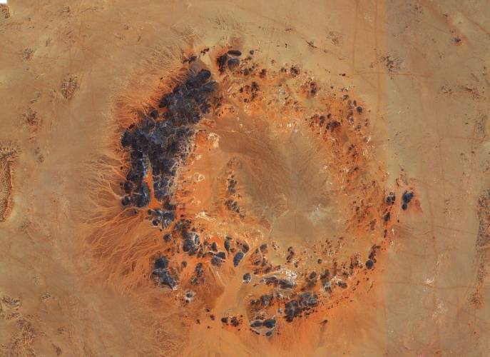
4.3 Craters Arkenu
The JERS-1 radar mosaic reveals two
circular structures partially hidden by Quaternary deposits. The radar scene
then clearly reveals a double circular structure composed of a southwestern
crater 10.3 km in diameter and a northeastern crater of diameter 6.8 km. The
NE crater is composed of concentric inner and outer rings separated by a depression
filled with sediments, also observed in the optical scene. The SW crater also
presents a circular shape with possibly three concentric annular ridges. The
host rock of the double circular structure is a cross-bedded coarse-grained
to conglomeratic sandstone and containing plant fossils and thin shale
interbeds (Carboniferous ?).
First time, the team Philippe Paillou observed quantities of Shatter
Cone structures on the site, all located close to the inner ridge of the NE
crater. Large outcrops of allochthonous breccia could also be observed in
both craters. He could find several quartz grains presenting planar fractures
(PF's) in these breccia.
Di Martino et al. (2008) reported about a field visit that they could
not detect any shock deformation in quartz and reported that the shatter cones
alleged by Paillou et al. were the result of wind erosion (ventifacts). They
categorically stated that they could not find any evidence that would support
an impact origin. According to Di Martino et al. the local geology involves
Paleozoic sandstones and siltstones. The strata in the areas of the structures
are impregnated by Fe-oxide minerals. In Arkenu 1, the sandstones are quite
well preserved in the structure’s interior.
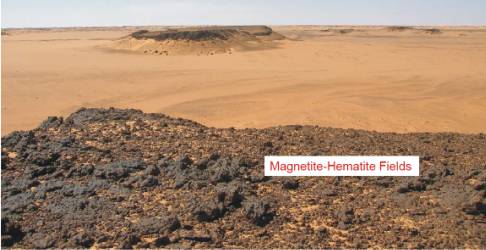
In Arkenu 2 they are disaggregated and contain massive magnetite deposits.
The authors interpret the local geology as the result of partial ‘‘digestion
of sandstones by a subvolcanic intrusive body (now partially outcropping within
the crater area)’’. In Arkenu 2 they observed a first mafic hypabyssal phase,
followed by granite that is locally preserved in the northern sector of this
structure.
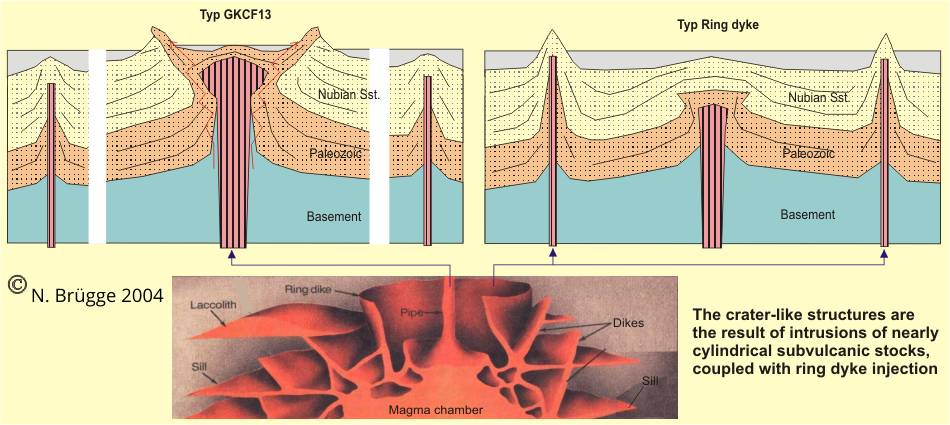
They concluded that these crater-like features could be the result of intrusion
of two nearly cylindrical sub-volcanic pipes, which was accompanied by hydrothermal
venting and dike injection.
Most recently, Cigolini et al. (2012) reported further evidence in
support of a volcanic genesis of the Arkenu bodies from field and petrographic
work. They did not observe shock metamorphic evidence in samples of sandstone
from the Arkenu circular structures and also state clearly that the alleged
shatter cones have an origin as wind-ablation features. They support the conclusion
that the two features represent volcanic stocks and interpret their existence
as a consequence of intrusion of syenitic porphyritic rocks into the sandstone
formation. These volcanics are part of a ‘‘rather simple and eroded ring complex’’.
They make a case for hydrothermal activity subsequent to volcanic intrusion,
which deposited massive magnetite-hematite, coeval with the emplacement of
silicified dikes in the environs. Finally, they observed ‘‘plugs of tephritic-phonolitic
rocks and lamprophyres (monchiquites) inject into the sandstone along conjugate
fracture zones.
|
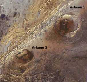
Craters Arkenu: Ark 1
position 22° 05' N / 23° 47' E
|
Centre of crater Arkenu-2
|
|
Subvolcanic structures at the western
edge of Arkenu-2
|
Western edge of the structure Arkenu-2
|
|
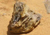
Bleached white breccia
|
.........
at crater rim
|
|
|
|
 |
 |
 |
|
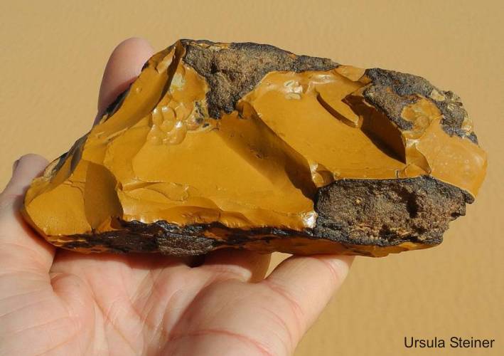
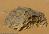
Arkenu-1: Yellow Jasper in silicified
sandstone - formed by hydrovolcanic solutions |
|
|
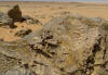
Hardened breccia with
not rounded fragments of basement material
|
|
|
|

Two small craters; 40 km WNW from
the Arkenu structures
|
|
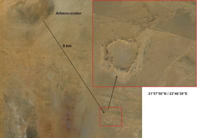
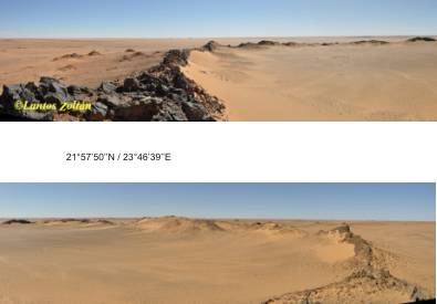
Crater southeast of Arkenu
2
(21° 57' 50' N/ 23° 46' 39'' E)
|
|
What's new:
ENDOGENOUS AND NONIMPACT ORIGIN OF THE ARKENU
CIRCULAR STRUCTURES (Al-KUFRA BASIN -- SE LIBYA)
C. Cigolini, M. Di Martino, M.Laiolo, D. Coppala, P.
Rosetti, M. Morelli -- Meteoritics & Planetary Science 47, Nr 11,
1772–1788 (2012); doi: 10.1111/maps.12012
Field Observations
In the Arkenu 1 structure the sandstone cover is locally overlain
by massive magnetite–hematite bodies, whereas in the Arkenu 2 area
such bodies are sparse and limited to some sectors in the southern
area. Rocks are essentially brownish porous medium to coarse-grained,
occasionally fine-grained, moderately to poorly sorted sandstones
with subrounded to subangular quartz and rarely sedimentary lithic
fragments. Thin bedded siltsones underlie quartz-arenites.
In the north-central part of the Arkenu 1 structure, were found a
decameter-sized body of syenite porphyry locally surrounded by meter-thick
veins of similar composition. In some sectors of the structure’s floor
these rocks may show a shell of argillic alteration.
At the contact with syenite intrusive veins, were found a brownish
horizon of muscovite-rich fragmental feldspathic material (containing
magnetite, apatite, barite, and Mn and Zn oxides) that is overlain
by a massive magnetite–hematite unit with subhorizontal attitude and
a thickness of several meters. This unit is mainly composed of massive
magnetite (partially transformed to hematite and ⁄ or limonitic products),
with abundant centimeter-sized cavities often lined with octahedral
magnetite crystals that are vertically oriented.
In some places, in the eastern sector the contact between the sandstones
and the overlying massive magnetite–hematite horizon is marked by
a few-meters thick hydrovolcanic breccia. This breccia in places shows
silicified syenite clasts embedded in apatite-rich veinlets. Pervasive
hydrothermal alteration was observed at the bottom of the Arkenu 2
structure, in the central part of the southwestern sector, where a
finegrained sandstone is strongly affected by argillic alteration
and shows typically bleached white to gray color. Together with the
findings at Arkenu 1, this strongly supports the idea that ‘‘paired’’
syenitic bodies may be present at depth.
At the inner rim of Arkenu 1, the magnetite–hematite horizons are
covered by the above described porous sandstones, but this sedimentary
unit is missing at the top of the mesas in the interior of the structures.
In the surroundings of both Arkenu 1 and Arkenu 2 were found silicified
dikes that transect the sandstones. These dikes are essentially vertical
at the surface but seem to follow a cone sheets geometry, at depth,
that extend coaxially (for approximately 5 km) from the central axis
of the circular structures. Within these circular features were found
the presence of hypabyssal tephrite to phonolite and lamprophyric
plugs (the latters may also outcrop outside the circular cone sheet
area). In fact, these intrusive bodies inject the sandstone along
conjugate fracture zones trending NE–SW (parallel with the orientation
of the circular structures).
Petrography of Igneous Rocks
There are two types of syenite porphyries. They outcrop within the
northeastern sector of the Arkenu 1 structure. Syenite of the first
type is more peripheral and is proximal to the intrastructural massive
magnetite bodies and shows a porphyritic texture consisting of large
K-feldspar (sanidine with subordinated microcline) grains, up to 5
mm across and very rare albite at the rims of feldspar laths in a
fine-grained feldspathic matrix. The rock has been subject to strong
potassic alteration. Secondary phases are sericite, carbonate, ankerite,
and Fe-Mn oxides. Sparse zircon, apatite, and rutile are accessory
phases.
The second type is a quartz-bearing syenite porphyry with crystals
of sanidine-microcline, albite, abundant microphertite, rare biotite
flakes, and patches of acicular greenish amphibole (likely of the
richteritearfedsonite series) locally altered to chlorite. Matrix
minerals are of the same mineral phases with patches of granophyric
intergrowths consisting of K-feldspar and quartz. Secondary minerals
are sericite, Mg-chlorite, carbonate, ankerite, and Fe-Mn oxides (in
veinlets). Zircon, apatite, rutile, allanite, opaques (Ti-magnetite
and ilmenite) are accessory phases.
Tephrites-phonotephrite-tephriphonolites and phonolites are well represented
in the Arkenu area. These rocks are found as necks and dikes that
crosscut the sandstones in the areas surrounding both Arkenu structures.
Tephrites and related lavas (phonotephritetephriphonolites) show a
porphyritic texture with laths (up to 2–3 mm across) of euhedral plagioclase
(albiteoligoclase), subhedral amphibole (of the richteritearfedsonite
series), microphenocrysts of nepheline and sanidine in a microgranular
texture consisting of these same mineral phases. Additional matrix
minerals are calcite and ankerite, apatite, Fe-Mn oxides. In more
altered samples the amphibole is altered to chlorite; secondary K-feldspar
replaces sodalite; secondary carbonate and ankerite are common and
coexist with zeolites. Accessory minerals are zircon and apatite.
Only a single neck of phonolite has been observed in the area SE of
Arkenu 1. It shows a porphyritic texture with sanidine macrophenocrysts
(up to 5 mm across), phenocrysts of aegirine, and laths of subhedral
phlogopite in a microfelsitic matrix of the same phases, nepheline
and secondary zeolites, carbonates and opaques. Accessory phases are
sparse zircon and apatite.
Lamprophyres are also well represented as plugs and subordinate dikes.
They show a holocrystalline porphyritic texture of euhedral olivine
(with 2 mm on average size) locally altered to iddingsite, euhedral
to subhedral Ti-augite, kaersutitic amphibole, microphenocryts of
nepheline, and late poikiolitic phlogopite (which locally overgrows
iddingsitic alteration haloes around olivine), in a pilotaxitic to
cryptofelsitic matrix consisting of these mineral phases plus abundant
rutile, sparse apatite, and microgranular zircon. Secondary phases
are zeolites in patches and analcime.
|
 |
 |
 |
 |
| Quartz-arenitic
silicified dyke produced by hydrovolcanic fluid circulation |
Phonolitic plug
about 2 km from the SSE rim of Arkenu |
Hydrovolcanic altered
breccia in altered syenite at the contact with magnetite bodies |
Muscovite-rich hornfels
magnetite bodies |
Syenite apophysis
with fragmental brownish gangue (upper contact) overlain by massive
magnetite and vacuolar sandstone |
NON-IMPACT ORIGIN OF THE ARKENU
CRATERS (LIBYA)
M. Di Martino,
C. Cigolini, L. Orti -
www.lpi.usra.edu/meetings/lmi2008/pdf/3012.pdf
“The interpretation
of Arkenu structures as impact-related is based on the observation
of shatter cones and impact breccias with planar fractures in quartz
grains."
"We visited the area on November 2007 and we carried out a preliminary
geological and structural survey.”
“In fact, we did not observe PDF in the collected quartz grains and,
in addition, the so called “shatter cones” (brought by Paillou and
co-workers as an evidence of an impact event) have been likely produced
by the erosion of sandstones. All of them, in fact, are oriented in
the same direction of the dominant winds (we prefer to name these
structures as “pseudo-shatter cones)".
Geological Survey:
The rocks outcropping in the craters’ area are a variety of sandstones
and subordinated siltstones. Sandstones on the top of the sequence
that also outcrop within the craters, are coarser and carry abundant
concretions of diagenetic hematite (millimeters to tens of centimeters
in size). These sandstones are well preserved within the Arkenu 2.
Conversely, within Arkenu 1 the floor consists essentially of disaggregated
portions of these rocks coexisting with massive magnetite deposits.
In this case, field evidence and mineral distribution (diagenetic
hematite recrystallized as magnetite), suggests digestion of the above
sandstones by a subvolcanic intrusive body (now partially outcropping
within the crater area). The intrusion is characterized by a mafic
precursor, followed by granite locally preserved in the northern sector
of the crater. It is suggested that the mafic precursor contributed
to the melting of the original sandstone sequence and was then followed
by the injection of a granitic magma within the subvolcanic region.
Discussion: We, therefore, suggest the craters forming episode
is the result of intrusion of a paired, nearly cylindrical subvolcanic
stocks (coupled with ring dike injection in the surroundings) accompanied
by hydrothermal degassing. This process was then followed by local
structural adjustments, likely due to thermal contraction of the whole
edifices along circular fractures. This produced moderate folding
and subsidence of the “crater sectors” (currently delimited by the
crater rims) as well as the origin of the outer circular structures.
Erosion did its cycle and finally revealed the architecture we are
now observing.
|
|
|
4.4 Hadid
Crater
|
|
The Jebel Hadid Structure
is located in southeast Libya (20°52'07"N / 22°42'15"E). It is made up
of five concentric rings, the outermost of which is approximately 4.7
km across.
In 2009 a paper appeared in the journal Marine and Petroleum Geology in
which M. Schmieder and E. Buchner of the Institut für Planetologie at
Universität Stuttgart and D.P. Le Heron of Royal Holloway, University
of London, propose that the Jabal Hadid structure is an impact structure.
This is an error. The structure fits in with the other subvolcanic structures
in the region.
|
|
| |
|
4.5. Jabal Dalma Structures
Further crater-like structures
are located far north, at the terminus of the Howar-Uweinat Uplift, on
the Jabal Dalma in Libya. These include some large crater-like structures
without the typical rings as in Oasis or B.P.
|
|
|
|
| 25.64320° / 22.78860° |
26.21851° / 24°97064 |
26.20818° /24.79096° |
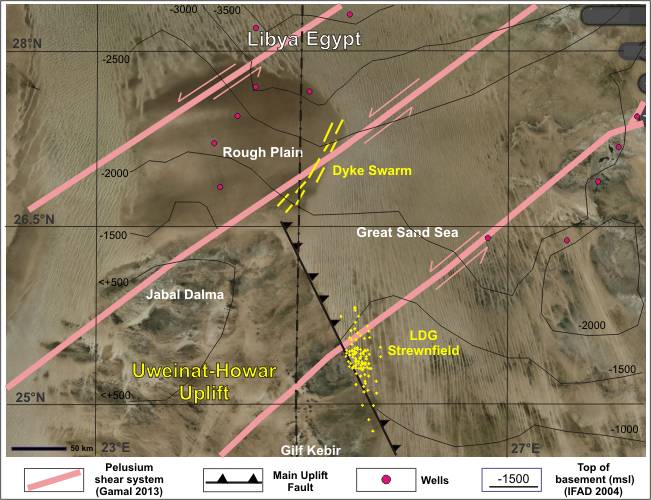
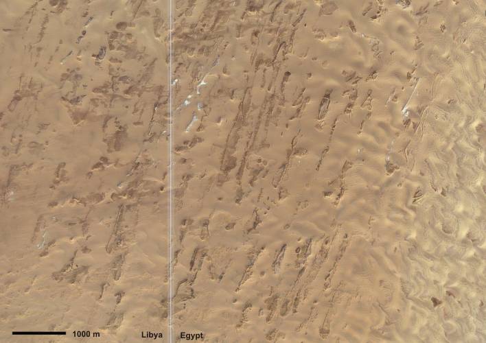
Of interest is the "Rough
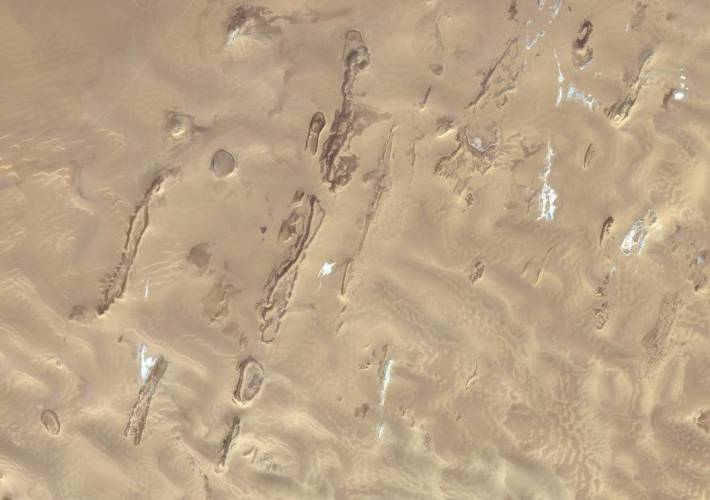
Plain", north of Jabal Dalma, on which some long dykes can be seen. Striking
is on its eastern edge a dyke-swarm, running SW-NE and is about 190 km
long. These dykes, partially "open" like craters, are located at the Trans-African
"Pelusium Shear System" (sensu Gamal, 2013). The furthest north structures
have the coordinates 27.3241° / 25.3568°. Drillings has proven that the
basement is in a depth of up to 2500m, meaning that the "Rough Plain"
is no longer part of the Uplift.
|
|
Structural sample for the origin the Libyan craters
Oasis and BP
|
Conclusion
The "impact" craters
in Libya are comparably to the craters and dykes of the "Scarp-Contours"
in Egypt (GKCF). We can see erected and tipped over sandstones and crushed
breccia. The breccia contains differently material. Clear igneous material
was only found in the Arkenu structures, because it has climbed probably
rarely to the surface. There is ultimately no imperative proofs, that
the craters have emerged by an impact.
The breccia is formed by heat and contains also material from Paleozoic
underground and the deeper basement. Microbreccia with shock-quartz fragments
and pieces of sandstone, mixes with partially glass, all within a baked
groundmass.
All this intrusive plugs, dykes and craters in the region have emerged
probably at the same time in the Tertiary period. Them all become found
at the Howar-Uweinat Uplift nearby of tectonic features and lineaments.
This conspicuous cluster of crater and dyke structures may be related
to a magmatic plume in the Earth's mantle. The magmatic activities evidently
were joined with hydrovolcanic processes, which could have led also to
the origin of the unique Libyan Desert Glass.
|
|