|
Subvolcanic and
hydrovolcanic activities in the Bahariya depression (Egypt)
Norbert
Brügge, Germany
Dipl.-Geol.
|
|
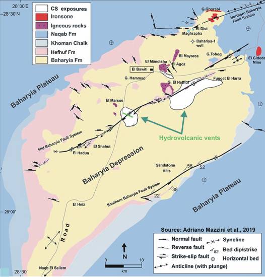
The Bahariya Oasis is an
oval shaped depression trending in a NE-SW direction. Within the depression,
the Cretaceous rocks outcrop at its base as well as at the base of the
conical hills and the scarp. The Cretaceous rock succession (Sabaya, Bahariya,
El Heiz and El Hefhuf Formations) comprises fluvialite to fluviomarine
clastics of sandstone, claystone and shale. The Sabaya Formation of Lower
Cenomanian age is coverd by Bahariya Formation which also belongs to the
Lower Cenomanian. The Bahariya Formation is unconformably overlain by
the Upper Cenomanian fluviomarine marly shale, sandy dolomitic limestone
and calcareous sandstone of El Heiz Formation as well as by the Campanian
cherty cavernous dolostone, crossbedded sandstone and phosphatic limestone
of El Hafhuf Formation.
The succeeding Maeastrichtian Khoman Formation is mainly represented by
chalk and chalkly limestone. It overlies conformably El Hafhuf Formation
on both sides of the depression and extends southward with increasing
thickness. The Eocene rocks are represented by the Naqab Formation which
belongs to the Middle Eocene and comprises gray and pink limestone and
by the Qalamoun Formation which belongs to the Lower Eocene. The Qalamoun
Formation is deposited on the Bahariya Formation and El Hafhuf Formation
to the North of Bahariya depression. The succeeding Oligocene Qatrani
Formation covers Bahariya Formation at the top of the conical hills besides
occurring as small outcrops within the depression. This formation consists
of quartizitic sandstone, quarzite, shale and silt.
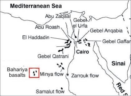
At the northern part of
Gebel El Hefhuf, Oligo-Miocene basaltic and doleritic extrusions are recorded.
The types
of volcanic rocks in this region can be divided into three main varieties,
mainly an amygdaloidal basalt which is the oldest extruded lava followed
by the intruded dolerite. Later another period of volcanicity took place
and the olivine basalt porphyry was extruded covering the amygdaloidal
basalt in Gebel El Hefhuf and the small basalt hill nearby, and helped
to cover and preserve in these two hills the layer of amygdaloidal basalt
below it, while in Gebel Maysarah and Mandisha where this basalt porphyry
was not represented caused the lower layer of amygdaloidal basalt to be
also absent and probably leached.
As to the age of these volcanic rocks there is no doubt that it is post-cretaceous.
The Eocene being not represented in this part of the oasis leads the writer
to conclude that the volcanic rocks are probably of Oligocene age specially
that this period of Tertiary volcanicity was recorded in Egypt. The eruption
was at several steps and took a long period. The variation in types of
rock and alteration indicate that the formation of the volcanic rocks
in this area took place at several times and more or less during long
periods of volcanicity.
Columnar Oligocene flood basalt sheets cover the Cenomanian Bahariya Formation
at Gebel Mandisha area in the Bahariya oasis depression. The Mandisha
basalts are located with the position of 28° 54' E and 28°22' N, nearby
the iron ore mines in the eastern direction. The basaltic intrusions took
place during Oligocene, when the Gulf of Suez rift began to open. As noted
earlier, hydrovolcanic solutions associated with this subvolcanic
activity caused intensive mineralization and iron precipitation in parts
of the depression. Iron forms as a replacement to Eocene limestone where
open cast quarries are located in several places. Mostly known are the
mines of El Harra area and El Gedida area at the northern edge of the
depression.
|
|
|
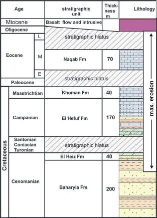
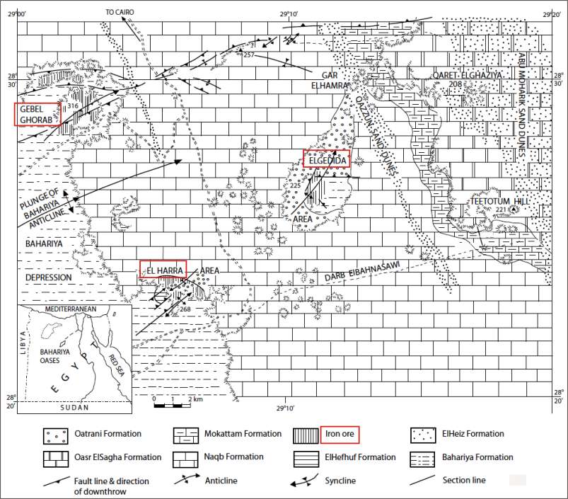
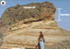
Bahariya depression: Stratigraphic
profile
|
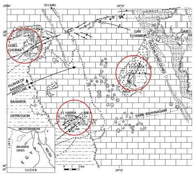
Iron ore deposits/mines El Ghorabi,
El Harra and El Gedida
Iron ores at
Gebel Ghorabi, occurring mainly in lower Eocene limestone, include
an oolitic type consisting essentially of goethite, a vesicular type
containing hematite with pyrolusite and psilomelane, a hard, dark
brown type consisting of goethite and hematite with some pyrolusite,
and a low-grade limonitic type. Study of the mineral assemblages and
ore textures shows that processes of metasomatic replacement, colloidal
precipitation, cavity filling, and impregnation have been involved
in formation of the deposits.
|
| |
|
| |
|
|
What is new ?
Concentric Structures and Hydrothermal Venting in the Western Desert,
Egypt
Adriano Mazzini
et al. --
Front. Earth Sci., 18 October 2019
|https://doi.org/10.3389/feart.2019.00266
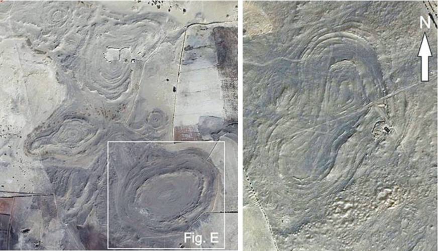
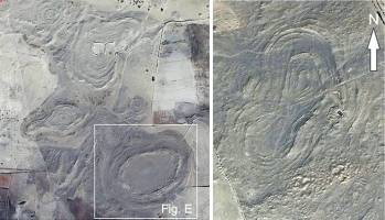
"Here
we describe for the first time the results of mapping and characterization
of about 100
large concentric circular structures found in Early Cenomanian argillaceous
strata of the Bahariya depression.
The mapped circular structures increase in number
approaching the fault zone. These features are up to 10 m high and 625
m wide.
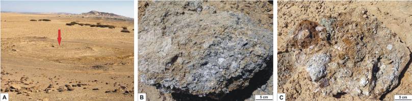
Halite-cemented brecciated sediments from different
geological units have been sampled in the central part of the concentric
circular structures implying a subsurface mechanism involved in their
formation. Petrography analyses revealed also the presence of high-
and low-temperature minerals (e.g., Ba-K-feldspars and ferroaluminoceladonite)
suggesting former phases of hydrothermal circulation. Soil-gas flux
profiles (CO2 and CH4) reveal a modest CO2 increase when crossing the
central part of the circular structures inferring enhanced permeability.
Field and laboratory data are consistent with a scenario envisaging
a diffused and vigorous hydrothermal venting."
|
|
|
| |
|
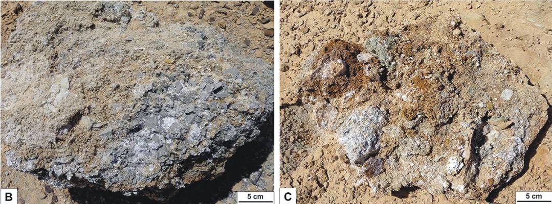
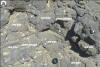
Sediments
dug out from the central part of the CS show brecciated shale and
sandstone clasts within a fine-grained matrix cemented by halite (white crystals)
|
|
|
Photo Gallery
|
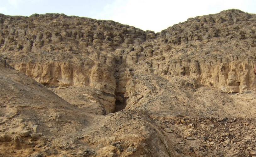
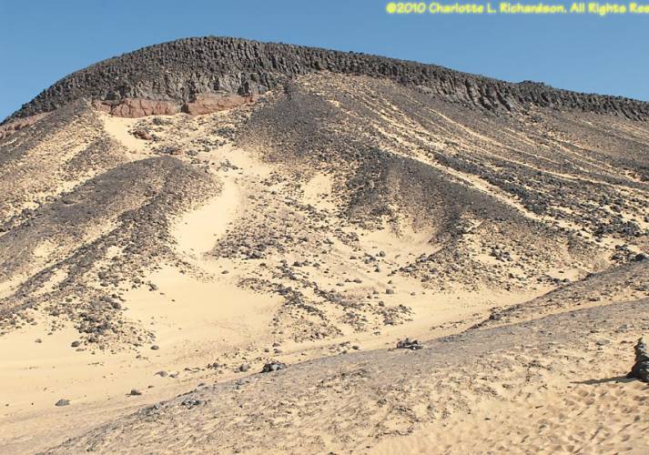
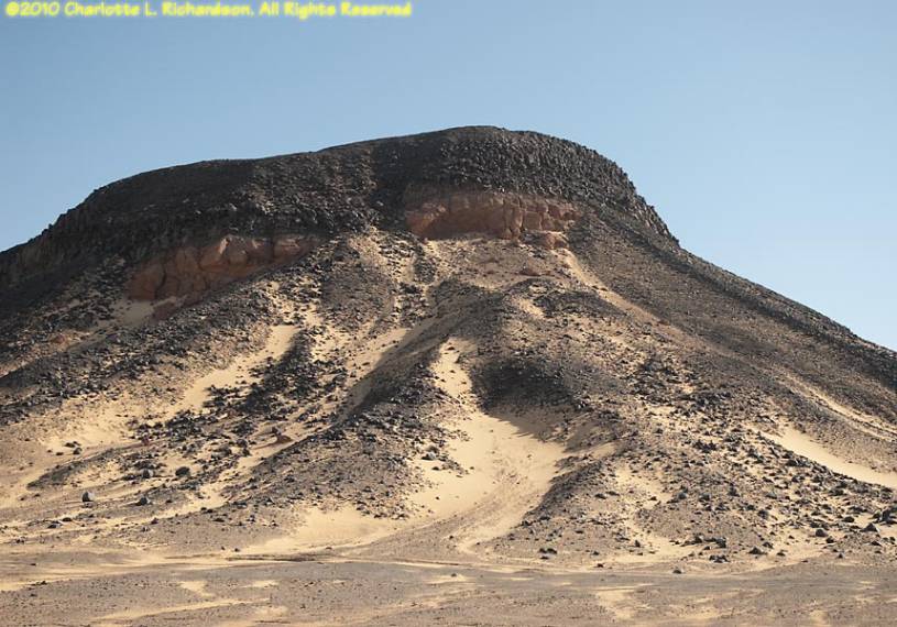
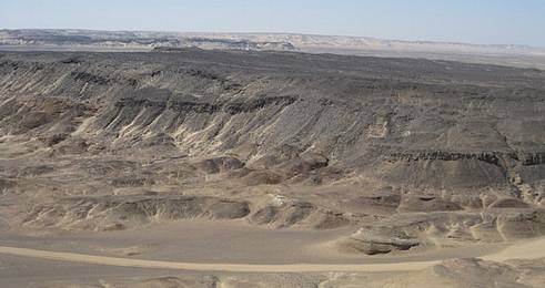
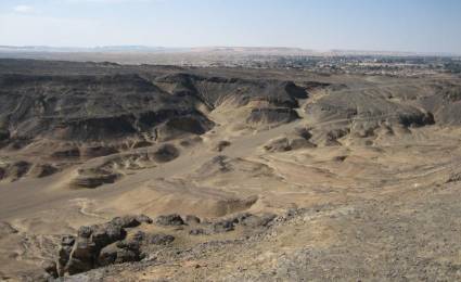
| Jebel
Hefhuf & Mandisha basalt flows |
|
|
 |
|
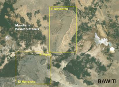
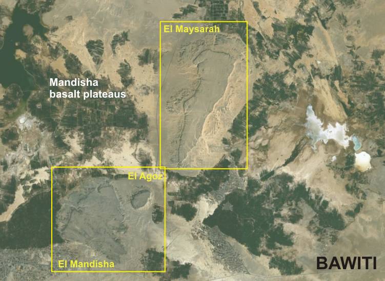
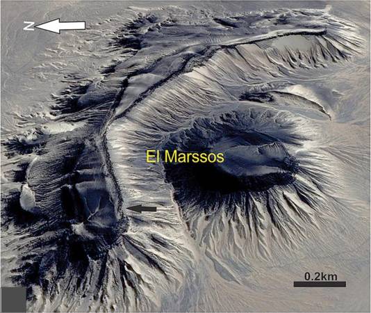
Mandisha basalt plateaus from
space
|
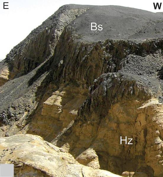
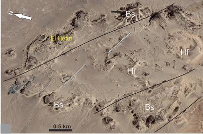
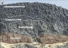
The Jebel
Hefhuf is aligned along
the central segment of the Mid Bahariya fault. The exposure of the mafic
rocks covers an area subelliptical in shape elongated toward the NW,
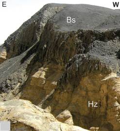
reaching the maximum thickness on the outer margin. The hill consists
of two basaltic sheets (sills) with well-developed colonnade overlying
the cross-bedded sandstones and clastics of El Heiz and Bahariya Fms.
and partially concordantly overlain by the sedimentary deposits of El
Hefuf Fm. (El Akkad and Issawi, 1963; Medani, 1995). Toward the east,
doleritic dikes reach a thickness up to 3 m and dissect the Campanian
rocks of El Hefhuf Fm. Basaltic flows are observed in the central and
eastern side of the area flooding the substratum of the Cenomanian clastics
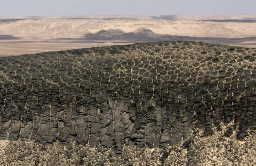
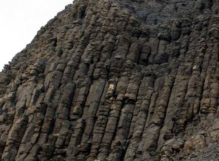
(El Heiz Fm.). The basaltic
Mandisha lava flows have a thickness of 10 m and thin down to
4 m moving northwards away from the Mid Bahariya Fault. The lava flows
can be subdivided into an upper fresh unit with spectacular columnar
joints and a lower moderately weathered unit. The latter has intensive
fracturing and a continuous sharp contact with the underlying Cenomanian
rocks. Medani (1995) described a set of doleritic dikes as a feeder
of the basaltic flows which are dissected normal faults distinguished
with brecciated basaltic zones and rotation of the adjacent sedimentary
rocks. To the east, the Jebel Agoz hill forms an isolated exposure
separated from Mandisha normal fault that cuts through the basaltic
flow and the underlying Bahariya Form.. The basaltic flows consist of
vertical and horizontal tier of the rounded columnar joints particularly
in the lower part of the basaltic flow (El Qaluabi, 1974; Khalaf et
al., 2018). Further to the northeast, the Jebel Maysarah basaltic
flows occur as an isolated NE-elongated sub-triangular outcrop. According
to Tosson (1964), these fissure eruption basalts occurred at the floor
of the Bahariya depression.
|
|
|
|
|
|

|
|

|
|
|
|
|
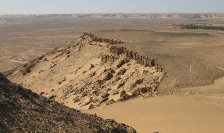
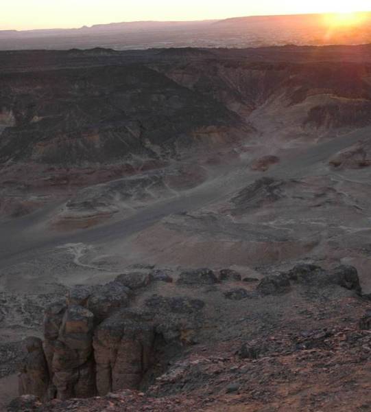
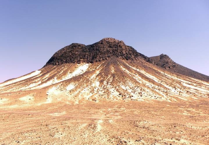
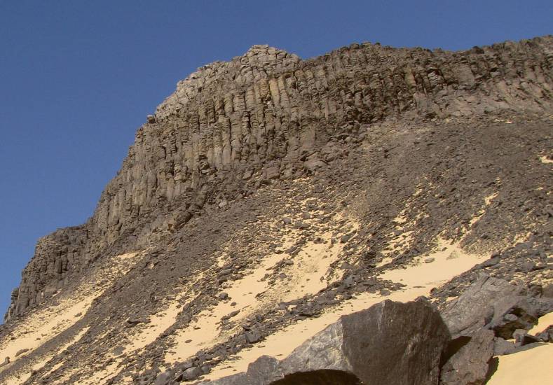
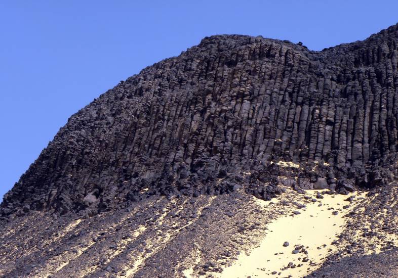
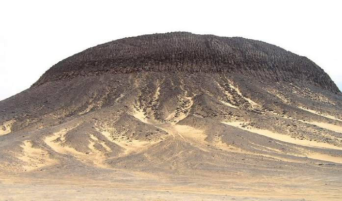
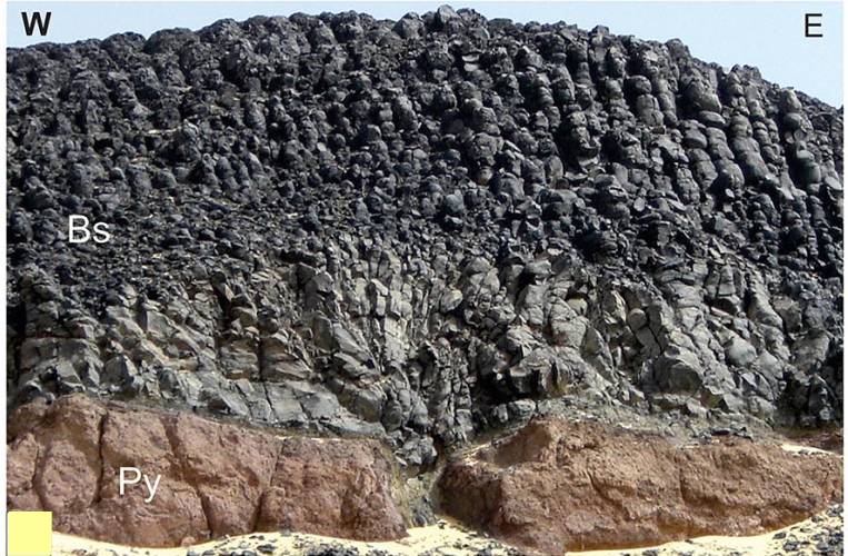
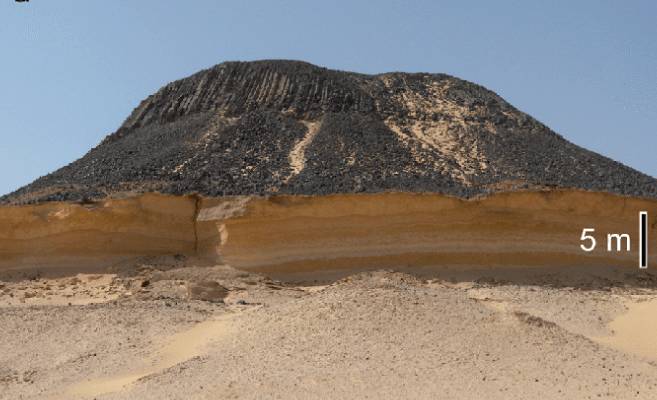
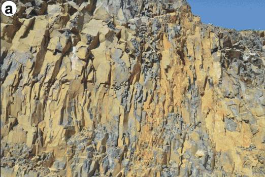
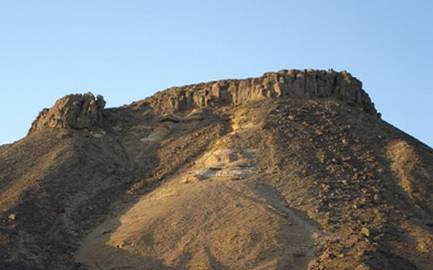
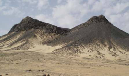
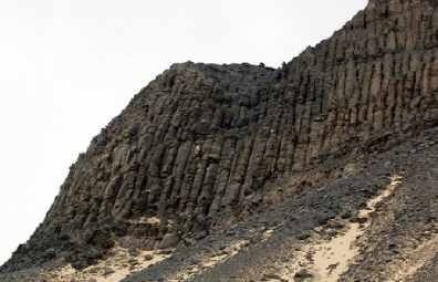
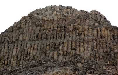
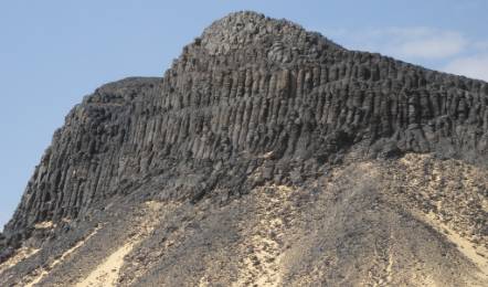
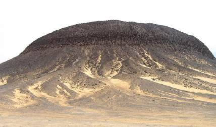
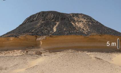
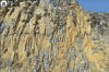
Jebel Marsus flow basalts
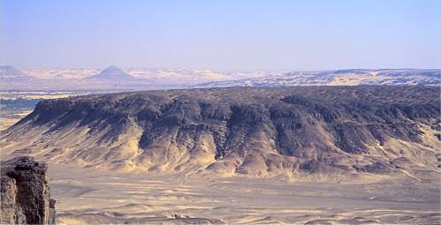
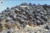
The Jebel Marsus
has a positive and plug-like shape reaching a thickness of more than
170 m above the base of the depression. The basaltic flow has a distinct
columnar structure resting on a ~2
m thick pyroclastic mound of scoria lapilli, blocks, and bombs with
mainly sub-millimeter vesicles exhibiting cauliflower structure (Khalaf
et al., 2018). Both pyroclastics and flow are overlying the sandstones
and shales of the Bahariya Fm. |
|

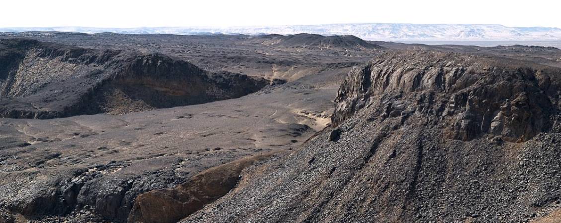
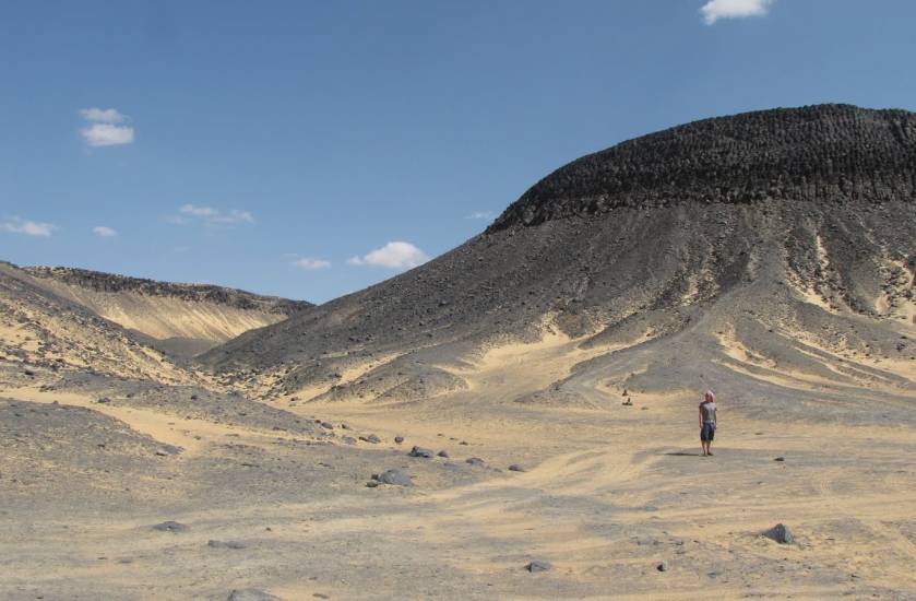
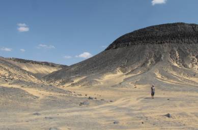
Black Desert flood basalt remains:
Jebel Marsus (28°15'55''N / 28°45'10"E)
|

Hill with fantastic basalt columns
|
|
|
|
|
|
|
|
|
|
|
|
|
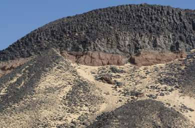
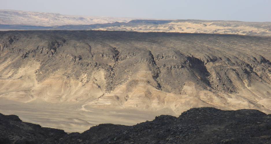
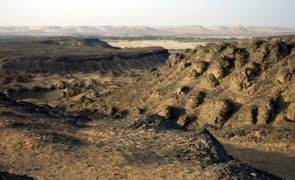
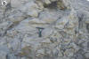
Here basalt cover pyroclastic
deposits
|
Here basalt cover deposits of
the Bahariya Fm
|
|
|
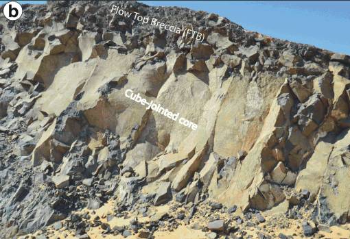
The
Bahariya monogenetic volcanic field is characterized by important
geomorphological features. There have been some geosites recognized
such as the scoria cone, the lava flows and their surface morphological
features, the pseudopillow fractures, columnar joints, peperites,
tumuli, and rootless cones.
(Source: Ezz El Din Abdel
Hakim Khalaf et al., 2019)
|
|
|
|
|
|
|
|
|
Conclusion
|
|
|
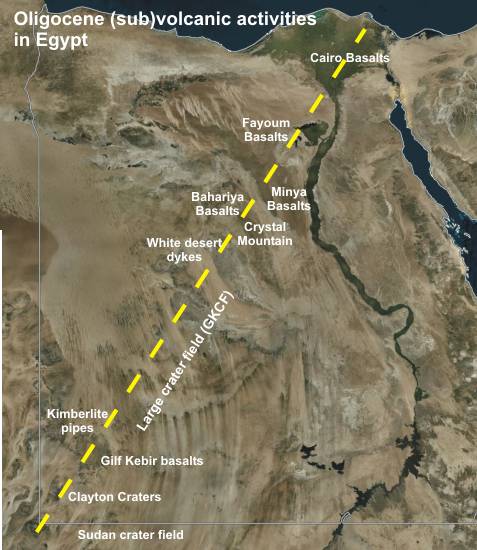
Further
areas of flood basalts in north- and middle-Egypt are distributed. They
are concentrated in the region of Cairo, are found however also in the
Bahariya depression and western to southwestern of it.
Remarkable is the dating of the basalt intrusions in the Oligocene age.
It agrees with the dating of other subvolcanic and hydrovolcanic structures
in the Gilf Kebir region, in the White Desert and Black Desert as well
as the Libyan Desert Glass area with its kimberlte pipes. All structures
are placed on a line, which proceeds from southwest to northeast. Can
we suppose here a connection to a Lineament ?
|
|