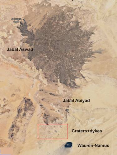
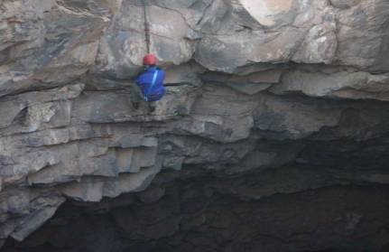
The Al-Haruj
is part of an alkaline basaltic intracontinental flood basalt field
in central Libya. The northern part the Al-Haruj is marked as Jabal
Al-Aswad. The smaller southern part is marked as Jabal Al-Abiyad.
Trigger of the volcanic activity in the Al-Haruj and the neighboring
areas could have been a so-called mantle-plume, which probably already
in the Mesozoic from the outer Earth's core to the frontier between
mantle and crust penetrated and remained for a long time under the African
plate. When a plume hits the bottom of the lithosphere, it is partially
melted and thinned. This causes the Earth's crust to stretch, causing
certain sections of the Earth's surface to sink and rifts were formed
(tectonic trenches). The Al-Haruj is located in the so-called Hun-Graben.
The eruptions of the magma took place in the Al-Haruj on this fault
zone. The eruption activity periodically flooded the sediments in area.
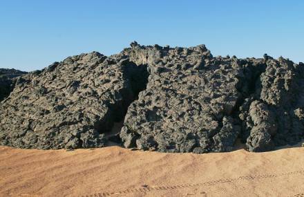
Pyroclastites (ashes, lapilli and tuffs, etc.) are almost completely
absent in Al-Haruj. Petrographically, the volcanic rocks in Al-Haruj
are mainly alkaline basalts with olivine and pyroxene as well as feldspars.
Such (mostly potassium-rich) rocks are typical of continental rift zones.
Morphologically, flood basalt fields and lava flows predominate in the
Al-Haruj. Shield volcanoes, cinder cones as well as diatrems and pit-crater
sit on the flood basalts. The oldest lavas in the Al-Haruj are about
5.3 million years old, the youngest probably only thousands of years.
|
|
|
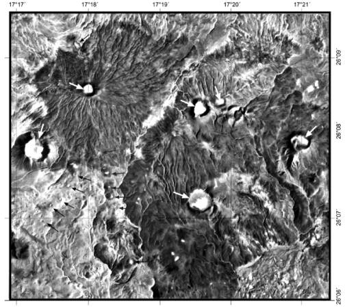
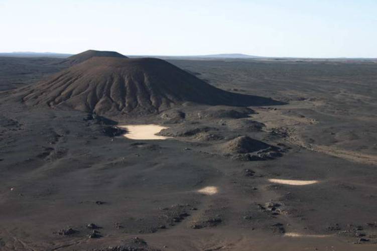
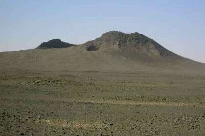
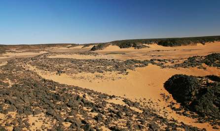
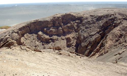
A photo of the central part of
the volcanic chain exhibiting large shield volcanoes
with wide pit craters on their tops and smaller pit craters on their flanks
(black arrows)
|
|
|
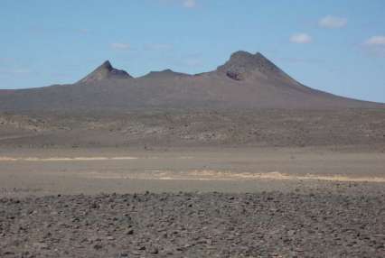
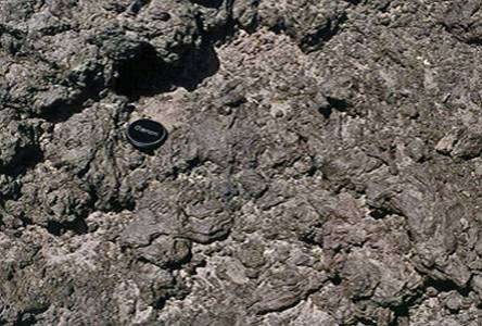
Ruin of a volcano in the southern
Al-Abiyad area
|
Geochemistry and Petrology
of Basic Volcanic Rocks of Jabal Al Haruj Al-Aswad, Libya
Al-Hafdh & El-Shaafi -- International Journal
of Geosciences, 2015, 6, 109-144
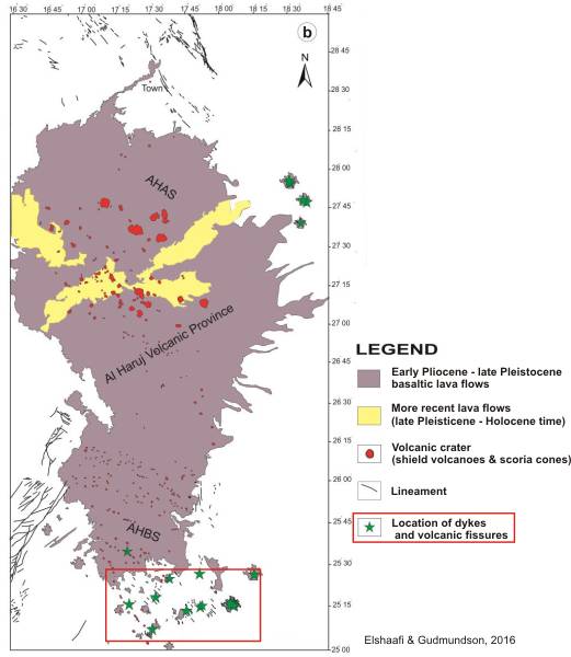
"The Al Haruj Intra-continental
Volcanic Province is the largest part of the extensive volcanic activity
in Libya which is considered to be a typical within plate basalts. The
volcano-tectonics evolution of this province, as well as its origin,
are still widely disputed. According to K-Ar dating previously studied,
the volcanic activity started in the Late Miocene and lasted until at
least the Late Pleistocene. The field may still be volcanically active.
The mafic rocks of Jabal Al Haruj have been classified into six major
phases or groups. These phases have been differentiated using Landsat
images together with aerial photographs of different scales as well
as field observations. The topographic forms of the earliest phase are
highly eroded while the forms of the latest phase are usually fresh
and very well preserved as regards primary features. Mafic lavas of
this field consist of alkali basalts to olivine tholeiites (transitional
basalt) which contain olivine as essential constituent together with
clinopyroxene, plagioclase and glass. The basalt exhibits intergranular,
intersertal, ophitic and subophitic relations. Amygdaloidal and glomerporphyritic
textures are also observed. The basaltic rocks of different ages and
from different localities are petrographically rather similar.
Phenocrysts of olivine probably the result from slow cooling in crustal
magma chambers prior to eruptions, suggesting that magmas ascended slowly
through the crust. 109 samples have been carefully collected
from various phases, some of these samples have been chosen for major
and trace elements analyses, using XRF in order to determine the characteristics
of the mantle source and investigate crustal interaction. The major
and trace elements revealed a slightly significant chemical diversity
among the phases and within each phase. The normative classification
of most of these rocks shows close agreement with their modal classification.
A vague correlation between MgO and most major oxides in the studied
samples suggests different degrees of partial melting rather than fractional
crystallization. A characteristic feature of the studied volcanic rocks
is the relatively constant ratios of certain incompatible trace elements
(Nb/Zr, Rb/Zr), which provides strong evidence of a common source. In
addition, the rocks display similar patterns of the peaks and troughs;
this strongly suggests that they have a common parent and common subsequent
processes. The compatible transitional metals Ni (81 - 193 ppm) and
Cr contents (238 - 361 ppm) and relatively low Mg# (Mg/(Mg + Fet)) (52
- 62) give an indication that the studied basaltic rocks have slightly
to moderately fractionated olivine and/or spinel. The magmatism of this
volcanic field seems to be related to reactivation of pre-existing structures
during the passive rifting of the Sirt Basin that most likely produced
in response to convergence between European and African plates since
Jurassic until Holocene times."
|
|
|
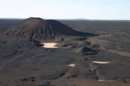
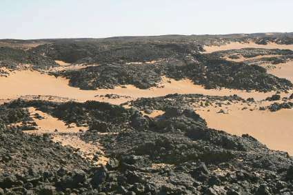
Volcanoes in the central Al-Haruj
|
|
|
|
|
|
|
|

|
|
|
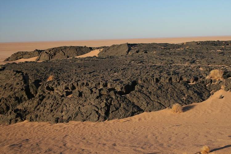
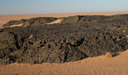
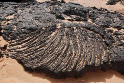
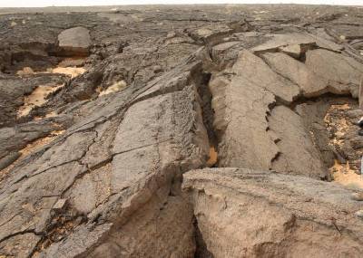
This lava ropes in the northern Al-Haruj
are thousands years old in maximum
|
|

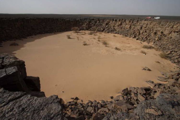
"Black Hole"
|
Massive basalt at a hole
|
|
Young lava nearby Al-Fogaha
|
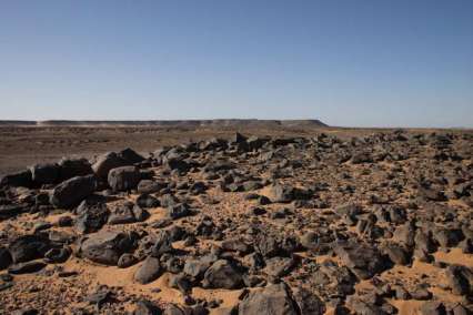
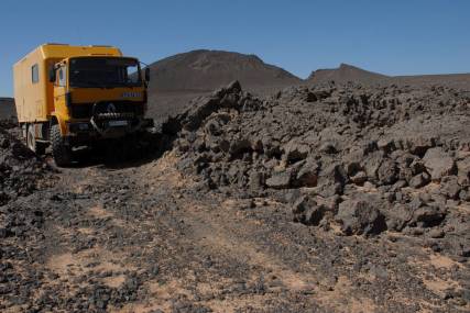
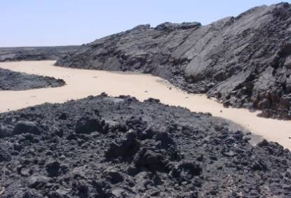
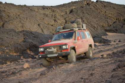
Typical terrain in the Al-Haruj
|
|
|
|
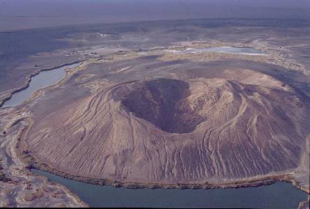
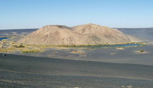
2. Volcano Wau-en-Namus
"The Wau-en-Namus lies southeast of Al-Haruj. The
cone itself consists of a massive sequence of poorly sorted lapilli agglomerate
that appears well stratified from a distance. The agglomerate, locally enclosing
bombs and some ash, shows no mesoscopic welding effects and is somewhat friable.
It is thus deduced that ejecta must have considerably cooled prior to cone
build up. However, at a small area of the cone there is congealed twisted
spatter in the form of ribbon bombs attesting perhaps to the waning eruptive
activity of the volcano as the magma reservoir emptied and pressure dropped.
The slopes of the cone are marked by huge rills in places and in others by
curling up and outward bulging thin crust of ash and sand in the vicinity
of gashes and cracks, both suggesting escaping volcanic gases. The underside
of the crust in such localities shows nodular to botroidal deposits of white
salts and yellow sulfur. The latter may also occur as small thin tablets scattered
around or in the form of yellow staining on adjacent rock blocks. All of these
features appear recent and suggest continued, slow activity of a dormant volcano.
Repeated eruption at the site is attested to by locally slumped agglomerate
strata, truncation of the present cone of two earlier structures to the west,
and a collapsed dome on the northern side where a shallow, bowl-like crater
had developed."
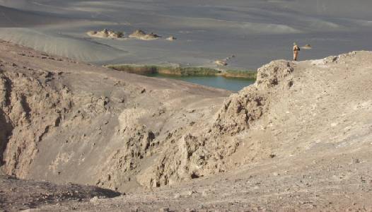
"The Wau-en-Namus is a remote and isolated volcanic
caldera complex composed of alkalibasaltic scoria, located in southern Libya
at 24°56′N, 17°45′E, about 70 km south of the Pliocene-to-Holocene Al-Haruj
volcanic field. The Wau-en-Namus caldera has a diameter of about 4 km and
is surrounded by an extensive halo of black ash and lapilli.
No lava flows are present at the crater, but bombs and
blocks of various types of basalt, olivine megacrysts and upper mantle xenoliths
were ejected from the central cinder cone that
rises about 140 m above the floor of the caldera. A reliable 40Ar/39Ar age
determination of the host basalts was impossible due to the extremely low
radiogenic content of the matrix. Step-heating of the whole-rock material,
however, suggests that the K-rich matrix is very young."
|
|
|
|
|
|
|
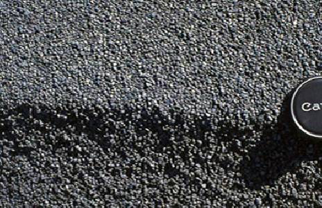
Lapilli on the caldera ground
|
Ash of the crater cone
|
Mafic and silica-rich glasses in mantle xenoliths from Wau-en-Namus,
Libya: Textural and geochemical evidence for peridotite–melt reactions
C. Miller et al. -- Lithos 128-131
(2012) 11–26
"Anhydrous spinel
peridotite xenoliths in Quaternary nepheline-basanite and melilite-
or sodalite-bearing lavas of the Wau-en-Namus volcano range from lherzolites
to harzburgites recording melt extraction in a shallow setting (≤2 GPa). Primary
clinopyroxenes have distinct trace element characteristics documenting LILE
(large ion lithophile element) depletion or enrichment events predating the
formation of glass pockets and veins in the xenoliths. These glasses are aluminous
and alkali-rich, range in composition fromultrabasic to silicic (43–67 wt.%
SiO2) and may contain empty vugs and micro-phenocrysts of olivine, clinopyroxene,
spinel, plagioclase, sodalite, apatite that are similar in composition to
phenocrysts in the host lavas. Reactions of infiltrating melt and xenolith
minerals are documented by diffuse Fe–Ca-rich rims of olivine in contact with
glass, and by spongy-textured reaction domains caused by incongruent dissolution
of primary pyroxenes and spinel. Some glasses have trace element characteristics
similar to that of the host Ne-basanite, suggesting they were derived from
the same source during entrainment and transport to the surface. Incompatible
element enrichment and Sr–Nd isotopic compositions of the analyzed host lava
are similar to HIMU (high μ; μ=238Pb/204Pb)-type magmas, but the Pb isotopic
composition is less radiogenic compared to other intra-plate Neogene magmatic
rocks from N Africa."
|
|
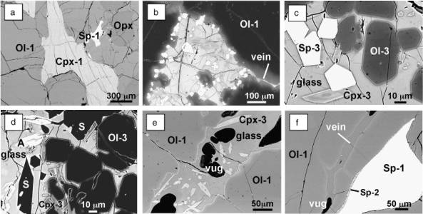
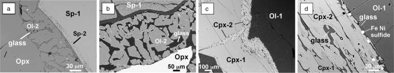
BSE images illustrating
micro-textures in Wau en Namus xenoliths.
a - Homogeneous Cpx-1 in lherzolite (i) sample L2.
b - Type (Ia) glass pocket containing phenocrysts of Cpx-3 and Sp-3.
Note the feeder veinlets (type Ib glass) that crosscut primary olivine,
the undulating olivine-glass contact and the necking off of anhedral olivine
from the main grain. The diffuse light gray margins at the edge of Ol-1
in contact with type Ia and Ib glasses indicate the development of Fe–Ca-rich
diffusion zones; sample L2 (lherz (i)).
c - Detail of type (Ia) glass pocket with newly crystallized euhedral
Ol-3, Sp-3 and zoned Cpx-3; sample H124b (hzb (iii)).
d - Type (Ia) glass pocket containing euhedral sodalite (S) in addition
to Ap (A=white skeletal crystals), Ol-3 and Cpx-3 phenocrysts, sample
H124b (hzb (iii)).
e - Veining of primary olivine by former melt (type Ib glass). Note
the Cpx-3 phenocrysts and the development of Fe–Ca-rich diffusion zones
at the undulating olivine–glass contact; sampleW13 (lherz (i)).
f - Type Ib glass crosscutting Ol-1 and infiltrating along
the olivine/spinel boundary. Note the sieve-texture development of Sp-2
at the margin of Sp-1 where it is in contact with glass; sample L2 (lherz
(i)). |
|
|
a - BSE image showing incongruent
breakdown of primary Opx to Ol-2 and silica-rich type IIa glass. Note
the sieve textured reaction rim consisting of Sp-2 and Al-rich glass that
surrounds primary spinel; sampleWL3 (lherz (i)).
b - X-ray elemental map (Mg) of reaction zone consisting of Ol-2
and type IIa glass (black) developed on primary Opx; sample W128 (hzb
(iii).
BSE images illustrating (c) development of spongy-textured Cpx-2 domains
on grain boundaries of Cpx-1 and along a fracture; sample L4 (lherz (i))
and (d) detail of spongy-textured Cpx-2 reaction domain, with dark blebs
representing type IIb glass. Note Fe–Ni-sulfide droplets and glass at
the contact with Ol-1; sample L4 (lherz (i)). |
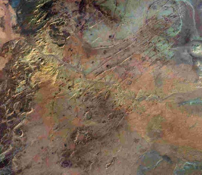
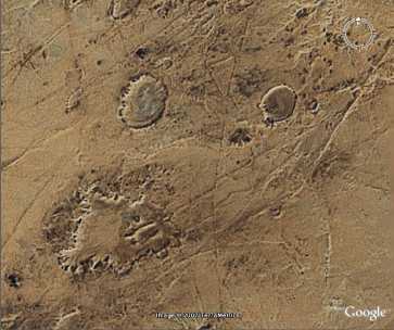
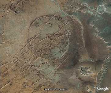
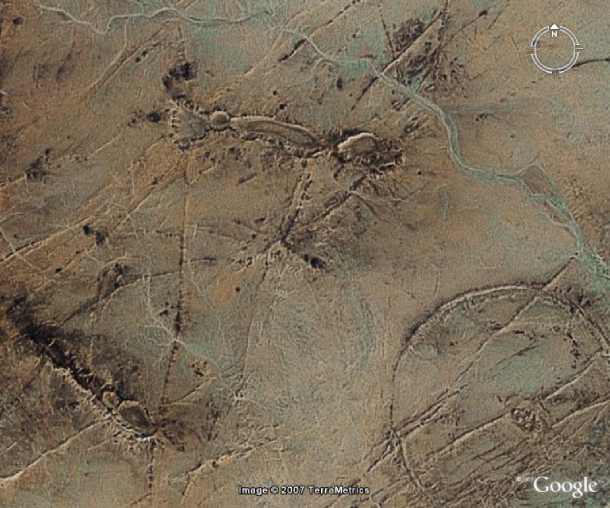
3. Crater-shaped and dyke structures
(South of Jabal Abiyad)
|
|
One crater similar of Oasis crater (Kufra
region)
Position: 17° 20' 12" E and 25° 13' 07" N
|
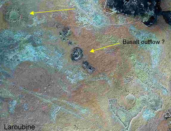
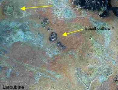
Christian
Laroubine, Societe Astronomique de France, presents some Landsat - pictures
from centrally Libya, on which a strikingly field of crater-like structures
was to be seen. These craters-like structures have a surprising similarity
to the craters in the
Gilf Kebir region
(Egypt).
After searching of the craters-field was to be ascertained, that could be
a context to the Tertiary flood basalts in Haruj. The new craters-field is
found near in the southwest of the large basalt shield of the Al-Haruj. There
is a large ring structure and many small craters. Some are covered evidently
with outflows of basalt. One crater has a similarity to the Oasis crater (nearby
Kufra). The large ring-structure is crossed by long dykes.
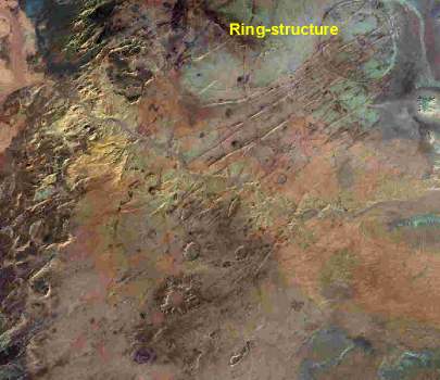
Striking section of crater-field: 16
24' E and 24° 50' N
|